University of Minnesota
http://www.umn.edu/
612-625-5000
http://www.umn.edu/
612-625-5000
Minnesota Biodiversity Atlas
Bell Museum
Dataset: All Collections
Taxa: Aulacomnium palustre (Aulacomnium pygmaeum, Aulacomnium venezuelanum, Aulacomnium palustre var. congestum, Aulacomnium palustre var. dimorphum, Aulacomnium palustre var. imbricatum, Aulacomnium androgynum var. pygmaeum), Aulacomnium palustre var. acuminatum, Aulacomnium palustre var. andinum, Aulacomnium palustre var. fasciculare, Aulacomnium palustre var. laxifolium, Aulacomnium palustre var. palustre, Aulacomnium palustre var. papillosum, Aulacomnium palustre var. polycephalum, Aulacomnium palustre var. rupestre, Aulacomnium palustre var. alpestre
Search Criteria: Bell Museum bryophytes; Minnesota; excluding cultivated/captive occurrences
Bell Museum bryophytes | |
 MIN:Bryophytes | 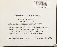 Aulacomnium palustre (Hedw.) Schwägr. 748938[1100040]Jan A. Janssens 70121981-09-02 United States, Minnesota, Beltrami, Waskish Area: Red Lake Peatland, eastern watershed, 1.1 km from Hwy 72, 48.339444 -94.540833, 364m |
MIN:Bryophytes | 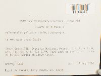 Aulacomnium palustre (Hedw.) Schwägr. 851920[1100047]Frank D. Bowers 223151994-08-29 United States, Minnesota, Lake, Keely Creek RNA, Superior National Forest. Just west of Hwy 1, ca. 17 km SE of Ely, South of Keely Creek, 47.633333 -91.7 |
MIN:Bryophytes | 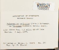 Aulacomnium palustre (Hedw.) Schwägr. 731102[1099983]Trana, Thomas D. 5521975-08-07 United States, Minnesota, Hubbard, Lake Alice Bog, 3.5 miles NW of Lake George., 47.232797 -95.067171 |
MIN:Bryophytes | 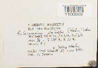 Aulacomnium palustre (Hedw.) Schwägr. 747904[1100049]Paul Glaser 19781978-06-21 United States, Minnesota, Beltrami, Red Lake Peatlands |
MIN:Bryophytes | 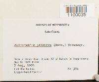 Aulacomnium palustre (Hedw.) Schwägr. 754133[1100035]Barkley, Rae 5061976-08-05 United States, Minnesota, Lake, West of Stony River, 8 miles SE of Babbitt; Copper-Nickel Plot T17 |
MIN:Bryophytes | 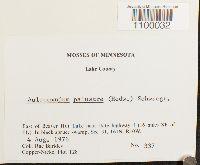 Aulacomnium palustre (Hedw.) Schwägr. 753942[1100032]Barkley, Rae 3371976-08-04 United States, Minnesota, Lake, East of Beaver Hut Lake near state highway I (16 miles SE of Ely). |
MIN:Bryophytes |  Aulacomnium palustre (Hedw.) Schwägr. 733614[1099984]Quinn, Robert 7061980-08-05 United States, Minnesota, Clearwater, trail opposite of the enterance of UMBS |
MIN:Bryophytes |  Aulacomnium palustre (Hedw.) Schwägr. 382925[1099955]Mary C. Van Wert s.n.1929-04-27 United States, Minnesota, Anoka, Anoka Sand Plain, 274m |
MIN:Bryophytes |  Aulacomnium palustre (Hedw.) Schwägr. 864784[1100007]Gerald A. Wheeler 168921997-07-26 United States, Minnesota, Stearns, Ca. 5 mi. N of St. Joseph, W of Rte. 4. NW1/4 SWl/4 SE1/4. (St. Wendel 16) |
MIN:Bryophytes | 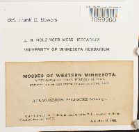 Aulacomnium palustre (Hedw.) Schwägr. 635526[1099960]Holzinger, J.M. s.n.1901-07-10 United States, Minnesota, Yellow Medicine, near Granite Falls |
MIN:Bryophytes | 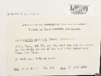 Aulacomnium palustre (Hedw.) Schwägr. 610352[1099967]Olson, W.A. 5641960-07-27 United States, Minnesota, Lake, SE 1/4 NE 1/4 Section 28, near the public access to the south branch of the Kawishiwi River near Minn. hwy No. 1., 47.815599 -91.737855 |
MIN:Bryophytes | 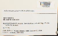 Aulacomnium palustre (Hedw.) Schwägr. 799652[1100000]Kern, R. ll6511651984-10-13 United States, Minnesota, Saint Louis, Meadowlands Area; Toivola/Meadowlands Bog, 47.06667 -92.85 |
MIN:Bryophytes | 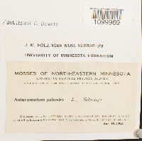 Aulacomnium palustre (Hedw.) Schwägr. 635529[1099969]J.M. Holzinger 21902-08-14 United States, Minnesota, at the west base of Mt. Josephin, 2 miles east of Grand Portage |
MIN:Bryophytes | 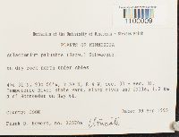 Aulacomnium palustre (Hedw.) Schwägr. 852929[1100009]Frank D. Bowers 23570a1995-09-09 United States, Minnesota, Cook, sec. 30 + sec. 31.; Temperence River State Park, along river and falls, 1.2 km N of Schroeder on Hwy 61, 47.516667 -90.933333 |
MIN:Bryophytes | 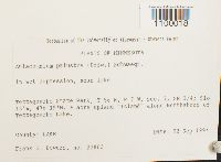 Aulacomnium palustre (Hedw.) Schwägr. 853281[1100018]Frank D. Bowers 228031994-09-02 United States, Minnesota, Lake, Tettegouche State Park. SE 1/4 of Section 7. & acre upland "Island" along Northshore of Tettegouche, 47.316667 -91.266667 |
MIN:Bryophytes | 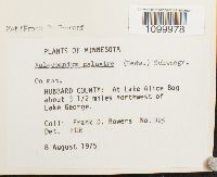 Aulacomnium palustre (Hedw.) Schwägr. 677650[1099978]Frank D. Bowers 9251975-08-08 United States, Minnesota, Hubbard, At Lake Alice Bog, about 3 1/2 miles northwest of Lake George., 47.232797 -95.067171 |
MIN:Bryophytes |  Aulacomnium palustre (Hedw.) Schwägr. 853545[1099976]Frank D. Bowers 223501994-08-29 United States, Minnesota, Lake, Keely Creek RNA, Superior National Forest, T 61N, R 11 W Sec. 14; R 11 W; ca 17 km SE of Ely, just west of Hwy 1, 47.633333 -91.7 |
MIN:Bryophytes |  Aulacomnium palustre (Hedw.) Schwägr. 812875[1100011]J.A. Janssens 194981989-08-19 United States, Minnesota, Clearwater, LAKE ITASCA AREA: Iron Springs Bog Scientific and Natural Area, north of gravel road, 3 km west of Lake Itasca (S_ of Section 28), 47.255 -95.24528, 440m |
MIN:Bryophytes |  Aulacomnium palustre (Hedw.) Schwägr. 856610[1100016]Frank D. Bowers 22497a1994-08-30 United States, Minnesota, Lake, Kawishiwi Pines CRNA, Superior National Forest, R11 W, T62N sec. 21; ca. 21 km SE of Ely, N. of S Kawishiwi River., 47.816667 -91.75 |
MIN:Bryophytes |  Aulacomnium palustre (Hedw.) Schwägr. 334719[1099971] s.n.1883-00-00 United States, Minnesota, Washington |
MIN:Bryophytes | 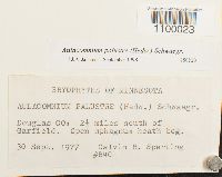 Aulacomnium palustre (Hedw.) Schwägr. 850820[1100023]Calvin R. Sperling B401977-09-30 United States, Minnesota, Douglas, 2 1/2 miles south of Garfield |
MIN:Bryophytes | 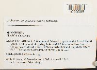 Aulacomnium palustre (Hedw.) Schwägr. 799637[1099995]Kern, R. 12051985-08-08 United States, Minnesota, Itasca, MARCELL AREA: S-2 Watershed, Marcell Experimental Forest (South Unit), 0.5 km west of Spring Lake and 1.5 km east of Bog Lake, Chippewa National Forest, 32 km north of Grand Rapids (NWNW Section 13), 47.516667 -93.466667, 426m |
MIN:Bryophytes |  Aulacomnium palustre (Hedw.) Schwägr. 747873[1099992]Frank D. Bowers 97561977-08-16 United States, Minnesota, Clearwater, West side of Lake Itasca near Garrison Point, Lake Itasca State Park |
MIN:Bryophytes | 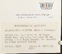 Aulacomnium palustre (Hedw.) Schwägr. 850821[1100024]Calvin R. Sperling B711977-10-23 United States, Minnesota, Becker, 2.5 miles W. of Osage, along Hwy. 34, at a rest area in the Smokey Hills State Forest |
MIN:Bryophytes | 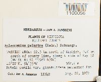 Aulacomnium palustre (Hedw.) Schwägr. 748785[1100056]Jan A. Janssens 111421982-08-22 United States, Minnesota, Beltrami, WASKISH AREA: 22.3 km north of Waskish, 0.5 km south of county line, along W side of Hwy 72 (NW SE NE Section 1), 48.366667 -94.55, 363m |
MIN:Bryophytes | 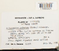 Aulacomnium palustre (Hedw.) Schwägr. 748775[1100051]Jan A. Janssens 110561982-08-21 United States, Minnesota, Beltrami, WASKISH AREA: 5.9 km upstream on Tamarac River (SW SW NE Section 15), 48.15 -94.466667, 359m |
MIN:Bryophytes |  Aulacomnium palustre (Hedw.) Schwägr. 853166[1100008]Frank D. Bowers 235711995-09-09 United States, Minnesota, Cook, Temperence River State Park, 1.2 km N of Schroeder on Hwy 61. Section 30 and Section 31, 47.516667 -90.933333 |
MIN:Bryophytes | 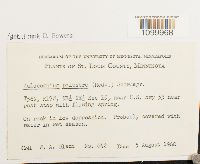 Aulacomnium palustre (Hedw.) Schwägr. 610354[1099968]Olson, W.A. 6421960-08-05 United States, Minnesota, Saint Louis, NE1/4 NE1/4 of Sec 15, near U.S. hwy 53 near rest stop with flowing spring., 47.336051 -92.481944 |
MIN:Bryophytes | 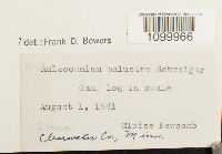 Aulacomnium palustre (Hedw.) Schwägr. 400951[1099966]Eloise Newcomb s.n.1941-08-01 United States, Minnesota, Itasca |
MIN:Bryophytes |  Aulacomnium palustre (Hedw.) Schwägr. 812785[1100001]J.A. Janssens 212931990-09-18 United States, Minnesota, Roseau, PINE CREEK AREA: Pine Creek Peatland, marginal area between upland and Pine Greek Peatland, northwest from Minnesota Hill, 6.5 km ENE from Pine Creek (SE of SW of Section 30 ), 48.99417 -95.87389, 320m |
MIN:Bryophytes | 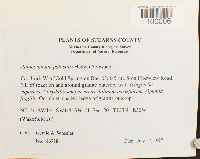 Aulacomnium palustre (Hedw.) Schwägr. 864771[1100006]Gerald A. Wheeler 169181997-07-27 United States, Minnesota, Stearns, Ca. 3 mi. W of Cold Spring on Rte. 23; 0.5 mi. S on Frostview Road, NE of road. NE1/4 Sw1/4 SW1/4 SW1/4 of Section 20 (Wakefield 20) |
MIN:Bryophytes | 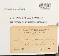 Aulacomnium palustre (Hedw.) Schwägr. 635528[1099961]J.M. Holzinger 751895-08-04 United States, Minnesota, near Minneapolis |
MIN:Bryophytes | 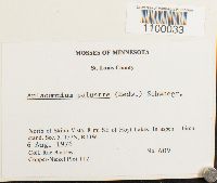 Aulacomnium palustre (Hedw.) Schwägr. 754113[1100033]Barkley, Rae 6091976-08-06 United States, Minnesota, Saint Louis, North of Skibo Vista, 8 mi SE of Hoyt Lakes. Copper-Nickel Plot T12. |
MIN:Bryophytes | 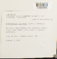 Aulacomnium palustre (Hedw.) Schwägr. 733615[1099985]Quinn, Robert 7921980-08-02 United States, Minnesota, Lake Of The Woods, Zippel Bay State Park |
MIN:Bryophytes | 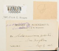 Aulacomnium palustre (Hedw.) Schwägr. 28211[1099954]J.M. Holzinger s.n.1895-08-04 United States, Minnesota, New Brighton |
MIN:Bryophytes | 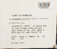 Aulacomnium palustre (Hedw.) Schwägr. 676995[1099982]Frank D. Bowers 8571975-07-24 United States, Minnesota, Clearwater, at Iron Bridge (Iron Springs) just north of Hwy. 200, about 1 mile west of Lake Itasca P.O. |
MIN:Bryophytes |  Aulacomnium palustre (Hedw.) Schwägr. 851663[1100048]Frank D. Bowers 226751994-09-01 United States, Minnesota, Lake, Kawashiwi Pines RNA State Natural Area, ca. 9 mi. SE of Ely. W 1/2 of SW 1/4 of Section 16, 47.833333 -91.75 |
MIN:Bryophytes | 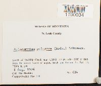 Aulacomnium palustre (Hedw.) Schwägr. 754123[1100034]Barkley, Rae 6341976-08-06 United States, Minnesota, Saint Louis, South of Stubble Creek near USFS 113 (9 miles SSE of Babbitt). Copper-Nickel Plot T18. |
MIN:Bryophytes |  Aulacomnium palustre (Hedw.) Schwägr. 850819[1100046]Calvin R. Sperling B661977-09-16 United States, Minnesota, Saint Louis, Near the E. end of Kabetogama Lake, along the Ash River Campground, 48.408333 -92.808333, 347m |
MIN:Bryophytes |  Aulacomnium palustre (Hedw.) Schwägr. 749339[1100041]Frank Bowers 5431978-10-21 United States, Minnesota, Beltrami, NW of Waskish in Red Lake Peatlands. |
MIN:Bryophytes |  Aulacomnium palustre (Hedw.) Schwägr. 747943[1100050]Jerry Wheeler s.n.1978-07-13 United States, Minnesota, Beltrami, Red Lake Peatlands. NE1/4 NW1/4 of Secion 5. Releve #36. |
MIN:Bryophytes | 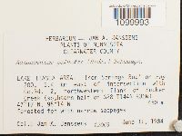 Aulacomnium palustre (Hedw.) Schwägr. 809355[1099993]Jan A. Janssens 120031984-06-11 United States, Minnesota, Clearwater, LAKE ITASCA AREA: 'Iron Springs Bog' on Hwy, 200, 2.4 km east of intersection with. Co.Rd. 2, northwestern flank of Sucker Creek (souhtern half of Section 28 ), 47.28333 -95.23333, 450m |
MIN:Bryophytes | 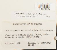 Aulacomnium palustre (Hedw.) Schwägr. 850822[1100025]Calvin R. Sperling B1861978-06-27 United States, Minnesota, Pope |
MIN:Bryophytes | 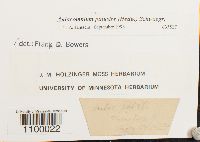 Aulacomnium palustre (Hedw.) Schwägr. 635527[1100022] 311895-08-10 United States, Minnesota, Taylor's Falls |
MIN:Bryophytes | 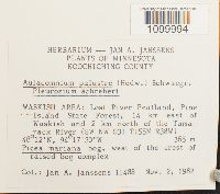 Aulacomnium palustre (Hedw.) Schwägr. 809570[1099994]Jan A. Janssens 114881982-11-02 United States, Minnesota, Koochiching, WASKISH AREA: Lost River Peatland, Pine Island State Forest, 14 km east of Waskish and 2 km north of the Tamarack River, west of the crest of raised bog complex, SW NW S31 T155N R38W, 48.2 -94.29167, 365m |
MIN:Bryophytes | 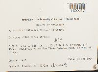 Aulacomnium palustre (Hedw.) Schwägr. 853518[1100017]Frank D. Bowers 22720a1994-09-01 United States, Minnesota, Lake, Kawishiwi Pines RNA State Natural Area, ca 9 mi SE of Ely. W1/2 of SW1/4 of Section 16, 47.83333 -91.75 |
MIN:Bryophytes | 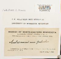 Aulacomnium palustre (Hedw.) Schwägr. 635530[1099970]J.M. Holzinger s.n.1902-07-16 United States, Minnesota, Cook, in the vicinity of Grand Marais |
MIN:Bryophytes | 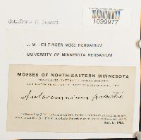 Aulacomnium palustre (Hedw.) Schwägr. 635531[1099977]J.M. Holzinger s.n.1902-08-15 United States, Minnesota, on Hat Point, a peninsula projecting southward from Mt. Josephine, into Lake Superior, near Grand Portage |
MIN:Bryophytes | 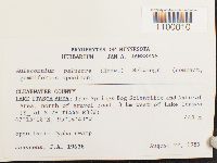 Aulacomnium palustre (Hedw.) Schwägr. 812856[1100010]J.A. Janssens 196381989-08-22 United States, Minnesota, Clearwater, Lake Itasca Area: Iron Springs Bog Scientific and Natural Area, north of gravel road, 3 km west of Lake Itasca, 440m |
MIN:Bryophytes | 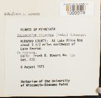 Aulacomnium palustre (Hedw.) Schwägr. 677656[1099979]Frank D. Bowers 9251975-08-08 United States, Minnesota, Hubbard, At Lake Alice Bog, about 3 1/2 miles northwest of Lake George., 47.232797 -95.067171 |
MIN:Bryophytes |  Aulacomnium palustre (Hedw.) Schwägr. 852232[1100019]Frank D. Bowers 227041994-09-01 United States, Minnesota, Lake, Kawashiwi Pines RNA State Natural Area, ca. 9 mi. SE of Ely. W 1/2 of SW 1/4 of Section 16, 47.833333 -91.75 |
MIN:Bryophytes | 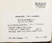 Aulacomnium palustre (Hedw.) Schwägr. 748783[1100054]Jan A. Janssens 78081981-11-01 United States, Minnesota, Saint Louis, Cloquet Area: Alborn fen, 47.011667 -92.575, 402m |
MIN:Bryophytes |  Aulacomnium palustre (Hedw.) Schwägr. 753830[1100028]Barkley, Rae 2361976-06-28 United States, Minnesota, Lake, Near Tony Lake on state highway I (16 miles SE of Ely). Copper-Nickel Plot T14. |
MIN:Bryophytes | 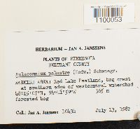 Aulacomnium palustre (Hedw.) Schwägr. 748782[1100053]Jan A. Janssens 104341982-07-13 United States, Minnesota, Beltrami, WASKISH AREA: Red Lake Peatland. Southern edge of westcentral watershed., 48.251944 -94.699722, 365m |
MIN:Bryophytes | 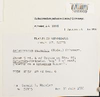 Aulacomnium palustre (Hedw.) Schwägr. 857429[1099999]Gerald A. Wheeler 301151981-07-11 United States, Minnesota, Saint Louis, About 9 mi. E of Cotton on Rte. 49; S of road. S1/2 of Section 6 |
MIN:Bryophytes |  Aulacomnium palustre (Hedw.) Schwägr. 28217[1100021]J.M. Holzinger s.n.1901-07-10 United States, Minnesota, Yellow Medicine, near Granite Falls |
MIN:Bryophytes |  Aulacomnium palustre (Hedw.) Schwägr. 856852[1099997]Gerald A. Wheeler 310891985-05-26 United States, Minnesota, Stearns, About 1.5 mi. W of Rockville on unmarked county road; adjacent to Sauk River. S1/2 of Section 8 |
MIN:Bryophytes | 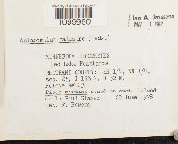 Aulacomnium palustre (Hedw.) Schwägr. 734167[1099990]Paul Glaser s.n.1978-06-22 United States, Minnesota, Beltrami, Red Lake Peatlands. SE1/4, NW 1/4 of Section 25. Releve s#13. |
MIN:Bryophytes | 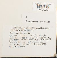 Aulacomnium palustre (Hedw.) Schwägr. 749344[1100026]Paul Glaser s.n.1978-07-01 United States, Minnesota, Beltrami, Red Lake Peatlands. NW1/4 SE1/4 of Section 12. Releve #23. |
MIN:Bryophytes | 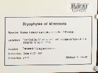 Aulacomnium palustre (Hedw.) Schwägr. 865220[1099974]Michael R. Smith 5791997-08-27 United States, Minnesota, Saint Louis, Tom Cod Bay, Voyageurs National Park, 48.488333 -93.186667 |
MIN:Bryophytes | 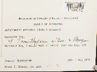 Aulacomnium palustre (Hedw.) Schwägr. 852789[1100013]Frank D. Bowers Z-71979-08-01 United States, Minnesota, Clearwater, 7 miles west of Zerkel just off hwy. 200. Marshall Bog. |
MIN:Bryophytes | 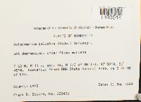 Aulacomnium palustre (Hedw.) Schwägr. 852141[1100014]Frank D. Bowers 22643b1994-09-01 United States, Minnesota, Lake, W 1/2 of SW 1/4 of Section 16. Kawishiwi Pines RNA State Natural Area, ca 9 mi SE of Ely., 47.833333 -91.75 |
MIN:Bryophytes | 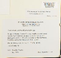 Aulacomnium palustre (Hedw.) Schwägr. 864957[1099973]Gerald A. Wheeler 176781997-09-05 United States, Minnesota, Renville, W side of Morton, Morton Outcrop complex. SW1/4 NW1/4 NW1/4 of Section 31. (Birch Cooley 31) |
MIN:Bryophytes | 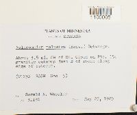 Aulacomnium palustre (Hedw.) Schwägr. 856823[1100005]Gerald A. Wheeler 311301985-05-27 United States, Minnesota, Stearns, About 3.5 mi. SW of St. Cloud on Rte. 15; granitic outcrop just E of road |
MIN:Bryophytes | 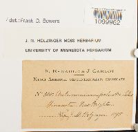 Aulacomnium palustre (Hedw.) Schwägr. 637132[1099962]J.M. Holzinger 3801895-00-00 United States, Minnesota |
MIN:Bryophytes | 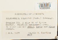 Aulacomnium palustre (Hedw.) Schwägr. 850823[1099965]Calvin R. Sperling B381977-10-01 United States, Minnesota, Douglas, 1 mile NE of Spruce Center. Wildlife management area. |
MIN:Bryophytes |  Aulacomnium palustre (Hedw.) Schwägr. 857180[1100002]Gerald A. Wheeler 305421982-06-08 United States, Minnesota, Aitkin, About 6 mi. N of McGrath.; 0.5 mi. E of Rte. 65 on Rte. 2; growing in. S1/2 of Section 33. |
MIN:Bryophytes | 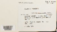 Aulacomnium palustre (Hedw.) Schwägr. 677690[1099981]Frank D. Bowers 6231975-07-31 United States, Minnesota, Beltrami, About 4 1/2 miles north of Waskish, just east of Hwy. 72. |
MIN:Bryophytes | 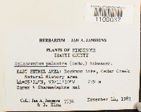 Aulacomnium palustre (Hedw.) Schwägr. 748786[1100037]Jan A. Janssens 75361981-11-14 United States, Minnesota, Isanti, EAST BETHEL AREA: Beckman Lake, Cedar Creek Natural History area, 44.423333 -93.186111, 279m |
MIN:Bryophytes | 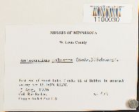 Aulacomnium palustre (Hedw.) Schwägr. 753878[1100030]Barkley, Rae 4791976-08-05 United States, Minnesota, Saint Louis, East end of Snort Lake, 7 miles SE of Babbitt. Copper-Nickel Plot T16 |
MIN:Bryophytes | 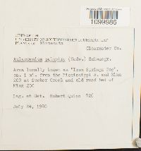 Aulacomnium palustre (Hedw.) Schwägr. 733616[1099986]Quinn, Robert 7261980-07-24 United States, Minnesota, Clearwater, Area locally known as ''Iron Springs Bog", ca. 1 mi. from the Mississippi R. and Minn 200 at Sucker Creek and old road ted of Minn 200 |
MIN:Bryophytes |  Aulacomnium palustre (Hedw.) Schwägr. 382699[1099957]Arthur Holmes s.n.1930-07-12 United States, Minnesota, Itasca, near Northome |
MIN:Bryophytes | 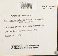 Aulacomnium palustre (Hedw.) Schwägr. 734021[1099988]Quinn, Robert 4481979-08-10 United States, Minnesota, Beltrami, Red Lake Bog |
MIN:Bryophytes |  Aulacomnium palustre (Hedw.) Schwägr. 28215[1099959]J.M. Holzinger s.n.1901-07-14 United States, Minnesota, Yellow Medicine, near Granite Falls |
MIN:Bryophytes | 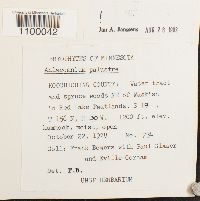 Aulacomnium palustre (Hedw.) Schwägr. 749340[1100042]Frank Bowers 7241978-10-22 United States, Minnesota, Koochiching, and spruce woods NE of Waskish in Red Lake Peatlands., 366m |
MIN:Bryophytes | 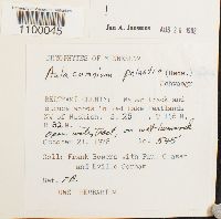 Aulacomnium palustre (Hedw.) Schwägr. 749343[1100045]Frank Bowers 5451978-10-21 United States, Minnesota, Beltrami, Red Lake Peatlands NW of Waskish. |
MIN:Bryophytes | 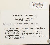 Aulacomnium palustre (Hedw.) Schwägr. 748928[1100039]Jan A. Janssens 7204A1981-09-16 United States, Minnesota, Isanti, EAST BETHEL AREA: Beckman Lake, Cedar Creek Natural History area, SW shore of lake., 44.423333 -93.186111, 279m |
MIN:Bryophytes | 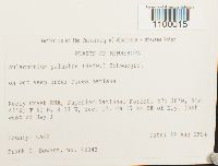 Aulacomnium palustre (Hedw.) Schwägr. 853541[1100015]Frank D. Bowers 223421994-08-29 United States, Minnesota, Lake, Keely Creek RNA, Superior National Forest. Ca 17 km SE of Ely, just west of Hwy 1, 47.633333 -91.7 |
MIN:Bryophytes | 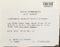 Aulacomnium palustre (Hedw.) Schwägr. 856732[1099972]Gerald A. Wheeler 302891981-07-17 United States, Minnesota, Carlton, Jay Cooke State Park; about 15 mi. SW of Duluth; N of Rte. 210. N1/2 of Section 10. |
MIN:Bryophytes | 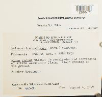 Aulacomnium palustre (Hedw.) Schwägr. 857465[1099975]Gerald A. Wheeler 300471997-08-04 United States, Minnesota, Itasca, Clay Boswell Steam Electric Station, Collection site No. Releve 50. NW1/4 SW1/4 of Section 4 |
MIN:Bryophytes | 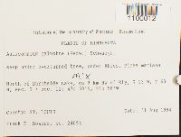 Aulacomnium palustre (Hedw.) Schwägr. 852709[1100012]Frank D. Bowers 240941994-08-31 United States, Minnesota, Saint Louis, North of Burntside Lake, ca 9 km NW of Ely N Sec. 2 and Sec. 11, 47.966667 -91.966667 |
MIN:Bryophytes | 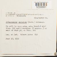 Aulacomnium palustre (Hedw.) Schwägr. 734023[1099991]Quinn, Robert 6921980-06-25 United States, Minnesota, Clearwater, area located, near Minn. 200 and Clearwater 38 approx. 3 mi west of that pt. on Minn. 200 |
MIN:Bryophytes | 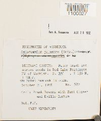 Aulacomnium palustre (Hedw.) Schwägr. 749345[1100027]Frank Bowers 5291978-10-21 United States, Minnesota, Beltrami, Red Lake Peatlands NW of Waskish., 48.303133 -94.695865 |
MIN:Bryophytes | 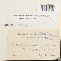 Aulacomnium palustre (Hedw.) Schwägr. 28213[1100020]J.M. Holzinger 751895-08-04 United States, Minnesota, near Minneapolis |
MIN:Bryophytes | 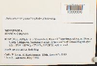 Aulacomnium palustre (Hedw.) Schwägr. 799581[1099996]Kern, R. 12461985-08-09 United States, Minnesota, Itasca, MARCELL AREA: S-5 Watershed, Marcell Experimental Forest (North Unit), Chippewa National Forest, 32 km north of Grand Rapids (SE Section 26), 47.55 -93.46667, 430m |
MIN:Bryophytes | 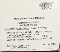 Aulacomnium palustre (Hedw.) Schwägr. 748781[1100052]Jan A. Janssens 80401981-11-03 United States, Minnesota, Beltrami, WASKISH AREA: Red Lake Peatland, western watershed, northern margin, 48.288889 -94.957222, 367m |
MIN:Bryophytes | 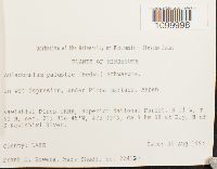 Aulacomnium palustre (Hedw.) Schwägr. 853003[1099998]Frank D. Bowers 224121994-08-30 United States, Minnesota, Lake, Kawishiwi Pines cRNA; Superior National Forest; R11 W, T 62 N, sec. 21; ca 9 km SE of Ely; N of S Kawishiwi River |
MIN:Bryophytes | 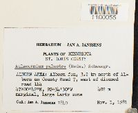 Aulacomnium palustre (Hedw.) Schwägr. 748784[1100055]Jan A. Janssens 78401981-11-01 United States, Minnesota, Saint Louis, ALBORN AREA: Albom fen, 3.2 km north of Alborn on County Road 7, east of disused road 144, 47.011667 -92.575, 402m |
MIN:Bryophytes | 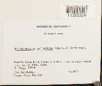 Aulacomnium palustre (Hedw.) Schwägr. 753834[1100029]Barkley, Rae 6261976-08-06 United States, Minnesota, Saint Louis, Near St. Louis River, 5 miles S of Hoyt Lakes. Copper-Nickel Plot T13 |
MIN:Bryophytes | 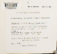 Aulacomnium palustre (Hedw.) Schwägr. 749342[1100044]Frank Bowers 5521978-10-21 United States, Minnesota, Beltrami, Red Lake Peatlands NW of Waskish. Relieve #9 |
MIN:Bryophytes | 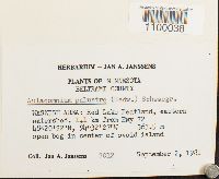 Aulacomnium palustre (Hedw.) Schwägr. 748922[1100038]Jan A. Janssens 70121981-09-02 United States, Minnesota, Beltrami, WASKISH AREA: Red Lake Peatland, eastern watershed, 1.1 km from Hwy 72, 48.339444 -94.540833, 364m |
MIN:Bryophytes | 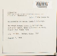 Aulacomnium palustre (Hedw.) Schwägr. 734022[1099989]Quinn, Robert 7471980-08-02 United States, Minnesota, Lake Of The Woods, behind the swimming beach, Zippel Bay State Park |
MIN:Bryophytes |  Aulacomnium palustre (Hedw.) Schwägr. 382924[1099958]Mary C. Van Wert s.n.1929-04-27 United States, Minnesota, Anoka, Anoka Sand Plain, 274m |
MIN:Bryophytes |  Aulacomnium palustre (Hedw.) Schwägr. 749341[1100043]Frank D. Bowers 79661977-07-29 United States, Minnesota, Lake of the Woods, 21 km north of Waskish, just north of county like, west side of road |
MIN:Bryophytes |  Aulacomnium palustre (Hedw.) Schwägr. 753905[1100031]Barkley, Rae 4511976-08-05 United States, Minnesota, Saint Louis, East of Snort Lake, 6 miles ESE of Babbitt. Cooper-Nickel Plot T15. |
MIN:Bryophytes |  Aulacomnium palustre (Hedw.) Schwägr. 733617[1099987]Quinn, Robert 3841979-07-20 United States, Minnesota, Hubbard, Lake Alice Bog, 47.232797 -95.067171 |
MIN:Bryophytes | 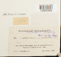 Aulacomnium palustre (Hedw.) Schwägr. 28216[1099956]C. MacMillan 371895-09-00 United States, Minnesota, International Boundary Line, Northern Minnesota, Saganaga Lake to South Lake |
MIN:Bryophytes | 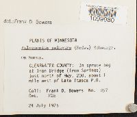 Aulacomnium palustre (Hedw.) Schwägr. 677660[1099980]Frank D. Bowers 8571975-07-24 United States, Minnesota, Clearwater, at Iron Bridge (Iron Springs) just north of Hwy. 200, about 1 mile west of Lake Itasca P.O. |
MIN:Bryophytes | 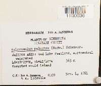 Aulacomnium palustre (Hedw.) Schwägr. 748766[1100036]Jan A. Janssens 81081981-11-04 United States, Minnesota, Beltrami, WASKISH AREA: Red Lake Peatland, westcentral watershed, 48.308056 -94.694444, 363m |
MIN:Bryophytes | 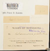 Aulacomnium palustre (Hedw.) Schwägr. 28214[1099964]C. MacMillan 91895-09-00 United States, Minnesota, International Boundary Line, Northern Minnesota, Saganaga Lake to South Lake |
Google Map
Google Maps is a web mapping service provided by Google that features a map that users can pan (by dragging the mouse) and zoom (by using the mouse wheel). Collection points are displayed as colored markers that when clicked on, displays the full information for that collection. When multiple species are queried (separated by semi-colons), different colored markers denote each individual species.