University of Minnesota
http://www.umn.edu/
612-625-5000
http://www.umn.edu/
612-625-5000
Minnesota Biodiversity Atlas
Dataset: SMM
Search Criteria: United States OR USA OR U.S.A. OR United States of America; excluding cultivated/captive occurrences
Science Museum of Minnesota | |
SMM | Z92:8:3[] United States, Minnesota |
SMM | FIC 41[] United States, Minnesota |
SMM | Z91:11:6[] United States, Minnesota |
SMM | FIC 47[] United States, Minnesota |
SMM | FIC 46[] United States, Minnesota |
SMM | Z2007:1:33[] United States, South Dakota, Detailed locality information protected. This is typically done to protect rare or threatened species localities. |
SMM | Z95:9:7[] United States, Minnesota, Detailed locality information protected. This is typically done to protect rare or threatened species localities. |
SMM | Z80:8:7[] United States, Minnesota |
SMM | Z80:1:36[] United States, Minnesota |
SMM | Z79:2:36[] United States, Minnesota |
SMM | Z80:1:50[] United States, Minnesota |
SMM | Z79:2:33[] United States, Minnesota |
SMM | Z79:2:32[] United States, Minnesota |
SMM | FIC 48[] United States, Minnesota |
SMM | FIC 49[] United States, Minnesota |
SMM | Z91:11:4[] United States, Minnesota |
SMM | Z90:7:2[] United States, Minnesota |
SMM | Z90:5:5[] United States, Minnesota |
SMM | Z94:14:28[] United States, Minnesota |
SMM | Z91:10:17[] United States, Minnesota |
SMM | Z91:10:14[] United States, Minnesota |
SMM | Z95:10:25[] United States, Minnesota |
SMM | Z91:10:8[] United States, Minnesota |
SMM | Z91:10:15[] United States, Minnesota |
SMM | Z94:14:30[] United States, Minnesota |
SMM | Z91:10:9[] United States, Minnesota |
SMM | Z91:10:11[] United States, Minnesota |
SMM | Z88:14:5[] United States, Minnesota |
SMM | Z2018:2:292[] United States, Minnesota |
SMM | Z79:2:20[]John A. Jarosz 63.2.41958-11-06 United States, Minnesota, Anoka, Linwood Lake, 45.351521 -93.109556 |
SMM | Z79:2:18[]John A. Jarosz 63.2.211962-11-13 United States, Minnesota, Anoka, Linwood Lake, 45.3514 -93.108354 |
SMM | Z80:1:65[] 1980-05-07 United States, Minnesota, Washington |
SMM | Z73:10:183[]D.C. and I. Elberg 1972-03-07 United States, Minnesota, Washington, 45.279398 -93.004194 |
SMM | Z78:1:49[]J.A. Jarosz 1976-11-01 United States, Minnesota, Mille lacs, 2 mi. NW of Milaca, 45.776272 -93.684786 |
SMM | Z2018:2:284[]R. J. Oehlenshlager 2016-10-23 United States, Minnesota, Wadena, 46.61041 -94.828856 |
SMM | Z2018:2:293[]R. J. Oehlenschlager 2008-10-17 United States, Minnesota, Wadena, 46.608219 -94.811641 |
SMM | Z2018:2:294[]R. J. Oehlenschlager 2005-10-15 United States, Minnesota, Wadena, 46.616569 -94.797688 |
SMM | Z2018:2:282[]Richard Oehlenschlager United STates, Minnesota, Wadena, 46.632118 -94.929415 |
SMM | Z73:10:176[]C. Hadland 1972-11-24 United States, Texas, Kenedy, 26.918167 -97.617262 |
SMM | Z78:1:77[]S.M.M. 1978-10-04 United States, Minnesota, Beltrami, 1/4 mi W of Rice Lake on Mississippi River, 47.452149 -94.881994 |
SMM | Z79:1:213[]Ed Spoon 1979-03-29 United States, Minnesota, Pope, near Glenwood, 45.650239 -95.389758 |
SMM | Z2001:4:16[]R.J. Oehlenschlager 2001-04-13 United States, Minnesota, Ramsey, Silver Lake Road just S. of Cty Rd. H at railroad crossing, 45.090365 -93.21895 |
SMM | Z79:1:57[]John Ludwig 1979-01-05 United States, Texas, Wilbarger, 10 mi N. 5 mi. W Vernon, 34.299582 -99.352203 |
SMM | Z79:1:56[]John Ludwig 1979-01-05 United States, Texas, Wilbarger, 10 mi. N, 5 mi. W of Vernon, 34.297242 -99.345766 |
SMM | Z79:1:58[]Robin Naplin 1979-01-05 United States, Texas, 10 miles N, 5 miles W. of Vernon, 34.299582 -99.35289 |
SMM | Z74:2:40[] 1974-06-22 United States, Alaska, Prince William Sound, (Chuqach Nat'l Forest), Blackstone Bay, 60.741506 -148.585361 |
SMM | Z74:2:39[] 1974-06-22 United States, Alaska, Prince William Sound, Blackstone Bay, 60.734625 -148.601299 |
SMM | Z74:2:66[]S.M.M. 1974-06-25 United States, Alaska, Prince William Sound; Dutch Group, South Island, 60.756677 -147.804132 |
SMM | Z80:3:3[]C.J. Maynard 1911-00-00 United States, Florida, 28.599736 -83.318359 |
SMM | Z80:3:21[MPLS Lib. #6269 & 1704, Nat. Mus. #108826]C.H. Townsend 1886-05-05 United States, Florida, at sea |
SMM | Z80:1:10[]Dave Duncan 1979-09-26 United States, Minnesota, St. Louis, T50N R14W, 46.809367 -92.112706 |
SMM | Z80:1:9[]Dave Duncan 1979-09-26 United States, Minnesota, St. Louis, T50N R14W; Duluth Landfill, 46.810537 -92.110012 |
SMM | Z80:1:8[]Dave Duncan 1979-09-26 United States, Minnesota, St. Louis, T50N R14W; Duluth Land Fill, 46.807717 -92.112415 |
SMM | Z80:1:7[]Dave Duncan 1979-08-26 United States, Minnesota, St. Louis, T50N R14W; Duluth Landfill, 46.807717 -92.111386 |
SMM | Z74:2:206[]S.M.M. 1974-08-25 United States, Alaska, 60.788992 -148.623219 |
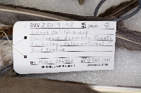
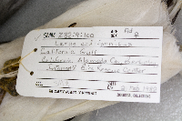
SMM | Z82:9:98[]Mary Candee 1981-12-09 United States, California, Alemeda, International Bird Rescue, 37.86869 -122.280332 |
SMM | Z78:4:27[]S.M.M. 1978-10-05 United States, Minnesota, Becker, Sand Lake, 46.864972 -96.17276 |
SMM | Z78:1:26[]D.N.R. 1978-04-20 United States, Minnesota, Swift, T120N R42 Sec. 31; Highway 59, 45.159068 -95.970238 |
SMM | Z82:9:42[]Mary Candee 1982-03-15 United States, California, Marin, 38.094992 -122.55185 |
SMM | Z78:1:132[]D.N.R. 1977-11-14 United States, Minnesota, Lac qui parle, Lac Qui Parle Refuge, 45.132106 -96.026002 |
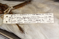
SMM | Z79:2:48[] 1940-10-17 United States, Minnesota, Hennepin, Mpls Airport, 44.880835 -93.219707 |
SMM | Z82:9:3[]M. Candee 1982-03-04 United States, California, Alameda, International Bird Rescue Center, 37.779041 -122.215466 |
SMM | Z78:4:28[]S.M.M. United States, Minnesota, Becker, Detailed locality information protected. This is typically done to protect rare or threatened species localities. |
SMM | Z78:4:29[]S.M.M. United States, Minnesota, Becker, Detailed locality information protected. This is typically done to protect rare or threatened species localities. |
SMM | Z78:1:58[]D.N.R. 1978-05-03 United States, Minnesota, Anoka, Sec 35; T31N R22W; between Otter and Amelia lakes, 45.131263 -93.050686 |
SMM | Z74:2:60[] 1974-06-25 United States, Alaska, Prince William Sound, Chugach Nat'l Forest; Dutch Group, North Rock, 60.770343 -147.805162 |
SMM | Z74:2:198[]C. Hadland 1974-08-24 United States, Alaska, 60.781772 -148.646123 |
SMM | Z74:2:59[] 1974-07-25 United States, Alaska, Prince William Sound; Chugach National Forest; Dutch Group, North Rock, 60.763888 -147.80293 |
SMM | Z74:2:61[] 1974-06-25 United States, Alaska, Prince William Sound, Chugach Nat'l Forest, rock E. of Perry Island, 60.703701 -147.863186 |
SMM | Z80:3:17[MPLS Public Library #12308]M.D. Thompson United States, Minnesota, Jackson, Detailed locality information protected. This is typically done to protect rare or threatened species localities. |
SMM | Z74:2:51[]S.M.M. 1974-06-25 United States, Alaska, Prince William Sound, Esther Rock, 60.801667 -148.178056 |
SMM | Z74:2:49[]S.M.M. 1974-06-25 United States, Alaska, Prince William Sound, Esther Rock Island, 60.801667 -148.178056 |
SMM | Z74:2:50[] 1974-06-25 United States, Alaska, Chugach Nat'l Forest; Prince William Sound; Esther Rock, 60.801667 -148.178056 |
SMM | Z74:2:48[]SMM 1974-06-25 United States, Alaska, Prince William Sound, Chugach Nat. Forest; Esther Rock, 60.801667 -148.178056 |
SMM | Z82:9:100[]S.M.M. 1982-02-02 United States, California, Alameda, International Bird Rescue Center, 37.871985 -122.27778 |
SMM | Z74:2:10[]Curtis Hadland 1974-06-19 United States, Alaska, Federal Refuge, Kenai Moose Range; Finger Lakes Area, 60.501575 -150.773657 |
SMM | Z2018:2:277[]R.J. Oehlenschlager 2000-01-28 United States, Minnesota, Ramsey, 6th St. and Wabasha, 44.94653 -93.095264 |
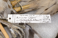
SMM | Z2018:2:278[]Cari Owver 2017-08-09 United States, Minnesota, Ramsey, 1361 Kenneth St., 44.90056 -93.185135 |
SMM | Z73:10:142[]D.N.R. United States, Minnesota, Anoka, Detailed locality information protected. This is typically done to protect rare or threatened species localities. |
SMM | Z90:7:31[]David S Paulson United States, Minnesota, Scott, Detailed locality information protected. This is typically done to protect rare or threatened species localities. |
SMM | Z80:1:76[]Bill Peterson United States, Minnesota, Cook, Detailed locality information protected. This is typically done to protect rare or threatened species localities. |
SMM | Z71:24:1[]M. Overbye United States, Minnesota, Crow Wing, Detailed locality information protected. This is typically done to protect rare or threatened species localities. |
SMM | Z74:7:48[]Dan Mills United States, Minnesota, Lake, Detailed locality information protected. This is typically done to protect rare or threatened species localities. |
SMM | Z92:8:41[] 1992-04-09 United States, Minnesota, Washington, 45.250203 -93.014162 |
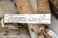
SMM | Z2003:1:11[]Ron Lawrenz 2003-07-07 United States, Minnesota, Washington, Manning Ave (Drive) or trail, N 1/4 mile of Highway 96, 45.077015 -92.858458 |
SMM | Z71:15:3[]D. Beardsley 1971-10-06 United States, Minnesota, Anoka, 45.244174 -93.266326 |
SMM | Z73:10:147[]Mrs. W. W. Fricke 1972-10-01 United States, Minnesota, Ramsey, Summit Ave, 44.941271 -93.143296 |
SMM | Z89:13:14[] 1989-06-15 United States, Minnesota, Goodhue, 1 mi. S of Red Wing along Hghwy 61, 44.561987 -92.546003 |
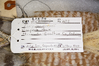
SMM | Z84:3:6[Raptor Rehab #J79 B174]Julie Lee, Carpenter N. C. 1983-05-03 United States, Minnesota, Goodhue, 44.562468 -92.533801 |
SMM | ZR9:16[] United States, Minnesota |
SMM | Z81:1:91[]Pat Reding 1980-00-00 United States, Minnesota, Pennington, along Roseau River, 48.065189 -96.132336 |
SMM | Z71:16:1[] United States, Minnesota, Armstrong Ranch, 45.20428 -93.392096 |
SMM | Z74:7:78[]C.M.H. 1974-03-23 United States, Minnesota, Fillmore, 4 mi. S of Spring Valley, 43.627013 -92.389274 |
SMM | Z63:5:5[]Carnes 1962-11-07 United States, Minnesota, Saint louis, 47.657637 -92.375537 |
SMM | Z81:1:44[]Paul Hopp 1980-09-15 United States, Minnesota, Kanabec, county road 6, 4 mi W. of Mora, 45.888823 -93.381144 |
SMM | Z73:10:130[]Forester 1970-05-14 United States, Minnesota, Pine, Changwatena State Forest, 45.92312 -92.710388 |
SMM | Z79:1:203[]MNDNR-Jim Breyan 1979-06-27 United States, Minnesota, Saint louis, Lake Vermillion, 47.852023 -92.36181 |
SMM | Z79:3:8[#504]H.F. Kendall 1906-05-05 United States, Minnesota, Mississipi River, town 48-29 N.W. of Deerwood, MN, 46.525565 -93.977148 |
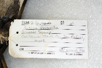
SMM | Z82:9:17[] 1980-03-18 United States, California, Marin, MWC, 37.965308 -122.470119 |
SMM | Z82:9:108[] United States |
Google Map
Google Maps is a web mapping service provided by Google that features a map that users can pan (by dragging the mouse) and zoom (by using the mouse wheel). Collection points are displayed as colored markers that when clicked on, displays the full information for that collection. When multiple species are queried (separated by semi-colons), different colored markers denote each individual species.
