University of Minnesota
http://www.umn.edu/
612-625-5000
http://www.umn.edu/
612-625-5000
Minnesota Biodiversity Atlas
Dataset: SMM
Search Criteria: United States OR USA OR U.S.A. OR United States of America; excluding cultivated/captive occurrences
Science Museum of Minnesota | |
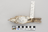
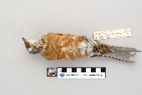
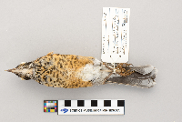
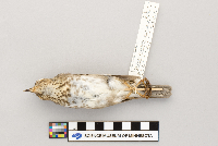
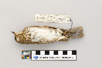
SMM | Z87:9:25[]Richard Oehlenschlager B-221987-09-19 United States, Minnesota, Cook, Forest Road 153, 5.8 miles E junction with Caribou Trail, N side; site C30, 47.868642 -90.502573 |
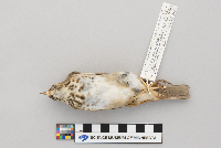
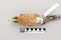
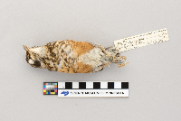
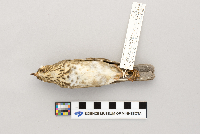
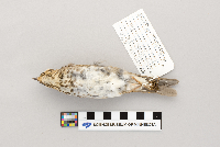
SMM | Z82:2:7[]Richard Oehlenschlager 1966-05-01 United States, Minnesota, Wadena, 4.5 miles E of Nimrod, 46.638574 -94.785967 |
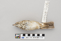
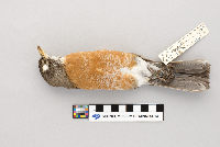
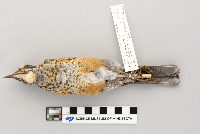
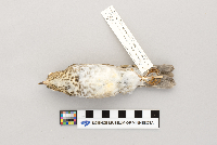
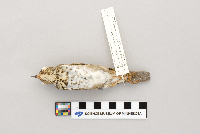
SMM | Z82:2:4[]Richard Oehlenschlager 1966-04-30 United States, Minnesota, Wadena, 4.5 miles E of Nimrod, 46.63881 -94.785967 |
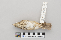
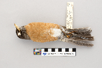
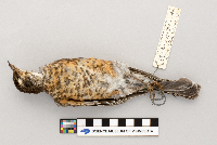
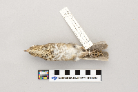
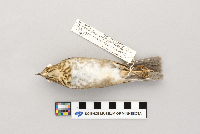
SMM | Z82:2:5[]Richard Oehlenschlager 1966-04-30 United States, Minnesota, Wadena, 4.5 miles E of Nimrod, 46.63881 -94.785967 |
SMM | Z2002:1:4[]Joe Maccanelli 2007-04-00 United States, Minnesota, Ramsey, 45.011174 -93.159014 |
SMM | Z2003:1:16[] 2003-04-21 United States, Minnesota, Ramsey, 120 W Kellogg Blvd; the Science Museum of Minnesota |
SMM | Z2005:1:30[]Susan Koche 2005-10-10 United States, Minnesota, Ramsey, 1064 Como Place, 44.973224 -93.134185 |
SMM | Z2003:1:14[]Sue Zwickel 2003-10-05 United States, Wisconsin, Polk, Haugen, 45.608243 -91.778841 |
SMM | Z2000:1:78[] 2000-10-09 United States, Minnesota, Carver, Lowry Nature Center |
SMM | Z98:6:12[]Betty Lou Lee 1998-08-10 United States, Minnesota, Saint louis, Camp Van Vac; Lake Burntside; about 5 miles from Ely, 47.922283 -91.964404 |
SMM | Z88:14:45[] 1988-09-26 United States, Minnesota, Cook, Forest Road 326, 1.3 miles N junction Forest Roads 153 and 165, W side; site C22 |
SMM | Z88:14:41[] 1988-09-24 United States, Minnesota, Cook, Forest Road 326, 1.3 miles N junction Forest Road 153 and 165, W side; site C22 |
SMM | Z82:2:18[] 759B1932-04-18 United States, Minnesota, Ramsey, Saint Paul Public Library |
SMM | Z90:5:21[]Richard Oehlenschlager B-1441990-09-19 United States, Minnesota, Cook, Forest Road 153, 5.8 miles E junction with Caribou Trail, N side; site C305, 47.869031 -90.500192 |
SMM | Z82:2:3[]N. Erickson 1961-04-14 United States, Minnesota, Hennepin, 45.047734 -93.244335 |
SMM | Z90:5:20[]Richard Oehlenschlager B-1371990-09-15 United States, Minnesota, Cook, Forest Road 153, 2 miles E Caribou Trail S side; site C 59, 47.861506 -90.583796 |
SMM | Z85:11:8[]Dr. M. Gibbs 302101874-10-12 United States, Minnesota, 46.425727 -93.824219 |
SMM | Z98:4:21[]Frederick Jannett Jr 1998-09-16 United States, Minnesota, Cook, Forest Road 323, 1.8 miles N Forest Road 153; site C 62, 47.901249 -90.488532 |
SMM | Z97:15:48[]Richard Oehlenschlager B-6591997-10-16 United States, Minnesota, Hennepin, E side of Lincoln Center on sidewalk, 44.974393 -93.267937 |
SMM | Z2008:1:22[]Minnesota DNR K392008-09-16 United States, Minnesota, Itasca, T147N R29W Sec14, 47.545583 -94.327722 |
SMM | Z2006:1:46[]Mary Lysne 2005-00-00 United States, Minnesota, Koochiching, Rainy Lake, Copenhagen Island, 48.654478 -93.174296 |
SMM | Z2008:1:24[]Minnesota DNR CBS K4a2008-09-18 United States, Minnesota, Itasca, T147N R39W Sec14, 47.545583 -94.327722 |
SMM | Z2008:1:23[]Linda Mona 2008-04-12 United States, Minnesota, Hennepin, 44.911938 -93.359219 |
SMM | Z2018:2:123[]Kate Clover 2015-10-07 United States, Minnesota, Ramsey, 7th St & Cedar, MN Public Radio, 44.94875 -93.095418 |
SMM | Z2000:1:88[]Frederick Jannett Jr 2000-09-13 United States, Minnesota, Cook, Forest Road 165 .3 miles W Baker Access Road N side, site C11, 47.835235 -90.818419 |
SMM | Z97:14:17[]R.J. Oehlenschlager 1997-08-22 United States, Minnesota, Saint louis, South of VNP boundary, North of Ash river Camp ground, 48.410051 -92.81533 |
SMM | Z83:41:4[]Frederick Jannett Jr 1983-09-00 United States, Minnesota, Cook, 5.8 miles E junction Caribou trail from Forest Road 153; T163N R1W Sec7 SW NE, 47.859141 -90.489055 |
SMM | Z2007:1:41[] 2007-04-29 United States, Minnesota, Wadena |
SMM | Z2018:2:11[] 1999-11-06 United States, Minnesota, Ramsey |
SMM | Z2018:2:78[]Jane Olyphant 1996-05-15 United States, Wisconsin, 44.594614 -89.626465 |
SMM | Z86:6:7[]R.J. Oehlenschlager 1985-05-19 United States, Minnesota, Washington, 4.5 miles SW of marion on St. Croix at wilder Forest may township, 45.161158 -92.845448 |
SMM | Z82:2:8[] 1965-09-00 United States, Minnesota, Olmsted, TV Tower |
SMM | Z94:11:25[]Jane Olyphant 1995-06-13 United States, Wisconsin, Saint croix, 44.852545 -92.247207 |
SMM | Z94:11:26[]Jane Olyphant 1994-06-13 United States, Wisconsin, Saint croix, 44.851206 -92.243946 |
SMM | Z2000:1:50[]Peder 2000-09-20 United States, Minnesota, Ramsey, The St. Paul Companies, 44.945671 -93.098224 |
SMM | Z2005:1:6[]Poder Thompson 2005-05-11 United States, Minnesota, Ramsey, 120 W. Kellogg Blvd, The Science Museum of Minnesota, 44.942478 -93.09903 |
SMM | Z97:15:9[]Virgil Nelson 1997-05-23 United States, Minnesota, Itasca, 47.362785 -93.587219 |
SMM | Z2018:2:207[]R.J. Oehlenschlager 2016-06-19 United States, Minnesota, Wadena, 46.609988 -94.818937 |
SMM | Z2018:2:213[] 2009-09-30 United States, Minnesota, Ramsey |
SMM | Z2018:2:136[]R.J. Oehlenschlager 2012-05-28 United States, Minnesota, Wadena, 46.613349 -94.819108 |
SMM | Z2018:2:170[]David Gardnor 2012-10-23 United States, Minnesota, Ramsey, Gem Lake, 45.058012 -93.039478 |
SMM | Z2018:2:200[]R.J. Oehlenschlager 2017-09-26 United States, Minnesota, Hennepin, 6th St & 4th Ave, 44.975511 -93.265981 |
SMM | Z75:1:39[]Science Museum of Minnesota 1975-05-14 United States, Minnesota, Fillmore, 5 miles S Spring Valley, 43.614485 -92.389059 |
SMM | Z79:1:300[]Robert Peters 1979-10-21 United States, Minnesota, 2561 South Shore BLVD. |
SMM | Z79:1:231[]Gretchen Wolfe 1979-09-17 United States, Minnesota, Ramsey, 45.102744 -93.079109 |
SMM | Z91:11:12[]Mudge Hawkinson 1991-03-23 United States, Minnesota, Ramsey, Valentine Lake, 45.060592 -93.167275 |
SMM | Z78:1:17[]C.M.H. 1978-04-24 United States, Minnesota, Dakota, 44.885976 -93.039136 |
SMM | Z75:1:104[]Science Museum of Minnesota 1975-07-06 United States, Minnesota, Fillmore, 5 mi South of Spring Valley, 43.614485 -92.389059 |
SMM | Z73:16:1[]Tim Fiske 1973-09-22 United States, Minnesota, Hennepin, Saint Albans Bay, 44.907238 -93.552396 |
SMM | Z78:1:18[]Lois Bohon 1978-05-10 United States, Minnesota, 45.084688 -93.00994 |
SMM | Z2004:1:7[]James L. Smith 2004-04-17 United States, Minnesota, Anoka, 45.403853 -93.267728 |
SMM | Z2008:1:7[] 2008-04-16 United States, Minnesota, Hennepin, dog park |
SMM | Z2018:2:34[] 1987-07-09 United States, Minnesota, Goodhue, Welch |
SMM | Z94:11:31[]R.J. Oehlenschlager 1994-04-26 United States, Minnesota, Ramsey, River Park Plaza, Fillmore and Robertson St, MN dept. of Revenue building, 44.942039 -93.084286 |
SMM | Z73:16:5[]Bob Durch 1972-04-18 United States, Minnesota, Chisago, Junction Highway 8 and 98, 45.377039 -92.855218 |
SMM | Z2002:1:109[]Wildlife Rehab 2002 R:162002-00-00 United States, Minnesota |
SMM | Z98:6:4[] 1998-06-01 United States, Minnesota, Anoka, 6 mi E of St. Francis on County Rd 70 |
SMM | Z89:13:13[] 1989-10-23 United States, Minnesota, Anoka |
SMM | Z2010:1:11[]Alice Aamodt 2010-10-18 United States, Minnesota, Washington, 45.060468 -92.856275 |
SMM | Z2018:2:113[]Richard Oehlenschlager 2014-04-18 United States, Minnesota, Ramsey, 120 W Kellogg Blvd; The Science Museum of Minnesota, 44.942539 -93.098343 |
SMM | Z2007:1:48[]R.J. Oehlenschlager 2007-04-15 United States, Minnesota, Wadena, 46.634603 -95.068818 |
SMM | Z2007:1:47[] 2007-10-14 United States, Minnesota, Wadena, T135N R33W Sec10 SE NE |
SMM | Z92:8:21[]R.J. Oehlenschlager 1992-05-10 United States, Minnesota, Cass, pn Highway 64, 46.579489 -94.700498 |
SMM | Z98:6:5[]Richard Oehlenschlager B-6621998-05-14 United States, Minnesota, Anoka, near intersection Onandaga and Hayes Street, 45.102411 -93.233009 |
SMM | Z96:2:78[]Anita Randen 1996-04-09 United States |
SMM | Z2005:1:57[]Kurt Lysne, Mary Lysne 2005-10-02 United States, Minnesota, Koochiching, Rainy Lake, Copenhagen Island, 48.654137 -93.173524 |
SMM | Z2018:2:105[]Staff 2014-07-22 United States, Minnesota, Ramsey, Science Museum of Minnesota; 120 W Kellogg Blvd, 44.9426 -93.098536 |
SMM | Z83:36:1[] 1967-10-05 United States, Minnesota, Dakota |
SMM | Z290:7:21[]Phyllis Gene Jones 1990-06-14 United States, Minnesota, Washington, 10726 Grey Cloud Island Drive, 44.796235 -92.986692 |
SMM | Z78:1:133[]J. Getman 1978-07-00 United States, Minnesota, Ramsey, East Side, 44.97764 -93.023893 |
SMM | Z2008:1:6[] 2008-08-06 United States, Minnesota, Ramsey, Albany and Arona |
SMM | Z78:1:24[]Bob Charles 1978-05-06 United States, Minnesota, Ramsey, 44.952255 -93.094973 |
SMM | Z95:5:2[]NJV 1995-07-10 United States, Wyoming, Grand Teton National Park, West of Leeks marina on Research Station Rd, 43.874614 -110.617597 |
SMM | Z95:5:1[]N.J.V. 1995-07-13 United States, Wyoming, Grand Teton National Park; University of Wyoming Research Station, 43.944364 -110.64163 |
SMM | Z2018:2:205[]Museum staff 2010-07-26 United States, Minnesota, Ramsey, 120 West Kellogg Blvd, 44.942506 -93.098775 |
SMM | Z98:4:20[]Frederick Jannett 1998-09-16 United States, Minnesota, Cook, Forest Road 153, 2.1 miles W junction with Forest Road 323, N side; site C31, 47.852589 -90.699032 |
SMM | Z82:2:11[]BAF 1965-09-00 United States, Wisconsin, Eau claire, TV Tower, 44.817794 -91.47374 |
SMM | Z82:2:6[]B.A.F. 1965-09-19 United States, Minnesota, Cook, Bally Creek, 47.785591 -90.471525 |
SMM | Z95:10[]R.J. Oehlenschlager 1995-09-11 United States, Minnesota, Cook, F.S.R. 326 1.0 mi N junct F.R. 153/165 E Side, 47.87332 -90.652597 |
SMM | Z94:14:2[]Richard Oehlenschlager B-4131994-09-08 United States, Minnesota, Cook, Sawbill Trail, 4.5 miles N junction County Road 3, E side, 47.861059 -90.886659 |
SMM | Z95:10:6[]R.J. Oehlenschlager 1995-09-12 United States, Minnesota, Cook, 47.913018 -90.473096 |
SMM | Z94:14:3[]Richard Oehlenschlager B-4151994-09-08 United States, Minnesota, Cook, Sawbill Trail, 4.5 miles N junction County Road 3, E side, 47.861001 -90.886166 |
SMM | Z95:10:18[]R.J. Oehlenschlager 1995-09-17 United States, Minnesota, Cook, F.R. 153, 1.2 mi W Junc, F.R. 323 S. side, 47.880976 -90.47437 |
SMM | Z95:10:9[]R.J. Oehlenschlager 1995-09-10 United States, Minnesota, Cook, F.R. 326, 1.0 miles N. junc. F.R. 153, E side, 47.872744 -90.655001 |
SMM | Z92:8:23[]Mudge Hawkinson 1992-05-28 United States, Minnesota, Ramsey, Valentine Lake, 45.061289 -93.167404 |
SMM | Z89:12:12[]R.J. Oehlenschlager 1989-09-08 United States, Minnesota, Cook, Sawbill Trail, 1.5 mi N. southerly junc. Rd 3, E side, 47.818946 -90.889706 |
SMM | Z86:9:16[]F. Jannett 1986-09-19 United States, Minnesota, Cook, FSR 153 5.8 mi E. junc. Caribou Trail N. side, 47.869103 -90.500556 |
SMM | Z82:2:19[]H.F.K. 1904-09-04 United States, Minnesota, 47.409265 -92.942913 |
SMM | Z96:2:31[]Richard Oehlenschlager 1996-05-24 United States, Minnesota, Hennepin, 7th street, 44.984587 -93.28496 |
SMM | Z93:11:6[]R.J. Oehlenschlager 1993-09-23 United States, Minnesota, Cook, F.S.R. 326, 2.5 mi N junc. F.S.R. 153/165 W side, 47.889035 -90.640581 |
SMM | Z92:7:8[] 1992-09-13 United States, Cook, Sawbill Trail, 4.5 mi N |
SMM | Z88:14:12[] 1988-09-06 United States, Minnesota, Cook, Co. Rd 3, 1.3 miles W. Sawbill Trail, S. Side |
SMM | Z97:15:11[] 1997-05-20 United States, Minnesota, Ramsey, 245250 Shore BLVD |
SMM | Z2005:1:28[]Kurt Lysne 2005-06-02 United States, Minnesota, Koochiching, Rainy Lake, Copenhagen Island, 48.654421 -93.173695 |
SMM | Z87:9:17[]R.J. Oehlenschlager 1987-08-31 United States, Minnesota, Cook, Brule Lake Rd., 47.892569 -90.643188 |
SMM | Z88:14:10[] 1988-09-06 United States, Minnesota, Cook, Co Rd 3, 1.3 mil W Sawbill Trail, S. side |
SMM | Z79:4:102[]C. Hadlund 1979-05-23 United States, Minnesota, Anoka, Carlos Avery Wildlife Management Area; T33N R22W sec26 NW, 45.322237 -93.055828 |
SMM | Z74:2:32[] 1974-06-21 United States, Alaska, Kenai Moose Range, Fuller Lake Trail |
SMM | Z87:9:10[]R.J. Oehlenschlager 1987-08-17 United States, Minnesota, Cook, 3.3 mi S of North end of Caribou Trail, 47.822429 -90.662828 |
SMM | Z90:5:13[]R.J. Oehlenschlager 1990-09-08 United States, Minnesota, Cook, Co Rd 3, 1.3 mi W Sawbill Trail S. side, 47.802054 -90.906203 |
Google Map
Google Maps is a web mapping service provided by Google that features a map that users can pan (by dragging the mouse) and zoom (by using the mouse wheel). Collection points are displayed as colored markers that when clicked on, displays the full information for that collection. When multiple species are queried (separated by semi-colons), different colored markers denote each individual species.
