University of Minnesota
http://www.umn.edu/
612-625-5000
http://www.umn.edu/
612-625-5000
Minnesota Biodiversity Atlas
Dataset: SMM
Search Criteria: United States OR USA OR U.S.A. OR United States of America; excluding cultivated/captive occurrences
Science Museum of Minnesota | |
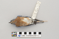
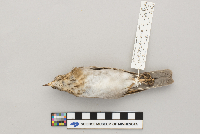
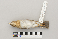
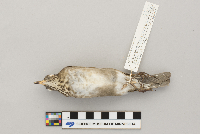
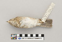
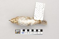
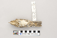
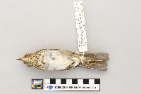
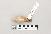
SMM | Z90:5:14[]R.J. Oehlenschlager 1990-09-08 United States, Minnesota, Cook, F.R. 165, SE intersection F.R. 339 (site C3), 47.852676 -90.68723 |
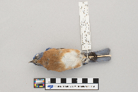
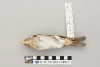
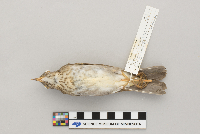
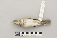
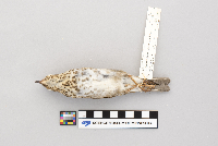
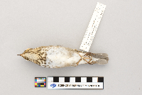
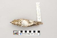
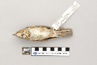
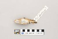
SMM | Z96:2:56[]Ron Lawrenz 1996-10-25 United States, Minnesota, Washington, Big Marine Lake, Manning Trail and County Rd 4, 45.195663 -92.882168 |
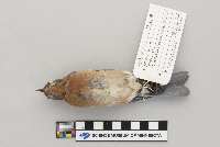
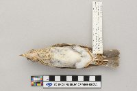
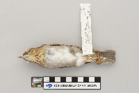
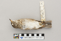
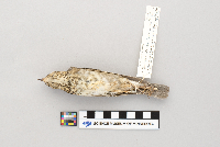
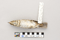
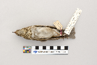
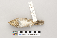
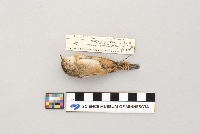
SMM | Z82:2:23[]J.S.H. 1932-10-13 United States, Minnesota, Ramsey, Hodgson Rd, 45.107237 -93.124135 |
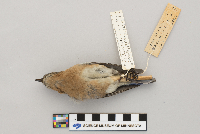
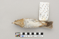
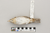
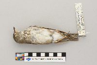
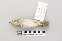
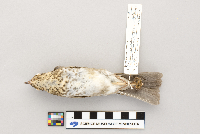
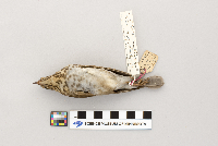
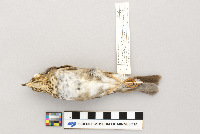
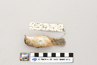
SMM | Z82:2:25[]LHP 1932-10-13 United States, Minnesota, Ramsey, Hodson Rd., 45.10754 -93.126324 |
SMM | Z82:2:22[]Nancy Nelson 1967-04-15 United States, Minnesota, Ramsey, 45.080829 -93.14648 |
SMM | Z2002:1:10[]Larry Lambert 2002-04-24 United States, Minnesota, Chicago, North Branch, 39121 Heron Ave., 45.515502 -92.951944 |
SMM | Z90:7:20[] 1990-06-12 United States, Minnesota, Ramsey |
SMM | Z82:2:24[]JSH 1932-02-01 United States, Minnesota, Big Lake, 45.340188 -93.73372 |
SMM | Z2000:1:4[]R.J. Oehlenschlager 2000-03-28 United States, Minnesota, Ramsey, World Trade Center, 44.947931 -93.095757 |
SMM | Z90:7:13[]Marian Walker 1990-04-07 United States, Minnesota, Washington, 44.995314 -92.900663 |
SMM | Z2007:1:30[]Mary Harrison 2007-04-06 United States, Minnesota, Wadena, 14523 274 st., 46.622834 -94.811864 |
SMM | Z2008:1:38[]Dave Pickett 2008-06-28 United States, Minnesota, Scott, 26071 Prairie Rose Ct., 44.570268 -93.47337 |
SMM | Z80:4:32[]Science Museum of Minnesota 1980-07-13 United States, North Dakota, Billings, Sentinal Butte, Wannagan Creek Quarry; T141N R101W sec 3 SW, 47.055824 -103.471783 |
SMM | Z2018:2:218[]R.J. Oehlenschlager 2018-07-04 United States, Minnesota, Wadena, 46.571007 -94.901306 |
SMM | Z2001:4:59[]Larry Smith 2001-08-28 United States, Minnesota, Anoka, Main Street, 45.403764 -93.267601 |
SMM | Z94:11:6[] 1994-05-20 United States, Minnesota, Ramsey, IRS Building |
SMM | Z2004:1:14[]R.J. Oehlenschlager 2004-05-00 United States, Wisconsin, 46.56983 -91.430212 |
SMM | Z94:11:1[]R.J. Oehlenschlager 1997-05-16 United States, Minnesota, Hennepin, 45.008129 -93.469143 |
SMM | Z86:6:12[]Larry Smith 1986-05-25 United States, Minnesota, Saint louis, Lake Vermillion, Birch Point Rd., 47.857302 -92.373586 |
SMM | Z84:16:3[]Mildred Lalor 1984-05-20 United States, Minnesota, Ramsey, 2596 19th Ave East, 45.022985 -92.990725 |
SMM | Z82:2:10[] 1965-09-00 United States, Minnesota, Olmsted, Rochester TV Tower |
SMM | Z2002:1:60[] 2002-05-30 United States, Minnesota, Koochiching, Rainy Lake |
SMM | Z2002:1:106[]Wildlife Rehab 2002-00-00 United States, Minnesota |
SMM | Z90:5:17[]R.J. Oehlenschlager 1990-09-11 United States, Minnesota, Cook, F.R. 153, 2.7 mi E Caribou Trail, S. side, 47.859829 -90.566595 |
SMM | Z89:13:22[]R.J. Oehlenschlager 1989-08-26 United States, Minnesota, Wadena, 46.439385 -95.136139 |
SMM | Z2000:1:23[]R.J. Oehlenschlager 2000-05-16 United States, Minnesota, Ramsey, St. Paul companies building, 44.945679 -93.098208 |
SMM | Z96:16:1[]Richard Oehlenschlager B-6111996-08-28 United States, Minnesota, Saint louis, Voyageurs National Park, VM2, 48.483546 -92.835351 |
SMM | Z2006:1:48[]Mary Lysne 2006-07-16 United States, Minnesota, Koochiching, Copenhagen Island, 48.654426 -93.173702 |
SMM | Z98:4:4[]Frederick Jannett Jr. 1998-09-07 United States, Minnesota, Cook, F.R. 326, 1.0 mi N Junct F.R. 153.165 E Side, 47.874011 -90.651482 |
SMM | Z98:4:1[]F.J. 1998-09-05 United States, Minnesota, Cook, Sawbill Trail, 4.5 mi N Southerly Junc Co. Rd 3, E. Side, 47.736277 -90.881166 |
SMM | Z90:5:12[]Richard Oehlenschlager B-1251990-09-07 United States, Minnesota, Cook, Parents Lake Road Esker; County Road 3 5.3 miles W Sawbill trail, N side; E side of creek, 47.809192 -90.975828 |
SMM | Z87:9:24[]R.J. Oehlenschlager 1987-09-18 United States, Minnesota, Cook, F.R. 326, 1.5 miles N junc. F.S.R. 153/165, E side (cite C23), 47.876832 -90.645216 |
SMM | Z93:11:2[]R.J. Oehlenschlager 1993-09-12 United States, Minnesota, Cook, F.S.R. 165, 0.9 mi E Baker Lake access road, 47.836352 -90.798153 |
SMM | Z88:14:25[]R.J. Oehlenschlager 1988-09-14 United States, Minnesota, Cook, F.S.R. 153, 2.7 miles E Caribou Trail, S side (site c60), 47.857353 -90.680207 |
SMM | Z73:10:91[] 1971-05-12 United States, Minnesota, Ramsey, Crocus Hill |
SMM | Z73:16:30[]Chas Kne 1968-05-09 United States, Minnesota, 44.187245 -93.983435 |
SMM | Z82:2:9[]B.A.F., P.T. 1965-09-00 United States, Wisconsin, Eau claire, TV tower, 44.820716 -91.4655 |
SMM | Z87:9:18[]R.J. Oehlenschlager 1987-09-02 United States, Minnesota, Cook, 47.892764 -90.43739 |
SMM | Z91:10:31[]Richard Oehlenschlager B-2511991-09-22 United States, Minnesota, Cook, Forest Road 326, 2.5 miles N junction Forest Roads 153 and 165, W side; site 24, 47.888862 -90.639637 |
SMM | Z86:6:13[]Richard Oehlenschlager 1985-09-13 United States, Minnesota, Washington, May Field Avenue N, 0.75 mi NW of Square Lake, Stillwater Township |
SMM | Z90:5:11[]R.J. Oehlenschlager 1990-09-06 United States, Minnesota, Cook, Co. Rd. 3, 1.3 mi W Sawbill Trail, s. side, 47.802054 -90.905903 |
SMM | Z82:2:12[]Richard Oehlenschlager 1966-05-00 United States, Minnesota, Wadena, 4 miles E of Nimrod; T136N R33W sec10 or sec11, 46.607839 -94.822141 |
SMM | Z87:9:19[]R.J. Oehlenschlager 1987-09-05 United States, Minnesota, Cook, Brule Lake Rd, 1.0 mi S of boat landing, 47.914089 -90.654461 |
SMM | Z91:10:41[]Frederick Jannett 1991-09-17 United States, Minnesota, Cook, F.S.R. 326, 0.95 mi N Junct. F.S.R. 153/165 W Side, 47.873032 -90.654486 |
SMM | Z83:36:54[]Arlene Zwickel 1982-09-14 United States, Minnesota, Ramsey, 45.006077 -93.157298 |
SMM | Z90:5:10[]Richard Oehlenschlager B-1231990-09-05 United States, Minnesota, Cook, Forest Service Road 153 and 165, 47.859097 -90.673197 |
SMM | Z89:12:13[]R.J. Oehlenschlager 1989-09-10 United States, Minnesota, Cook, F.R. 1278, 1.2 mi E junc F.R. 339, N side, (site J20), 47.756084 -90.730618 |
SMM | Z97:11:10[]Fredrick Jannett 1997-09-15 United States, Minnesota, Cook, F.R. 323, 1.8 mi N F.R. 153- N/E side (c62), 47.90066 -90.478704 |
SMM | Z97:11:13[]F. Jannett 1997-09-11 United States, Minnesota, Cook, F.R. 326, 1.0 mi N Junc. F.R. 153/165, E. side, 47.873147 -90.653971 |
SMM | Z90:5:15[]Richard Oehlenschlager B-1301990-09-09 United States, Minnesota, Cook, Forest Road 165 0.4 miles E Baker Lake access road N side, site C11, 47.83748 -90.804241 |
SMM | Z82:2:20[]H.F.K. 1904-09-04 United States, Minnesota, 47.4167 -92.9333 |
SMM | Z82:2:17[]H.F.K. 1904-09-04 United States, Minnesota, Hibbing, 47.416005 -92.934942 |
SMM | Z92:7:9[]R.J. Oehlenschlager 1992-09-13 United States, Minnesota, Cook, F.S.R. 326, .95 miles N junc. F.S.R. 153/165, W side, 47.872917 -90.654314 |
SMM | Z94:14:33[]Richard Oehlenschlager 1994-09-19 United States, Minnesota, Cook, Forest Road 153 3.5 miles E junction Caribou trail N side, J18, 47.863044 -90.54982 |
SMM | Z98:4:2[]Frederick Jannett 1998-09-06 United States, Minnesota, Cook, F.R. 165, 0.3 mi W Baker L. access road, N side, 47.83535 -90.81814 |
SMM | Z2005:1:21[]Sharon Mallman 2005-05-14 United States, Minnesota, Washington, May Twnship, 14273 St. Croix Trail, 45.156265 -92.762092 |
SMM | Z2002:1:110[] 2002-05-18 United States, Minnesota, Hennepin, North East Minneapolis |
SMM | Z94:14:32[]Richard Oehlenschlager 1994-09-14 United States, Minnesota, Cook, Forest Road 326, 2.5 miles N junction Forest Road 153/165, W side, site C24; T63N R3W sec36 NW SE, 47.895861 -90.644803 |
SMM | Z96:12:10[]R.J. Oehlenschlager 1996-09-12 United States, Minnesota, Cook, 0.25 mi S of boat landing on Brule Lake Road, 47.922833 -90.646235 |
SMM | Z96:12:11[]Richard Oehlenschlager B-5911996-09-06 United States, Minnesota, Cook, Forest Road 165 3 miles W Baker Lake access road N side, site C10, 47.812416 -90.845037 |
SMM | Z98:6:9[] 1998-05-26 United States, Minnesota, Ramsey |
SMM | Z98:4:8[]Frederick Jannett Jr 1998-09-12 United States, Minnesota, Cook, Forest Road 326 .95 miles N juction Forest Road 153/165 W side, site C 18, 47.873435 -90.652254 |
SMM | Z2004:1:46[]Mary Lysne 2004-09-14 United States, Minnesota, Koochiching, Rainy Lake, Copenhagen Island,, 48.654704 -93.174468 |
SMM | Z2008:1:21[]Melanie Wegner 2008-05-00 United States, Minnesota, Carver, Flamingo Drive, 44.847621 -93.556535 |
SMM | Z2000:1:86[]Frederick Jannett 2000-09-09 United States, Minnesota, Cook, USPS trailer on highway 61, 47.543999 -90.894039 |
SMM | Z2007:1:38[]Staff 2007-00-00 United States, Minnesota, Washington, Marine on Saint Croix, Science Museum of Minnesota Saint Croix Wildlife Refuge System, 45.170924 -92.76197 |
SMM | Z96:13:2[] 1996-05-18 United States, Minnesota, Ramsey, North Cooks, 45 Pheasant Lane |
SMM | Z2018:2:169[]Dave Gardner 2012-09-03 United States, Minnesota, Ramsey, 45.056496 -93.037762 |
SMM | Z2017:2:191[]SMM staff 2018-05-18 United States, Minnesota, Ramsey, 120 West Kellogg BLVD., 44.942573 -93.098893 |
SMM | Z2018:2:192[]Richard Oehlenschlager 2018-09-18 United States, Minnesota, Hennepin, 6th Street and 7th Avenue, 44.986318 -93.243944 |
SMM | Z2018:2:172[]R.J. Oehlenschlager 2011-05-11 United States, Minnesota, Ramsey, 7545 Spring Lake Rd, 45.104828 -93.22465 |
SMM | Z83:36:42[]Lawrence N. Huber LNH 18581968-01-29 United States, Arizona, Pima, .5 miles N Cortaro Road, 32.355167 -111.099428 |
SMM | Z97:9:2[]Richard Oehlenschlager B-6241997-06-13 United States, Minnesota, Ramsey, Twin Cities Army Ammunition Plant, 45.094223 -93.166239 |
SMM | Z94:1:26[]Larry Smith 1993-06-13 United States, Minnesota, Anoka, 45.400719 -93.270303 |
SMM | Z95:9:34[]Richard Oehlenschlager 1995-05-03 United States, Minnesota, Hennepin, 44.903296 -93.566346 |
SMM | Z2000:1:27[]R.J. Oehlenschlager 2000-06-03 United States, Minnesota, Sherburne, Ca. 3 mi. S. of St. Cloud on US 10 at entrance to state highway information center |
SMM | Z2000:1:44[]Jerry Jacine 2000-08-31 United States, Tennessee, Putnam, 38506 Village Road, 36.230965 -85.484374 |
SMM | Z95:7:6[]R.J. Oehlenschlager 1995-06-13 United States, Minnesota, Ramsey, Arden Hills, The Twin Cities army ammunition plant, 45.095768 -93.164909 |
SMM | Z96:2:33[]N.J.V. 1996-05-21 United States, Minnesota, Ramsey, National Charity League Building of Minnesota |
SMM | Z91:11:32[]R.J. Oehlenschlager 1991-05-21 United States, Minnesota, Houston, 3 mi E of Caledonia, N side of MN 249 just below SCS, 43.634676 -91.436768 |
SMM | Z2006:1:36[]Richard Oehlenschlager 2006-09-29 United States, Minnesota, Ramsey, Sibley 6th Street Skyway N of intersection, 44.949615 -93.08879 |
SMM | Z2009:1:23[]David Edlund 2009-00-00 United States, Minnesota, Ramsey, 45.022624 -93.0833 |
SMM | Z93:3:54[]Dick Kulisheck 1993-10-24 United States, Minnesota, Hennepin, 5324 Park Avenue, 44.906281 -93.265637 |
SMM | Z92:7:11[]R.J. Oehlenschlager 1992-09-24 United States, Minnesota, Cook, F.S.R. 326, 2.5 mi N. Junct F.S.R. 153/165 W. side, 47.889181 -90.640635 |
SMM | Z87:9:28[]Richard Oehlenschlager B-461987-09-26 United States, Minnesota, Cook, Forest Road 326 2.5 miles N junction Forest Road 153/165 W side, site C24, 47.887584 -90.639466 |
SMM | Z98:5:16[]Fredrick Jannett Jr 1998-10-04 United States, Minnesota, Saint louis, bog NW of Ash River Campground, S. of Voyagers National Park Sullivan Bay |
SMM | Z85:9:1[]F.J. 1984-09-19 United States, Minnesota, Cook, Forest Road 165 SE intersection Forest Road 339, site C3, 47.802006 -90.841444 |
SMM | Z85:9:6[]F. Jannett 1984-09-00 United States, Minnesota, Cook, 47.9167 -90.484082 |
SMM | Z96:2:71[] 1996-10-01 United States, Minnesota, Ramsey, 7th Street and Wabasha |
SMM | Z92:7:25[]Richard Oehlenschlager B-2711992-08-19 United States, Minnesota, Rock, Rosedell township, sec16 NE SE; propery of Dale Hartz |
SMM | Z92:8:49[]Marian Walker 1992-06-19 United States, Minnesota, Washington, 1871 Margo Ave N., 44.976854 -92.859036 |
SMM | ZR1:12[] United States, Minnesota, Fillmore, Ostrander TV Tower |
SMM | Z78:4:21[]Science Museum of Minnesota 1978-10-06 United States, Minnesota, Otter tail, Orwell Wildlife Area, 46.215501 -96.162241 |
SMM | Z79:4:6[]C. Hadlund 1979-04-23 United States, Minnesota, Anoka, Carlos Avery Wildlife Management Area; T32N R22W sec19, 45.247242 -93.131862 |
SMM | Z2002:1:131[] R:302002-05-16 United States, Minnesota, Hennepin, NE Minneapolis |
SMM | Z78:1:65[]C. Henderson 1978-08-23 United States, Minnesota, Pope, Gilchrist township, outlet of Gilchrist Lake; T123N R37W sec17, 45.464726 -95.355069 |
SMM | Z78:4:41[]Science Museum of Minnesota 1978-10-04 United States, Minnesota, Beltrami, Rice Lake; Mississippi Headwaters Canoe Trail, 47.445988 -95.073638 |
SMM | Z78:4:42[]Science Museum of Minnesota 1978-10-04 United States, Minnesota, Beltrami, Rice Lake; Mississippi Headwaters |
SMM | Z82:2:64[] 1967-12-17 United States, Arizona, Pima, 1 mile SW Golf Link and Camio Seco |
SMM | Z82:2:65[] 1967-12-17 United States, Arizona, Pima, 1 mile SW Golf links and Camino Seco. |
Google Map
Google Maps is a web mapping service provided by Google that features a map that users can pan (by dragging the mouse) and zoom (by using the mouse wheel). Collection points are displayed as colored markers that when clicked on, displays the full information for that collection. When multiple species are queried (separated by semi-colons), different colored markers denote each individual species.
