University of Minnesota
http://www.umn.edu/
612-625-5000
http://www.umn.edu/
612-625-5000
Minnesota Biodiversity Atlas
Dataset: SMM
Search Criteria: United States OR USA OR U.S.A. OR United States of America; excluding cultivated/captive occurrences
Science Museum of Minnesota | |
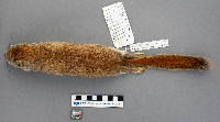
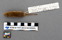
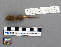
SMM | Z2017:2:464[]Virgil Nelson 1997-06-06 United States, Minnesota, Itasca, 47.362785 -93.587219 |
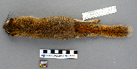
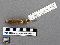
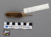
SMM | Z96:14:13[]Bill Johnson 1996-12-05 United States, Minnesota, Hennepin, 29 Penn Ave. So., 44.976277 -93.308043 |
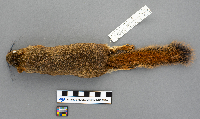
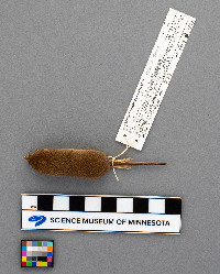
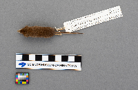
SMM | Z83:37:5[]R.A.S. 1982-07-30 United States, Ohio, Erie, Perkins Twnshp, Plum Brook NASA, Columbus Ave 50 mi. So. of Fox Road, 41.372851 -82.657842 |
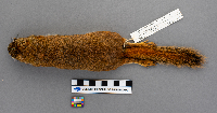
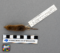
SMM | Sciurus carolinensis Gmelin, 1788 Z2018:1:68[]Crowder 2001-10-28 United States, Minnesota, Ramsey, Bronson Drive, 45.105738 -93.206318 |
SMM | Sciurus carolinensis Gmelin, 1788 Z92:13:10[]R.J.O. 1992-10-24 United States, Minnesota, Wadena, 46.611945 -94.785803 |
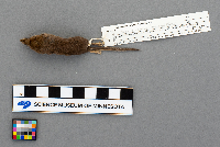
SMM | Z83:37:6[]R.A.S. 1981-03-29 United States, Ohio, Erie, Perkins Twnshp; NASA Plum Brook Station, Mason Road ~1 mi. W. of Rt. 250, 100 m. west of Columbus Rd., 41.334043 -82.644874 |
SMM | Sciurus carolinensis Gmelin, 1788 Z2017:4:94[]R.J.O. 2003-09-13 United States, Minnesota, Wadena, 46.613743 -94.787863 |
SMM | Z74:2:181[] 1974-07-09 United States, Alaska, Steese Highway, 65.374078 -145.98584 |
SMM | Sciurus carolinensis Gmelin, 1788 Z2017:2:465[]Leland Grim 2002-02-16 United States, Minnesota, Koochiching, Rainy Lake, Jackfish Bay, Cty. Rd 94, 48.613827 -93.271337 |
SMM | Z2018:1:34[]N.J.V. 1997-01-04 United States, Minnesota, Ramsey, 44.968084 -93.019934 |
SMM | Z95:14:34[]F.J. 1995-09-07 United States, Minnesota, Cook, Co. Rd. 3, 1.3 mi. W. of Sawbill Trail, S. side (site C1) |
SMM | Z95:14:35[]F.J. 1995-09-07 United States, Minnesota, Cook, Parents Lake Road Esker, Co. Rd. 3, 5.3 mi. W. of Sawbill Trail, N. side road E. side creek; (site J4) |
SMM | Z89:11:27[]F.J. 1989-09-08 United States, Minnesota, Cook, Graded road, 1.8 mi. E. of Sawbill Trail |
SMM | Z85:4:10[]F.J. 1984-09-00 United States, Minnesota, Cook, Superior National Forest, 47.689754 -91.634521 |
SMM | Z85:15:1[]F.J. 1985-09-08 United States, Minnesota, Cook, CCC Camp |
SMM | Sciurus carolinensis Gmelin, 1788 Z91:14:5[]R.J.O. 1991-10-14 United States, Minnesota, Wadena, 46.611886 -94.785631 |
SMM | Sciurus carolinensis Gmelin, 1788 Z2017:4:101[]R.J. Oehlenschlager 2003-10-25 United States, Minnesota, Wadena, 46.609881 -94.787777 |
SMM | Sciurus carolinensis Gmelin, 1788 Z80:1:27[]Derek Hadland 1977-09-00 United States, Minnesota, Fillmore, 43.620246 -92.375008 |
SMM | Z85:15:2[]James Moody 1985-09-12 United States, Minnesota, Cook, Co. Rd. 3, 1.3 mi. W. Sawbill Trail, S. side |
SMM | Z2017:4:95[]R.J.O. 2001-04-00 United States, Minnesota, Wadena, U.S. Highway 71, 46.526938 -95.09376 |
SMM | Z78:1:82[]S.M.M. 1978-06-10 United States, Minnesota, Pope, 17 mi. E. Cyrus, 45.614142 -95.38619 |
SMM | Poliocitellus franklinii Sabine Z89:17:51[]F.J. 1989-08-14 United States, Minnesota, Clay, E. of Felton, 47.078808 -96.452214 |
SMM | Z83:18:13[]Gary Flatten 1968-05-16 United States, Minnesota, Houston, Sheldon Twnshp, 43.717023 -91.551485 |
SMM | Z92:13:11[]R.J. Oehlenschlager 1992-11-07 United States, Minnesota, Wadena, 46.611532 -94.785459 |
SMM | Z91:12:191[]F.J. 1991-08-15 United States, Minnesota, Chippewa, Intersection of Co. Rd. 32 & State Hwy #7, 44.949145 -95.373655 |
SMM | Z83:18:5[]D.L. Hunt 1972-04-15 United States, New Mexico, Grant, 30 mi. NW of Silver City, 33.006653 -108.58884 |
SMM | Z83:20:15[]F. Jannett 1982-09-20 United States, Minnesota, Cook, ~1 km N. Lutsen, Carlton Mt, W. side |
SMM | Z94:16:1[]R.J.O. 1994-08-07 United States, Minnesota, Ramsey, 7546 Spring Lake Rd, 45.104944 -93.225903 |
SMM | Z95:17:1[]N.J.V. 1995-08-31 United States, Minnesota, Ramsey, 44.901695 -93.087077 |
SMM | Z76:1:46[]D.N.R. 1973-01-06 United States, Minnesota, Martin, Fairmont Township, S.14 SW 1/4, 43.633702 -94.402584 |
SMM | Z79:1:34[]Brekke Kramer 1978-04-11 United States, Minnesota, Watonwan, 1.5 mi. No. of Truman on State Hwy 15, 43.855473 -94.429191 |
SMM | Z19:12:12[]R.J. Oehlenschlager 1991-08-23 United States, Minnesota, Lac Qui Parle, County gravel pit land; Freeland Twnshp, E 1/2 NW 1/4 Sec. 16; (site 91P), 44.859393 -96.288841 |
SMM | Z91:12:9[]R.J.O. 1991-08-22 United States, Minnesota, Lac qui parle, County Gravel Pit Land, Freeland Township, E 1/2 NW 1/4 Sec. 16 (site 91P), 44.859849 -96.288841 |
SMM | Z91:13:9[]R.J.O. 1991-05-22 United States, Minnesota, Houston, ~3 mi. E. of Caledonia, N. side MN 249, just below S.C.S. earthen dam; (site 91B), 43.633809 -91.430059 |
SMM | Z2017:4:7[]R.J.O. 1995-04-17 United States, Minnesota, Wadena, 46.628504 -95.053422 |
SMM | Z94:17:213[]R.J.O. 1994-04-20 United States, Minnesota, Wadena, 46.422806 -94.83638 |
SMM | Z95:13:37[]R.J.O. 1995-08-25 United States, Minnesota, Lincoln, Altona W.M.A, N. side of Co. Rd. 117; (site 95C), 44.193335 -96.327277 |
SMM | Sciurus carolinensis Gmelin, 1788 Z94:17:212[]R.J.O. 1994-10-22 United States, Minnesota, Wadena, 46.611768 -94.785459 |
SMM | Z94:17:211[]R.J.O. 1994-10-30 United States, Minnesota, Wadena, 46.612063 -94.785416 |
SMM | Z91:12:143[]F.J. 1991-08-28 United States, Minnesota, Lac qui parle, Freeland township, W 1/2 NE 14 Sec. 27, prop. Glenn Haugen (site 91Q), 44.830547 -96.263907 |
SMM | Z90:4:110[]F.J. 1990-09-24 United States, Minnesota, Cook, F.R. 326, 5.45 mi. N. junc, F.R. 153/165, west side |
SMM | Z93:7:127[]R.J.O. 1993-08-11 United States, Minnesota, Rock, Rose Dell Twnshp, NE 1/4 SE 1/4 Sec. 16; (site 93A), 43.810772 -96.35391 |
SMM | Z91:12:22[]R.J.O. 1991-08-30 United States, Minnesota, Rock, Rose dell Township, NE SE S. 16, prop. Dale Hartz, 43.811111 -96.354647 |
SMM | Z91:12:11[]R.J.O. 1991-08-23 United States, Minnesota, Lac Qui Parle, County gravel pit land, Freeland Twnshp, E 1/2 NW 1/4 Sec. 16; (site P), 44.859302 -96.288798 |
SMM | Z92:10:16[]R.J.O. 1992-08-18 United States, Minnesota, Rock, Rose Dell Township, NE 1/4 SE 1/4 sec. 16 prop. Dale Hartz (site 92A), 43.810987 -96.353531 |
SMM | Z91:12:21[]RJO-M-1192 1991-08-30 United States, Minnesota, Rock, Rose Dell Twnshp, Sec. 16 NE 1/4 SE 1/4; (site 91S), 43.810679 -96.35421 |
SMM | Z91:12:154[]R.J.O. 1991-08-29 United States, Minnesota, Rock, Rose Dell Township, NE 1/4 SE 1/4, prop Dale Hartz (site 91S), 43.810368 -96.354647 |
SMM | Z91:12:8[]RJO-M-1149 1991-08-28 United States, Minnesota, Pipestone, Altona Twnshp, NW 1/4 Sec. 22; (site 91R), 44.150461 -96.363342 |
SMM | Z95:13:42[]R.J.O. 1995-08-22 United States, Minnesota, Lincoln, Altona WMA, N. side of Co. Rd. 117 (site 95C), 44.192324 -96.327293 |
SMM | Z93:7:202[]R.J.O. 1993-08-14 United States, Minnesota, Clay, 3.3 mi. E. of Felton, 1.0 mi. S. of Co. Rd. 34; (site 93B), 47.064406 -96.436268 |
SMM | Z93:7:105[]R.J.O. 1993-09-05 United States, Minnesota, Wadena, 46.417177 -95.076409 |
SMM | Z91:12:7[]R.J.O. 1991-08-28 United States, Minnesota, Piipestone, Altona Twnshp, NW 1/4 of Sec. 22; (site 91R), 44.150522 -96.363171 |
SMM | Z91:12:232[]R.J.O. 1991-08-28 United States, Minnesota, Pipestone, Altona Township NW 1/4 Sec. 22 prop Benson, leased by Larry Hillard (site 91R), 44.150676 -96.362599 |
SMM | Z94:5:140[]F.J. 1994-08-29 United States, Minnesota, Kittson, Caribou W.M.A, Sec. 8, 2 mi. (by road) W. of Co. Rd. 4, ~1/2 mi. N. Sec. 17, 48.953861 -96.515243 |
SMM | Z92:10:17[]R.J.O. 1992-08-19 United States, Minnesota, Rock, Rose Dell Township NE 1/4 SE 1/4 Sec. 16, prop. Dale Hartz (site 92A), 44.160002 -96.37147 |
SMM | Z91:12:233[]R.J.O. 1991-08-28 United States, Minnesota, Pipestone, Altona Twnshp, NW 1/4 of Sec. 22; (site 91R), 44.150492 -96.363342 |
SMM | Z91:12:23[]R.J.O. 1991-08-30 United States, Minnesota, Rock, Rose Dell Township, Sec. 16, NE 1/4 SE 1/4. prop. Dale Hartz, 43.810925 -96.353874 |
SMM | Z97:5:15[]R.J.O. 1997-06-18 United States, Minnesota, Ramsey, Twin Cities Army Ammunition Plant, 45.097555 -93.163621 |
SMM | Z97:5:18[]R.J.O. 1997-06-19 United States, Minnesota, Ramsey, Arden Hills, Twin Cities Army Ammunitions Plant 97TC5, 45.096132 -93.163519 |
SMM | Z97:5:21[]R.J.O. 1997-06-27 United States, Minnesota, Ramsey, Twin Cities Army Ammunition Plant, 45.097585 -93.162892 |
SMM | Z97:5:19[]R.J.O. 1997-06-25 United States, Minnesota, Ramsey, Twin Cities Army Ammunition Plant 97TC6, 45.094889 -93.163793 |
SMM | Z97:6:2[]F.J. 1997-06-27 United States, Minnesota, Ramsey, J. Jill Farm/estate, 45.101263 -93.091616 |
SMM | Z97:5:16[]R.J.O. 1997-06-19 United States, Minnesota, Ramsey, Twin Cities Army Ammunition Plant 97TC5, 45.095434 -93.160961 |
SMM | Z97:5:14[]R.J.O. 1997-06-17 United States, Minnesota, Ramsey, Twin Cities Army Ammunition Plant, 45.096707 -93.163106 |
SMM | Z97:5:20[]R.J.O. 1997-06-27 United States, Minnesota, Ramsey, Twin Cities Army Ammunition Plant, 45.093556 -93.168085 |
SMM | Z97:5:17[]R.J.O. 1997-06-19 United States, Minnesota, Ramsey, Twin Cities Army Ammunition Plant, 45.097373 -93.162978 |
SMM | Z94:5:15[]R.J.O. 1994-08-29 United States, Minnesota, Kittson, Caribou WMA, Sec. 8, 2 mi. (by road) W. of Co. Rd. 4 ~1/2 N sec. 17 (site 94G), 48.962882 -96.531335 |
SMM | Z97:6:4[]F.J. 1997-06-29 United States, Minnesota, Ramsey, 45.102502 -93.089752 |
SMM | Z97:6:3[]F.J. 1997-06-29 United States, Minnesota, Ramsey, North Oaks, J. Hill Estate/Farm, 45.103471 -93.089409 |
SMM | Z93:7:22[]R.J.O. 1993-08-22 United States, Minnesota, Kittson, Skull Lake WMA, 1.9 mi. (by road) from Co. Rd. 4 N. side (site 93G), 48.929558 -96.708117 |
SMM | Z89:17:98[]F.J. 1989-08-15 United States, Minnesota, Clay, N. of Buffalo River State Park + R.R. S. of U.S. 10, W. of park entrance rd. (site 89 F2 & 3), 46.874544 -96.479535 |
SMM | Z91:12:145[]F.J. 1991-08-28 United States, Altona, Pipestone, Altona Township, NW 1/4 Sec. 22 prop Benson, leased by Larry Hillard (site 91R), 44.150769 -96.363085 |
SMM | Z91:12:149[]F.J. 1991-08-22 United States, Minnesota, Lac Qui Parle, Freeland Twnshp, Sec. 16, E 1/2 NW 1/4 (site 91P), 43.816317 -96.364029 |
SMM | Z91:12:150[]F.J. 1991-08-22 United States, Minnesota, Lac qui parle, County Gravel Pit Land, Freeland Township, E 1/2 NW 1/4 Sec. 16 (site 91P), 44.858997 -96.288498 |
SMM | Z85:12:34[]R.A. Dolber 1978-02-12 United States, Ohio, Erie, 2 mi. S. of Birmingham, along East Fork of the Vermillion River near Huron and Lorain counties; Camp Timberline - Erie Shores Girl Scouts, 41.295974 -82.343305 |
SMM | Z87:1:16[] 1984-06-22 United States, Alaska, Yukon Delta National Wildlife Refuge, Nelson Island, 16 km S. of Nightmute, 2 km W. of Kolavinarak River, 60.332659 -164.68251 |
SMM | Z87:1:15[]R.A.S. 1984-05-21 United States, Alaska, Yukon Delta National Wildlife Refuge, Nelson Island, 16 km. S. of Nightmute, 2 km. W. of Koavinarak River, 60.330631 -164.698757 |
SMM | Z87:1:14[] 1984-06-21 United states, Alaska, Yukon Delta National Wildlife Refuge, Nelson Island, 16 km S. of Nightmute, 2 km W. of Kolavinarak River, 60.333637 -164.682653 |
SMM | Z94:9:3[] 1991-05-26 United States, Oregon, Lake, H.J. Andrews Experimental Forest Stand, Station A5, 42.787403 -120.34908 |
SMM | Z95:8:7[]R.J.O. 1995-06-16 United States, Minnesota, Ramsey, Twin Cities Army Ammunition Plant (site TCAAP O8), 45.095434 -93.164051 |
SMM | Z90:8:63[]R.J.O. 1990-08-29 United States, Minnesota, Houston, Beaver Creek Valley State Park (site 90H), 43.646625 -91.579529 |
SMM | Z95:13:8[]R.J.O. 1995-08-17 United States, Minnesota, Rock, Rose Dell Township, NE 1/4 SE 1/4 Sec. 16 prop. Dale Hartz. (site 95A), 43.810615 -96.353188 |
SMM | Z88:8:22[]R.J.O. 1988-09-22 United States, Minnesota, Cook, Forestry Serv. Rd #326, mi. N. of Grade Rd.; Brule Lake Rd.; (cabin) |
SMM | Z88:8:21[]R.J.O. 1988-08-25 United States, Minnesota, Cook, Brule Lk Rd (forest serv. Rd #326) mi. N of Grade Rd (F. Serv Rd #) (Cabin) |
SMM | Z90:4:3[]F.J. 1990-07-30 United States, Minnesota, Cook, F.R. 326, 2.5 mi. N. of jct. with F.R. 153/165, W. side; (site C24) |
SMM | Z89:11:29[]F.J. 1989-09-13 United States, Minnesota, Cook, F.R. 153, 3.5 mi. W. junc. Caribou Trail, N. side (site J18) |
SMM | Z90:4:17[]R.J.O. 1990-09-20 United States, Minnesota, Cook, Brule Lake, at Cabin, 47.94296 -90.676147 |
SMM | Z90:4:4[]F.J. 1990-08-01 United States, Minnesota, Cook, F.R. 153, 5.3 mi. E. of jct. Caribou trail, N. side (site C30) |
SMM | Z94:17:201[]R.J.O. 1994-11-02 United States, Minnesota, Wadena, 46.606188 -94.825231 |
SMM | Z2005:3:2[]R.J.O. 2005-07-17 United States, Minnesota, Wadena, Yaeger Lake WMA, 46.699599 -94.966782 |
SMM | Z87:6:9[]R.J.O. 1987-09-13 United States, Minnesota, Cook, F.R. 326, 5.2 mi. N. junc. F.R. 153/165, W. side |
SMM | Z94:1:1[]James L. Smith United States, Minnesota, Anoka, 45.403853 -93.267728 |
SMM | Z79:1:221[]K. Zentzis 1979-09-16 United States, Minnesota, Dakota, Lilydale, Twin City brickyards, 44.765869 -93.097344 |
SMM | Z2017:2:298[]MN DNR CBS 2003-09-18 United States, Minnesota, Cook, 9 mi. N. 4 mi. W. Hovland, 47.971297 -90.052356 |
SMM | Z2017:2:318[]MN DNR CBS 2003-00-00 United States, Minnesota, Cook, 9 mi. N, 4 mi. W Hovland |
SMM | Z94:5:149[]F.J. 1994-08-25 United States, Minnesota, Kittson, Caribou WMA, Sec. 8, 2 mi. (by road) W. of Co. rd. 4 ~ 1/2 mi. N. Sec. 17 (site 94G), 48.957697 -96.51477 |
SMM | Z94:5:133[]F.J. 1994-08-28 United States, Minnesota, Kittson, Caribou WMA, Sec. 8, 2 mi. (by road) W. of Co. Rd. 4, ~1/2 mi. N. of Sec. 17, 48.954259 -96.521293 |
SMM | Z94:5:80[]F.J. 1994-08-27 United States, Minnesota, Kittson, Caribou WMA, Sec. 8, 2 mi. (by road) W. of Co. Rd. 4, ~1/2 mi. N. of Sec. 17, 48.956964 -96.509963 |
SMM | Z95:8:14[]N.J.V. 1995-06-15 United States, Minnesota, Ramsey, Ditch along A street, N. side, E. end. (site TCAAP 8), 45.104637 -93.167011 |
SMM | Z97:5:12[]N.J.V. 1997-06-18 United States, Minnesota, Ramsey, Twin cities Army Ammunition Plant, 45.095495 -93.165853 |
Google Map
Google Maps is a web mapping service provided by Google that features a map that users can pan (by dragging the mouse) and zoom (by using the mouse wheel). Collection points are displayed as colored markers that when clicked on, displays the full information for that collection. When multiple species are queried (separated by semi-colons), different colored markers denote each individual species.
