University of Minnesota
http://www.umn.edu/
612-625-5000
http://www.umn.edu/
612-625-5000
Minnesota Biodiversity Atlas
Dataset: SMM
Search Criteria: United States OR USA OR U.S.A. OR United States of America; excluding cultivated/captive occurrences
Science Museum of Minnesota | |
SMM | Parthenocissus inserta (A. Kern.) Fritsch Z2001:1:137[]Welby R. Smith 1992-09-07 United States, Minnesota, Watonwan, On the north side of Kansas Lake, about 5 miles southwest of St. James., 43.91841 -94.702611 |
SMM | Z2001:1:138[]Welby R. Smith 1986-08-02 United States, Minnesota, Sherburne, Sherburne National Wildlife Refuge, about 2 1/2 miles southeast of Santiago., 45.506788 -93.791619 |
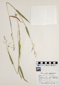
SMM | Panicum leibergii (Vasey) Scribn. Z2001:1:139[]Welby R. Smith 1981-06-23 United States, Minnesota, Mower, About 3 1/2 miles northwest of LeRoy. Prairie strip between State Highway 56 and the Chicago, Milwaukee, St. Paul and Pacific Railraod tracks. Near the junction with County Highway 8., 43.534294 -92.565807 |
SMM | Panicum oligosanthes Schult. Z2001:1:140[]Welby R. Smith 1986-06-28 United States, Minnesota, Anoka, Lamprey Pass State Wildlife Management Area, about two miles southwest of Forest Lake (town)., 45.263192 -93.027133 |
SMM | Z2001:1:141[]Welby R. Smith 1987-05-25 United States, Minnesota, Steele, Aurora State Wildlife Management Area, about 8 miles northwest of Blooming Prairie., 43.973851 -93.138454 |
SMM | Ostrya virginiana (Miller) K. Koch Z2001:1:142[]Richard Oehlenschlager 1983-07-27 United States, Minnesota, Mower, About 3 miles northeast of Lyle., 43.526667 -92.89604 |
SMM | Osmunda regalis var. spectabilis (Willdenow) A. Gray Z2001:1:143[]Welby R. Smith 1986-06-17 United States, Minnesota, Goodhue, Perched Valley State Wildlife Management Area, ca 4 miles W. of Frontenac., 44.522061 -92.402082 |
SMM | Froelichia floridana (Nuttall) Moquin-Tandon Z2001:1:144[]Welby R. Smith 1981-07-10 United States, Minnesota, Sherburne, On the west side of County Highway 1, about 3 1/2 miles north-northwest of its junction with U.S. Highway 10 in Elk River., 45.345094 -93.609988 |
SMM | Fragaria virginiana Duchesne Z2001:1:145[]Welby R. Smith 1981-05-17 United States, Minnesota, Jackson, Kilen Woods State Park. About 1/4 mile west of the Des Moines River on a steep north-facing slope above a small unnamed tributary stream., 43.726923 -95.066966 |
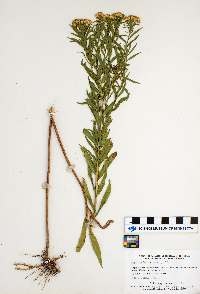
SMM | Euthamia graminifolia (L.) Nuttall Z2001:1:146[]Welby R. Smith 1983-09-07 United States, Minnesota, Cottonwood, Expandere State Wildlife Management Area, about 13 miles west-northwest of Windom., 43.922257 -95.353302 |
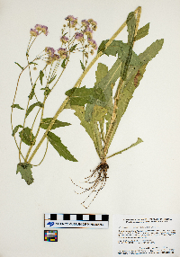
SMM | Erigeron strigosus Muhl. ex Willd. Z2001:1:147[]Welby R. Smith 1986-07-02 United States, Minnesota, Sherburne, Sherburne National Wildlide Refuge, about 2 1/2 miles southeast of Santiago., 45.506367 -93.791705 |
SMM | Z2001:1:148[]Welby R. Smith 1986-06-03 United States, Minnesota, Mower, Brandt-Larson State Wildlife Management Area, about four miles northeast of Lyle., 43.556033 -92.881324 |
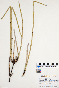
SMM | Equisetum laevigatum A. Braun Z2001:1:151[]Welby R. Smith 1986-05-31 United States, Minnesota, Sherburne, Sherburne National Wildlife Refuge, about 2 1/2 miles southeast of Santiago., 45.506428 -93.791448 |
SMM | Z2001:1:71[]Welby R. Smith 1985-08-14 United States, Minnesota, Yellow medicine, Sioux Nation State Wildlife Management Area, about 8 miles west-southwest of Canby., 44.679943 -96.436888 |
SMM | Platanthera hyperborea Lindl. Z2001:1:73[]Welby R. Smith United States, Minnesota, Clearwater, Detailed locality information protected. This is typically done to protect rare or threatened species localities. |
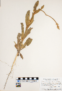
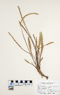
SMM | Plantago eriopoda Torrey Z2001:1:75[]Welby R. Smith 1983-06-08 United States, Minnesota, Polk, Burnham State Wildlife Management Area, about 2 miles east-northeast of Melvin., 47.631996 -96.353032 |
SMM | Physalis virginiana Mill. Z2001:1:77[]Welby R. Smith 1986-07-12 United States, Minnesota, Sherburne, Sherburne National Wildlife Refuge, about 2 1/2 miles southeast of Orrock., 45.445898 -93.681777 |
SMM | Z2001:1:80[]Welby R. Smith 1986-07-08 United States, Minnesota, Mower, Brandt-Larson State Wildlife Management Area, about four miles northeast of Lyle., 43.54888 -92.881496 |
SMM | Erechtites hieraciifolius (L.) Rafinesque ex de Candolle Z2001:1:149[]Welby R. Smith 1988-09-14 United States, Minnesota, Goodhue, In Frontenac State Park, about 8 miles east-southeast of Red Wing., 44.540518 -92.340359 |
SMM | Z2001:1:150[]Welby R. Smith 1987-07-08 United States, Minnesota, Washington, About 2 miles northeast of Scandia., 45.276054 -92.771311 |
SMM | Z2001:1:152[]Welby R. Smith 1981-07-07 United States, Minnesota, Fillmore, About one mile southwest of Peterson., 43.772654 -91.842899 |
SMM | Ellisia nyctelea (L.) L. Z2001:1:153[]Welby R. Smith 1985-05-28 United States, Minnesota, Jackson, Kilen Woods State Park, about eight miles north-northwest of Jackson., 43.730086 -95.062074 |
SMM | Platanthera obtusata (Banks ex Pursh) Lindley Z2001:1:72[]Welby R. Smith United States, Minnesota, Clearwater, Detailed locality information protected. This is typically done to protect rare or threatened species localities. |
SMM | Habenaria dilatata (Pursh) Hook. Z2001:1:74[]Welby R. Smith United States, Minnesota, Koochiching, Detailed locality information protected. This is typically done to protect rare or threatened species localities. |
SMM | Pilea pumila (L.) A. Gray Z2001:1:76[]Richard Oehlenschlager 1988-09-14 United States, Minnesota, Goodhue, In Frontenac State Park, about 8 miles east-southeast of Red Wing., 44.540273 -92.340187 |
SMM | Z2001:1:78[]Welby R. Smith 1982-06-23 United States, Minnesota, Fillmore, In the Root River Valley, about 1 1/4 miles east of Peterson., 43.790894 -91.807596 |
SMM | Z2001:1:79[]Welby R. Smith 1987-07-13 United States, Minnesota, Scott, Murphy-Hanrahan Regional Park; on the south side of the Hanrahan Lake, about 2 miles west on Burnsville., 44.726732 -93.335338 |
SMM | Carex muehlenbergii Schkuhr ex Willdenow Z2001:1:81[]Welby R. Smith, Gerald Wheeler 1981-06-10 United States, Minnesota, Sherburne, On the west side of County Highway 1, about 3 1/2 miles north-northwest of its junction with U.S. Highway 10 in Elk River., 45.344611 -93.610332 |
SMM | Carex limosa L. Z2001:1:82[]Welby R. Smith 1988-06-17 United States, Minnesota, Washington, About 4 1/2 miles southeast of Forest Lake (town)., 45.240732 -92.899876 |
SMM | Carex lasiocarpa Ehrhart Z2001:1:83[]Welby R. Smith 1984-06-12 United States, Minnesota, Koochiching, Forest Grove Peatland, about 9 miles north of Northome., 48.014691 -94.350974 |
SMM | Z2001:1:84[]Welby R. Smith 1988-05-31 United States, Minnesota, Lac Qui Parle, About 9 miles SW on Madison. Wet meadow on the N. side of the West Branch Lac Qui Parle River., 44.944734 -96.361197 |
SMM | Carex laeviconica Dewey Z2001:1:85[]Welby R. Smith 1994-07-02 United States, Minnesota, Scott, In the Minnesota Valley, about 7.5 miles north of Jordan., 44.784491 -93.593695 |
SMM | Carex intumescens Rudge Z2001:1:86[]Richard Oehlenschlager 1987-06-18 United States, Minnesota, Pine County, In the St. Croix River Valley, about 7 miles southeast of Pine City., 45.771522 -92.839637 |
SMM | Carex interior L.H. Bailey Z2001:1:87[]Welby R. Smith 1984-06-11 United States, Minnesota, Morrison, Pellager Peatland, about 4 miles southwest of Pellager (town)., 46.295238 -94.535181 |
SMM | Carex hystericina Muhlenberg ex Willdenow Z2001:1:88[]Welby R. Smith 1986-05-26 United States, Minnesota, Goodhue, Perched Valley State Wildlife Management Area, about four miles west of Frontenac., 44.518145 -92.407232 |
SMM | Carex gravida L.H. Bailey Z2001:1:89[]Welby R. Smith, Gerald Wheeler 1981-06-23 United States, Minnesota, Mower, About 3 1/2 miles northwest of LeRoy. Prairie strip between State Highway 56 and the Chicago, Milwaukee, St. Paul and Pacific Railraod tracks. Near the junction with County Highway 8., 43.534605 -92.566065 |
SMM | Carex interior L.H. Bailey Z2001:1:90[]Welby R. Smith 1982-06-08 United States, Minnesota, Redwood, About 2 miles northeast of Delhi, in the Minnesota Valley. On the west side of Rice Creek near where it enters the Minnesota River., 44.623454 -95.190754 |
SMM | Z2001:1:91[]Welby R. Smith 1986-05-16 United States, Minnesota, Sherburne, Sherburne National Wildlife Refuge, about four miles north-northwest of Orrock, along the Blue Hill Trail., 45.496255 -93.734452 |
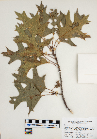
SMM | Quercus velutina Lamarck Z2001:1:92[]Welby R. Smith 1983-08-16 United States, Minnesota, Wabasha, Kellogg-Weaver Sand Dunes State Scientific and Natural Area. About 4 miles southeast of Kellogg, on the east side of County Road 84., 44.27439 -91.936493 |
SMM | Quercus ellipsoidalis E.J. Hill Z2001:1:93[]Welby R. Smith 1986-06-22 United States, Minnesota, Ramsey, In the city of Maplewood, about 1/2 mile south of Larpenteur Ave, and 1/2 mile east of McKnight Road., 44.986446 -92.997274 |
SMM | Ribes americanum Miller Z2001:1:94[]Welby R. Smith 1981-05-18 United States, Minnesota, Mower, Wild Indigo Scientific and Natural Area. About 2 1/4 miles east of the junction of State Highway 56 and County Highway 2 in Brownsdale., 43.734174 -92.821726 |
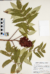
SMM | Rhus glabra L. Z2001:1:95[]Welby R. Smith 1986-08-10 United States, Minnesota, Wabasha, Snake Creek Recreation Area, about three miles south of Kellogg., 44.26008 -91.992316 |
SMM | Z2001:1:96[]Richard Oehlenschlager 1983-06-07 United States, Minnesota, Becker, Ruona National Waterfowl Production Area, about 4 miles southwest of Ogema., 47.066583 -96.000767 |
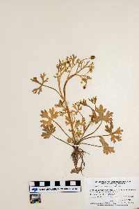
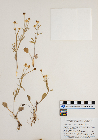
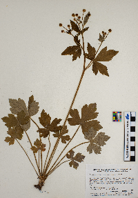
SMM | Ranunculus rhomboideus Goldie Z2001:1:97[]Welby R. Smith 1981-04-28 United States, Minnesota, Goodhue, McKnight Prairie; about 1 3/4 miles south-southeast of Randolph., 44.502807 -93.031861 |
SMM | Ranunculus recurvatus Poir. Z2001:1:98[]Welby R. Smith 1985-05-27 United States, Minnesota, Hennepin, Wolsfeld Woods State Scientific and Natural Area, about 2 1/2 miles east of Plymouth., 44.997917 -93.576373 |
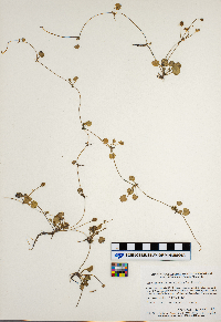
SMM | Ranunculus cymbalaria Pursh Z2001:1:99[]Welby R. Smith 1985-08-15 United States, Minnesota, Cottonwood, Expandere State Wildlife Management Area, about 13 miles west-north-west of Windom., 43.922133 -95.353646 |
SMM | Salix bebbiana Sarg. Z2001:1:100[]Welby R. Smith 1987-05-09 United States, Minnesota, Scott, Murphy-Hanrahan Regional Park; on the south side of Hanrahan Lake, about 2 miles west of Burnesville., 44.726854 -93.335682 |
SMM | Z2001:1:101[]Welby R. Smith 1983-05-18 United States, Minnesota, Wabasha, Kellogg-Weaver Dunes State Scientific and Natural Area. About 4 miles southeast of Kellogg, on the east side of County Road 84., 44.274575 -91.931515 |
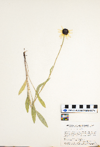
SMM | Rudbeckia serotina Nutt. Z2001:1:102[]Welby R. Smith 1985-07-19 United States, Minnesota, Marshall, About 1/8 mile north of the Marshall-Pennington County line, and 3 mile south-southeast of Viking., 48.176703 -96.376119 |
SMM | Rubus pubescens Raf. Z2001:1:103[]Welby R. Smith 1986-05-16 United States, Minnesota, Sherburne, Sherburne National Wildlife Refuge, about four miles north-northwest of Orrock, along the Blue Hill Trail., 45.496195 -93.713596 |
SMM | Z2001:1:104[]Welby R. Smith 1986-06-14 United States, Minnesota, Olmstead, Oxbow County Park, about three miles north of Byron., 44.077316 -92.65557 |
SMM | Z2001:1:105[]Welby R. Smith 1987-07-13 United States, Minnesota, Scott, Murphy-Hanrahan Regional Park; on the south side of Hanrahan Lake, about 2 miles west of Burnesville., 44.726671 -93.335596 |
SMM | Lythrum alatum Pursh Z2001:1:106[]Welby R. Smith 1981-08-06 United States, Minnesota, Freeborn, About 4 miles east-northeast of Hayward. Prairie strip between County Highway 46 and the Chicago, Milwaukee, St. Paul and Pacific Railroad., 43.664631 -93.181582 |
SMM | Lysimachia terrestris (L.) Britton, Sterns & Poggenburg Z2001:1:107[]Welby R. Smith 1981-07-10 United States, Minnesota, Sherburne, At the northwest tip of Rice Lake, about 3 miles due east of the junction of County Highways 5 and 9., 45.495722 -93.678281 |
SMM | Z2001:1:108[]Welby R. Smith 1981-08-06 United States, Minnesota, Fairbault, About 3.5 miles southeast of Wells. Prairie, strip between State Highway 109 and the Chicago, Milwaukee, St. Paul and Pacific Railroad tracks., 43.719194 -93.671486 |
SMM | Z2001:1:109[]Welby R. Smith 1990-05-21 United States, Minnesota, Waseca, Goose Lake County Park; at the southwest end of Goose Lake, about 2 miles east of Waseca., 44.071199 -93.443532 |
SMM | Andropogon gerardii Vitman Z2001:1:110[]Welby R. Smith 1985-08-14 United States, Minnesota, Yellow Medicine, Sioux Nation State Wildlife Management Area, about 8 miles west-southwest of Canby., 44.680004 -96.436973 |
SMM | Z2001:1:111[]Welby R. Smith 1987-09-01 United States, Minnesota, Scott, Murphy-Hanrahan Regional Park; on the S. side of Hanrahan Lake., 44.726367 -93.335596 |
SMM | Ambrosia psilostachya de Candolle Z2001:1:112[]Welby R. Smith 1986-08-28 United States, Minnesota, Sherburne, Sherburne National Wildlife Refuge, about 2 1/2 miles southeast of Orrock., 45.445928 -93.687313 |
SMM | Alnus incana (L.) Moench Z2001:1:113[]Welby R. Smith 1994-06-01 United States, Minnesota, St. Louis, McCarthy Beach State Park; on the north side of Sturgeon Lake., 47.678857 -93.047608 |
SMM | Agoseris glauca (Pursh) Raf. Z2001:1:114[]Welby R. Smith 1981-06-11 United States, Minnesota, Norman, On the west side of County Highway 40, about 2 miles south of Faith., 47.265561 -96.106515 |
SMM | Acalypha rhomboidea Rafinesque Z2001:1:115[]Welby R. Smith 1987-09-01 United States, Minnesota, Scott, Murphy-Hanrahan Regional Park, about 2 miles west of Burnsville., 44.726732 -93.335596 |
SMM | Thelypteris palustris Schott Z2001:1:26[]Welby R. Smith 1986-07-02 United States, Minnesota, Sherburne, Sherburne National Wildlife Refuge, about 2 1/2 miles southeast of Santiago., 45.510277 -93.796426 |
SMM | Zizia aurea (L.) W.D.J. Koch Z2001:1:51[]Welby R. Smith 1987-05-09 United States, Minnesota, Scott, Murphy-Hanrahan Regional Park, on the S side of Hanrahan Lake, about 2 mi W of Burnsville. SW1/4 NW1/4 sec. 34, T115N R21W; 44.7277778 -93.3363889, 44.726854 -93.335596 |
SMM | Zizia aptera (A. Gray) Fernald Z2001:1:52[]Welby R. Smith 1985-05-22 United states, Minnesota, Dodge, Iron Horse Prairie Scientific and Natural Area, about 1 1/2 miles south of Hayfield., 43.868595 -92.846302 |
SMM | Vitis riparia Michaux Z2001:1:53[]Welby R. Smith 1986-08-10 United States, Minnesota, Wabasha, Snake Creek Recreation Area, about three miles south of Kellogg., 44.256207 -91.992595 |
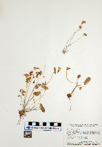
SMM | Viola sororia Willdenow Z2001:1:54[]Welby R. Smith 1983-05-19 United States, Minnesota, Jackson, Kilen Woods State Park, about 6 1/2 miles northeast of Lakefield., 43.726675 -95.066881 |
SMM | Viola pedatifida G. Don Z2001:1:55[]Welby R. Smith 1982-05-22 United States, Minnesota, Jackson, Sangle State Wildlife Management Area. On the north side of County Highway 4, about 1/2 mile east of its junction with State Highway 4., 43.535155 -95.167003 |
SMM | Z2001:1:56[]Welby R. Smith 1984-05-29 United States, Minnesota, Jackson, Kilen Woods State Park, about 8 miles north-northwest of Jackson. Mesic forest on a northeast-facing bluff in the Des Moines River Valley., 43.722767 -95.067481 |
SMM | Vicia americana Muhlenberg ex Willdenow Z2001:1:57[]Welby R. Smith 1986-05-17 United States, Minnesota, Anoka, Lamprey Pass State Wildlife Management Area, about two miles southwest of Forest Lake (town)., 45.263192 -93.02709 |
SMM | Veronica catenata Pennell Z2001:1:58[]Welby R. Smith 1990-08-30 United States, Minnesota, Morrison, About 1 km east of the junction of the Chorwan Road and East Boundary Road., 46.270498 -94.343339 |
SMM | Vaccinium macrocarpon Aiton Z2001:1:59[]Welby R. Smith 1988-06-25 United States, Minnesota, Aitkin, Long Lake Conservation Center, about 7.5 miles west-northwest of McGregor., 46.647074 -93.461087 |
SMM | Z2001:1:60[]Welby R. Smith 1986-05-04 United States, Minnesota, Stearns, Mesic deciduous forest, about 4.5 miles south-southwest of Clearwater., 45.359999 -94.094235 |
SMM | Helianthemum canadense (L.) Michaux Z2001:1:21[]Welby R. Smith United States, Minnesota, Houston, Detailed locality information protected. This is typically done to protect rare or threatened species localities. |
SMM | Helianthemum bicknellii Fernald Z2001:1:22[]Welby R. Smith 1986-08-02 United States, Minnesota, Sherburne, Sherburne National Wildlife Refuge, about 2 1/2 mi SE of Santiago., 45.506488 -93.79222 |
SMM | Z2001:1:23[]Welby R. Smith 1988-06-20 United States, Minnesota, Washington, At the south end of Oneka Lake, about 2 miles northeast Hugo., 45.1838 -92.965727 |
SMM | Tofieldia glutinosa (Michx.) Pers. Z2001:1:24[]Welby R. Smith 1981-07-02 United States, Minnesota, Clay, About 3 miles east-southeast of the junction of State Highway 9 and County Highway 34 in Felton., 47.069098 -96.439552 |
SMM | Z2001:1:25[]Welby R. Smith 1987-05-25 United States, Minnesota, Steele, Aurora State Wildlife Management Area, about 8 miles northwest of Blooming Prairie., 43.973542 -93.138454 |
SMM | Taenidia integerrima (L.) Drude Z2001:1:27[]Welby R. Smith United States, Minnesota, Fillmore, Detailed locality information protected. This is typically done to protect rare or threatened species localities. |
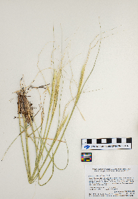
SMM | Stipa spartea Trin. Z2001:1:28[]Welby R. Smith 1986-06-12 United States, Minnesota, Pipestone, Prairie Coteau State Scientific and Natural Area (Aetna Prairie); on the northwest side of State Highway 23, about 2 1/2 miles northeast of Holland., 44.114853 -96.151695 |
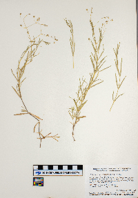
SMM | Stellaria longifolia Muhlenberg ex Willdenow Z2001:1:29[]Welby R. Smith 1986-06-03 United States, Minnesota, Mower, Brandt-Larson State Wildlife Management Area, about four miles northeast of Lyle., 43.54888 -92.88141 |
SMM | Z2001:1:30[]Welby R. Smith 1986-06-28 United States, Minnesota, Anoka, Lamprey Pass State Wildlife Management Area, about two miles southwest of Forest Lake (town)., 45.263253 -93.027219 |
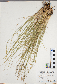
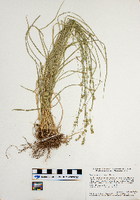
SMM | Sporobolus heterolepis (A. Gray) A. Gray Z2001:1:31[]Welby R. Smith 1985-07-24 United States, Minnesota, Cottonwood, Expandere State Wildlife Mangament Area, about 13 miles west-north-west of Windom., 43.922257 -95.35356 |
SMM | Lysimachia hybrida Michaux Z2001:1:32[]Welby R. Smith 1988-07-25 United States, Minnesota, Kanabec, On the west bank of the Snake River, just south of the Highway 3 crossing., 46.022097 -93.235374 |
SMM | Z2001:1:33[]Welby R. Smith 1986-07-02 United States, Minnesota, Sherburne, Sherburne National Wildlife Refuge, about 2 1/2 miles southeast of Santiago., 45.510097 -93.795825 |
SMM | Carex disperma Dewey Z2001:1:34[]Welby R. Smith 1987-06-09 United States, Minnesota, Washington, In the St. Croix River Valley, about 2 miles south of Marine on St. Croix., 45.164175 -92.761049 |
SMM | Carex convoluta Mack. Z2001:1:35[]Welby R. Smith 1987-06-02 United States, Minnesota, Scott, Murphy-Hanrahan Regional Park; on the south side of Hanrahan Lake, about 2 miles west on Burnsville., 44.726793 -93.335252 |
SMM | Carex deweyana Schweinitz Z2001:1:36[]Welby R. Smith 1990-05-21 United States, Minnesota, Steele, Kaplan Woods City Park, on the south side of Owatonna., 44.063684 -93.23922 |
SMM | Carex buxbaumii Wahlenberg Z2001:1:37[]Welby R. Smith, Gerald Wheeler 1981-06-16 United States, Minnesota, Sibley, About 3 miles east of the junction of State Highways 15 and 19 in Winthrop. Prairie strip between Highway 19 and the Chicago and Northwestern Railroad tracks., 44.540974 -94.31367 |
SMM | Carex aquatilis Wahlenberg Z2001:1:38[]Welby R. Smith 1984-06-13 United States, Minnesota, Roseau, Pinecreek Peatland, about 12 miles northwest of Roseau (town)., 48.998278 -95.879285 |
SMM | Carex cephalantha (L.H. Bailey) E.P. Bicknell Z2001:1:39[]Welby R. Smith 1984-06-12 United States, Minnesota, Koochiching, Forest Grove Peatland, about 9 mi. north of Northome., 48.0131408 -94.3436783 |
SMM | Carex woodii Dewey Z2001:1:40[]Welby R. Smith 1988-06-14 United States, Minnesota, Fillmore, About 2 miles west of Wykoff, in the valley of Spring Valley Creek., 43.716339 -92.302183 |
SMM | Carex trichocarpa Willdenow Z2001:1:41[]Welby R. Smith 1992-06-04 United States, Minnesota, Rice, In the Cannon River Wilderness Park, about 5 miles south-southwest of Northfield., 44.382746 -93.204187 |
SMM | Carex tribuloides Wahlenberg Z2001:1:42[]Welby R. Smith 1987-07-07 United States, Minnesota, Washington, Island in the St. Croix River, about 2 miles northeast of Scandia., 45.269501 -92.755476 |
SMM | Carex tenera Dewey Z2001:1:43[]Welby R. Smith 1986-07-02 United States, Minnesota, Sherburne, Sherburne National Wildlife Refuge, about 2 1/2 miles southeast of Santiago., 45.510458 -93.79634 |
SMM | Carex stricta Lamarck Z2001:1:44[]Welby R. Smith 1990-06-07 United States, Minnesota, Carver, At the base of a south facing bluff in the Minnesota Valley, about 2 miles northwest of Shakopee., 44.810021 -93.554239 |
SMM | Carex sterilis Willdenow Z2001:1:45[]Welby R. Smith United States, Minnesota, Scott, Detailed locality information protected. This is typically done to protect rare or threatened species localities. |
SMM | Carex scoparia Schkuhr ex Willdenow Z2001:1:46[]Welby R. Smith 1986-07-02 United States, Minnesota, Sherburne, Sherburne National Wildlife Refuge, about 2 1/2 miles southeast of Santiago., 45.510097 -93.795825 |
SMM | Carex utriculata Boott in W.J. Hooker Z2001:1:47[]Welby R. Smith 1994-06-21 United States, Minnesota, Sherburne, 45.549784 -94.081896 |
SMM | Carex rosea Schkuhr ex Willdenow Z2001:1:48[]Welby R. Smith 1983-06-04 United States, Minnesota, Mower, Lake Louise State Park, about one mile north-northwest of LeRoy., 43.53101 -92.526424 |
Google Map
Google Maps is a web mapping service provided by Google that features a map that users can pan (by dragging the mouse) and zoom (by using the mouse wheel). Collection points are displayed as colored markers that when clicked on, displays the full information for that collection. When multiple species are queried (separated by semi-colons), different colored markers denote each individual species.


