University of Minnesota
http://www.umn.edu/
612-625-5000
http://www.umn.edu/
612-625-5000
Minnesota Biodiversity Atlas
Dataset: SMM
Search Criteria: United States OR USA OR U.S.A. OR United States of America; excluding cultivated/captive occurrences
Science Museum of Minnesota | |
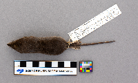
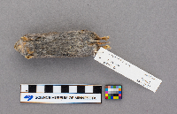
SMM | Z96:15:409[]M.M.M. 1996-08-21 United States, Minnesota, St. Louis, VNP, west side of Browns Bay; (site 96V2), 48.530149 -92.796509 |
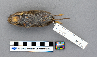
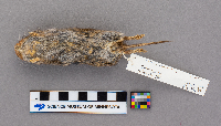
SMM | Z96:15:7[]Richard Oehlenschlager 1996-08-28 United States, Minnesota, Washington, VNP, Gold Portage; (site 96V10), 48.55857 -93.08873 |
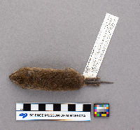
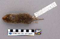
SMM | Z96:15:92[]R.J.O. 1996-08-23 United States, Minnesota, St. Louis, VNP; NW side of Browns Bay, in and around drained beaver pond (site 96V2), 48.532153 -92.797346 |
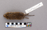
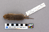
SMM | Z96:15:826[]F.J. 1996-08-27 United States, Minnesota, St. Louis, VNP, Kabetogama Penninsula. bog 1 mi. WNW of Kettle Falls dam. (site 96V6), 48.509961 -92.654525 |
SMM | Z96:15:827[]F.J. 1996-08-27 United States, Minnesota, St. Louis, VNP; Kabetogama Peninsula, bog 1 mile WNW of Kettle Falls dam; (site 96V6), 48.504538 -92.659585 |
SMM | Z96:15:825[]F.J. 1996-08-27 United States, Minnesota, St. Louis, VNP, Kabetogama Penninsula, bog1 mi. WNW of Kettle Falls dam. (site 96V6), 48.505164 -92.658941 |
SMM | Z96:15:861[]F.J. 1996-08-29 United States, Minnesota, Koochiching, VNP, NE corner of expansive bog bordering Kabetogama Lake, N. of Tom Cod Bay. (site 96V9), 48.516302 -93.105994 |
SMM | Z96:15:772[]F.J. 1996-08-21 United States, Minnesota, St. Louis, VNP; NW side of Brown's Bay, in and around drained beaver pond., 48.381443 -92.547806 |
SMM | Z96:15:836[]F.J. 1996-08-29 United States, Minnesota, Koochiching, NE corner of expansive bag bordering Kabetogama Lake, N. of Tom Cod Bay. (site 96V9) |
SMM | Z96:15:5[]R.J.O. 1996-08-29 United States, Minnesota, St. Louis, VNP; Kettle Falls Campground Bog; (96V6), 48.505241 -92.646872 |
SMM | Z96:15:4[]R.J.O. 1996-08-29 United States, Minnesota, St. Louis, Kettle Falls Campground bog. (96V6)., 48.505468 -92.655541 |
SMM | Z96:15:837[]F.J. 1996-08-29 United States, Minnesota, Koochiching, VNP, NE corner of expansive bog bordering Kabetogama Lake, N. of Tom Cod Bay; (site 96V9), 48.518007 -93.111831 |
SMM | Z96:15:846[]F.J. 1996-08-29 United States, Minnesota, Koochiching, NE corner of expansive bog bordering Kabetogama Lake, N. of Tom Cod Bay; (site 96V9), 48.496228 -93.11226 |
SMM | Z96:15:851[]F.J. 1996-08-29 United States, Minnesota, Koochiching, VNP, NE corner of expansive bog bordering Kabetogama Lake, N. of Tom Cod Bay. (site 96V9), 48.523238 -93.108569 |
SMM | Z96:15:710[]F.J. 1996-08-29 United States, Minnesota, St. Louis, Kabetogama Peninsula, bog 1 mi. WNW of Kettle Falls dam; (site 96V6), 48.504482 -92.659799 |
SMM | Z96:15:432[]M.M.M., N.J.V. 1996-08-24 United States, Minnesota, St. Louis, N. of & E. of entrance to Blind Ash Bay, S. of Lake Kabetogama. (site 96V4)., 48.4337 -92.859192 |
SMM | Z96:15:499[]M.M.M., Lee Grimm 1996-08-23 United States, Minnesota, St. Louis, VNP, E. side of Browns Bay, 48.529297 -92.790802 |
SMM | Z96:15:501[]M.M.M., Lee Grimm 1996-08-23 United States, Minnesota, St. Louis, E. side of Browns Bay, 48.529496 -92.79033 |
SMM | Z96:15:500[]M.M.M., Lee Grimm 1996-08-23 United States, Minnesota, St. Louis, VNP; E. side of Browns Bay; (site 96V1), 48.529837 -92.789858 |
SMM | Z96:15:473[]M.M.M., Lee Grimm 1996-08-24 United States, Minnesota, St. Louis, E. side of Browns Bay, 48.530093 -92.79033 |
SMM | Z96:15:53[]R.J.O. 1996-08-27 United States, Minnesota, St. Louis, VNP, Kabetogama Peninsula, bog 1 mi. WNW of Kettle Falls dam; (site 96V6), 48.505164 -92.658941 |
SMM | Z96:15:397[]M.M.M., Lee Grimm 1996-08-21 United States, Minnesota, St. Louis, VNP, west side of Browns Bay; (site 96V2), 48.530007 -92.797196 |
SMM | Z2023:1:10[] United States, Minnesota |
SMM | Z2022:5:8[] United States, Minnesota |
SMM | Z2022:5:2[] United States, Minnesota |
SMM | Z2022:5:9[] United States, Minnesota |
SMM | Z2022:5:3[] United States, Minnesota |
SMM | Z2022:5:5[] United States, MInnesota |
SMM | Z2022:5:4[] United States, Minnesota |
SMM | Z2022:5:7[] United States, Minnesota |
SMM | Z2023:1:2[] United States, Minnesota |
SMM | Z2022:5:6[] United States, Minnesota |
SMM | Z2023:1:4[] United States, Minnesota |
SMM | Z2023:1:11[] United States, Minnesota |
SMM | Z2020:2:6[] United States, Minnesota |
SMM | Z2023:1:6[] United States, Minnesota |
SMM | Z2020:2:10[] United States, Minnesota |
SMM | Z2022:5:16[] United States, Minnesota |
SMM | Z2023:1:5[] United States, Minnesota |
SMM | Z96:15:62[]R.J.O. 1996-08-21 United States, Minnesota, St. Louis, NW side of Browns Bay, in and around beaver pond; (site 96V2), 48.531974 -92.79704 |
SMM | Z96:15:393[]M.M.M., Lee Grimm 1996-08-21 United States, Minnesota, St. Louis, VNP, west side of Browns Bay; (site 96V2), 48.530007 -92.797196 |
SMM | Z96:15:64[]R.J.O. 1996-08-21 United states, Minnesota, St. Louis, NW side of Browns Bay, in and around drained beaver pond; (site 96V2), 48.531485 -92.797067 |
SMM | Z96:15:54[]R.J.O. 1996-08-21 United States, Minnesota, St. Louis, NW side of Browns Bay, in and around drained beaver pond; (site 96V2)., 48.532131 -92.796996 |
SMM | Z96:15:704[]F.J. 1996-08-24 United States, Minnesota, St. Louis, VNP; N of & E. of entrance to Blind Ash Bay, S. of Lake Kabetogama; (site 96V4), 48.431908 -92.857859 |
SMM | Z96:15:706[]F.J. 1996-08-29 United States, Minnesota, St. Louis, VNP, Kabetogama Penninsula, bog 1 mi. WNW of Kettle Falls dam; (site 96V6), 48.505164 -92.658941 |
SMM | Z96:15:071[]R.J.O. 1996-08-24 United States, Minnesota, St. Louis, VNP; E. side of Browns Bay, 48.529837 -92.790287 |
SMM | Z96:15:753[]F.J. 1996-08-00 United States, Minnesota, VNP, 48.473372 -92.881932 |
SMM | Z96:15:010[]R.J.O. 1996-08-28 United States, Minnesota, St. Louis, VNP, Kabetogama Peninsula, NE side of stream along Gold Portage., 48.534319 -93.092334 |
SMM | Z96:15:752[]F.J. 1996-08-00 United States, Minnesota, VNP, 48.465775 -92.803085 |
SMM | Z96:15:011[]R.J.O. 1996-08-28 United States, Minnesota, St. Louis, Kabetogama Peninsula, NE side of stream along Gold Portage; (site 96V10), 48.534046 -93.089502 |
SMM | Z96:15:517[]M.M.M. 1996-08-26 United States, Minnesota, St. Louis, E. side of Browns Bay; (site 96V1), 48.530121 -92.790845 |
SMM | Z96:15:033[]R.J.O. 1996-08-29 United States, Minnesota, St. Louis, Kabetogama Peninsula, NE side of stream along Gold Portage, 48.531818 -93.087012 |
SMM | Z96:15:075[]R.J.O. 1996-08-24 United States, Minnesota, St. Louis, VNP, N.W. side of Browns Bay; (site v21996), 48.531855 -92.795565 |
SMM | Z96:15:756[]F.J. 1996-08-00 United States, Minnesota, St. Louis, VNP, 48.436884 -92.838351 |
SMM | Z96:15:735[]F.J. 1996-08-24 United States, Minnesota, St. Louis, N. and E. of entrance to Blind Ash Bay, S. of Kabetogama Lake; (site 96V4), 48.431697 -92.858146 |
SMM | Z96:15:813[]F.J. 1996-08-26 United States, Minnesota, St. Louis, VNP, Kabetogama Penninsula, bog 1 mi. WNW of Kettle Falls dam; (site 96V6), 48.504851 -92.659156 |
SMM | Z96:15:396[]M.M.M., Lee Grimm 1996-08-21 United States, Minnesota, St. Louis, NW side of Browns Bay, in and around drained beaver pond; (site 96V2), 48.531794 -92.796809 |
SMM | Z96:15:814[]F.J. 1996-08-26 United States, Minnesota, St. Louis, VNP, Kabetogama Penninsula, bog 1 mile WNW of Kettle Falls dam, 48.505107 -92.658855 |
SMM | Z96:15:474[]M.M.M. 1996-08-24 United States, Minnesota, St. Louis, NW side of Browns Bay, in and around drained beaver pond; (site 96V2), 48.531944 -92.796179 |
SMM | Z96:15:431[]M.M.M., N.J.V. 1996-08-24 United States, Minnesota, St. Louis, N. of & E. of entrance to Blind Ash Bay, S. of Kabetogama Lake; (site 96V4)., 48.43139 -92.853451 |
SMM | Z2022:5:13[]R.J. Oehlenschlager 2022-09-26 United States, Minnesota, Ramsey, Ordway Theater, 44.944662 -93.09815 |
SMM | Z2022:5:14[] United States, Minnesota |
SMM | Z2022:5:18[] United States, Minnesota, Ramsey, Sibley and 7th St., 44.950494 -93.089642 |
SMM | Z2022:5:15[] United States, Minnesota |
SMM | Z2023:1:7[] United States, Minnesota, Ramsey, 120 West Kellogg Blvd; SMM, 44.94257 -93.098487 |
SMM | Z2023:1:8[] United States, Minnesota |
SMM | Z2023:1:3[] United States, Minnesota, Ramsey, NW corner of Xcel Center on West 7th St., 44.944766 -93.101001 |
SMM | Z2022:5:21[] United States, Minnesota |
SMM | Z2020:2:11[] United States, Minnesota |
SMM | Z2023:1:12[] United States, Minnesota |
SMM | Z2022:5:26[] United States, Minnesota |
SMM | Z2022:5:25[] United States, Minnesota |
SMM | Z2022:5:24[] United States, Minnesota |
SMM | Z2022:5:23[] United States, Minnesota |
SMM | Z96:15:866[]N.J.V. 1996-08-27 United States, Minnesota, St. Louis, Kabetogama Peninsula, bog 1/2 mi. W. of Lost Lake., 48.444767 -92.859521 |
SMM | Z96:15:128[]R.J.O. 1996-08-22 United States, Minnesota, St. Louis, NW side of Browns Bay, in and around drained beaver pond., 48.5314 -92.796252 |
SMM | Z96:15:186[]N.J.V. 1996-08-24 United States, Minnesota, St. Louis, VNP; NW side of Browns Bay, in and around drained beaver pond; (site 96V2), 48.531516 -92.797213 |
SMM | Z96:15:290[]N.J.V., F.J. 1996-08-27 United States, Minnesota, St. Louis, VNP; N. of and E. of entrance to Blind Ash Bay, S. of Lake Kabetogama. (site 96V4), 48.430769 -92.851594 |
SMM | Z96:15:535[]M.M.M. 1996-08-28 United States, Minnesota, St. Louis, Bog NW of Ash River State Campground, S. of Sullivan Bay; (site 96V7)., 48.413585 -92.816116 |
SMM | Z96:15:273[]N.J.V. 1996-08-27 United States, Minnesota, St. Louis, N & E of entrance to Blind Ash Bay, S. of Kabetogama Lake (site 96V4)., 48.432529 -92.859373 |
SMM | Z96:15:398[]M.M.M., Lee Grimm 1996-08-21 United States, Minnesota, St. Louis, VNP, west side of Browns Bay; (site 96V2)., 48.530007 -92.797196 |
SMM | Z96:15:337[]N.J.V. 1996-08-21 United States, Minnesota, St. Louis, E. side of Browns Bay, 48.529666 -92.790587 |
SMM | Z96:15:345[]N.J.V. 1996-08-23 United States, Minnesota, St. Louis, NW side of Browns Bay, in and around drained beaver pond; (site 96V2), 48.530974 -92.797497 |
SMM | Z96:15:135[]N.J.V. 1996-08-24 United States, Minnesota, St. Louis, VNP; West side of Browns Bay, 48.530149 -92.79681 |
SMM | Z96:15:335[]N.J.V. 1996-08-21 United States, Minnesota, St. Louis, E. side of Browns Bay. (site 96V1), 48.529695 -92.790201 |
SMM | Z96:15:151[]N.J.V. 1996-08-23 United States, Minnesota, St. Louis, E. side of Browns Bay, 48.529638 -92.790201 |
SMM | Z96:15:158[] United States, Minnesota |
SMM | Z96:15:336[]N.J.V. 1996-08-21 United States, Minnesota, St. Louis, E. side of Browns Bay, 48.529496 -92.790201 |
SMM | Z96:15:388[]M.M.M., Lee Grimm 1996-08-24 United States, minnesota, St. Louis, VNP, east side of Browns Bay; (site 96V1)., 48.530021 -92.790265 |
SMM | Z96:15:685[]M.M.M. 1996-08-25 United States, Minnesota, St. Louis, N. of and E. of entrance to Blind Ash Bay, S.of Kabetogama Lake. (site 96V4)., 48.430735 -92.851949 |
SMM | Z96:15:644[]M.M.M. 1996-08-26 United States, Minnesota, St. Louis, N. of & E. of entrance to Blind Ash Bay, S. of Kabetogama Lake. (site 96V4)., 48.429077 -92.852825 |
SMM | Z96:15:667[]M.M.M. 1996-08-28 United States, Minnesota, St. Louis, VNP; Kabetogama Peninsula, bog 1 mi. WNW of Kettle Falls dam. (site 96V6), 48.504766 -92.659542 |
SMM | Z96:15:574[]M.M.M. 1996-08-23 United States, Minnesota, St. Louis, VNP, NW side of Browns Bay, in and around drained beaver pond., 48.531002 -92.797411 |
SMM | Z96:15:391[]M.M.M., Lee Grimm 1996-08-21 United States, Minnesota, St. Louis, VNP, East side of Browns Bay, 48.529752 -92.790416 |
SMM | Z96:15:679[]M.M.M. 1996-08-24 United States, Minnesota, St. Louis, E. side of Browns Bay (site 96V1)., 48.529553 -92.789772 |
SMM | Z96:15:502[]M.M.M. 1996-08-23 United States, Minnesota, St. Louis, E. side of Browns Bay; (site 96V1), 48.529354 -92.789901 |
SMM | Z96:15:503[] United States, Minnesota |
SMM | Z96:15:518[]M.M.M. 1996-08-26 United States, Minnesota, St. Louis, VNP; E. side of Browns Bay; (site 96V1), 48.529382 -92.790373 |
SMM | Z96:15:519[]M.M.M. 1996-08-26 United States, Minnesota, St. Louis, VNP; E. side of Browns Bay; (site 96V1), 48.529439 -92.790416 |
SMM | Z96:15:677[]M.M.M. 1996-08-24 United States, Minnesota, St. Louis, E. side of Browns Bay; (site 96V1), 48.52995 -92.789772 |
Google Map
Google Maps is a web mapping service provided by Google that features a map that users can pan (by dragging the mouse) and zoom (by using the mouse wheel). Collection points are displayed as colored markers that when clicked on, displays the full information for that collection. When multiple species are queried (separated by semi-colons), different colored markers denote each individual species.
