University of Minnesota
http://www.umn.edu/
612-625-5000
http://www.umn.edu/
612-625-5000
Minnesota Biodiversity Atlas
Dataset: CONCOL
Search Criteria: United States OR USA OR U.S.A. OR United States of America; excluding cultivated/captive occurrences
Elsie Welter Natural History Museum of Concordia College | |
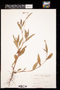
CONCOL | CONC005720[]Shana Theusch 1992-08-07 United States, Minnesota, Clay, SE 1/4, S 11, T 138, R 44 |
CONCOL | CONC005721[]Brooke Liffrig 1995-10-24 United States, Minnesota, Clay, 1/2mile N of Hwy 10 on 75N Sec4 T139N R48W |
CONCOL | CONC005722[]Gerald Van Amburg 1995-07-27 United States, Minnesota, Clay, Flowing township, SW1/4, Sec13, T141N, R46W |
CONCOL | CONC005723[]Richard P. Williams 1974-09-21 United States, Minnesota, Lac Qui Parle, Lake shore of Marsh Lake above dam. Sec. 30 T120N R43W |
CONCOL | CONC005724[]D.T. Disrud 1965-07-03 United States, Minnesota, Anoka, T34N-R23W-Sec.27-NE1/4 of NE1/4 |
CONCOL | Persicaria amphibia (L.) Delarbre CONC005725[]Vicki Rehn 1993-06-29 United States, Minnesota, Otter Tail, Bluebird Farm NE of Fergus Falls |
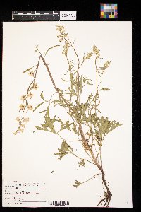
CONCOL | Delphinium carolinianum Walter CONC005727[]Becky Frederick 2000-06-23 United States, Minnesota, Norman, T141N R43W Sec 6 |
CONCOL | Alisma subcordatum Rafinesque CONC005730[]G. L. Van Amburg United States, Minnesota, Pipestone, NE1/4 NE1/4 Sec 5 Rock Twp |
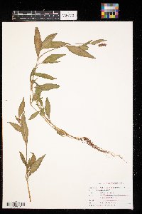
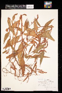
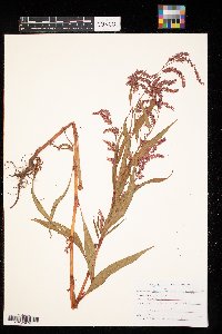
CONCOL | Persicaria lapathifolia (L.) A. Gray CONC005742[]Adrian A. Niemi 1970-08-04 United States, Minnesota, Chisago, Coveen lake |
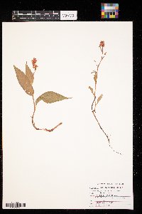
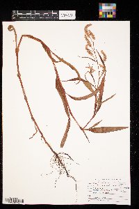
CONCOL | Persicaria lapathifolia (L.) A. Gray CONC005743[]Dennis Cuchna 1979-09-14 United States, Minnesota, Clay, SW 1/4 Sec. 4 T139, R46W |
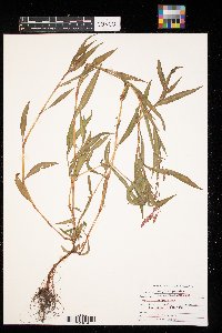
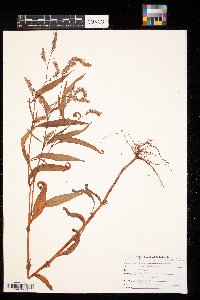
CONCOL | Persicaria lapathifolia (L.) A. Gray CONC005744[]Richard P. Williams 1974-08-29 United States, Minnesota, Otter Tail, Sec. 25 T132N R44W |
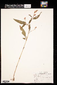
CONCOL | Persicaria lapathifolia (L.) A. Gray CONC005745[]M.D. Hoffmann 1985-06-10 United States, Minnesota, Clay |
CONCOL | Persicaria lapathifolia (L.) A. Gray CONC005746[]MS 1979-08-27 United States, Minnesota, Polk, W1/2 NW1/4 Sec. 16 T149N R48W |
CONCOL | Persicaria lapathifolia (L.) A. Gray CONC005747[]Richard P. Williams 1974-03-09 United States, North Dakota, Roberts, Sec. 6 T127N R48W |
CONCOL | Persicaria lapathifolia (L.) A. Gray CONC005748[]Mark Berntson 1979-09-12 United States, Minnesota, Clay, T137 R47 N. West Sec. 15 |
CONCOL | Persicaria lapathifolia (L.) A. Gray CONC005749[]Julie Hendrickson 1979-09-09 United States, Minnesota, Saint Louis |
CONCOL | Persicaria lapathifolia (L.) A. Gray CONC005750[]Gerald L. Van Amburg 1995-07-27 United States, Minnesota, Clay, Cromwell township, Sec6, T140N, R45W |
CONCOL | Persicaria lapathifolia (L.) A. Gray CONC005751[]Gerald L. Van Amburg 1995-07-27 United States, Minnesota, Clay, Cromwell township, NE1/4, Sec6, T140N, R45W |
CONCOL | Persicaria lapathifolia (L.) A. Gray CONC005752[]Marvin Christianson 1972-09-16 United States, Minnesota, Polk, 5 mi west of Crookston |
CONCOL | CONC005753[]Elizabeth Balstad 2012-09-06 United States, Minnesota, Clay, T139N R48W Sec 17, by Olin Art and Comm Center on Concordia College Campus, Moorhead |
CONCOL | Dalea purpurea Ventenat CONC005756[]Laura Wood 2014-09-12 United States, North Dakota, Billings, T139N, R102W, sec35 |
CONCOL | Mentzelia decapetala (Pursh) Urban CONC005757[]Ethan Nemmers 2014-09-12 United States, North Dakota, Billings, T139N, R102W, S35, E or W of East River Rd, 1 km S of Plumely Draw Rd |
CONCOL | Opuntia polyacantha Haworth CONC005758[]Ethan Nemmers 2014-09-12 United States, North Dakota, Billings, T138N; R102W; S11, E side of East River Rd |
CONCOL | Catalpa speciosa (Warder) Warder ex Engelman CONC005759[]Tyler Head 2014-09-12 United States, Minnesota, Clay, Moorhead, 1018 12th Ave S, 0.2 miles east of Concordia College |
CONCOL | CONC005760[]Ethan Nemmers 2014-09-12 United States, North Dakota, Cass, T139N; R48W; S30, 50 m N of retention pond, 1 km S of Moorhead |
CONCOL | CONC005761[]Joleen Baker 2015-09-16 United States, Minnesota, Clay, T50N, R16W, sec30, E side of 180th Street S, 1 km N of intersection with County Hwy 12, 1.5 km E of Downer, 30m E of road |
CONCOL | CONC005762[]Joleen Baker 2015-10-03 United States, Minnesota, Becker, T139N, R39W, sec7, .75 km E of 350th Ave and Hubble Pond Rd intersection, 10 m off N edge of road |
CONCOL | CONC005763[]Annika J. Strand 2015-10-07 United States, Minnesota, Mahnomen, T134N; R42W; S32, E side of Township Rd 136, 1 km N of Coburn State Wildlife Management Area |
CONCOL | Artemisia tridentata Nuttall CONC005764[]Danielle Braund 2015-09-04 United States, North Dakota, Billings, T138N, R102W, sec11, Northeast side of East River Road, across from Coal Creek trailhead |
CONCOL | Corylus americana Walter CONC005765[]Joleen Baker 2015-10-03 United States, Minnesota, Becker, T139N, R39W, sec7, 1 km E of 350th Ave and Hubble Pond Rd intersection, SW edge of driveway by North County Trailhead |
CONCOL | CONC005766[]Elliott Gielen 2013-09-25 United States, Minnesota, Becker, T139N; R39W; S7, 35km outside of Detroit Lakes, S of Hubble Pond and 10m SE of Hubble Pond Rd |
CONCOL | Taxus canadensis Marshall CONC005767[]Jesse Wixo 2013-10-16 United States, Minnesota, Clay, T139N; R48W; sec 20 |
CONCOL | Ratibida columnifera (Nuttall) Wooton & Standley CONC005768[]Christian Anderson 2015-09-04 United States, North Dakota, Billings, T141N; R102W; S9 |
CONCOL | CONC005769[]Elliott Gielen 2013-10-02 United States, Minnesota, Becker, T139N; R43W; S30, 12km E of Hawley; 25 km W of Detroit Lakes along County Hwy 8; 200m E from intersection 117 Ave |
CONCOL | CONC005770[]Jens A. Hulden 2015-09-23 United States, Minnesota, Becker, T139N; R47W; S8, N side of Hubble Pond Rd NE of North County Trailhead |
CONCOL | Ostrya virginiana (Miller) K. Koch CONC005771[]Joleen Baker 2015-09-09 United States, Minnesota, Becker, T139N, R41W, sec29, W bank of Long Lake, at E edge of old homestead clearing |
CONCOL | CONC005772[]Karley Petersen 2014-09-24 United States, Minnesota, Cass, T139N; R48W; sec30, 50 m N of retention pond, immeditaely NE of stage in mown area at riparian woodland edge, 1 km S of Moorhead |
CONCOL | CONC005773[]Tisha Burch 2014-09-19 United States, Minnesota, Clay, T139N; R48W, Sec. 8, 4m north of 7th ave |
CONCOL | CONC005774[]Joleen Baker 2015-09-09 United States, Minnesota, Becker, T139N, R41W, sec29, 1 km S of Hwy 10 and Long Lake Rd intersection |
CONCOL | Liatris punctata Hook. CONC005775[]Ben Stubbs 2015-09-04 United States, North Dakota, Billings, T139N; R102W; sec35, 1 km S of Plumely Draw Rd, Little Missouri National Grasslands |
CONCOL | Lygodesmia juncea (Pursh) D. Don ex Hooker CONC005776[]Ben Stubbs 2015-09-04 United States, North Dakota, Billings, T139N; R102W; sec35, 1 km S of Plumely Draw Rd, Little Missouri National Grasslands |
CONCOL | CONC005777[]Ben Stubbs 2015-09-30 United States, Minnesota, Becker, T139N; R84W; sec9, S side of Hubbel Pond Rd, 2.25 E of intersection with Cr 29 |
CONCOL | CONC005778[]Ben Stubbs 2015-10-18 United States, Minnesota, Roseau, T163N; R41W; sec28, 0.2 miles N of intersection with County Rd 115 and 350th Street |
CONCOL | Corylus americana Walter CONC005779[]Ben Stubbs 2015-09-30 United States, Minnesota, Becker, T139N; R84W; sec9, S side of Hubbel Pond Rd, 2.25 E of intersection with CR 29 |
CONCOL | Polygala alba Nutt. CONC005780[]Ben Stubbs 2015-09-04 United States, North Dakota, Billings, T139N; R102W; sec11, W side of East River Rd, Little Missouri National Grassland |
CONCOL | Eriogonum pauciflorum Pursh CONC005781[]Ben Stubbs 2015-09-04 United States, North Dakota, Billings, T139N; R102W; sec11, E side of East River Road across from campground, Little Missouri National Grasslands |
CONCOL | CONC005782[]Ben Stubbs 2015-09-09 United States, Minnesota, Becker, T139N; R41W; sec29, 1 km S of Highway 10 |
CONCOL | Allionia albida Walter CONC005783[]Ben Stubbs 2015-09-04 United States, North Dakota, Billings, T139N; R102W; sec11, 1.2 km N from trailhead at Coal Creek campground, Little Missouri National Grasslands |
CONCOL | Cleome serrulata Pursh CONC005784[]Ben Stubbs 2015-09-04 United States, North Dakota, Billings, T139N; R102W; sec3, N side of East River Rd, 1 km W of intersection with Sully Creek Ro, Little Missouri National Grassland |
CONCOL | CONC005785[]Ben Stubbs 2015-09-09 United States, Minnesota, Becker, T139N; R41W; sec29, 1 km S of Highway 10 |
CONCOL | Dalea candida Michaux ex Willdenow CONC005786[]Ben Stubbs 2015-09-04 United States, North Dakota, Billings, T139N; R102W; sec11, E side of East River Road across from campground, Little Missouri National Grasslands |
CONCOL | CONC005787[]Ben Stubbs 2015-09-16 United States, Minnesota, Clay, T139N; R44W; sec20, NE side of intersection with 255 St S and 40 Ave S |
CONCOL | Linum sulcatum Riddell CONC005788[]Ben Stubbs 2015-09-04 United States, North Dakota, Billings, T139N; R102W; sec35, 1 km S of Plumely Draw Rd, Little Missouri National Grasslands |
CONCOL | Symphoricarpos albus (L.) S.F. Blake CONC005789[]Ben Stubbs 2015-09-30 United States, Minnesota, Becker, T139N; R84W; sec9, S side of Hubbel Pond Rd, 2.25 E of intersection with CR 29 |
CONCOL | Agastache foeniculum (Pursh) Kuntze CONC005791[]Ben Stubbs 482015-09-30 United States, Minnesota, Becker, T139N; R39W; sec7. Access point to WMA, N side of Hubbel Pond Rd, 2.25 mi E of intersection with County Rd 29, 46.863361 -95.654528 |
CONCOL | Larix laricina (Du Roi) K. Koch CONC005792[]Karley Petersen 412014-09-24 United States, Minnesota, Becker |
CONCOL | Mentzelia decapetala (Pursh) Urban CONC005790[]Ben Stubbs 0072015-09-04 United States, North Dakota, Billings, 46.814306 -103.506667 |
CONCOL | Parthenocissus quinquefolia (L.) Planchon CONC005793[]Ben Stubbs 192015-09-04 United States, North Dakota, Billings, 46.993333 -103.586667 |
CONCOL | Onosmodium molle Michaux CONC005795[]Ben Stubbs 642015-10-07 United States, Minnesota, Norman, W side of County Highway 36, 1.1 miles N of intersection with MN Highway 113, Frenchman's Bluff Scientific and Natural Area, 47.186 -96.178333 |
CONCOL | Centaurea podospermifolia Loscos & J. Pardo CONC005794[]Ben Stubbs 602015-09-30 United States, Minnesota, Becker, S side of Hubbel Pond Rd, parking lot, 2.25 E of intersection with CR 29., 46.865028 -95.651167, 447m |
CONCOL | Berteroa incana (L.) de Candolle CONC005796[]Ben Stubbs 342015-09-09 United States, Minnesota, Becker, 1 km S of Highway 10, end of Long Lake Rd, W shore of Long Lake Field Station., 46.818889 -95.896111, 410m |
CONCOL | Oxybaphus nyctagineus Michx CONC005797[]Annika J. Strand 232015-09-05 United States, North Dakota, Kidder, Lake Isabel Recreational Area on NE shore of lake, S of Slade National Wildlife Refuge, 46.82125 -99.735417 |
CONCOL | Cleome serrulata Pursh CONC005799[]Annika J. Strand 212015-09-04 United States, North Dakota, On N side of Sulley Creek Rd., 46.912778 -103.683056 |
CONCOL | Schizachyrium scoparium (Michaux) Nash CONC005800[]Annika J. Strand 152015-09-04 United States, North Dakota, Golden Valley, Collected 50 m E of Coal Creek Maah Daah Key Trailhead in Little Missouri National Grass Land., 46.9575 -103.710833 |
CONCOL | Quercus alba L. CONC005801[]Annika J. Strand 272015-09-09 United States, Minnesota, Becker, 20 m from W shore of Long Lake, 1 km S of Hwy 10 at Long Lake Field Station., 46.820567 -95.891 |
CONCOL | CONC005802[]Annika J. Strand 352015-09-09 United States, Minnesota, Clay, E side of 180th Street S, 1 km N of intersection with County Hwy 12., 46.782194 -96.420639 |
CONCOL | Atriplex nuttallii S. Watson CONC005803[]Annika J. Strand 122015-09-04 United States, North Dakota, Golden Valley, 50 m E of Coal Creek Maah Daah Hey Trailhead in Little Missouri National Grassland., 46.9575 -103.710833 |
CONCOL | Echinocystis lobata (Michaux) Torrey & A. Gray CONC005804[]Annika J. Strand 382015-09-09 United States, Minnesota, Clay, 30 m from E shore of Silver Lake 400 m SW of intersection of CR 12 and Co Hwy 31, 5 km S of Hawley., 46.8325 -96.326111, 343m |
CONCOL | Capsella bursa-pastoris (L.) Medikus CONC005805[]Ben Stubbs 702015-10-18 United States, Minnesota, Roseau, NW side of Red Sand Lake on private property, accessible on E side of Welton Rd., 48.910111 -95.962639, 315m |
CONCOL | CONC005806[]Annika J. Strand 402015-09-23 United States, Minnesota, Becker, On N side of Hubble Pond Rd NE of North County Trailhead, 46.862778 -95.650556, 454m |
CONCOL | CONC005807[]Annika J. Strand 422015-09-23 United States, Minnesota, Becker, On E side of North County Trail 800 m from trailhead., 454m |
CONCOL | Capnoides sempervirens Borkh. CONC005808[]Ben Stubbs 712015-10-26 United States, Minnesota, Crow wing, NW side of Red Sand Lake on private property, accessible on E side of Welton Rd., 46.372778 -94.296667, 363m |
CONCOL | Potamogeton illinoensis Morong CONC005809[]Dr. Marko, Chris Rud, Brandon Smith 12013-07-18 United States, Minnesota, Becker, Near Detroit Lakes, MN. Site 91, South East of Long Lake |
CONCOL | Myriophyllum sibiricum Komarov CONC005810[]Dr. Marko, Chris Rud, Brandon Smith 2013-07-18 United States, Minnesota, Becker, Near Detroit Lakes, MN. Site 102, South Long Lake. |
CONCOL | CONC005811[]Dr. Marko, Chris Rud, Brandon Smith 1002013-07-10 United States, Minnesota, Becker, Site 14, south side of LL |
CONCOL | Stuckenia pectinata (L.) Börner CONC005812[]Dr. Marko, Chris Rud, Brandon Smith 1012013-06-10 United States, Minnesota, Becker, Site 4, (South) Long Lake |
CONCOL | Sarcobatus vermiculatus (Hooker) Torrey CONC005813[]Annika J. Strand 162015-09-04 United States, North Dakota, Golden valley, Collected on Maah Daah Hey trail, 1/4 mile E of Coal Creek, S side of East River Road. 1/2 mi S of trailhead., 46.960556 -103.648889, 785m |
CONCOL | Artemisia tridentata Nuttall CONC005814[]Annika J. Strand 132015-09-05 United States, North Dakota, Golden valley, 50 m E of Coal Creek Maah Daah Hey Trailhead in Little Missouri National Grass Land., 46.9575 -103.710833 |
CONCOL | Krascheninnikovia ceratoides (L.) Gueldenst. CONC005815[]Annika J. Strand 202015-09-04 United States, North Dakota, Golden valley, Collected on Maah Daah Hey trail, 1/4 mile E of Coal Creek, S side of East River Road. 1 mi S of trailhead., 46.960556 -103.648889 |
CONCOL | Mentzelia decapetala (Pursh) Urban CONC005816[]Annika J. Strand 52015-09-04 United States, North Dakota, Billings, Collected on East River Rd 800 m S of intersection with Plumely Draw Rd., 47.040556 -103.61, 746m |
CONCOL | Linum sulcatum Riddell CONC005817[]Annika J. Strand 72015-09-04 United States, North Dakota, Billings, Collected on East River Rd 800 m S of intersection with Plumely Draw Rd., 47.040556 -103.61, 746m |
CONCOL | Rosa arkansana Porter CONC005818[]Annika J. Strand 112015-09-04 United States, North Dakota, Billings, Collected on East River Rd 800 m S of intersection with Plumely Draw Rd.; 47.040556 -103.61, 47.040556 -103.61, 746m |
CONCOL | Eriogonum pauciflorum Pursh CONC005819[]Annika J. Strand 142015-09-04 United States, North Dakota, Golden valley, Collected 50 m E of Coal Creek Maah Daah Hey Trailhead in Little Missouri National Grass Land., 46.9575 -103.710833 |
CONCOL | CONC005820[]Jens A. Hulden 272015-10-07 United States, Minnesota, Becker, 300 m S of HW 10 on CR 1 on East side of road., 46.873611 -96.133056, 404m |
CONCOL | Lygodesmia juncea (Pursh) D. Don ex Hooker CONC005821[]Joleen Baker 102015-09-04 United States, North Dakota, Billings, W of Plumely Dr and E River Rd intersect 1km, 150m W of road, 47.040556 -103.61 |
CONCOL | CONC005822[]Danielle Braund 232015-09-05 United States, North Dakota, Kidder, NE of Lake Isabel recreation area, by beach at the picnic area., 46.821253 -99.735417 |
CONCOL | Capsella bursa-pastoris (L.) Medikus CONC005823[]Jens A. Hulden 222015-10-14 United States, Minnesota, Clay, 50 m from shore of Red River just south of Trollwood Performing Arts School., 46.815833 -96.798333, 285m |
CONCOL | Eriogonum pauciflorum Pursh CONC005824[]Joleen Baker 142015-09-04 United States, North Dakota, Billings, Little Missouri Grassland. S of E River Road and Sully Creek Rd intersection 1.5 km, across from Maah Daah Hey Trailhead., 46.962778 -103.698889, 792m |
CONCOL | Juniperus scopulorum Sargent CONC005825[]Karley Petersen 132014-09-12 United States, North Dakota, Billings, W side of butte on W side of East River Rd, adjacent to Maah Daah Hey Trail., 46.7815 -103.518944, 812m |
CONCOL | Atriplex confertifolia (Torrey & Fr̩mont) S. Watson CONC005826[]Tisha Burch 132014-09-12 United States, North Dakota, Billings, West side of butte on West side of East River Rd, adjacent to Maah Daah Hey Trail and along the Trail marked by a Turtle sign., 46.7815 -103.518944, 812m |
CONCOL | Ostrya virginiana (Miller) K. Koch CONC005827[]Jens. A Hulden 122015-09-09 United States, Minnesota, Becker, W shore of Long Lake, 1 km S of Hwy 10., 46.820567 -95.891, 408m |
CONCOL | Linum lewisii Pursh CONC005828[]Tyler Head 252014-09-12 United States, North Dakota, Billings, West side of butte on west side of East River Rd, adjacent to Maah Daah Hey Trail., 46.7815 -103.518944 |
CONCOL | Corylus americana Walter CONC005829[]Jens A. Hulden 262015-09-23 United States, Minnesota, Becker, S side of Hubble Pond Rd NE of North County Trailhead., 46.862778 -95.650556, 454m |
CONCOL | CONC005830[]Annika J. Strand 42015-09-04 United States, North Dakota, Billings, Collected on Plumely Draw Rd 600 m W of intersection with East River Rd., 46.823889 -103.520556, 792m |
CONCOL | Persicaria pensylvanica (L.) M. G CONC005831[]Joleen Baker 372015-09-16 United States, Minnesota, Clay, NE shore of Silver Lake, SW of CR 31 and CR 12, 2km S of Hawley, 46.829917 -96.327028, 340m |
CONCOL | Persicaria pensylvanica (L.) M. G CONC005832[]Jens A. Hulden 322015-09-16 United States, Minnesota, Clay, East facing bank of MN side of Red River 500m west of CR 96, 4 km North of Moorhead. M B Johnson Park., 46.914167 -96.7575, 268m |
CONCOL | Linaria vulgaris Miller CONC005833[]Jens A. Hulden 212015-10-14 United States, Minnesota, Clay, 200 m S of HW 10 on the W side of the Carpet Garage., 46.815833 -96.798333, 285m |
CONCOL | CONC005834[]Jens A. Hulden 232015-10-14 United States, Minnesota, Clay, 50 m from shore of Red River just south of Trollwood Performing Arts School., 46.815833 -96.798333, 395m |
CONCOL | CONC005835[]Joleen Baker 392015-09-16 United States, Minnesota, Clay, CR 12 and CR 8 changeover (county line). About 30 m S of road., 47.088889 -96.328611, 331m |
CONCOL | CONC005836[]Jens A. Hulden 112015-09-09 United States, Minnesota, Becker, W shore of Long Lake, 1 km S of Hwy 10 at Long Lake Field Station., 46.820567 -95.891, 408m |
Google Map
Google Maps is a web mapping service provided by Google that features a map that users can pan (by dragging the mouse) and zoom (by using the mouse wheel). Collection points are displayed as colored markers that when clicked on, displays the full information for that collection. When multiple species are queried (separated by semi-colons), different colored markers denote each individual species.
