University of Minnesota
http://www.umn.edu/
612-625-5000
http://www.umn.edu/
612-625-5000
Minnesota Biodiversity Atlas
Dataset: MIN-Plants
Taxa: Araceae
Search Criteria: excluding cultivated/captive occurrences
Bell Museum plants | |
 MIN:Plants | 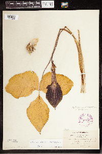 Arisaema triphyllum (L.) Schott 264296[1335281]Holzinger, John s.n.1901-04-00 United States, Minnesota, Winona, Winona Co.;;;;, 43.910786 -91.723308 |
MIN:Plants | 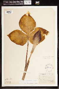 Arisaema triphyllum (L.) Schott 270074[1335251]Wheeler, William 181896-05-26 United States, Minnesota, Houston, Winnebago Valley. Houston Co.;Dorer Memorial Hardwood State Forest;;;, 43.53984 -91.41209 |
MIN:Plants | 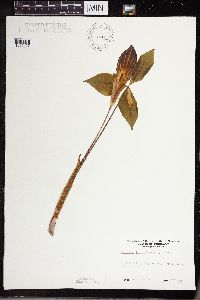 Arisaema triphyllum (L.) Schott 270569[1335127]Sanford, J. s.n.1948-05-12 United States, Minnesota, Hennepin, Fort Snelling Region.;;028N;23W;, 44.905162 -93.166462 |
MIN:Plants | 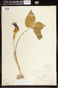 Arisaema triphyllum (L.) Schott 271228[1335260]Horn, Elsa s.n.1923-05-22 United States, Minnesota, Hennepin, Near Minneapolis, along Mississippi River Road.;;;;, 44.979965 -93.263836 |
MIN:Plants |  Arisaema triphyllum (L.) Schott 275969[1335291]Grant, Martin 33411929-09-14 United States, Minnesota, Clearwater, Itasca State Park. Clearwater Co. Elk Pasture. 11-T143-R36;Itasca State Park;143N;36W;11, 47.217521 -95.201495 |
MIN:Plants |  Arisaema triphyllum (L.) Schott 276929[1335325]Moyer, Lycurgus s.n.1890-05-25 United States, Minnesota, Chippewa, Montevideo.;;117N;40W;, 44.934626 -95.675774 |
MIN:Plants |  Arisaema triphyllum (L.) Schott 278335[1335306]Roberts, Thomas s.n.1876-06-10 United States, Minnesota, Hennepin, Minneapolis;;;;, 44.979965 -93.263836 |
MIN:Plants |  Arisaema triphyllum (L.) Schott 281802[1335168]Budde, C. s.n.1893-05-17 United States, Minnesota, Blue Earth, Mankato;;108N;27W;, 44.152457 -94.068583 |
MIN:Plants | 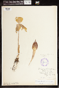 Arisaema triphyllum (L.) Schott 288136[1335297]Meck, Carlton s.n.1914-05-17 United States, Minnesota, Hennepin, Minnehaha Glen;Minnehaha Falls Park;028N;23W;, 44.905162 -93.166462 |
MIN:Plants | 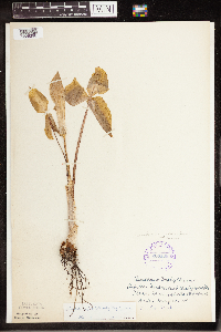 Arisaema triphyllum (L.) Schott 288168[1335298]Meck, Carlton s.n.1914-05-17 United States, Minnesota, Hennepin, Minnehaha bottoms;Minnehaha Falls Park;028N;23W;, 44.905162 -93.166462 |
MIN:Plants | 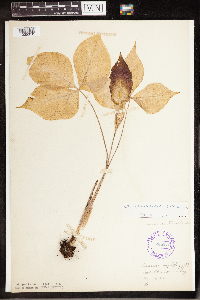 Arisaema triphyllum (L.) Schott 288216[1335310]Anonymous s.n.1914-05-24 United States, Minnesota, Hennepin, River Glen, Fort Snelling;Fort Snelling State Park;028N;23W;, 44.905162 -93.166462 |
MIN:Plants | 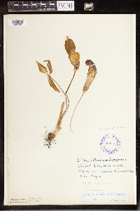 Arisaema triphyllum (L.) Schott 288266[1335317]Piruerisal, F. s.n.2000-05-07 United States, Minnesota, Hennepin, Minnehaha River bottom;Minnehaha Falls Park;028N;23W;, 44.905162 -93.166462 |
MIN:Plants | 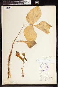 Arisaema triphyllum (L.) Schott 288335[1335252]Johnson, Ruth s.n.1923-05-19 United States, Minnesota, Hennepin, Minnehaha Glen;Minnehaha Falls Park;028N;23W;, 44.905162 -93.166462 |
MIN:Plants | 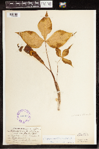 Arisaema triphyllum (L.) Schott 288390[1335309]Cady, LeRoy s.n.1907-05-00 United States, Minnesota, Hennepin, Fort Snelling;Fort Snelling Military Reservation;028N;23W;, 44.905162 -93.166462 |
MIN:Plants | 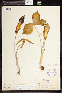 Arisaema triphyllum (L.) Schott 288468[1335250]Beach, W. 571914-05-19 United States, Minnesota, Ft. Snelling Reservation [old regional park spanning junction of Minnesota and Mississippi rivers].;Fort Snelling Reservation [former regional park];028N;23W;, 44.90516 -93.16646 |
MIN:Plants | 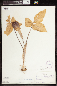 Arisaema triphyllum (L.) Schott 332200[1335285]Ueland, A. s.n.1896-05-21 United States, Minnesota, Polk, Near East Grand Forks.;;151N;50W;, 47.902843 -97.010649 |
MIN:Plants | 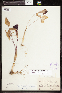 Arisaema triphyllum (L.) Schott 345836[1335256]Lakela, Olga 19381937-05-30 United States, Minnesota, Carlton, Jay Cook Park, across the Swinging Bridge up the path to a terrace. Carlton Co.;Jay Cooke State Park;048N;16W;, 46.634249 -92.364588 |
MIN:Plants |  Arisaema triphyllum (L.) Schott 348785[1335277]Nielsen, E. 21929-05-15 United States, Minnesota, McLeod, McLeod Co.; 1 mi south of Silver Lake.;;116N;28W;, 44.84865 -94.192656 |
MIN:Plants |  Arisaema triphyllum (L.) Schott 348786[1335272]Nielsen, E. 11371931-05-17 United States, Minnesota, Lincoln, Lincoln Co.; Indian Grove. 3 mi. west of Tyler on hwy. 7.;;109N;44W;, 44.240517 -96.139595 |
MIN:Plants |  Arisaema triphyllum (L.) Schott 353817[1335321]Lakela, Olga 13721938-05-16 United States, Minnesota, Saint Louis, Near the College of St. Scholastica, on hwy. 4, Duluth.;;;;, 46.81105 -92.12199 |
MIN:Plants | 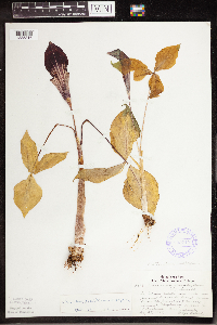 Arisaema triphyllum (L.) Schott 355712[1335316]Lakela, Olga 28941939-05-28 United States, Minnesota, Saint Louis, St. Louis Co.; On Grand Rapids Road, [?] mi from the junction of Miller Trunk Hwy. 11 mi north of Duluth.;;051N;16W;, 46.894711 -92.364816 |
MIN:Plants | 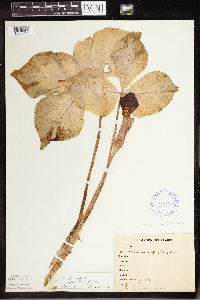 Arisaema triphyllum (L.) Schott 356969[1335315]Stevenson, J. 471912-06-22 United States, Minnesota, Beltrami, Bemidji;;146N;33W;, 47.453829 -94.863614 |
MIN:Plants | 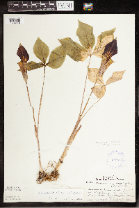 Arisaema triphyllum (L.) Schott 360390[1335273]Lakela, Olga; Hero, C. 36271940-06-12 United States, Minnesota, Pine, Pine Co. Hwy. 23, near Duquette.;;045N;18W;, 46.37481 -92.615751 |
MIN:Plants | 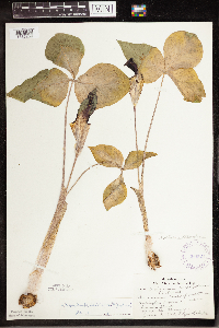 Arisaema triphyllum (L.) Schott 360521[1335259]Lakela, Olga 34641940-06-02 United States, Minnesota, Saint Louis, Arlington Avenue near Garden Street. Duluth.;;;;, 46.81199 -92.13203 |
MIN:Plants | 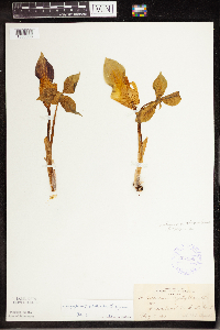 Arisaema triphyllum (L.) Schott 364990[1335308]Beach, W. 691913-05-11 United States, Minnesota, Ramsey, Groveland Park [neighborhood between Highland and Summit aves.], St. Paul;;028N;23W;, 44.905162 -93.166462 |
MIN:Plants | 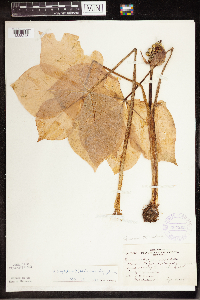 Arisaema triphyllum (L.) Schott 367202[1335245]Moore, John; Butters, F. 135081940-09-04 United States, Minnesota, Aitkin, Along hwy. 210, 2 mi. E of Tamarack.;;048N;22W;, 46.636585 -93.126918 |
MIN:Plants | 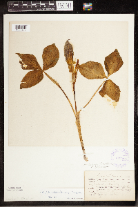 Arisaema triphyllum (L.) Schott 367316[1335233]Tollman, Louise s.n.1886-05-03 United States, Minnesota, Minnesota. Fish Hatchery [prob. the one in St. Paul];;028N;22W;, 44.905226 -93.045075 |
MIN:Plants | 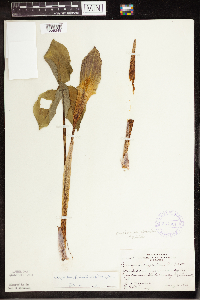 Arisaema triphyllum (L.) Schott 367601[1335249]Moore, John; et al. 123841940-05-16 United States, Minnesota, Steele, South edge of Owatonna. Steele Co.;;107N;20W;, 44.066112 -93.226071 |
MIN:Plants |  Arisaema triphyllum (L.) Schott 367613[1335300]Moore, John; et al. 125751940-05-25 United States, Minnesota, Wright, Southside Twp. SW1/4 sec.36. Wright Co.;;121N;28W;36, 45.246193 -94.147327 |
MIN:Plants |  Arisaema triphyllum (L.) Schott 367697[1335269]Moore, John; et al. 125201940-05-18 United States, Minnesota, Fillmore, 4 mi W of Harmony. Fillmore Co.;;101N;10W;, 43.544021 -92.029582 |
MIN:Plants |  Arisaema triphyllum (L.) Schott 367719[1335238]Moore, John; et al. 126271940-05-25 United States, Minnesota, Meeker, Meeker Co. ...3/4 mi. West of Eden Valley, on hwy. 55.;;121N;31W;, 45.282618 -94.572664 |
MIN:Plants |  Arisaema triphyllum (L.) Schott 367734[1335276]Moore, John; et al. 12600A1940-05-25 United States, Minnesota, Saint Louis, Beside the railroad right-of-way, 2.6 mi. west of Kimball. Sect. 5 T22N R29W. St. Louis Co.;; T022N R29W S05, 47.583286 -92.555794 |
MIN:Plants | 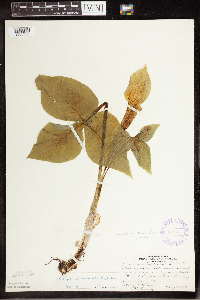 Arisaema triphyllum (L.) Schott 367735[1335299]Moore, John; et al. 126001940-05-25 United States, Minnesota, Stearns, Maine Prairie Twp. Beside RR right-of-way, 2.6 mi W of Kimball. Stearns Co.;;122N;29W;05, 45.406615 -94.353709 |
MIN:Plants | 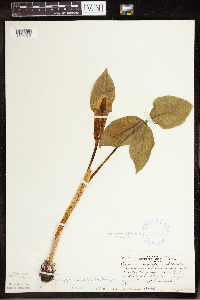 Arisaema triphyllum (L.) Schott 367781[1335278]Moore, John; et al. 124701940-05-17 United States, Minnesota, Mower, along creek tributary to the Upper Iowa River, Le Roy Twp. T101N R14W Sect. 21. Mower Co.;;101N;14W;21, 43.536578 -92.519043 |
MIN:Plants | 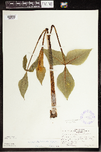 Arisaema triphyllum (L.) Schott 367913[1335307]Moore, John; et al. 12875A1940-05-28 United States, Minnesota, Big Stone, Near Big Stone Lake, 1 mi N of Ortonville. Big Stone Co.;;122N;46W;, 45.37066 -96.429193 |
MIN:Plants | 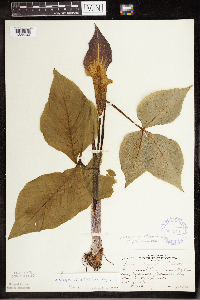 Arisaema triphyllum (L.) Schott 367914[1335244]Moore, John; et al. 128751940-05-28 United States, Minnesota, Big Stone, Near Big Stone Lake; 1 mi. N of Ortonville. Big Stone Co.;;121N;46W;, 45.37066 -96.429193 |
MIN:Plants | 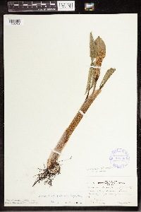 Arisaema triphyllum (L.) Schott 368026[1335253]Moore, John; et al. 126921940-05-25 United States, Minnesota, Pope, Sect. 11 Leven Twp Pope Co.;;126N;37W;11, 45.737324 -95.293784 |
MIN:Plants | 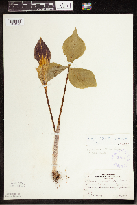 Arisaema triphyllum (L.) Schott 368081[1335286]Moore, John; et al. 127701940-05-26 United States, Minnesota, Otter Tail, Sect. 8 T131N R38W. Otter Tail Co.;;131N;38W;08, 46.173461 -95.490892 |
MIN:Plants | 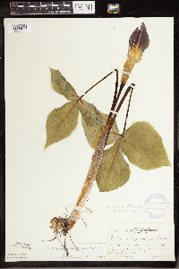 Arisaema triphyllum (L.) Schott 368254[1335288]Moore, John; et al. 128241940-05-27 United States, Minnesota, Grant, Sec. 10 T130N R41W. Grant Co.;;130N;41W;10, 46.085944 -95.821795 |
MIN:Plants | 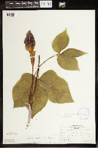 Arisaema triphyllum (L.) Schott 368293[1335282]Moore, John 129111940-05-28 United States, Minnesota, Swift, Pomme de Terre River, near hwy. 12. Swift Co.;;121N;42W;, 45.282602 -95.932602 |
MIN:Plants | 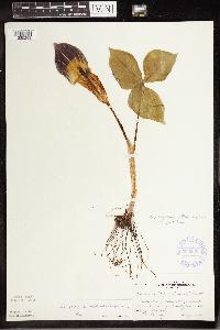 Arisaema triphyllum (L.) Schott 368330[1335289]Moore, John 127281940-05-25 United States, Minnesota, Douglas, Douglas Co.; T130N R39W sec. 34;;130N;39W;34, 46.027556 -95.572745 |
MIN:Plants | 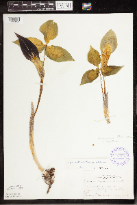 Arisaema triphyllum (L.) Schott 369208[1335293]Gunderson, Harvey s.n.1940-05-19 United States, Minnesota, Winona, Gwinn's Bluff, near Winona.;Great River Bluffs State Park;106N;05W;, 43.963328 -91.43962 |
MIN:Plants | 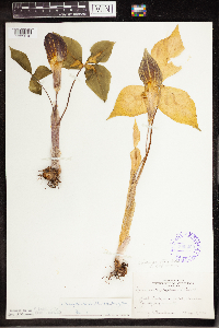 Arisaema triphyllum (L.) Schott 369209[1335318]Gunderson, Harvey s.n.1940-05-18 United States, Minnesota, Goodhue, Goodhue Co.; Belle Creek, near Welch;Dorer Memorial Hardwood State Forest;113N;16W;, 44.586441 -92.73235 |
MIN:Plants | 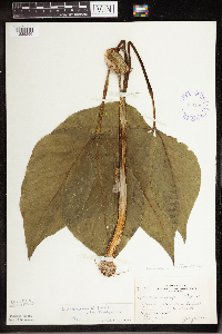 Arisaema triphyllum (L.) Schott 369426[1335296]Moore, John; et al. 146901941-07-06 United States, Minnesota, Douglas, Douglas Co.; 1 mi. South of Garfield.;;128N;38W;, 45.889822 -95.448171 |
MIN:Plants |  Arisaema triphyllum (L.) Schott 369716[1335262]Moore, John; et al. 139501941-05-11 United States, Minnesota, Fillmore, Fillmore Co.; east of the road; 4 mi southwest of Peterson.;Dorer Memorial Hardwood State Forest;104N;09W;, 43.803609 -91.909948 |
MIN:Plants |  Arisaema triphyllum (L.) Schott 370100[1335226]Moore, John; et al. 141561941-05-25 United States, Minnesota, Pine, Beside Hwy 23; 1 mi south of Nickerson. Pine Co.;;045N;17W;, 46.374491 -92.489103 |
MIN:Plants |  Arisaema triphyllum (L.) Schott 370786[1335303]Moore, John; et al. 137851941-05-03 United States, Minnesota, Washington, Washington Co.; NE1/4 Sec.21 Stillwater Twp.;;030N;20W;21, 45.071961 -92.812692 |
MIN:Plants |  Arisaema triphyllum (L.) Schott 371286[1335295]Moore, John; et al. 149921941-08-07 United States, Minnesota, Kanabec, 4[?] mi W of Warman. Kanabec Co.;;041N;24W;, 46.025971 -93.369213 |
MIN:Plants |  Arisaema triphyllum (L.) Schott 374062[1335255]Linnaean Club, U of M, 2011939-05-21 United States, Minnesota, Rice, Nerstrand Woods. Rice Co.;Nerstrand Woods State Park;110N;19W;, 44.327064 -93.100886 |
MIN:Plants |  Arisaema triphyllum (L.) Schott 379059[1335284]Lakela, Olga 52911943-05-30 United States, Minnesota, Saint Louis, St. Louis Co.; Near the Matter cabin at Cook's Lake.;;052N;15W;, 46.981398 -92.238527 |
MIN:Plants |  Arisaema triphyllum (L.) Schott 381129[1335254]Moore, John; et al. 152601942-06-01 United States, Minnesota, Isanti, Isanti County...Stanchfield Twp. Sect. 32;;037N;23W;32, 45.651613 -93.234247 |
MIN:Plants |  Arisaema triphyllum (L.) Schott 381853[1335268]Allison, Helen s.n.1944-07-04 United States, Minnesota, Grant, Grant County;;;;, 45.93 -96.01 |
MIN:Plants | 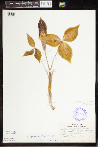 Arisaema triphyllum (L.) Schott 386900[1335275]Hero, C. s.n.1940-05-12 United States, Minnesota, Renville, Renville Co.; 12 mi. southwest of Renville.;;116N;36W;, 44.711025 -95.369713 |
MIN:Plants | 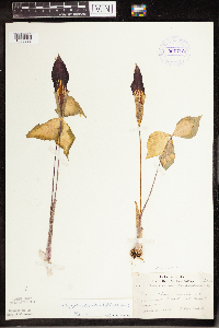 Arisaema triphyllum (L.) Schott 391716[1335322]Lakela, Olga 59581945-06-03 United States, Minnesota, Saint Louis, St. Louis Co.; French River Woods at Lismore Road.;;;;, 46.939242 -91.951785 |
MIN:Plants | 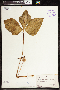 Arisaema triphyllum (L.) Schott 393864[1335311]Butters, F.K. 1461938-07-00 United States, Minnesota, Cook, Between Mountain Lake and Pike Lake. Cook Co.;Boundary Waters Canoe Area Wilderness / Superior National Forest;065N;02E;, 48.086124 -90.186483 |
MIN:Plants | 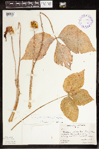 Arisaema triphyllum (L.) Schott 393865[1335241]Rosendahl, C.; Butters, F. 63701930-08-29 United States, Minnesota, Cook, Cross River, flowing into the W end of Gunflint Lake, near R.R. crossing. Cook Co.;Boundary Waters Canoe Area Wilderness / Superior National Forest;065N;04W;24, 48.098785 -90.782086 |
MIN:Plants |  Arisaema triphyllum (L.) Schott 405336[1335312]Lakela, Olga 80541949-05-21 United States, Minnesota, Saint Louis, Prairie Lake, SW St. Louis Co.;;050N;20W;, 46.809279 -92.870675 |
MIN:Plants |  Arisaema triphyllum (L.) Schott 407571[1335323]Lakela, Olga 82281949-05-29 United States, Minnesota, Saint Louis, Hunter's Hill, Duluth.;;;;, 46.835358 -92.089375 |
MIN:Plants |  Arisaema triphyllum (L.) Schott 407866[1335283]Lakela, Olga 80411949-05-20 United States, Minnesota, Saint Louis, NW of the Gun Club property, Duluth.;;;;, 46.7833 -92.1 |
MIN:Plants |  Arisaema triphyllum (L.) Schott 419923[1335173]Lakela, Olga 103021950-06-12 United States, Minnesota, Saint Louis, St. Louis Co.; On Lake Kabetogama Road. Lake Kabetogama.;Kabetogama State Forest;069N;21W;, 48.456965 -93.026751 |
MIN:Plants | 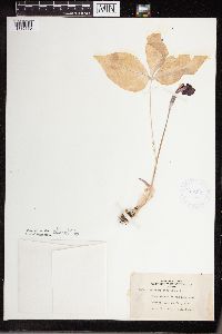 Arisaema triphyllum (L.) Schott 422561[1335170]Lakela, Olga 75041948-06-15 United States, Minnesota, Carlton, Big Lake W of Cloquet. Carlton Co.;Fond du Lac Indian Reservation;049N;18W;, 46.722868 -92.618389 |
MIN:Plants | 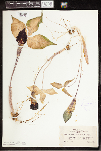 Arisaema triphyllum (L.) Schott 422579[1335187]Lakela, Olga 74441948-05-31 United States, Minnesota, Saint Louis, St. Louis Co.; Grand Rapids Road, 8 mi north of Duluth.;;050N;15W;, 46.807545 -92.238233 |
MIN:Plants | 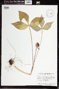 Arisaema triphyllum (L.) Schott 430458[1335096]Smith, Welby 130231987-06-18 United States, Minnesota, Pine, Pine County...In the St. Croix River Valley, about 7 miles southeast of Pine City; about 70 feet above the floodplain; SW1/4 NE1/4 section 21, T 38N R 20W. 038N 20W 21, 45.7666664 -92.8475037 |
MIN:Plants | 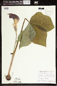 Arisaema triphyllum (L.) Schott 430722[1335228]Smith, Welby 152281989-05-31 United States, Minnesota, Freeborn, Myre Big Island State Park. Freeborn County...Helmer Myre State Park, about 2 miles southeast of Albert Lea. On 'Big Island' in Albert Lea Lake; SW1/4 NW1/4 section 19, T 102N R 20W. 102N 20W 19, 43.625 -93.2874985 |
MIN:Plants |  Arisaema triphyllum (L.) Schott 437112[1335152]Moore, John; et al. 122091939-08-29 United States, Minnesota, Lake of the Woods, Lake of the Woods County...West shore of Four Mile Bay, Lake of the Woods.;;162N;32W;, 48.844345 -94.762874 |
MIN:Plants |  Arisaema triphyllum (L.) Schott 440218[1335120]Smith, Welby 129841987-06-16 United States, Minnesota, Washington, Washington County ... On the E side of Highway 4, about 1/2 mi NW of Marine on St. Croix ... SW1/4 NE1/4 sec 1 T31N R20W. 031N 20W 1, 45.204179 -92.781691 |
MIN:Plants |  Arisaema triphyllum (L.) Schott 441846[1335103]Husveth, J. 95-35291995-09-08 United States, Minnesota, Houston, Houston Co. TN [should be T104N] R4W NE1/4 of the NW1/4 of S28; Former bank of the rechannelized (circa 1900) Root River Houston Co. TN [should be T104N] R4W NE1/4 of the NW1/4 of S28; Former bank of the rechannelized (circa 1900) Root River.. 104N 04W 28, 43.782126 -91.323861 |
MIN:Plants |  Arisaema triphyllum (L.) Schott 441847[1335199]Husveth, J. 95-26091995-09-11 United States, Minnesota, Winona, Winona Co. T108N R10W NW1/4 of the SW1/4 of S2; along Whitewater River.;;108N;10W;2, 44.185638 -91.990372 |
MIN:Plants |  Arisaema triphyllum (L.) Schott 441848[1335198]Husveth, J. 96-0171996-05-15 United States, Minnesota, Houston, Houston Co. T104N R4W NE1/4 of the NW1/4 of S28; along former channel of the Root River.;;104N;04W;28, 43.782126 -91.323861 |
MIN:Plants |  Arisaema triphyllum (L.) Schott 442273[1335174]Lakela, Olga 123701951-05-30 United States, Minnesota, Saint Louis, St. Louis Co.; Hwy. 2, south of Floodwood.;;051N;20W;, 46.895843 -92.869105 |
MIN:Plants |  Arisaema triphyllum (L.) Schott 442274[1335158]Lakela, Olga 123711951-05-30 United States, Minnesota, Saint Louis, St. Louis Co.; Hwy. 2, south of Floodwood.;;051N;20W;, 46.895843 -92.869105 |
MIN:Plants |  Arisaema triphyllum (L.) Schott 442487[1335159]Lakela, Olga 133591951-07-18 United States, Minnesota, Saint Louis, St. Louis County...Moose Bay Trail, Frontier Lodge, Ash River.;Kabetogama State Forest;068N;19W;04, 48.404426 -92.79166 |
MIN:Plants |  Arisaema triphyllum (L.) Schott 442979[1335092]Lakela, Olga 124001951-06-09 United States, Minnesota, Saint Louis, St. Louis Co.; On hwy. 2, about 5 mi. north of Floodwood.;;052N;21W;, 46.9832 -92.994535 |
MIN:Plants |  Arisaema triphyllum (L.) Schott 443100[1335156]Lakela, Olga 123991951-06-09 United States, Minnesota, Saint Louis, St. Louis Co.; Hwy. 2, about 5 mi. north of Floodwood.;;052N;21W;, 46.9832 -92.994535 |
MIN:Plants |  Arisaema triphyllum (L.) Schott 444588[1335113]Myhre, K. 53981995-05-23 United States, Minnesota, Mahnomen, Mahnomen Co.; Located 8 miles northeast of the town of Waubun; T 143N R 40W SE1/4 of NE1/4 of sec 20;White Earth Indian Reservation;143N;40W;20, 47.186693 -95.773995 |
MIN:Plants |  Arisaema triphyllum (L.) Schott 444884[1335179]Moore, John 171381945-06-09 United States, Minnesota, Morrison, Morrison Co.; 1 mi. south of Motley.;;133N;31W;, 46.325764 -94.585247 |
MIN:Plants |  Arisaema triphyllum (L.) Schott 444967[1335154]Moore, John; et al. 194481947-06-05 United States, Minnesota, Red Lake, Red Lake County ... Old Crossing Treaty State Historic Wayside Park.;;151N;45W;, 47.89102 -96.41755 |
MIN:Plants |  Arisaema triphyllum (L.) Schott 444968[1335176]Moore, John; et al. 194461947-06-05 United States, Minnesota, Red Lake, Red Lake County ... Old Crossing Treaty State Historic Wayside Park.;;151N;45W;, 47.89102 -96.41755 |
MIN:Plants |  Arisaema triphyllum (L.) Schott 445014[1335258]Moore, John; Huff, N. 194941947-06-11 United States, Minnesota, Itasca, Itasca Co.; 12[?] miles South of Grand Rapids;;;;, 47.10565 -93.52592 |
MIN:Plants |  Arisaema triphyllum (L.) Schott 445838[1335153]Moore, John; Huff, N. 179901945-07-25 United States, Minnesota, Morrison, Morrison Co.; Along Little Hillman Creek at Center Valley.;;040N;29W;, 45.94724 -93.95141 |
MIN:Plants | 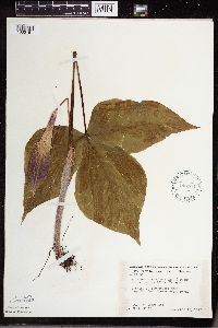 Arisaema triphyllum (L.) Schott 446104[1335151]Moore, John; Huff, N. 196131947-06-18 United States, Minnesota, Kandiyohi, Kandiyohi Co.; Near Mt. Tom, Sibley State Park.;Sibley State Park;131N;35W;, 45.2822688 -95.0707063 |
MIN:Plants | 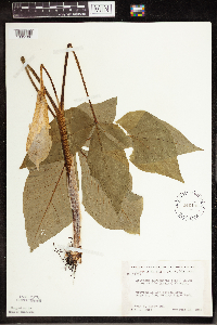 Arisaema triphyllum (L.) Schott 446105[1335180]Moore, John; Huff, N. 196121947-06-18 United States, Minnesota, Kandiyohi, Kandiyohi Co.; Near Mt. Tom, Sibley State Park.;Sibley State Park;121N;35W;, 45.2822688 -95.0707063 |
MIN:Plants | 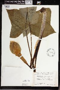 Arisaema triphyllum (L.) Schott 446121[1335091]Moore, John 196391947-06-19 United States, Minnesota, Swift, Swift Co. Monson Lake State Memorial Park.;Monson Lake State Park;121N;37W;, 45.282126 -95.316523 |
MIN:Plants |  Arisaema triphyllum (L.) Schott 446122[1335160]Moore, John; Huff, N. 196381947-06-19 United States, Minnesota, Swift, Swift Co. Monson Lake State Memorial Park.;Monson Lake State Park;121N;37W;, 45.282126 -95.316523 |
MIN:Plants | 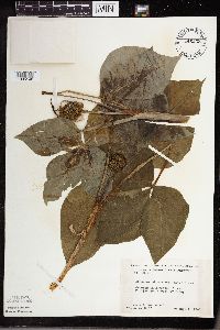 Arisaema triphyllum (L.) Schott 446233[1335146]Moore, John; Huff, N. 189011946-08-01 United States, Minnesota, Benton, Benton Co. 2 mi SW of Foley.;;036N;29W;, 45.603678 -93.945583 |
MIN:Plants |  Arisaema triphyllum (L.) Schott 448368[1335145]Moore, John 189941946-08-10 United States, Minnesota, Becker, 1/4 mi. E of Two Island Lake.;;142N;36W;, 47.108802 -95.233537 |
MIN:Plants |  Arisaema triphyllum (L.) Schott 449171[1335161]Moore, John 170191945-06-05 United States, Minnesota, Todd, Todd Co.; 1/2 mi. east of Staples.;;133N;33W;, 46.325235 -94.841496 |
MIN:Plants |  Arisaema triphyllum (L.) Schott 449172[1335090]Moore, John 170181945-06-05 United States, Minnesota, Todd, Todd Co.; 1/2 mi. east of Staples.;;133N;33W;, 46.325235 -94.841496 |
MIN:Plants |  Arisaema triphyllum (L.) Schott 457171[1311608]Boe, J.; et al. 940519101994-05-19 United States, Minnesota, Cass, Cass County...spit extending SW from Cook WMA on peninsula in N. part of Woman Lake; T140N R28W NE1/4 of NW1/4 of Sec 7;;140N;28W;07, 46.956574 -94.267783 |
MIN:Plants | 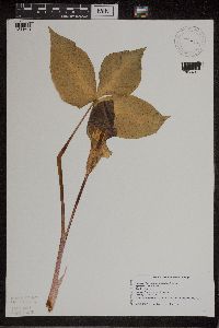 Arisaema triphyllum (L.) Schott 457234[1311601]Swanson, Gary s.n.1997-05-30 United States, Minnesota, Sherburne, Sherburne National Wildlife Refuge; NENW 16-35-27 [twp & rg]; near monitoring plot FQURU1#7;Sherburne National Wildlife Refuge;035N;27W;16, 45.52313 -93.70595 |
MIN:Plants | 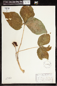 Arisaema triphyllum (L.) Schott 458108[1335177]Garrison, O. 1011880-09-20 United States, Minnesota, Upper Mississippi River.;;;;, 47.2333 -95.2 |
MIN:Plants | 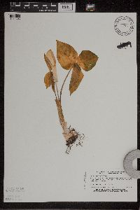 Arisaema triphyllum (L.) Schott 459056[1311606]Boe, J.; et al. 940512121994-05-12 United States, Minnesota, Cass, Cass County...Big Pelican Island in Leech Lake; near cabins at N end of island...T142N R29W SW1/4 of NE1/4 of Sec 17;Chippewa National Forest / Leech Lake Indian Reservation;142N;29W;17, 47.117613 -94.373852 |
MIN:Plants | 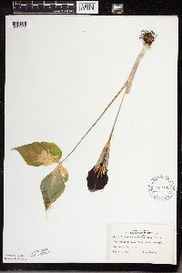 Arisaema triphyllum (L.) Schott 463193[1335157]Lakela, Olga 140161952-05-30 United States, Minnesota, Saint Louis, St. Louis Co.; Midway Road.;;049N;15W;, 46.721897 -92.241221 |
MIN:Plants |  Arisaema triphyllum (L.) Schott 466678[1335118]Kruse, K. 016 KMK1994-05-21 United States, Minnesota, Goodhue, Frontenac State Park. Goodhue Co.; T: 112N R: 13W Sec: 2 Quarter Sec: N 1/2;Frontenac State Park;112N;13W;2, 44.535072 -92.339158 |
MIN:Plants |  Arisaema triphyllum (L.) Schott 473302[1335015]Swanson, Gary s.n.1997-05-30 United States, Minnesota, Sherburne, Sherburne National Wildlife Refuge; Locality: NENW 16-[T]35-[R]27; Near monitoring plot FQURU1 #7;Sherburne National Wildlife Refuge;035N;27W;16, 45.52313 -93.70595 |
MIN:Plants |  Arisaema triphyllum (L.) Schott 488646[1335138]Moore, John 199761949-05-24 United States, Minnesota, Olmsted, Along the Root River, 3 mi. south of Simpson. Olmsted Co.;Dorer Memorial Hardwood State Forest;105N;13W;, 43.891437 -92.378495 |
MIN:Plants |  Arisaema triphyllum (L.) Schott 488649[1335139]Moore, John 199951949-05-26 United States, Minnesota, Isanti, Isanti Co.; 3 miles north of Cambridge.;;036N;23W;, 45.601277 -93.203765 |
MIN:Plants | 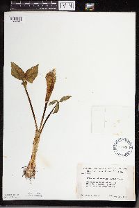 Arisaema triphyllum (L.) Schott 488729[1335030]Moore, John 199301949-05-11 United States, Minnesota, Norman, Norman Co.; Along the Wild Rice River, 1 1/2 mi. northwest of Twin Valley.;;144N;44W;, 47.281754 -96.258057 |
MIN:Plants | 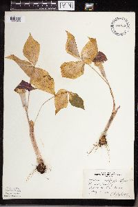 Arisaema triphyllum (L.) Schott 494332[1335029]Huff, N. s.n.1941-05-09 United States, Minnesota, Morrison, Morrison Co.; T130N R31W;;130N;31W;00, 46.064083 -94.581429 |
MIN:Plants | 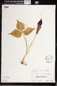 Arisaema triphyllum (L.) Schott 497418[1335028]Moore, John 201321949-06-11 United States, Minnesota, Lake, Lake County...Along the Gooseberry River.;Gooseberry Falls State Park / North Shore;054N;09W;00, 47.163947 -91.4853 |
Google Map
Google Maps is a web mapping service provided by Google that features a map that users can pan (by dragging the mouse) and zoom (by using the mouse wheel). Collection points are displayed as colored markers that when clicked on, displays the full information for that collection. When multiple species are queried (separated by semi-colons), different colored markers denote each individual species.