University of Minnesota
http://www.umn.edu/
612-625-5000
http://www.umn.edu/
612-625-5000
Minnesota Biodiversity Atlas
Bell Museum
Dataset: MIN-Plants
Search Criteria: Cambodia; excluding cultivated/captive occurrences
1
Page 1, records 1-8 of 8
Bell Museum plants | |
 MIN:Plants | 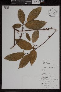 Ficus formosana Maxim. 438193[1297820]Middleton, D.J. Middleton & Monyrak 6922001-03-11 Cambodia, Kampot, Bokor National Park, on road from Kampot to Bokor Plateau, 10.631667 104.091667, 730m |
MIN:Plants | 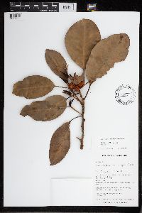 Ficus L. 438161[1297808]Middleton, D.J. Middleton & Monyrak 6912001-03-11 Cambodia, Kampot, Bokor National Park. On road from Kampot to Bokor Plateau., 10.631667 104.09, 770m |
MIN:Plants | 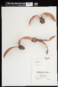 Dipterocarpus alatus Roxb. ex G. Don 947599[1293529]Murdock, Gordon s.n.2015-04-00 Cambodia, General vicinity of Ankor Wat. |
MIN:Plants | 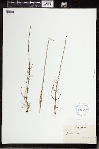 380259[1336445]Potter, David 1929-07-03 Cambodia, James Bay, Moose River. Basky Island |
MIN:Plants | 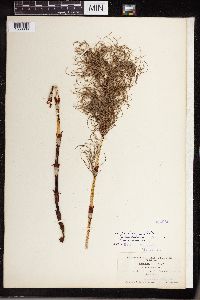 354960[1336606]Shaw, Chas. H. 7821905-07-01 Cambodia, British Columbia, Selkirk; Columbia river near Revelstoke, 488m |
MIN:Plants | 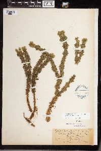 Huperzia lucidula (Michaux) Trevisan 55263[1338911]Fisher, G.L. 1899-07-29 Cambodia, Ontario, Wahnapitae |
MIN:Plants | 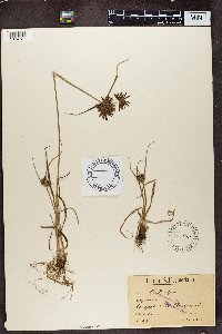 80470[1374721]Schlechter 1981892-01-23 Cambodia, Capeflats near Claremont |
MIN:Plants | 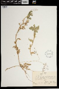 609263[1372588] Cambodia |
1
Page 1, records 1-8 of 8
Google Map
Google Maps is a web mapping service provided by Google that features a map that users can pan (by dragging the mouse) and zoom (by using the mouse wheel). Collection points are displayed as colored markers that when clicked on, displays the full information for that collection. When multiple species are queried (separated by semi-colons), different colored markers denote each individual species.