University of Minnesota
http://www.umn.edu/
612-625-5000
http://www.umn.edu/
612-625-5000
Minnesota Biodiversity Atlas
Bell Museum
Dataset: MIN-Plants
Search Criteria: Estonia; excluding cultivated/captive occurrences
1
Page 1, records 1-7 of 7
Bell Museum plants | |
 MIN:Plants | 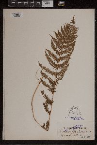 51375[1309333]Winkler, C. s.n.1872-00-00 Estonia, Selja insulae Dagoe [Dagoe Island], 58.811944 24.216667 |
MIN:Plants | Epipactis palustris (L.) Crantz, Stirp. Austr. Fasc. 92678[1310463]Winkler, C. Estonia, Hiiumaa, Detailed locality information protected. This is typically done to protect rare or threatened species localities. |
MIN:Plants | Goodyera repens (L.) R. Brown 92724[1313280]Winkler, C. Estonia, Detailed locality information protected. This is typically done to protect rare or threatened species localities. |
MIN:Plants | Listera cordata (L.) R. Brown 93735[1316127]Maximourez Estonia, Detailed locality information protected. This is typically done to protect rare or threatened species localities. |
MIN:Plants | 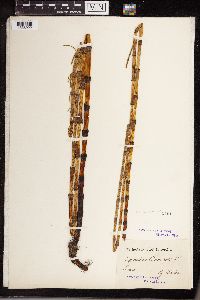 54617[1336922]Laaland s.n. Estonia, Livonia [Currently Estonia and Latvia] |
MIN:Plants | 121928[1345854] Estonia, Detailed locality information protected. This is typically done to protect rare or threatened species localities. |
MIN:Plants | 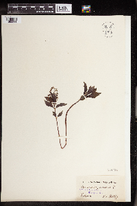 149211[1352311] Estonia |
1
Page 1, records 1-7 of 7
Google Map
Google Maps is a web mapping service provided by Google that features a map that users can pan (by dragging the mouse) and zoom (by using the mouse wheel). Collection points are displayed as colored markers that when clicked on, displays the full information for that collection. When multiple species are queried (separated by semi-colons), different colored markers denote each individual species.