University of Minnesota
http://www.umn.edu/
612-625-5000
http://www.umn.edu/
612-625-5000
Minnesota Biodiversity Atlas
Bell Museum
Dataset: MIN-Plants
Search Criteria: Ghana; excluding cultivated/captive occurrences
1
Page 1, records 1-11 of 11
Bell Museum plants | |
 MIN:Plants |  Chidlowia sanguinea Hoyle 499678[1369371]Merello, M.; et al. 11411995-07-01 Ghana, Asiakwa District: Atewa Range Forest Reserve, Accra-Kumasi Highway 4 km along the forest service road that intersects the highway at the village of Sagyimase.;;;;, 6.23 -0.545, 600m |
MIN:Plants |  Hymenocardia acida Tul. 489013[1369522]Schmidt, H. H. 18821995-12-01 Ghana, Northern region; Along the Larabanga-Wa road, travelling west. Ca. 2km from Larabanga, along southern boundary with Mole National Park, 9.221944 -1.871389, 140m |
MIN:Plants |  491112[1369795]C.C.H. Jongkind 17511994-10-12 Ghana, Legon, Pipeline track, 5.65 -0.2, 200m |
MIN:Plants |  Duboscia viridiflora (K. Schum.) Mildbr. 499681[1369807]Jongkind, C.C.H 18071994-10-26 Ghana, Atewa Range Forest Reserve, along Old Geological Survey road, 6.235 -0.55, 400m |
MIN:Plants | 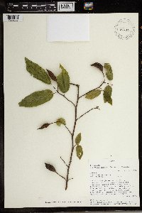 Glyphaea brevis (Spreng.) Monach. 491282[1369808]C.C.H. Jongkind 14091994-04-06 Ghana, Eastern. Just N of Abetifi, 6.7 -0.75, 700m |
MIN:Plants | 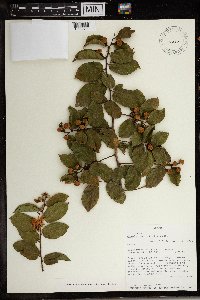 Grewia carpinifolia Juss. 492334[1369811]C.C.H. Jongkind 17071994-09-21 Ghana, Department of Botany, Legon., 5.646667 -0.2, 200m |
MIN:Plants | 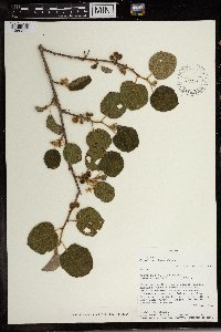 Grewia villosa Willd. 492343[1369822]C.C.H. Jongkind 14741994-05-09 Ghana, Accra plain, E. of Accra., 5.766667 0.083333, 200m |
MIN:Plants | 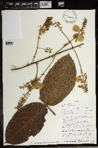 Combretum comosum G. Don 439004[1369941]Jongkind, C.C.H 19931995-01-26 Ghana, Along dust road at E side of Tano-Ofin Forest Reserve, 6.755 -2.038333, 350 - 400m |
MIN:Plants | 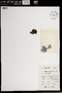 Salvinia nymphellula Desv. 653387[1383684] Ghana |
MIN:Plants | 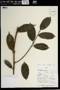 Calycobolus africanus (G. Don) Heine 460604[1302645]Jongkind, C.C.H 19841995-01-24 Ghana, Along dust road at E side of Tano-Ofin Forest Reserve, 6.88 -1.971667, 350m |
MIN:Plants | 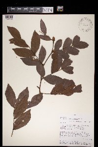 Cynometra megalophylla Harms 492344[1396435]Merello, M. 12991995-07-17 Ghana, Western: Along Takoradi-Elubo Road. Between 9.5-23.5 km E of Elubo, 5.166667 -2.666667, 95m |
1
Page 1, records 1-11 of 11
Google Map
Google Maps is a web mapping service provided by Google that features a map that users can pan (by dragging the mouse) and zoom (by using the mouse wheel). Collection points are displayed as colored markers that when clicked on, displays the full information for that collection. When multiple species are queried (separated by semi-colons), different colored markers denote each individual species.