University of Minnesota
http://www.umn.edu/
612-625-5000
http://www.umn.edu/
612-625-5000
Minnesota Biodiversity Atlas
Bell Museum
Dataset: MIN-Plants
Search Criteria: Guyana; excluding cultivated/captive occurrences
1
Page 1, records 1-23 of 23
Bell Museum plants | |
 MIN:Plants | 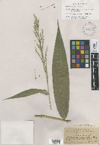 Panicum magnum Hitchc. 929532[1002842]Hitchcock, A.S. 171941919-12-10 Guyana, Hills Estate, 3 miles south of Bartica, 6.316543 -58.65405 |
MIN:Plants | 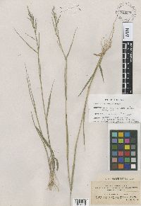 Panicum luticola Hitch. 929531[1002843]Hitchcock, A.S. 171131919-12-05 Guyana, "British Guiana" [Guyana]; Penal settlement, near Bartica, 6.3602 -58.65405 |
MIN:Plants | 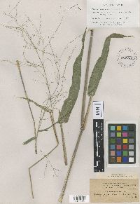 Panicum guianense Hitch. 929530[1002844]Hitchcock, A.S. 173131920-01-01 Guyana, "British Guiana" [Guyana]; Rockstone, 5.977954 -58.525018 |
MIN:Plants | 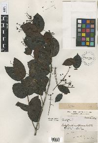 Calyptranthes obtusa Benth. 929545[1002871]Schomburgk 4800000-00-00 Guyana, illegible |
MIN:Plants |  Eugenia schomburgkii Benth. 929542[1002874]Schomburgk, T. 7030000-00-00 Guyana, [no further data] |
MIN:Plants |  Echites rugosus Benth. 337[1332179]Jenman S550 Guyana, Jenman [Georgetown], 6.8 -58.15 |
MIN:Plants |  Mesechites trifidus Müll.Arg. 352010[1332417]McDowell, T. s.n.1990-02-22 Guyana, Upper Takutu - Upper Essequibo; About 3 mi. NE of Surama village at Lake Surama., 4.197539 -59.052379 |
MIN:Plants |  Odontadenia nitida (Vahl) Müll.Arg. 173407[1332466] 51451889-04-00 Guyana, Lama Creek, 6.532106 -57.958364 |
MIN:Plants | 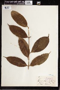 Tabernaemontana rupicola Benth. 173468[1332771]Jenman 54891889-08-00 Guyana |
MIN:Plants | 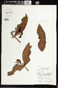 Tabernaemontana siphilitica (L.f.) Leeuwenb. 430733[1332776]McDowell, T. 19801990-02-22 Guyana, about 3 mi NE of Surama village at Lake Surama, 4.15 -59.033333, 65m |
MIN:Plants | 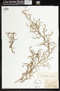 470114[1341636]Schomburgk s.n.1842-00-00 Guyana, Roraima, 4.811058 -58.908203 |
MIN:Plants | 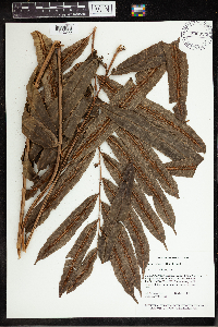 Metaxya rostrata (Humb. & Bonpl. ex Willd.) C. Presl 830923[1342358]Gillespie, L.J. 8441989-03-17 Guyana, Potora-Siparuni Region: 2-3 km N of Kato Village stroe-airstrip, off Kato-Kurukabaru road, 4.683333 -59.8, 690 - 750m |
MIN:Plants | 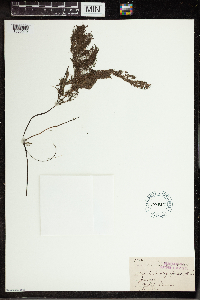 Utricularia oligosperma A.St.-Hil. 191487[1350019] 4792 Guyana, Bristol |
MIN:Plants |  Utricularia parkeriana A. DC. 191488[1350020]Jenman 4447 Guyana, Demarara |
MIN:Plants | 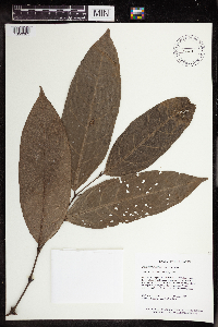 Piper bartlingianum C.DC 510118[1350383]Hoffman, B. 14891992-04-29 Guyana, Region: Potato-Siparuni. Annai-Karupukari Road; 18 km N of Surama village cut off; 0.5 km W of road., 4.233333 -58.933333, 80 - 90m |
MIN:Plants | 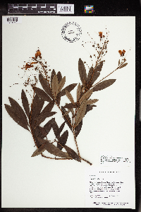 Bejaria Mutis 510841[1349671]Hoffman, B. 30781992-10-16 Guyana, Region: Cuyuni-Mazaruni. Pakaraima Mtns; Karowrieng River, 3-6 km upriver from mouth., 5.666667 -60.25, 50 - 60m |
MIN:Plants | 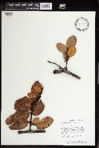 Thibaudia nutans Klotzsch & Mansf. 510127[1349747]McDowell, T. 48811991-05-22 Guyana, Region: Potaro-Siparuni. Overlooking Blackwater River, 5 -59.5, 411 - 442m |
MIN:Plants | 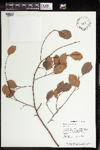 Maprounea guianensis Aubl. 511036[1353678] Guyana |
MIN:Plants | 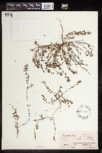 Euphorbia serpens Kunth 568437[1376476] Guyana |
MIN:Plants | 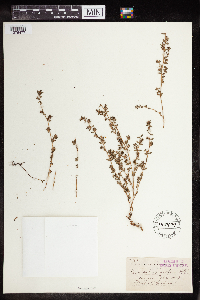 Euphorbia serpens Kunth 148979[1376477] Guyana |
MIN:Plants |  653381[1383685] Guyana |
MIN:Plants |  509597[1301886]B. Hoffman 22561992-08-04 Guyana, Cuyuni-Mazaruni Pakaraima Mtns, Meamu R. headwaters, 1.5 km W Marali Falls, riverside trail, 6.25 -60.45, 150 - 200m |
MIN:Plants |  Trichomanes muscoides Hook. 50455[1301889] Guyana |
1
Page 1, records 1-23 of 23
Google Map
Google Maps is a web mapping service provided by Google that features a map that users can pan (by dragging the mouse) and zoom (by using the mouse wheel). Collection points are displayed as colored markers that when clicked on, displays the full information for that collection. When multiple species are queried (separated by semi-colons), different colored markers denote each individual species.