University of Minnesota
http://www.umn.edu/
612-625-5000
http://www.umn.edu/
612-625-5000
Minnesota Biodiversity Atlas
Bell Museum
Dataset: MIN-Plants
Search Criteria: Netherlands; excluding cultivated/captive occurrences
1
Page 1, records 1-20 of 20
Bell Museum plants | |
 MIN:Plants | 342470[1304685]Ruudberg, Hidi Netherlands, Detailed locality information protected. This is typically done to protect rare or threatened species localities. |
MIN:Plants |  55036[1341646]Bagenholm, Gosta s.n.1895-07-00 Netherlands, Stadjrau and Dalarwa, 52.433676 5.208008 |
MIN:Plants |  Senecio congestus (R.Br.) DC. 971353[1394834]Janssens, J. 75/861975-05-19 Netherlands |
MIN:Plants |  971409[1394890]Janssens, J. 1441974-05-19 Netherlands |
MIN:Plants |  971905[1395740]Janssens, J. 2741974-08-04 Netherlands |
MIN:Plants | 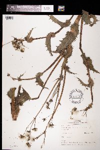 Sonchus asper (L.) Hill 971813[1395648]Verbelen, E. 2751974-08-04 Netherlands |
MIN:Plants | 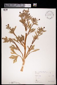 972077[1395812]Janssens, J. 75/871975-05-19 Netherlands |
MIN:Plants | 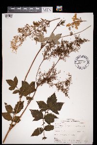 Filipendula ulmaria (L.) Maximowicz 972297[1395847]Verbelen, E. 2711974-08-04 Netherlands |
MIN:Plants | 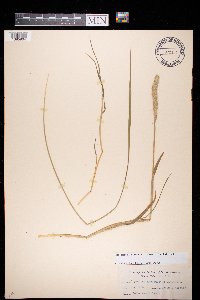 972354[1395904]Jansen s.n.1920-06-00 Netherlands |
MIN:Plants | 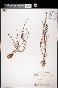 Salicornia ramosissima Woods 972436[1395985]Verbelen, E. 6.8.19741974-08-06 Netherlands, Krabbendijke |
MIN:Plants | 972458[1398007]Janssens, J. Netherlands, Detailed locality information protected. This is typically done to protect rare or threatened species localities. |
MIN:Plants | 972497[1398045]Janssens, J. Netherlands, Detailed locality information protected. This is typically done to protect rare or threatened species localities. |
MIN:Plants | 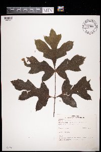 972628[1398181]Janssens, J. 2721974-08-04 Netherlands |
MIN:Plants | 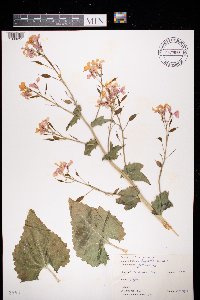 972698[1398251]Janssens, J. 76/81976-05-09 Netherlands |
MIN:Plants | 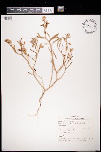 Cakile maritima Scop. 972699[1398252]Verbelen, E. 2791974-08-27 Netherlands, Veerse dijk |
MIN:Plants |  Myosotis stricta Link ex Roem. & Schult. 972710[1398263]Janssens, J. 76/121976-05-16 Netherlands, Meersel-dreef |
MIN:Plants |  Myosotis arvensis (L.) Hill 972712[1398265]Janssens, J. 76/141976-05-23 Netherlands, Big Island |
MIN:Plants |  Carex riparia Curtis 972740[1398293]Janssens, J. 76/91976-05-09 Netherlands |
MIN:Plants |  Glyceria plicata (Fr.) Fr. 972035[1395770]J. Janssens 3781974-09-30 Netherlands, Blokkersdijk |
MIN:Plants |  Centaurium pulchellum (Swartz) Druce 972020[1395755]J. Janssens 3631974-09-30 Netherlands, Blokkersdijk |
1
Page 1, records 1-20 of 20
Google Map
Google Maps is a web mapping service provided by Google that features a map that users can pan (by dragging the mouse) and zoom (by using the mouse wheel). Collection points are displayed as colored markers that when clicked on, displays the full information for that collection. When multiple species are queried (separated by semi-colons), different colored markers denote each individual species.