University of Minnesota
http://www.umn.edu/
612-625-5000
http://www.umn.edu/
612-625-5000
Minnesota Biodiversity Atlas
Bell Museum
Dataset: MIN-Plants
Search Criteria: Uganda; excluding cultivated/captive occurrences
1
Page 1, records 1-19 of 19
Bell Museum plants | |
 MIN:Plants | 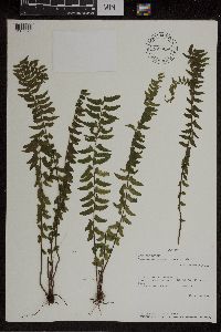 Asplenium erectum Bory; Willd. 507924[1307573]Rwaburindore, P.K. 24621987-06-20 Uganda, W. Ankole U2: Buhweju: Ntanzigurwa-Rugongo;TQ-60-20, -0.366667 30.483333, 1550m |
MIN:Plants | 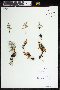 Pellaea doniana Hook. 507915[1377940] Uganda |
MIN:Plants | 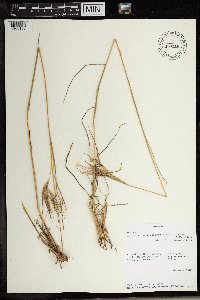 Hyparrhenia dissoluta (Nees ex Steud.) C.E. Hubb. 508126[1369156]Rwaburindore, P.K. 23481987-02-03 Uganda, E. Ankole U2: Kashari: Kanyamiyanga Hill. TQ-60-20, -0.366667 30.5, 1680m |
MIN:Plants | 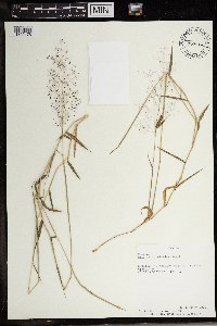 Melinis P. Beauv. 507884[1369178]Rwaburindore, P.K. 23421987-01-22 Uganda, Buhweju, W. Ankole, Rugongo, -0.366667 30.483333, 1770m |
MIN:Plants | 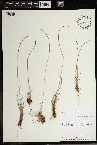 507925[1369180]Rwaburindore, P.K. 23301987-01-20 Uganda, E. Ankole U2: Kashari: Kanyamiyanga Hill. TQ-59-23, -0.366667 30.5, 1680m |
MIN:Plants | 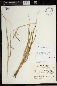 508124[1369184]Rwaburindore, P.K. 23451987-01-22 Uganda, W. Ankole U2: Buhweju: Rugongo. TQ-9-21, -0.366667 30.483333 |
MIN:Plants | 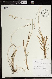 499312[1369185]Rwaburindore, P.K. 37951994-09-05 Uganda, District E. Mengo U4: Bulemezi County. Kalagala. Grid: VR-68-55, 0.616667 32.583333, 1200m |
MIN:Plants | 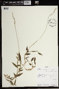 507923[1369188]Rwaburindore, P.K. 24611987-06-20 Uganda, W. Ankole U2: Buhweju: Ntanzigurwa-Rugongo. TQ-60-20, -0.366667 30.483333, 1550m |
MIN:Plants | 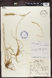 Aristida adoensis Hochst. 508130[1374808]Rwaburindore, P.K. 23471987-03-02 Uganda, Kashari, E. Ankole U2 District, Kanyaiyanga Hill, 512m |
MIN:Plants | 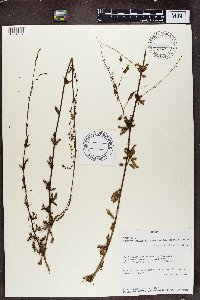 Aeschynomene abyssinica (A. Rich.) Vatke 969360[1374907]Rwaburindore, P. K. 23371987-01-22 Uganda, W. Ankole U2: Buhweju: Rugongo. TQ-59-21, -0.366667 30.483333, 1770m |
MIN:Plants | 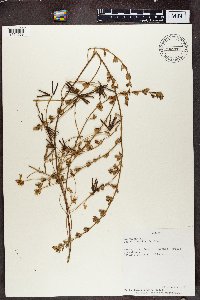 Lotus discolor E. Mey. 520797[1374969]P.K. Rwaburindore 22381987-01-22 Uganda, Buhweji, W. Ankole, Rugongo |
MIN:Plants | 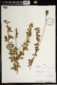 Crotalaria mesopontica Taub. 507879[1369382]P.K. Rwaburindore 23401987-01-22 Uganda, W. Ankole U2: Buhweju: Rugongo. TQ-59-21, -0.366667 30.483333, 1770m |
MIN:Plants | 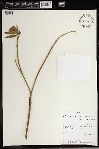 Crotalaria petitiana (A. Rich.) Walp. 499176[1369386]P.K. Rwaburindore 37931994-09-01 Uganda, Busiro, District W. Mengo U4: Busiro County. nakauka. Grid: VR-40-21., -0.2 32.466667 |
MIN:Plants | 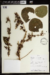 Rhynchosia congensis Baker 435446[1369399]P.K. Rwaburindore 26291988-06-29 Uganda, Central. W. Mengo (U4); Kyadondo. Bukoto (U4). VR-54-39., 0.35 32.583333, 1200m |
MIN:Plants | 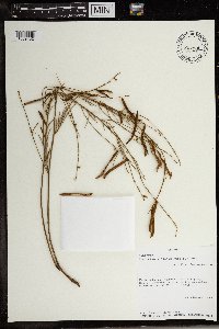 Tephrosia linearis (Willd.) Pers. 507919[1369432]P.K. Rwaburindore 23261987-01-20 Uganda, E. Ankole U2: Kashari: Kanyamiyanga Hill. TQ-59-23, -0.366667 30.5, 1680m |
MIN:Plants | 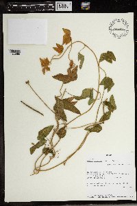 Vigna luteola (Jacq.) Benth. 508127[1369459]Rwaburindore, P.K. 24651987-07-01 Uganda, W. Ankoe U2: Buhweju: Kamukaki-Rugongo. Bushland, -0.383333 30.466667, 1800m |
MIN:Plants | 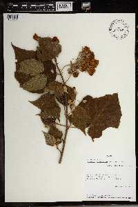 Dombeya burgessiae Gerrard ex Harv. 507913[1369797]Rwaburindore, P.K. 23341987-01-22 Uganda, W. Ankole U2: Buhweju: Rugongo. TQ-59-21; -0.366667 30.483333, -0.366667 30.483333, 1770m |
MIN:Plants | 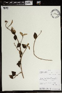 Dissotis rotundifolia (Sm.) Triana 493487[1369960]Rwaburindore, P.K. 37941994-09-01 Uganda, Busiro, District W. Mengo U4: Nakuaka. grid: VR-40-21., 0.2 32.466667, 1200m |
MIN:Plants | 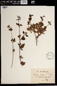 596446[1302517]Whyte s.n. Uganda, Milangi, Kyasa |
1
Page 1, records 1-19 of 19
Google Map
Google Maps is a web mapping service provided by Google that features a map that users can pan (by dragging the mouse) and zoom (by using the mouse wheel). Collection points are displayed as colored markers that when clicked on, displays the full information for that collection. When multiple species are queried (separated by semi-colons), different colored markers denote each individual species.