University of Minnesota
http://www.umn.edu/
612-625-5000
http://www.umn.edu/
612-625-5000
Minnesota Biodiversity Atlas
Bell Museum
Dataset: MIN-Plants
Taxa: Adiantaceae
Search Criteria: excluding cultivated/captive occurrences
1
Page 1, records 1-14 of 14
Bell Museum plants | |
 MIN:Plants | 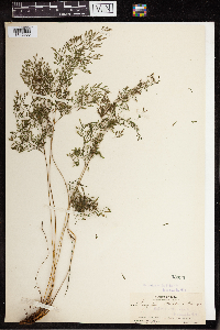 Onychium strictum Kurze 53035[1342963]Pollard, Charles L. 1161902-01-30 Cuba, Santiago, Slopes and summit of El Yunque, near Baracoa, 23.033333 -82.583333, 305 - 610m |
MIN:Plants | 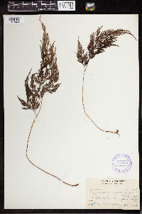 Onychium japonicum Kurze 349138[1342964]Topping, D.L. 11941909-02-02 Philippines, Mt. Tonglon, Benguet, Luzon, 16.640743 121.918976 |
MIN:Plants | 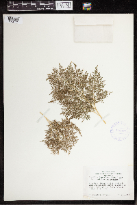 Onychium japonicum Kurze 408907[1342965]Whitcomb, William K. 1939-08-00 India, Dehra Dun District, Himalaya Mountains. Mussoorie, 30.416667 77.933333, 1829m |
MIN:Plants | 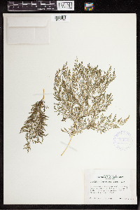 Onychium japonicum Kurze 408906[1342966]Whitcomb, William K. 1939-08-00 India, Dehra Dun District, Himalaya Mountains. Mussoorie, 30.416667 77.933333, 1829m |
MIN:Plants | 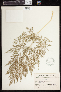 Onychium japonicum Kurze 540252[1342967]Inar, J.C. 1956-10-13 India, Mussorie, 30.459789 78.064372 |
MIN:Plants | 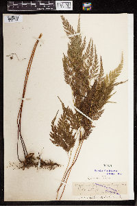 Onychium japonicum Kurze 53030[1342968]Stanford, Arthur N. 1431895-09-00 Japan, Kyoto, 35 135.75 |
MIN:Plants | 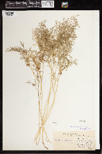 Onychium melanolepis Kunze 53033[1342969]Stapf, O Iran, Islamic Republic of, Bushehr, Dalaki, 37.0931 47.9917 |
MIN:Plants | 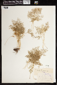 Onychium melanolepis Kunze 53034[1342970] 680 India |
MIN:Plants | 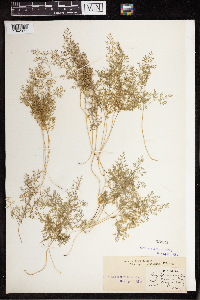 Onychium melanolepis Kunze 53032[1342971]Stapf, O 1895-00-00 Iran, Islamic Republic of, Nolepis Dene[?], 32.454911 54.617187 |
MIN:Plants | 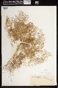 Onychium melanolepis Kunze 53031[1342972] |
MIN:Plants | 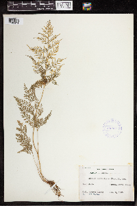 Onychium siliculosum C.Chr. 405862[1342973]Sidney, Cedric 1945-01-03 Myanmar, North Myanmar, Warzup, 24.884035 96.439453 |
MIN:Plants | 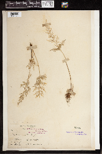 Onychium siliculosum C.Chr. 53029[1342974]King 1890-12-00 India, West Bengal, China, Baro Hills, 29.404354 79.44226, 152m |
MIN:Plants | 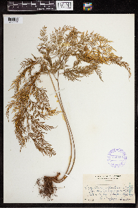 Onychium siliculosum C.Chr. 349136[1342975]Topping, D.L. 6301906-12-31 Philippines, Luzon, between Taytay and Antipolo, Rizal, 14.594672 121.167714 |
MIN:Plants | 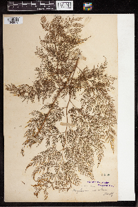 Onychium siliculosum C.Chr. 53028[1342976]Kaupf[?] |
1
Page 1, records 1-14 of 14
Google Map
Google Maps is a web mapping service provided by Google that features a map that users can pan (by dragging the mouse) and zoom (by using the mouse wheel). Collection points are displayed as colored markers that when clicked on, displays the full information for that collection. When multiple species are queried (separated by semi-colons), different colored markers denote each individual species.