University of Minnesota
http://www.umn.edu/
612-625-5000
http://www.umn.edu/
612-625-5000
Minnesota Biodiversity Atlas
Bell Museum
Dataset: MIN-Plants
Taxa: Amaryllidaceae
Search Criteria: excluding cultivated/captive occurrences
1
Page 1, records 1-17 of 17
Bell Museum plants | |
 MIN:Plants | Dianella sandwicensis Hooker & Arnott 454242[]US Nat. Arboretum staff s.n.1981-00-00 United States, Hawaii, Oahu, Na Polikona Forest Reserve, Honolulu |
MIN:Plants | Dianella sandwicensis Hooker & Arnott 268036[]Hapeman, H. s.n.1908-05-23 United States, Hawaii, Hawaii, Near volcano of Kilaua, island of Hawaii;Hawaii Volcanoes National Park |
MIN:Plants | 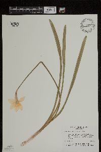 Narcissus x incomparabilis P. Miller 431935[1299148]Thieker, Truey T. United States, South Carolina, Richland |
MIN:Plants | Dianella lavarum O. Degener 365189[]Degener, O. 124681939-08-11 United States, Hawaii, Maui, Kaupo Gap, Haleakala, Maui;Haleakala National Park |
MIN:Plants | Dianella lavarum O. Degener 368573[]Degener, O. 124681939-08-11 United States, Hawaii, Maui, Kaupo Gap, Haleakala, Maui;Haleakala National Park |
MIN:Plants | 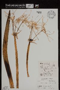 Hymenocallis liriosme (Rafinesque) Shinners 670043[1299150]Goodman, G.; et al. 81561971-05-02 United States, Oklahoma, McCurtain, McCurtain Co. ... 4.3 miles S.E. of Eagletown |
MIN:Plants | 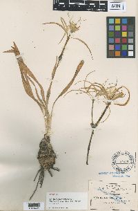 Hymenocallis graminifolia Greenman 91099[1001429]Pringle, C.G. 85321901-07-06 Mexico, Morelos, Valley near Yantepec, 1219m |
MIN:Plants | 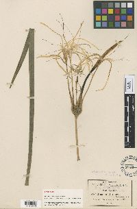 Hymenocallis riparia Greenman 91103[1001383]Pringle, C.G. 89521904-07-22 Mexico, Morelos, Barranca of Cuernavaca, 1433m |
MIN:Plants | 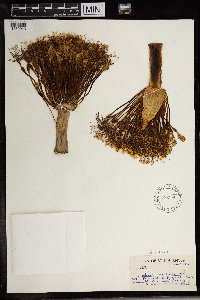 582390[1369043]Sidey, James L. 33811959-09-00 South Africa, Natal, Richmond Dist |
MIN:Plants | 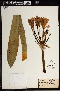 91174[1369045]MacOwan 8041885-11-00 South Africa, near Durban, 853m |
MIN:Plants | 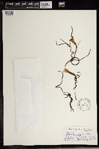 586212[1369046]Sidey, James L. 38391963-09-00 South Africa, Collected Bathurst District E. Cape |
MIN:Plants |  91052[1369047]Wood, J. M. 49051893-08-03 South Africa, Natal, 50m |
MIN:Plants | 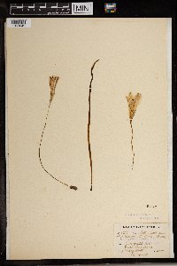 Apodolirion mackenii Baker 91053[1369042]Wood, J. Medley 8221989-04-24 South Africa, Natal, great woodsberg, 914m |
MIN:Plants | 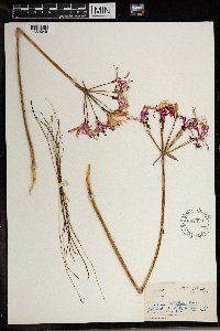 Nerine filifolia Baker 582339[1369049]Sidey, James L. 34641960-03-00 South Africa, Bathurst Dist, E. Cape |
MIN:Plants | 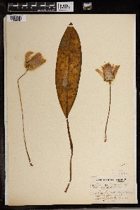 91093[1369048]Wood, J. Medley 39431884-03-01 South Africa, Natal, 15m |
MIN:Plants | 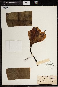 Crinum macowanii Baker 91085[1369280]MacOwan 5061854-12-00 South Africa, Cult. e bulbis epontaneis intia St. Kei & Bashee bectis. |
MIN:Plants | 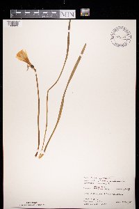 972539[1398089]Janssens, J. 75/391975-04-21 Belgium, Orneau, 125m |
1
Page 1, records 1-17 of 17
Google Map
Google Maps is a web mapping service provided by Google that features a map that users can pan (by dragging the mouse) and zoom (by using the mouse wheel). Collection points are displayed as colored markers that when clicked on, displays the full information for that collection. When multiple species are queried (separated by semi-colons), different colored markers denote each individual species.