University of Minnesota
http://www.umn.edu/
612-625-5000
http://www.umn.edu/
612-625-5000
Minnesota Biodiversity Atlas
Bell Museum
Dataset: MIN-Plants
Taxa: Aristolochiaceae
Search Criteria: excluding cultivated/captive occurrences
Bell Museum plants | |
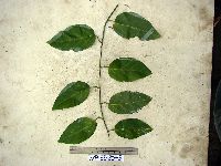
MIN:Plants | 912914[]Weiblen, G.D. WP5E30452007-05-03 Papua New Guinea, Madang, Wanang village, -5.2373 145.177183, 115m |
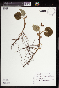
MIN:Plants | Asarum lemmonii S. Watson 230305[]Congdon, J. s.n.1893-06-16 United States, California, Mariposa, Footman Mt.;Yosemite National Park;;;, 37.54549 -119.82489 |
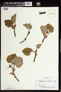
MIN:Plants | Asarum lemmonii S. Watson 246320[]Hall, H.; Babcock, E. 34131902-07-00 United States, California, Mariposa, Yosemite National Park...Vicinity of the Merced Grove of Big Trees;Yosemite National Park, 1676m |
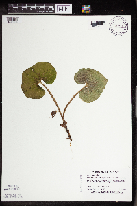
MIN:Plants | Asarum lemmonii S. Watson 230330[]Congdon, J. s.n.1885-06-00 United States, California, Mariposa, Footman Mt.;Yosemite National Park;;;, 37.54549 -119.82489 |
MIN:Plants | Asarum lemmonii S. Watson 230331[]Congdon, J. s.n.1885-05-00 United States, California, Mariposa, Foot Mt. Bickingham, Mariposa County;Yosemite National Park |
MIN:Plants | 813605[]Ballow, T.; et al. 71979-04-25 United States, Missouri, Franklin, Franklin Co. ... at the base of a bluff. Meramack State Park. |
MIN:Plants | 507942[]Gerdes, Lynden; et al. 24761998-05-23 United States, Minnesota, Cook, Boundary Waters Canoe Area Wilderness / Superior National Forest. T65N R03E S27NENW. Cook County; Superior National Forest, BWCAW. In woods near creek/drainage south of the Moose Lake/North Fowl Lake portage.. 065N 03E 27, 48.085377 -90.046955 |
MIN:Plants | 295331[]Benner, F.; Benner, J. 2731928-05-12 United States, Wisconsin, Polk, 2.8 mi N. of St. Croix Falls, Wis. S. of Whiskey Creek;Saint Croix National Riverway;;;, 45.452726 -92.649593 |
MIN:Plants | 919692[]Smith, Welby 221091993-05-12 United States, Minnesota, Sibley, Sibley County...In the Minnesota Valley about 3 miles north-northwest of Henderson...T113N R26W NE1/4 of SE1/4 of Sec 22;;113N;26W;22, 44.5769444 -93.9313889 |
MIN:Plants | 100821[]Elmer, A.D.E. 28341900-06-00 United States, Washington, Clallam, Olympic Mts. [Olympic National Park], 47.83 -123.83 |
MIN:Plants | 441170[]Scott, P. 16662004-05-20 United States, Minnesota, Saint Louis, Herriman Tr.;Superior National Forest;067N;16W;31, 48.243054 -92.445218 |
MIN:Plants | 492620[]Wheeler, Gerald 156921997-05-24 United States, Minnesota, Nicollet, Fort Ridgely State Park. Nicollet County ... Fort Ridgely State Park; 0.6 mi. NW of jct. of Rte. 4 and Rte. 5 ... W1/2 NE1/4 NE1/4 Sec. 6 T111N R32W. 111N 32W 6, 44.443975 -94.741492 |
MIN:Plants | 454432[]Juhnke, C. 183 CMJ FRO1999-05-08 United States, Minnesota, Goodhue, Frontenac State Park Goodhue County ... along trail to Sand Point ... T112N R13W NW SE NW 13;Frontenac State Park;112N;13W;13, 44.505359 -92.319092 |
MIN:Plants | 509402[]Wheeler, Gerald 197961999-06-02 United States, Minnesota, Blue Earth, Blue Earth County ... About 0.8 mi. S of jct. of Rte. 68 and Rte. 42 ... W of roadW1/2 SE1/2 Sec. 4 T108N R28W;;108N;28W;4, 44.188659 -94.198823 |
MIN:Plants | 476709[]Kaul, R. 63911989-06-15 United States, Minnesota, Clearwater, Clearwater County ... east side of Lake Itasca;Itasca State Park;143N;36W;, 47.19557 -95.233216 |
MIN:Plants | 476708[]Kaul, R. 65921989-07-08 United States, Minnesota, Hubbard, Hubbard County ... Along the north boundary road of Itasca Park, near LaSalle Creek.;Itasca State Park;143N;35W;, 47.195787 -95.107789 |
MIN:Plants | 920303[]Smith, Welby 184991991-05-20 United States, Minnesota, Morrison, Camp Ripley Military Reservation. Camp Ripley Military Reservation. Morrison County...On the north side of Pusan Road, about 5.5 km east-southeast of Pillager...UTM: 392000E 5129500N. T 133N R 30W NW1/4 of NE1/4 of Sec 25. 133N 30W 25, 46.3125 -94.4027778 |
MIN:Plants | 100798[]Bergman, H. 31341914-08-28 United States, Minnesota, Hubbard, Benedict, quadrat 24A;Paul Bunyan State Forest;143N;32W;35, 47.157287 -94.695698 |
MIN:Plants | 100801[]Butters, F.; et al. 36461918-07-23 United States, Minnesota, Houston, Root River Valley W of Hokah;;;;, 43.759412 -91.346526 |
MIN:Plants | 100808[]Rosendahl, C. 26181912-08-23 United States, Minnesota, Cook, Kimball Creek valley, N. Shore, L. Superior;North Shore / Superior National Forest;061N;02E;, 47.790671 -90.205991 |
MIN:Plants | 100874[]Sheldon, Edmund S20831892-06-00 United States, Minnesota, Aitkin, Nichols;;044N;27w;04, 46.323872 -93.757211 |
MIN:Plants | 100882[]Arthur, J.; et al. 159A1886-07-24 United States, Minnesota, Saint Louis, St. Louis County...Vemilion Lake;;;;, 47.870807 -92.349049 |
MIN:Plants | 100884[]Sheldon, Edmund S1461891-06-00 United States, Minnesota, Blue Earth, Madison Lake;;N;;, 44.204412 -93.815508 |
MIN:Plants | 100887[]Sheldon, Edmund S30351892-07-00 United States, Minnesota, Mille Lacs, Milaca;;037N;27W;, 45.692047 -93.698793 |
MIN:Plants | 224713[]Rosendahl, C.; Butters, F. 46191924-07-04 United States, Minnesota, Cook, Near camp ground, Pigeon River. Cook Co.;Grand Portage State Park / North Shore;064N;07E;, 47.994009 -89.575112 |
MIN:Plants | 270039[]Wheeler, William 641896-05-15 United States, Minnesota, Houston, Winnebago Valley;Dorer Memorial Hardwood State Forest;N;;, 43.5375 -91.40865 |
MIN:Plants | 270545[]Manning, Sara 851884-05-30 United States, Minnesota, Wabasha, Mount Pleasant;;N;;, 44.410833 -92.35 |
MIN:Plants | 271005[]Budde, C. s.n.1893-05-16 United States, Minnesota, Blue Earth, North Mankato;;N;;, 44.163578 -93.9994 |
MIN:Plants | 281632[]Vuke, G. 891948-08-00 United States, Minnesota, Clearwater, Itasca State Park;Itasca State Park;143N;36W;, 47.19557 -95.233216 |
MIN:Plants | 288400[]Anonymous s.n.1907-05-00 United States, Minnesota, Ramsey, Groveland Park [St. Paul neighborhood between Highland and Summit aves.];;028N;23W;, 44.905162 -93.166462 |
MIN:Plants | 333041[]Oestlund, O. 403-11888-08-17 United States, Minnesota, Hennepin, [no further data];;;;, 45 -93.47 |
MIN:Plants | 349619[]Nielsen, E. 13231932-05-01 United States, Minnesota, Redwood, 5 mi E of Redwood Falls;;;;, 44.539359 -95.01535 |
MIN:Plants | 393852[]Butters, F.; Abbe, E. 71936-06-18 United States, Minnesota, Lake, Old lumber camp on Manitou River ca. 2 mi from Lake Superior;;N;;, 47.44949 -91.08198 |
MIN:Plants | 412997[]Moore, John; et al. 119101939-08-19 United States, Minnesota, Koochiching, Koochiching County...south of Frank Bay, Rainy Lake;;;;, 48.600761 -93.212088 |
MIN:Plants | 413177[]Moore, John; et al. 110331939-07-21 United States, Minnesota, Lake of the Woods, 1 mi up from the mouth of Pine Creek, Angle Inlet, 3/4 mi W of the creek, Lake of the Woods Co.;Northwest Angle;168N;34W;, 49.344621 -95.028893 |
MIN:Plants | 416730[]Lakela, Olga 94851949-08-27 United States, Minnesota, Saint Louis, High ledge on Kabetogama;Voyageurs National Park;N;;, 48.437695 -93.027374 |
MIN:Plants | 419032[]Ahlgren, Clifford 1631949-07-09 United States, Minnesota, Lake, Lake Co.; Sec.20, T64N, R10W;Boundary Waters Canoe Area Wilderness / Superior National Forest;064N;10W;20, 48.002267 -91.639633 |
MIN:Plants | 421334[]Jacobs, D. s.n.1948-05-06 United States, Minnesota, Blue Earth, Glenwood Ave, Mankato;;N;;, 44.163578 -93.9994 |
MIN:Plants | 422696[]Lakela, Olga 78361948-09-11 United States, Minnesota, Carlton, Nemadji River bank S of Fond du Lac;;N;;, 46.513896 -92.418444 |
MIN:Plants | 430631[]Smith, Welby 195141991-07-16 United States, Minnesota, Koochiching, Koochiching County ... On the west side of Silverdale ... T 64N R 22W SW1/4 of NE1/4 of Sec 35;Koochiching State Forest;064N;22W;35, 47.9866676 -93.1188889 |
MIN:Plants | 430721[]Smith, Welby 152241989-05-31 United States, Minnesota, Freeborn, Myre Big Island State Park. Freeborn County...Helmer Myre State Park, about 2 miles southeast of Albert Lea. On 'Big Island' in Albert Lea Lake...SW1/4 NW1/4 section 19, T 102N R 20W. 102N 20W 19, 43.625 -93.2874985 |
MIN:Plants | 440072[]Spencer, O. s.n.1937-05-06 United States, Minnesota, Hennepin, Cliff slope of Miss. River. Fort Snelling;Fort Snelling Military Reservation;028N;23W;, 44.905162 -93.166462 |
MIN:Plants | 440370[1348390]Myhre, Karen 17081992-05-07 United States, Minnesota, Cass, Cass Co.; Located 2 mi SW of Willow Lake; T142N R25W NE1/4 of SW1/4 of Sec 11;Chippewa National Forest;142N;25W;11, 47.128536 -93.806241 |
MIN:Plants | 440789[]Boe, J. 930507101993-05-07 United States, Minnesota, Cass, Cass Co. Ottertail Peninsula; T143N R29W NW1/4 of NE1/4 of sec 6;Chippewa National Forest / Leech Lake Indian Reservation;143N;29W;6, 47.229896 -94.393289 |
MIN:Plants | 442865[]Lakela, Olga 138071951-09-14 United States, Minnesota, Saint Louis, Crane Lake near Vermilion gorge;Kabetogama State Forest;067N;17W;, 48.280155 -92.520857 |
MIN:Plants | 443093[]Lakela, Olga 131371951-07-11 United States, Minnesota, Saint Louis, shore of Rainy Lake near Kettle Falls;Voyageurs National Park;N;;, 48.502683 -92.639596 |
MIN:Plants | 445240[]Myhre, K. 53381995-05-15 United States, Minnesota, Mahnomen, Mahnomen Co.; Located 2 miles northeast of Tulaby Lake; T 143N R 39W NE1/4 of NE1/4 of Sec 36;White Earth Indian Reservation / White Earth State Forest;143N;39W;36, 47.158638 -95.561717 |
MIN:Plants | 445909[]Moore, John; Huff, N. 180251945-07-26 United States, Minnesota, Morrison, 13 mi NW of Little Falls;;N;;, 46.109289 -94.554018 |
MIN:Plants | 452728[1348395]Myhre, K. 16781992-05-06 United States, Minnesota, Cass, Cass Co.; located along the northeast shore of Waboose Bay; T 144N R 28W SE1/4 of NW1/4 of SEc 17;Chippewa National Forest / Leech Lake Indian Reservation;144N;28W;17, 47.289114 -94.253362 |
MIN:Plants | 452737[]Myhre, K. 15261991-10-08 United States, Minnesota, Aitkin, Aitkin Co.; located on the north side of highway 18; T 45N R 27W SW1/4 of SW1/4 of Sec 33;;045N;27W;33, 46.337869 -93.75801 |
MIN:Plants | 457179[1348394]Boe, J.; Estes, Carol 940512091994-05-12 United States, Minnesota, Cass, Chippewa National Forest / Leech Lake Indian Reservation. Cass Co.; Bear Island in Leech Lake. Chippewa National Forest. Walker Dist, Comp.32. Chipp. Nat. Forest old growth comp Cass Co.; Bear Island in Leech Lake. Chippewa National Forest. Walker Dist, Comp.32. Chipp. Nat. Forest old growth complex; T142N R29W SE1/4 of NW1/4 of Sec 2. 142N 29W 2, 47.147362 -94.307473 |
MIN:Plants | 462490[]Lakela, Olga 149651952-07-14 United States, Minnesota, Saint Louis, N shore of Kabetogama Lake, opposite Pine Island;Voyageurs National Park;;;, 48.4659 -92.92931 |
MIN:Plants | 466707[]Kruse, K. 006 KMK1994-05-20 United States, Minnesota, Goodhue, Frontenac State Park. Goodhue County...T: 112N R: 13W Sec: 2 Quarter Sec: N 1/2;Frontenac State Park;112N;13W;02, 44.535072 -92.339158 |
MIN:Plants | 475476[]Myhre, K. 5791991-08-11 United States, Minnesota, Aitkin, Hill River State Forest. Aitkin Co.; 2.75 miles south of Swatara on county road 29, 1.5 miles east-southeast on logging road; T 50N R 26W NE1/4 o Aitkin Co.; 2.75 miles south of Swatara on county road 29, 1.5 miles east-southeast on logging road; T 50N R 26W NE1/4 of NE1/4 of Sec 8. 050N 26W 8, 46.834282 -93.666444 |
MIN:Plants | 475585[]Smith, Welby 151771989-05-30 United States, Minnesota, Kanabec, Mille Lacs Wildlife Management Area. Kanabek [sic] County...Mille Lacs State Wildlife Management Area, about 9 miles northwest of Mora...SW1/4 SW1/4 section 16, T 40N R 25W. 040N 25W 16, 45.9511108 -93.4711075 |
MIN:Plants | 475610[1348396]Myhre, K. 8371991-08-30 United States, Minnesota, Aitkin, Aitkin Co.; North on coutny road 14, east at Forest Road to Remote Lakes; T 50N R 23W NW1/4 of NW1/4 of Sec 10;Savanna State Forest;050N;23W;10, 46.832028 -93.242168 |
MIN:Plants | 475659[]Myhre, K. 9561991-09-04 United States, Minnesota, Aitkin, Aitkin Co.; 4 miles south of Glen, 5 miles east, 1 mile south; T 45N R 24W NE1/4 of NW1/4 of Sec 29;;045N;24W;29, 46.355106 -93.400047 |
MIN:Plants | 475661[]Myhre, K. 7901991-08-29 United States, Minnesota, Aitkin, Aitkin Co.; 8 miles south of Jacobson; T 51N R 24W SE1/4 of NE1/4 of sec 24;Savanna State Forest;051N;24W;24, 46.890892 -93.325867 |
MIN:Plants | 481089[]Lakela, Olga 159581953-06-07 United States, Minnesota, Saint Louis, #24, Lake Vermilion, Treasure Island Resort;;N;;, 47.910471 -92.589612 |
MIN:Plants | 504856[]Smith, Welby 191811991-07-08 United States, Minnesota, Koochiching, Franz Jevne State Park. Koochiching County ... Franz Jevne State Park, in the Rainy River Valley, about 2 mi NE of Birchdale ... T160N R27W SW1/4 of SW1/4 of Sec 26. 160N 27W 26, 48.6427765 -94.078331 |
MIN:Plants | 515175[1348397]Myhre, K. 1761991-07-02 United States, Minnesota, Aitkin, Wealthwood State Forest. Aitkin Co.; 2.5 miles north of Mille Lacs Lake on township road 51, east side of the road. Private land; T 45N R 26W SW1 Aitkin Co.; 2.5 miles north of Mille Lacs Lake on township road 51, east side of the road. Private land; T 45N R 26W SW1/4 of NE1/4 of Sec 8. 045N 26W 8, 46.395823 -93.653344 |
MIN:Plants | 518491[]Puchalski, L. 3011993-07-19 United States, Minnesota, Polk, Polk County...Dorr WMA; T148N R43W NW1/4 of NE1/4 of Sec 24;Dorr Lake Wildlife Management Area;148N;43W;24, 47.62176 -96.078285 |
MIN:Plants | 519855[]Smith, Welby 188601991-06-21 United States, Minnesota, Aitkin, Aitkin County ... about 3 miles E of Hill City ... T52N R25W SE1/4 of NE1/4 of Sec 17;Hill River State Forest;052N;25W;17, 46.9949989 -93.5311127 |
MIN:Plants | 525922[]Lakela, Olga 188971955-07-20 United States, Minnesota, Saint Louis, Vermilion River woods, Gold Mine Camp, S of Crane Lake;;N;;, 48.205085 -92.617355 |
MIN:Plants | 543321[]Lakela, Olga 213711957-06-15 United States, Minnesota, Lake, shore of Gooseberry River;;N;;, 47.174005 -91.568857 |
MIN:Plants | 590087[]Meierotto, R. s.n.1963-07-26 United States, Minnesota, Clearwater, S12, T143N, R36W;Itasca State Park;143N;36W;12, 47.217742 -95.180169 |
MIN:Plants | 592175[]Moore, John 266111964-05-26 United States, Minnesota, Blue Earth, roadside 1 mi W of Mankato;;N;;, 44.163578 -93.9994 |
MIN:Plants | 592484[]Westkaemper, Remberta s.n.1962-05-00 United States, Minnesota, Stearns, Stearns Co. St. Cloud. St. Cloud Hospital river bank;;N;;, 45.560799 -94.16249 |
MIN:Plants | 594208[]Thorne, Robert 303161962-06-11 United States, Minnesota, Clearwater, S of Campus of Univ. of Minnesota Biol. Sta, Itasca State Park;Itasca State Park;143N;36W;, 47.19557 -95.233216 |
MIN:Plants | 607337[]Grafstrom, M. 111968-04-27 United States, Minnesota, Pine, NW1/4 of section;Saint Croix State Park;040N;18W;12, 45.972384 -92.545919 |
MIN:Plants | 616774[]Moore, John; et al. 5261969-10-07 United States, Minnesota, Crow Wing, Crow Wing Natural History Area, Crow Wing County...SE1/4 NE1/4 S6, Garrison Twp;Crow Wing Natural Area;044N;28W;06, 46.323097 -93.926287 |
MIN:Plants | 618810[]Monserud, W. s.n.1957-05-05 United States, Minnesota, Hennepin, In Bryn Mawr, side hill at washout above footbridge bewteen rr tracks, Chestnut and Russel Ave. S.;;N;;, 44.97713 -93.31092 |
MIN:Plants | 655195[]Gage Jr., Addison 571876-05-23 United States, Minnesota, Hennepin, Minneapolis;;N;;, 44.979965 -93.263836 |
MIN:Plants | 680788[]Wheeler, Gerald 10491977-05-01 United States, Minnesota, Olmsted, Olmsted Co. About 2 mi S of Simpson on hwy 1, bank of the Root River; T105N R13W Sec. 20;Dorer Memorial Hardwood State Forest;105N;13W;20, 43.884292 -92.408371 |
MIN:Plants | 680801[]Wheeler, Gerald 10131977-04-25 United States, Minnesota, Goodhue, Kenyon, just S of the jnc of the Zumbro River and hwy 60, bordering the Zumbro River; T109N R18W Sec. 5;;109N;18W;5, 44.276498 -93.010399 |
MIN:Plants | 680810[]Wheeler, Gerald 9821977-04-18 United States, Minnesota, Carver, Carver Co. Approx. 1/2 mi W of Stone Lake on hwy 7; T116N R24W Sec. 3;Carver Park Reserve County Park;116N;24W;3, 44.884124 -93.693368 |
MIN:Plants | 681160[]Swanson, Steven 4661975-06-13 United States, Minnesota, Winona, Mississippi River (Navigation Pool #8), Winona Co. Site 9, rr bank on W side of main channel;Upper Mississippi National Wildlife Refuge;105N;04W;, 43.873038 -91.336459 |
MIN:Plants | 685091[1293470]Stassen, Carol 381977-05-28 United States, Minnesota, Lyon, Camden State Park; T110N, R42W, S5;Camden State Park;110N;42W;5, 44.363181 -95.927443 |
MIN:Plants | 686074[]Anonymous s.n.1900-04-29 United States, Minnesota, Stearns, Saint Cloud;;N;;, 45.560799 -94.16249 |
MIN:Plants | 686809[]Wheeler, Gerald; Glaser, Paul 12351977-05-14 United States, Minnesota, Itasca, Coll. site no. 1. SE1/4 SE1/4 T56N, R26W; ca 10 mi NW of Grand Rapids;;056N;26W;19, 47.318171 -93.691967 |
MIN:Plants | 689752[]Davenport, F. s.n.1925-05-29 United States, Minnesota, Scott, Savage;;115N;21W;, 44.753605 -93.344349 |
MIN:Plants | 689753[]Genenah, A. s.n.1967-05-02 United States, Minnesota, Hennepin, Ft. Snelling;Fort Snelling Military Reservation;N;;, 44.905162 -93.166462 |
MIN:Plants | 691067[]Sperling, C. 1131976-05-22 United States, Minnesota, Douglas, Douglas Co. 2 1/2 mi E, 1 mi N of Holmes City;;N;;, 45.848039 -95.489202 |
MIN:Plants | 691136[]Sperling, C. 1661976-05-29 United States, Minnesota, Douglas, 1 1/4 mi S of Spruce Center;;N;;, 46.05242 -95.223644 |
MIN:Plants | 691566[]Clemants, Steven 999a1978-04-28 United States, Minnesota, Olmsted, Olmsted Co. Simpson's Bluff, ca 3 mi S of Simpson on Co Rd 1. North Branch Root River. T105N, R13W, E center S20.;Dorer Memorial Hardwood State Forest;105N;13W;20, 43.884292 -92.408371 |
MIN:Plants | 696619[]Smith, Welby 7111978-05-16 United States, Minnesota, Wright, Wright Co. T122N, R25W, NW1/4 S30; Between Burlington tracks and Mississippi river. About 3.5 mi NW of Monticello.;;122N;25W;30, 45.345989 -93.884027 |
MIN:Plants | 697859[]Ownbey, Gerald 52261976-08-03 United States, Minnesota, Cass, Cass Co. Ottertail Peninsula; T143N R30W NE1/4 Sec. 22;Chippewa National Forest / Leech Lake Indian Reservation;143N;30W;22, 47.185703 -94.456211 |
MIN:Plants | 699044[]Sather, Nancy; et al. 4781977-08-15 United States, Minnesota, Saint Louis, Plot G12; SW1/4 SW1/4 Sec. T57N R12W;;057N;12W;28, 47.393942 -91.866549 |
MIN:Plants | 708454[]Wheeler, Gerald 34071979-05-05 United States, Minnesota, Rice, Ca. 3 mi S of Lonsdale on rte 33; T111N R22W Sec. 12;;111N;22W;12, 44.435574 -93.412576 |
MIN:Plants | 708458[]Wheeler, Gerald 34111979-05-05 United States, Minnesota, Scott, Scott Co. Approx. 9.5 mi W of New Prague on hwy 19; E1/2 Sec. 36 T113N R25W;;113N;25W;36, 44.550567 -93.778353 |
MIN:Plants | 708529[]Wheeler, Gerald 35151979-05-29 United States, Minnesota, Fillmore, Fillmore Co. Bordering Spring Valley Creek where rt. 8 crosses the creek, ca. 2 mi NW of Wykoff. T103N R12W Sec.8.;Dorer Memorial Hardwood State Forest;103N;12W;8, 43.739222 -92.299275 |
MIN:Plants | 709122[]Wheeler, Gerald 41121979-06-27 United States, Minnesota, Redwood, Redwood Co. Approx. 4 mi E of Redwood Falls on hwy 19 (and 71); T112N R35W Sec. 3;;112N;35W;3, 44.535335 -95.037505 |
MIN:Plants | 709163[]Wheeler, Gerald 41531979-07-02 United States, Minnesota, Pine, Pine Co. About 1 mi SE of Denham; T45N R21W Sec. 25;;045N;21W;25, 46.354095 -92.938274 |
MIN:Plants | 709218[]Wheeler, Gerald 42101979-07-05 United States, Minnesota, Houston, Houston Co. Ca. 9 mi SW of Reno, overlooking Winnebago Creek, woods ca. 0.25 mi from rte 5; T101N R5W Sec. 15;Dorer Memorial Hardwood State Forest;101N;05W;15, 43.551362 -91.422031 |
MIN:Plants | 711630[]Smith, Welby 15831979-08-28 United States, Minnesota, Goodhue, T112N, R13W, NW1/4 NE1/4 S7; 2.5 mi NW of Frontenac.;;112N;13W;7, 44.520176 -92.419924 |
MIN:Plants | 711690[]Smith, Welby 17671979-09-08 United States, Minnesota, Rice, W1/2 Sec. 5.5 mi NE of jnc of Interstate 35 and State 65 in Faribault. W bank of Cannon River.;Cannon River Wilderness Park;111N;20W;34, 44.377654 -93.211311 |
MIN:Plants | 715603[]Keller, C. 161979-06-08 United States, Minnesota, Beltrami, Pennington Orchid Bog SNA: 1 mi N of Pennington, NW1/4 S3, T146N, R30W;Leech Lake Indian Reservation / Pennington Bog Scientific Natural Area;146N;30W;3, 47.491615 -94.469041 |
MIN:Plants | 717485[]Grimmelbein, G. 31979-05-24 United States, Minnesota, Hubbard, Spearhead L. Preserve;Spearhead Lake Preserve (Audubon);145N;34W;, 47.368099 -94.990966 |
MIN:Plants | 723661[]Smith, Welby 19571980-08-28 United States, Minnesota, Wright, Wright Co. On S side of co. rd 30, about 3/4 mi E of its jnc with st. hwy 25; T118N R26W SE1/4 NE1/4 Sec. 24;;118N;26W;24, 45.014149 -93.900222 |
MIN:Plants | 723828[]Smith, Welby 19451980-04-28 United States, Minnesota, Wright, Wright Co. SW side of st. hwy 55, 1/4 mi NW of its jnc with st. hwy 25 in Buffalo; T120N R25W NE1/4 SW1/4 Sec. 19;;120N;25W;19, 45.187024 -93.878938 |
Google Map
Google Maps is a web mapping service provided by Google that features a map that users can pan (by dragging the mouse) and zoom (by using the mouse wheel). Collection points are displayed as colored markers that when clicked on, displays the full information for that collection. When multiple species are queried (separated by semi-colons), different colored markers denote each individual species.
