University of Minnesota
http://www.umn.edu/
612-625-5000
http://www.umn.edu/
612-625-5000
Minnesota Biodiversity Atlas
Bell Museum
Dataset: MIN-Plants
Taxa: Buxaceae
Search Criteria: excluding cultivated/captive occurrences
1
Page 1, records 1-6 of 6
Bell Museum plants | |
 MIN:Plants | Pachysandra terminalis Siebold & Zuccarini 737199[]Ahles, H. 878131980-04-28 United States, Massachusetts, Hampshire, Hampshire Co. ... railroad, near junction of River and East Streets, Easthampton. |
MIN:Plants | 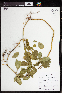 Pachysandra terminalis Siebold & Zuccarini 963450[1352001]Nee, M. 628932016-04-03 United States, Wisconsin, Sauk, 1.7km SE of center of Spring Green, W of Hwy. 23 on E-W trail between Hwy. 23 and S end of driveable portion of Old River Road, 43.160972 -90.061111, 230m |
MIN:Plants | 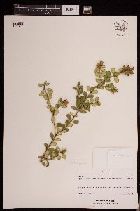 950607[1290174]Schimpf, David J. DJS8192015-06-25 United States, Minnesota, Saint Louis, Duluth. Park Hill Cemetery. T50N R14W SW1/4 Sec.1., 46.836667 -92.065 |
MIN:Plants | 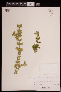 950606[1290175]Schimpf, David J. DJS8492016-04-21 United States, Minnesota, Saint Louis, Duluth. Park Hill Cemetery. T50N R14W SW1/4 Sec 1. S boundary of cemetery, 46.836667 -92.065 |
MIN:Plants | 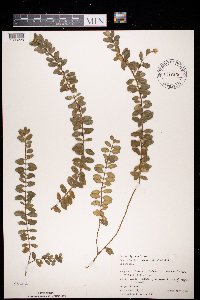 972675[1398228]Janssens, J. 75/261975-04-14 Belgium, IFBL H5 57 41, 180m |
MIN:Plants | 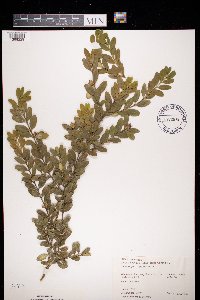 972676[1398229]Janssens, J. 76/541976-06-06 Belgium, Roche au bux, IFBL J5 31 43, 180m |
1
Page 1, records 1-6 of 6
Google Map
Google Maps is a web mapping service provided by Google that features a map that users can pan (by dragging the mouse) and zoom (by using the mouse wheel). Collection points are displayed as colored markers that when clicked on, displays the full information for that collection. When multiple species are queried (separated by semi-colons), different colored markers denote each individual species.