University of Minnesota
http://www.umn.edu/
612-625-5000
http://www.umn.edu/
612-625-5000
Minnesota Biodiversity Atlas
Bell Museum
Dataset: MIN-Plants
Taxa: Chrysobalanaceae
Search Criteria: excluding cultivated/captive occurrences
1
Page 1, records 1-13 of 13
Bell Museum plants | |
 MIN:Plants | Licania arborea NULL 939756[]P 222011-07-07 Costa Rica, Guanacaste, Liberia, , 10.84 -85.61, 320m |
MIN:Plants | 286290[]Harris, J. Arthur C229461922-12-14 United States, Florida, Monroe, Near Royal Palm Hammock;Everglades National Park |
MIN:Plants | 286699[]Harris, J. Arthur N23521923-03-01 United States, Florida, Coast of Florida Bay [Everglades National Park] |
MIN:Plants | 287061[]Harris, J. Arthur C233551923-04-13 United States, Florida, Coast of Florida Bay [Everglades National Park] |
MIN:Plants | 286595[]Harris, J. Arthur C23611923-01-17 United States, Florida, Miami-Dade, Royal Palm Hammock [Everglades National Park] |
MIN:Plants |  Licania venosa Rusby 128361[1001671]Rusby, H.H. 4231896-05-00 Venezuela, Lower Orinoco
Manoa |
MIN:Plants |  Licania venosa Rusby 929492[1002832]Rusby, H. 4231896-05-00 Venezuela, Manoa. Lower Orinoco River |
MIN:Plants |  Moquilea orinocensis Rusby 128390[1001824]Rusby, H.H. 4261886-05-00 Venezuela, Punta Piedra Island |
MIN:Plants |  Maranthes corymbosa Blume 920727[]Whitfeld, T.J.S. PA2E00632008-08-13 Papua New Guinea, Madang, Wanang Village, -5.237483 145.115733, 129m |
MIN:Plants | 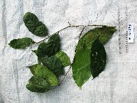 Maranthes corymbosa Blume 920755[]Whitfeld, T.J.S. PB5E03412008-08-29 Papua New Guinea, Madang, Wanang Village, -5.226533 145.085317, 130m |
MIN:Plants | 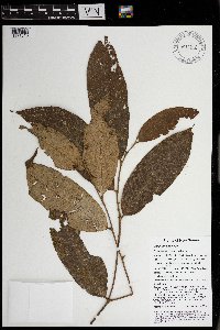 Parinari nonda F. Muell. ex Benth. 970212[1371813]Weiblen, G. D. & Binatang Research Center NP2A01142013-06-14 Papua New Guinea, Madang, Numba, -5.7222 145.2714, 1200m |
MIN:Plants | 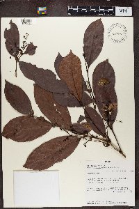 Magnistipula glaberrima """""(Samain" 499315[1370088]Gordon McPherson 166361996-09-19 Gabon, Ogooue-Lolo, East of Lastoursville, near Bambidie, C.E.B. chantier., -0.766667 13.05, 250m |
MIN:Plants | 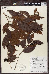 Dactyladenia gilletii """""(Thouars) Szlach." 438754[1370087]Gordon McPherson 158271992-05-29 Gabon, Moyen-Ogooue, North of Ndjole, along lumber roads starting NE of town., -0.083333 10.8, 250m |
1
Page 1, records 1-13 of 13
Google Map
Google Maps is a web mapping service provided by Google that features a map that users can pan (by dragging the mouse) and zoom (by using the mouse wheel). Collection points are displayed as colored markers that when clicked on, displays the full information for that collection. When multiple species are queried (separated by semi-colons), different colored markers denote each individual species.