University of Minnesota
http://www.umn.edu/
612-625-5000
http://www.umn.edu/
612-625-5000
Minnesota Biodiversity Atlas
Bell Museum
Dataset: MIN-Plants
Taxa: Cibotiaceae
Search Criteria: excluding cultivated/captive occurrences
1
Page 1, records 1-14 of 14
Bell Museum plants | |
 MIN:Plants | 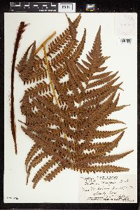 Cibotium Kaulf. 368658[1321056]Topping, D.L. 33391929-06-23 United States, Hawaii, Puu Peahinaia. Hawaii, T.H. |
MIN:Plants | 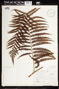 Cibotium Kaulf. 564866[1321057]Liu, J.H. 91958-07-09 Taiwan, Province of China, Taipei, Yanmingshan |
MIN:Plants | 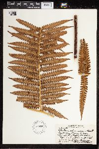 Cibotium Kaulf. 596479[1321058]Degener, O. 30,6911966-05-23 United States, Hawaii, Laukafsu Road, Olaa Forest, 26 miles |
MIN:Plants | 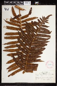 Cibotium Kaulf. 285201[1321059]Harris, J. Arthur C2421091924-08-23 United States, Hawaii, Windward side of Koolau Range between Waialae and Wailupe Valleys, Oahu |
MIN:Plants | 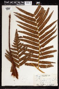 Cibotium Kaulf. 368659[1321060]Topping, D.L. 34261931-03-16 United States, Hawaii, Kahana Ditch Trail, Oahu, T.H. |
MIN:Plants | 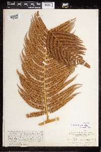 Cibotium Kaulf. 54350[1321062]Heller, A.A. 26001895-07-22 United States, Hawaii, Hanapepe and Wahiawa Watershed, Kauai |
MIN:Plants | 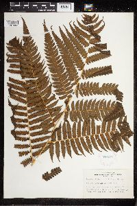 Cibotium Kaulf. 284972[1321063]Harris, J.A. C2420461924-08-16 United States, Hawaii, Between Waihale and Waikaue valleys, windward side of Koolu range, Oahu |
MIN:Plants | 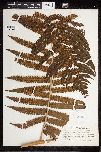 Cibotium Kaulf. 284971[1321064]Harris, J.A. C2420461924-08-16 United States, Hawaii, Between Waihale and Waikaue valleys, windward side of Koolau range, Oahu |
MIN:Plants | 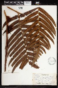 Cibotium Kaulf. 358373[1321065]Topping, D.L. 34261931-03-16 United States, Hawaii, Kahana Ditch Trail, Oahu, T.H. |
MIN:Plants | 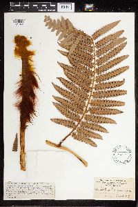 Cibotium Kaulf. 54351[1321066]Heller, A.A. 26931895-08-09 United States, Hawaii, Hanapepe and Wahiawa Watershed, Kauai |
MIN:Plants | 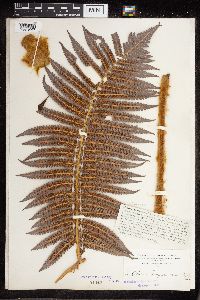 Cibotium Kaulf. 54348[1321067]Heller, A.A. 28181895-09-10 United States, Hawaii, near Wahiawa, Kauai and on Kaholuamano. |
MIN:Plants | 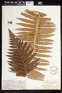 Cibotium Kaulf. 54349[1321068]Heller, A.A. 25901895-07-18 United States, Hawaii, Hanapepe and Wahiawa Watershed, Kauai |
MIN:Plants |  Cibotium Kaulf. 585960[1321069]Degener, O. 28, 1001962-11-11 United States, Hawaii, Between Nike Station and Peacock Flats, Mokuleia, Oahu; Kuksui forest, 579m |
MIN:Plants | 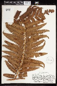 Cibotium Kaulf. 569839[1321070]Degener, O. 27, 6591960-11-16 United States, Hawaii, East rim of Kalalau Valley, Kauai |
1
Page 1, records 1-14 of 14
Google Map
Google Maps is a web mapping service provided by Google that features a map that users can pan (by dragging the mouse) and zoom (by using the mouse wheel). Collection points are displayed as colored markers that when clicked on, displays the full information for that collection. When multiple species are queried (separated by semi-colons), different colored markers denote each individual species.