University of Minnesota
http://www.umn.edu/
612-625-5000
http://www.umn.edu/
612-625-5000
Minnesota Biodiversity Atlas
Bell Museum
Dataset: MIN-Plants
Taxa: Equisetaceae
Search Criteria: excluding cultivated/captive occurrences
Bell Museum plants | |
 MIN:Plants | 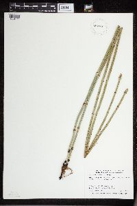 Equisetum NULL 933576[1331450]Smith, Welby R. 330532011-07-15 United States, Minnesota, Stearns, About 6 miles S-SE of Freeport. NW of SW of section;Daniel H. Shay Wildlife Management Area;124N;32W;01, 45.5770333 -94.6597 |
MIN:Plants | 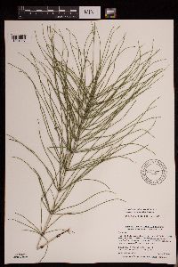 947827[1291897]Smith, Welby R. 304482007-08-01 United States, Minnesota, Cass, Foot Hills State Forest, about 4 miles west of Backus. NE of SW of section; T139N R31W sec33, 46.8091524 -94.6116174 |
MIN:Plants | 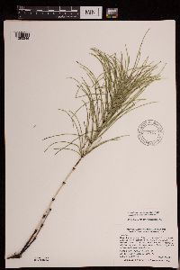 947915[1292346]Smith, Welby R. 305392007-08-14 United States, Minnesota, Pine, About 9 miles east of Askov on Highway 32. SW of SE of section; T043N R18W sec22, 46.1891817 -92.6013078 |
MIN:Plants | 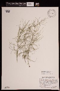 947956[1291962]Smith, Welby R. 305832007-08-16 United States, Minnesota, Carlton, In Fond Du Lac State forest, about 5 miles northeast of Cromwell. NW of SW of section; T049N R20W sec13, 46.7271603 -92.8260808 |
MIN:Plants | 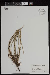 956185[1296018]Lawrence, D.B. s.n.1949-08-14 United States, Alaska, Glacier Bay National Monument. Station 49-3. [Glacier Bay National Park], 58.797845 -136.458473 |
MIN:Plants | 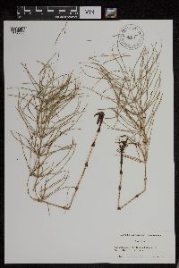 956175[1296025]Lawrence, D.B. s.n.1949-08-14 United States, Alaska, Glacier Bay National Monument. Station 49-3. [Glacier Bay National Park], 58.797845 -136.458473 |
MIN:Plants | 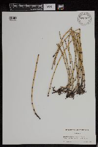 956168[1296023]Lawrence, D.B. s.n.1949-08-13 United States, Alaska, Glacier Bay National Monument. Station 49-3. [Glacier Bay National Park], 58.797845 -136.458473 |
MIN:Plants | 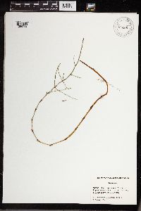 956266[1296144]Schoenike, R. 55-1751955-08-20 United States, Alaska, Glacier Bay National Monument. Ripple Cove area. [Glacier Bay National Park], 58.797845 -136.458473, 61m |
MIN:Plants | 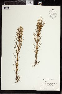 464401[1333632]Lawrence, D.B. s.n.1973-06-28 United States, Alaska, Chugach Mountains, northeast end of Hawkins Island, Deep Bay, 60.527778 -146.049167 |
MIN:Plants | 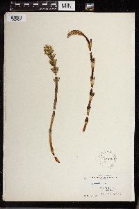 54478[1333633]Mylroie, Ruth 9 United States, Alaska, Kodiak Island, 57.79 -152.407222 |
MIN:Plants | 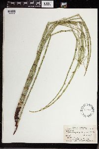 489967[1333634] 1934-07-11 United States, North Dakota, Cass, Kindred |
MIN:Plants | 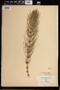 54476[1333635]Brown, H.E. 2451897-05-15 United States, California, Shasta, near Pit River Ferry, 213 - 274m |
MIN:Plants | 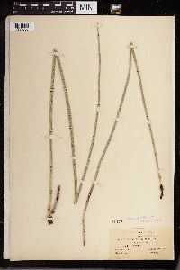 54477[1333636]Blumer, J.C. 14961906-10-27 United States, Arizona, Chiricahua Mountains; Stephens' Ranch, 31.884066 -109.302496, 1737m |
MIN:Plants | 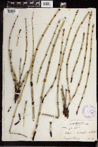 350213[1333637]Stoesz 27981934-07-27 United States, North Dakota, Station 21 Kindred |
MIN:Plants | 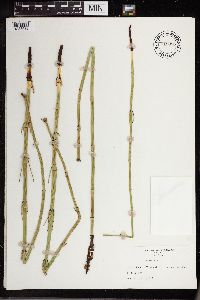 715886[1333638]Nelson, Aven 76281900-07-16 United States, Wyoming, Albany, Dunn's Ranch |
MIN:Plants | 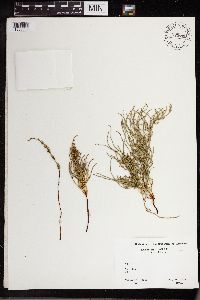 775765[1333639]Cooper, William S. 841928-07-19 United States, Oregon, Coos, Coos Bay |
MIN:Plants | 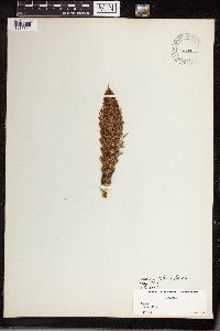 461522[1336891]Stork, H.E. s.n.1919-06-00 France, Vicinity of Paris |
MIN:Plants | 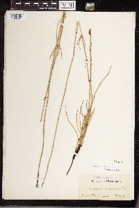 54580[1336925]Shrenk 1840-00-00 |
MIN:Plants | 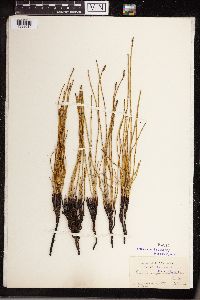 54819[1338010]Schrenk 1841-00-00 |
MIN:Plants | 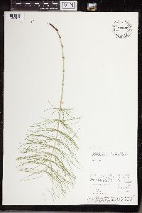 775608[1338102]Iltis, H.H. 1979-07-06 Russian Federation, near Akademgorodok about 4 km SW of Irkutsk, 52.266667 104.2, 460m |
MIN:Plants | 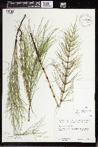 583929[1318241]Gunderson, R. 2411961-06-14 United States, Minnesota, Washington, Washington County ... St. Croix River, 3 mi N of Stillwater. Large island.;Saint Croix National Riverway;030N;20W;, 45.099799 -92.806041 |
MIN:Plants | 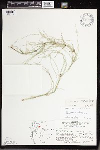 691291[1333074]Swanson, Steven 28781977-08-08 United States, Minnesota, Washington, Washington Co. Lake St. Croix, Mi.11.75; at the confluence of the Valley Branch Creek and St. Croix River;;028N;20W;14, 44.906109 -92.774788 |
MIN:Plants | 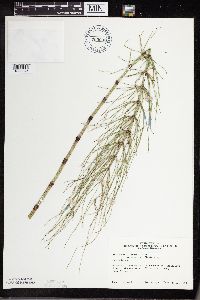 703003[1333075]Peck, J. 79-7271979-08-26 United States, Minnesota, Winona, Winona Co.; Mississippi River, Lake Onalaska, off Red Oak Island, near Dakota;;N;;, 43.903251 -91.337703 |
MIN:Plants | 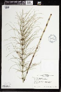 703015[1333076]Peck, J. 79-7341979-08-26 United States, Minnesota, Houston, Houston Co, Mississippi River; Crooked Creek by Reno off Co.26;Dorer Memorial Hardwood State Forest;101N;04W;, 43.608098 -91.399591 |
MIN:Plants | 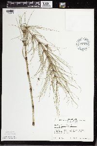 703028[1333073]Peck, J. 79-7091979-08-26 United States, Minnesota, Wabasha, Wabasha Co, Weaver twp.; Mississippi River; Weaver, 2 mi N of town;;109N;09W;, 44.296741 -91.941264 |
MIN:Plants | 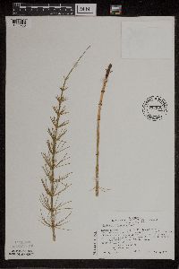 717196[1305980]Peck, J. 80-801980-05-25 United States, Minnesota, Winona, Winona Co, La Moille, mouth of Trout Creek at Hwy.61;Upper Mississippi National Wildlife Refuge;106N;05W;, 44.193017 -91.936542 |
MIN:Plants | 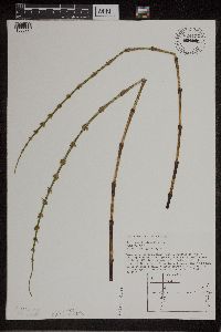 824127[1305979]Foster, R. s.n.1986-06-07 United States, Minnesota, Washington, Afton, Washington Co.; St. Croix River, about 50 feet N of a small stream in Afton. This stream is located 1/2 block S o Afton, Washington Co.; St. Croix River, about 50 feet N of a small stream in Afton. This stream is located 1/2 block S of the corner of St. Croix Trail S and 35th St. S, etc.. 028N 20W, 44.895773 -92.781916 |
MIN:Plants | 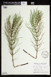 435251[1331342]Smith, Welby 151791989-05-30 United States, Minnesota, Kanabec, Mille Lacs Wildlife Management Area. Kanabec County...Mille Lacs State Wildlife Management Area, about 9 miles northwest of Mora...SW1/4 SW1/4 section 16, T 40N R 25W. 040N 25W 16, 45.9511111 -93.4711111 |
MIN:Plants | 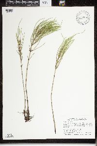 915879[1326950]Smith, Welby 313202009-06-28 United States, Minnesota, Cook, Boundary Waters Canoe Area Wilderness / Superior National Forest. Cook County...Boundary Waters Canoe Area Wilderness, Superior National Forest. A peninsula in Long Island Lake... T 64N R 4W NE1/4 of SW1/4 of Sec 24. 064N 04W 24, 48.0091667 -90.7819444 |
MIN:Plants | 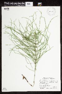 908433[1331023]Smith, Welby 311342008-08-18 United States, Minnesota, Beltrami, Beltrami County...About 12 miles northnortheast of Bemidji...little-used gravel road...T148 R33 SW1/4 of NE1/4 of Sec 12;Buena Vista State Forest;148N;33W;12, 47.6522222 -94.8072222 |
MIN:Plants | 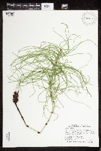 909263[1331036]Smith, Welby 312392008-08-20 United States, Minnesota, Marshall, Marshall County ... Old Mill State Park, about 4 miles east-northeast of Alma ... T156N R46W SW1/4 of NE1/4 of Sec 4;Old Mill State Park;156N;46W;04, 48.3655556 -96.5722222 |
MIN:Plants | 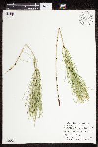 911399[1331038]Smith, Welby 286112000-06-22 United States, Minnesota, Chippewa, Chippewa County...Watson Sag, about 5 miles NW of Watson...T 119N R 42W SE1/4 of SE1/4 of Sec 36;Lac Qui Parle Wildlife Management Area;119N;42W;36, 45.0686111 -95.8627778 |
MIN:Plants |  493469[1326988]Smith, Welby 292062001-06-26 United States, Minnesota, Cook, Cook County...Along the Superior Hiking Trail about 2 miles northwest of Tofte...T 59N R 4W NE1/4 of NW1/4 of Sec 17;North Shore / Superior National Forest;059N;04W;17, 47.5994444 -90.8619444 |
MIN:Plants |  907232[1331116]Smith, Welby 285502000-06-15 United States, Minnesota, Otter Tail, Eastern Wildlife Management Area. Otter Tail County ... Eastern State Wildlife Management Area, about 4 miles E-NE of Parkers Prairie (town) ... T131N R36W SW1/4 of NW1/4 of Sec 9. 131N 36W 9, 46.1733333 -95.2258333 |
MIN:Plants |  401752[1333693]Spetzman, L. 14101948-07-14 United States, Alaska, Arctic North Slope ... Lake Peters;Arctic National Wildlife Refuge;;;, 69.3333333 -145, 914m |
MIN:Plants |  917069[1331087]Gerdes, Lynden 58122009-07-24 United States, Minnesota, Cook, Boundary Waters Canoe Area Wilderness / Superior National Forest. T64N R05W S03SENWNENE. Cook County, MN. Superior National Forest. Boundary Waters Canoe Area Wilderness. Approx. 0.11 miles west of Gillis Lake...NAD 83 / 653320 / 5325261. 064N 05W 3, 48.0622222 -90.9422222 |
MIN:Plants | 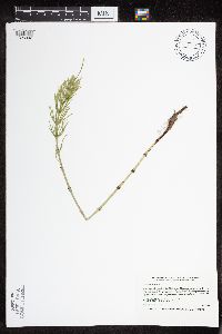 439239[1326992]Smith, Welby 167761990-06-07 United States, Minnesota, Carver, Carver County ... In the Minnesota Valley, about 2 miles northwest of Shakopee ... T116N R23W NE1/4 of SW1/4 of Sec 35;;116N;23W;35, 44.8111111 -93.5575 |
MIN:Plants | 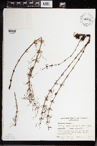 656956[1333644]Noble, Mark 4231974-08-05 United States, Alaska, Muir Point.;Glacier Bay National Park;;;, 58.827414 -136.07866 |
MIN:Plants | 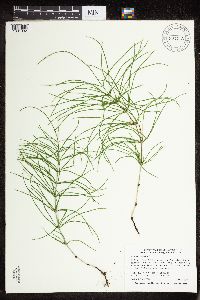 907773[1331032]Smith, Welby 308882008-06-12 United States, Minnesota, Benton, Sartell Wildlife Management Area. Benton County ... Sartell State Wildlife Management Area, about 5 miles southeast of Royalton ... Little Rock Creek ... T38N R31W NW1/4 of SW1/4 of Sec 15. 038N 31W 15, 45.7838889 -94.1927778 |
MIN:Plants | 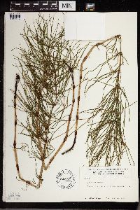 600092[1333642]Cooper, William 2291929-07-20 United States, Alaska, Glacier Bay, Station 18.;Glacier Bay National Park;;;, 58.97674 -136.09684 |
MIN:Plants | 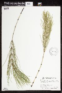 907111[1331035]Smith, Welby 285352000-06-15 United States, Minnesota, Otter Tail, Otter Tail County...Almora State Wildlife Management Area about 0.75 mi W of Almora...T132N R37W SW1/4 of NE1/4 of Sec18;Almora Wildlife Management Area;132N;37W;18, 46.2466667 -95.3786111 |
MIN:Plants | 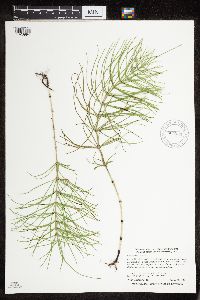 904534[1326994]Smith, Welby 282381999-08-31 United States, Minnesota, Itasca, Itasca County...About 10 miles south of Nashwauk...T 55N R 22W NW1/4 of NW1/4 of Sec 29;;055N;22W;29, 47.2241667 -93.1658333 |
MIN:Plants | 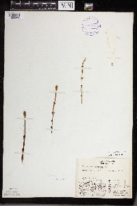 401784[1333864]Spetzman, L. 14081948-07-08 United States, Alaska, Arctic North Slope ... Lake Schrader;Arctic National Wildlife Refuge;;;, 69.4166667 -145, 914m |
MIN:Plants | 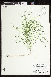 907758[1331055]Smith, Welby 309812008-07-06 United States, Minnesota, Hennepin, Baker Park Reserve County Park. Hennepin County ... Katrina Lake, in Baker Parker [sic] Reserve, about 2 miles east of Maple Plain ... T118N R23W NW1/4 of NW1/4 of Sec 29. 118N 23W 29, 45.005 -93.6211111 |
MIN:Plants | 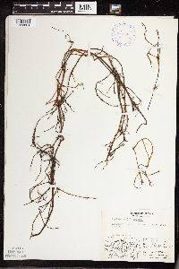 401696[1333694]Spetzman, L. 10751948-08-10 United States, Alaska, Arctic North Slope ... Sadlerochit R.;Arctic National Wildlife Refuge;;;, 69.5833359 -144.6666718, 457m |
MIN:Plants | 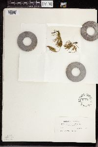 564899[1333773]Cotter, Shirley 31151951-08-08 United States, Montana, Logan Pass ... Glacier Park;Glacier National Park, 2012m |
MIN:Plants | 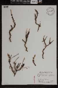 905278[1305933]Smith, Welby 276611999-05-04 United States, Minnesota, Mille Lacs, Mille Lacs County...Along the old Sioux Line Railroad tracks (now abandoned), on the south side of Wahkon...T42N R25W SE1/4 of SW1/4 of Sec 17. 042N 25W 17, 46.1138889 -93.5263889 |
MIN:Plants | 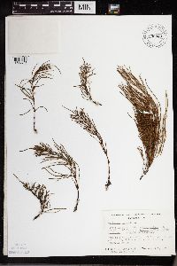 656949[1333641]Noble, Mark 4281974-08-05 United States, Alaska, Muir Point.;Glacier Bay National Park;;;, 58.827414 -136.07866 |
MIN:Plants | 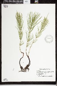 916882[1326951]Smith, Welby 223401993-06-08 United States, Minnesota, Carver, Carver County...Carver Park Reserve; about 5 miles west of Chanhassen...T 116N R 24W SE1/4 of NE1/4 of Sec 11;Carver Park Reserve County Park;116N;24W;11, 44.8716667 -93.6644444 |
MIN:Plants | 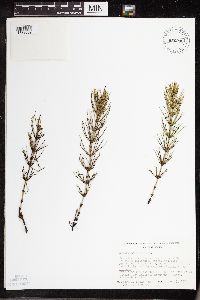 656946[1333689]Noble, Mark 4621974-08-05 United States, Alaska, Muir Point.;Glacier Bay National Park;;;, 58.827414 -136.07866 |
MIN:Plants | 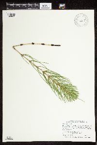 906530[1326997]Smith, Welby 309152008-06-13 United States, Minnesota, Hubbard, Hubbard County...On the northwest side of Mantrap Lake in Paul Bunyon State Forest...T142N R34W NE1/4 of NW1/4 of Sec 36;Paul Bunyan State Forest;142N;34W;36, 47.0769444 -94.9325 |
MIN:Plants | 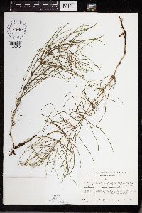 656968[1333645]Noble, Mark 3841974-08-05 United States, Alaska, Muir Point.;Glacier Bay National Park;;;, 58.827414 -136.07866 |
MIN:Plants | 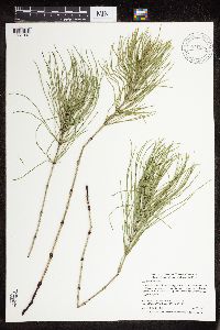 911398[1331037]Smith, Welby 285172000-06-12 United States, Minnesota, Dodge, Dodge County...Wasioja State Wildlife Management Area, about 4 mi W of Wasioja...T 107N R 17W SE1/4 of SW1/4 of Sec 17;Wasioja Wildlife Management Area;107N;17W;17, 44.0672222 -92.8916667 |
MIN:Plants | 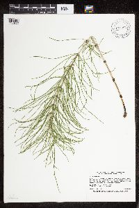 915884[1331022]Smith, Welby 224791993-06-18 United States, Minnesota, Grant, Grant County...On the south side of Ask Lake, about 1.5 miles east-southest of Ashby...T 130N R 41W NW1/4 of SW1/4 of Sec 12. 130N 41W 12, 46.0847222 -95.7886111 |
MIN:Plants | 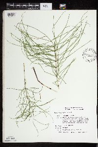 436098[1331188]Smith, Michael 1711996-08-20 United States, Minnesota, Saint Louis, Voyageurs National Park. St. Louis Co.; Plot name: Voya 19 DNR # 5777; Cranberry Bay / 48 34' 31" 93 05'16";Voyageurs National Park;071N;21W;, 48.5752792 -93.0877762 |
MIN:Plants | 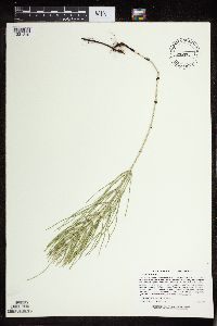 480816[1331210]Lee, Michael MDL21581998-06-22 United States, Minnesota, Sherburne, Sand Prairie Wildlife Management Area. Sherburne County ... Sand Prairie Wildlife Management Area on the southeast edge of St. Cloud ... T35N R30W NW1/4 of SW1/4 Sec. 4. 035N 30W 4, 45.551948 -94.079149 |
MIN:Plants | 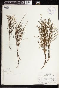 399364[1333691]Spetzman, L. 3691947-07-23 United States, Alaska, Canning River ... bluff, NE river bank, where river leaves mountains.;Arctic National Wildlife Refuge;;;, 69.2833328 -146, 457m |
MIN:Plants | 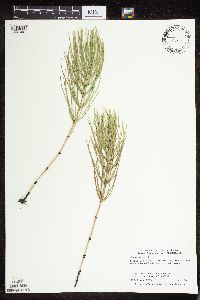 477520[1331067]Smith, Welby 291902001-06-21 United States, Minnesota, Pennington, Pembina Wildlife Management Area. Pennington County ... Pembina State Wildlife Management Area, about 4.5 miles north-northwest of Dorothy (town) ... T152N R45W NE1/4 of NW1/4 of Sec 16. 152N 45W 16, 47.9913902 -96.4713898 |
MIN:Plants | 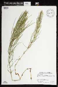 911555[1331208]Smith, Welby 284962000-06-05 United States, Minnesota, Wabasha, McCarthy Lake Wildlife Management Area. Wabasha County...McCarthy Lake State Wildlife Management Area, about 2 miles south of Kellogg...T 109N R 10W SW1/4 of NW1/4 of Sec 2. 109N 10W 2, 44.2766667 -91.9861111 |
MIN:Plants | 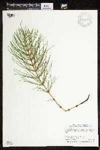 906506[1326998]Smith, Welby 308702008-06-07 United States, Minnesota, Sherburne, Sherburne National Wildlife Refuge. Sherburne County...In Sherburne National Wildlife Refuge, about 6 miles NW of Zimmerman...north side of Rice Lake... T 35N R 27W SE1/4 of NE1/4 of Sec 27. 035N 27W 27, 45.4969444 -93.6786111 |
MIN:Plants | 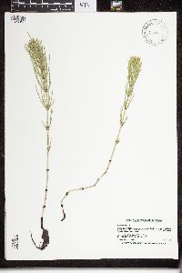 919151[1326957]Smith, Welby 222471993-06-02 United States, Minnesota, Watonwan, Watline Wildlife Management Area. Watonwan County ... Watline State Wildlife Management Area, about 2 miles southwest of St. James ...T106N R32W NW1/4 of NE1/4 of Sec 34. 106N 32W 34, 43.9463889 -94.6686111 |
MIN:Plants | 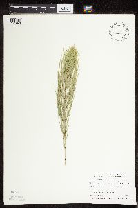 488884[1326990]Smith, Welby 291962001-06-22 United States, Minnesota, Mahnomen, Nelson Prairie / White Earth Indian Reservation. Mahnomen County ... Nelson Prairie National Waterfowl Production Area, about 2 miles north of Bejou on Hwy 59 T146N R42W SE1/4 of SE1/4 of Sec 10. 146N 42W 10, 47.4711113 -95.976387 |
MIN:Plants | 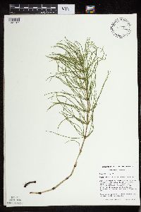 461840[1331187]Mensing, D. 96-731996-06-18 United States, Minnesota, Carlton, Carlton Co, T48N R17W NW1/4 of the NW1/4 of S12; Otter Creek; Site located near railroad bed and County Route 210.;;048N;17W;12, 46.656716 -92.564903 |
MIN:Plants | 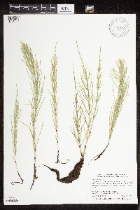 907079[1331056]Smith, Welby 284572000-05-25 United States, Minnesota, Beltrami, Beltrami County...Along Hwy 15, 3.3 mi N of its junction with Co Rd 32 in Nebish...T150N R33W SW1/4 of SW1/4 of Sec 11;Red Lake Indian Reservation;150N;33W;11, 47.8194444 -94.8480556 |
MIN:Plants | 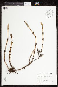 904526[1331051]Smith, Welby 276731999-05-05 United States, Minnesota, Carlton, Carlton County ... Moose Lake State Park, about 4 miles southwest of Barnum ... T46N R19W SE1/4 of SW1/4 of Sec 27;Moose Lake State Park;046N;19W;27, 46.4344444 -92.7338889 |
MIN:Plants | 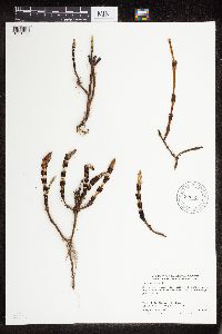 905316[1331052]Smith, Welby 276231999-04-28 United States, Minnesota, Pine, Pine County...General C.C. Andrews State Forest, about 3 mi E of Willow River (town)...T44N R19W NW1/4 of NE1/4 Sec 5;General C C Andrews State Forest;044N;19W;05, 46.3283333 -92.7536111 |
MIN:Plants | 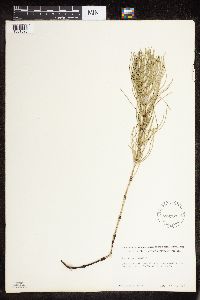 539964[1331025]Tester, John s.n.1957-06-28 United States, Minnesota, Mahnomen, 3-4 miles w. and 1 mile s. of Waubun.;Waubun Prairie Wildlife Management Area / White Earth Indian Reservation;143N;42W;33, 47.166009 -96.024401 |
MIN:Plants | 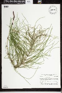 920853[1326954]Smith, Welby 175831990-07-31 United States, Minnesota, Morrison, Camp Ripley Military Reservation. Camp Ripley Military Reservation. Morrison County...On the north side of Livorno trail where it intersects East... Bounday Road...UTM: 392700E 5121400N. T 132N R 30W SE1/4 of SE1/4 of Sec 13. 132N 30W 13, 46.2397222 -94.3916667 |
MIN:Plants | 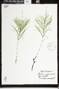 919500[1326956]Smith, Welby 222291993-05-25 United States, Minnesota, McLeod, Lake Marion County Park. McLeod County ... Lake Marion County Park; on the east side of Lake Marion, about 6 miles south of Hutchinson ... T115N R30W NE1/4 of NE1/4 of Sec 12. 115N 30W 12, 44.7877778 -94.3811111 |
MIN:Plants | 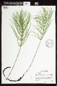 904358[1331088]Gerdes, Lynden 53802007-06-05 United States, Minnesota, Itasca, Chippewa National Forest / Leech Lake Indian Reservation. T146N R29W S29 NENESE Itasca County ... Leech Lake Reservation. Chippewa National Forest. Approximately 5.0 miles NE of Schley, MN and 0.23 miles east of a bend in the Mississippi River ... NAD 83 / 396423 / 5254451. 146N 29W 29, 47.4352778 -94.3736111 |
MIN:Plants | 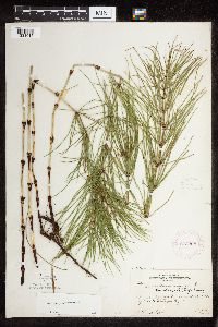 273298[1331015]Rosendahl, C. 60101929-08-11 United States, Minnesota, Cook, Along W side of Grand Portage Bay;Grand Portage Indian Reservation / North Shore;063N;06E;, 47.9667 -89.7667 |
MIN:Plants | 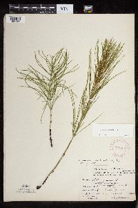 275798[1331299]Moyle, J. 166a1930-07-05 United States, Minnesota, Hubbard, Itasca Park. Hubbard Co. Lasalle Springs. NE NE 7 T143 R37;Itasca State Park;143N;35W;7, 47.217762 -95.161299 |
MIN:Plants |  275799[1331300]Moyle, J. 166a1930-07-05 United States, Minnesota, Hubbard, Itasca Park. Hubbard Co. La Salle Springs. NW NE 7 T143 R37;Itasca State Park;143N;35W;7, 47.217762 -95.161299 |
MIN:Plants |  278263[1331284]Roberts, Thomas s.n.1878-04-19 United States, Minnesota, Hennepin, Minneapolis;;N;;, 44.979965 -93.263836 |
MIN:Plants |  278265[1331283]Roberts, Thomas s.n.1885-05-00 United States, Minnesota, Hennepin, Minneapolis;;N;;, 44.979965 -93.263836 |
MIN:Plants |  288060[1331379]Jahnke, E. s.n.1914-05-15 United States, Minnesota, Ramsey, University [of Minnesota] Farm;;029N;23W;, 44.985294 -93.181536 |
MIN:Plants |  288189[1331375]Meck, Carlton s.n.1914-05-03 United States, Minnesota, Ramsey, St. Anthony Park [St. Paul neighborhood near U of M];;028N;23W;, 44.98382 -93.194806 |
MIN:Plants |  300205[1331332]unknown 111910-06-14 United States, Minnesota, Morrison, Flensburg, Morrison Co.;;N;;, 45.955243 -94.535009 |
MIN:Plants |  300206[1331383]unknown 141911-06-19 United States, Minnesota, Becker, Detroit. Becker Co.;;N;;, 46.817181 -95.845325 |
MIN:Plants |  307312[1331014]Grant, Martin 66851935-08-26 United States, Minnesota, Clearwater, Itasca Park. Clearwater Co. Lake Itasca. SW-NE 2 T143 R36;Itasca State Park;143N;36W;2, 47.231974 -95.201528 |
MIN:Plants |  337001[1331337]Lakela, Olga 13981936-06-05 United States, Minnesota, Saint Louis, E of the North breakwater, U.S.G. Property, Sec.20, Duluth;;N;;, 46.783273 -92.106579 |
MIN:Plants | 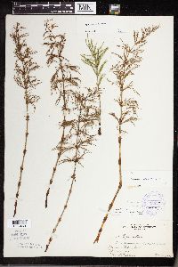 473596[1333468]Nielsen, E. 19581933-05-29 United States, Minnesota, Clearwater, Bohall Trail, Itasca State Park;Itasca State Park;143N;36W;, 47.197458 -95.201964 |
MIN:Plants | 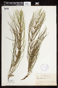 352799[1331020]Benner, F.R. 5801929-07-27 United States, Minnesota, Cook, 1 mi E Grand Portage;Grand Portage Indian Reservation / North Shore;063N;06E;, 47.963774 -89.663197 |
MIN:Plants | 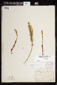 355774[1331263]Manning, Sara 4821884-05-29 United States, Minnesota, Wabasha, Lake City;;N;;, 44.449412 -92.266844 |
MIN:Plants | 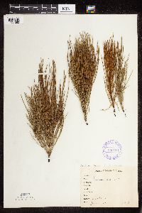 358133[1331062]O.B.G. 1571917-06-00 United States, Minnesota, Kandiyohi, Willmar;;N;;, 45.121908 -95.043342 |
MIN:Plants |  358138[1331391]Stevenson, J. 1821912-07-17 United States, Minnesota, Beltrami, Bemidji;;N;;, 47.536341 -94.82277 |
MIN:Plants |  366912[1331291]Carlander, K. s.n.1940-07-14 United States, Minnesota, Lake of the Woods, Oak Island, Lake of the Woods, Lake of the Woods Co.;Northwest Angle;167N;33W;, 49.080632 -94.939312 |
MIN:Plants |  367610[1331130]Moore, John 123751940-05-16 United States, Minnesota, Steele, N side of Owatonna, Steele Co.;;;;, 44.103331 -93.222267 |
MIN:Plants |  367730[1331180]Moore, John 126151940-05-25 United States, Minnesota, Meeker, 3/4 mi W of Eden Valley, on Hwy.55, Meeker Co.;;;;, 45.324625 -94.577347 |
MIN:Plants | 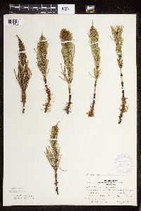 367748[1331132]Moore, John 125881940-05-25 United States, Minnesota, Stearns, Near railroad right of way & Hwy.#55, 1.3 mi W of Kimball, Stearns Co.;;121N;29W;, 45.312461 -94.327035 |
MIN:Plants | 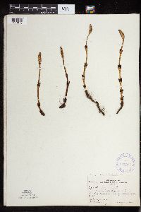 367763[1331176]Moore, John 124521940-05-17 United States, Minnesota, Mower, 1/2 mi SE of Austin, Mower Co.;;;;, 43.654802 -92.967557 |
MIN:Plants | 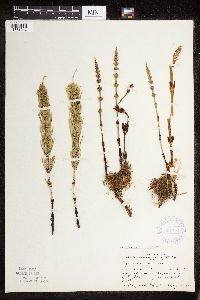 367795[1331047]Moore, John 125501940-05-25 United States, Minnesota, Wright, W edge of town of Maple Lake, Wright Co.;;;;, 45.230296 -94.013178 |
MIN:Plants | 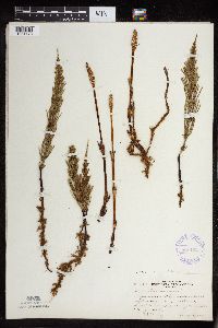 368162[1331173]Moore, John 126981940-05-25 United States, Minnesota, Pope, SW1/4 Sec.5, Leven Twp, Pope Co.;;126N;37W;05, 45.722233 -95.351123 |
MIN:Plants | 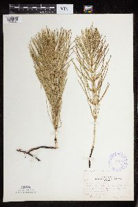 369683[1331326]Moore, John 140011941-05-24 United States, Minnesota, Pine, SE shore of Cross Lake, NW1/4, Sec.34, Pine City Twp, Pine Co.;;039N;21W;34, 45.8394 -92.937708 |
MIN:Plants | 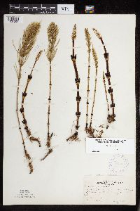 369723[1331290]Moore, John 139431941-05-11 United States, Minnesota, Fillmore, 5.9 mi SW of Peterson, Fillmore Co.;Dorer Memorial Hardwood State Forest;;;, 43.725895 -91.918576 |
MIN:Plants | 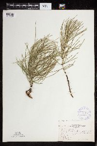 369809[1331309]Moore, John 145441941-06-15 United States, Minnesota, Red Lake, Clearwater River, 1/2 mi N of Plummer, on Hwy.59, Red Lake Co.;;151N;42W;, 47.929362 -96.041921 |
MIN:Plants | 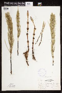 370284[1331043]Moore, John 138591941-05-10 United States, Minnesota, Mower, Bear Creek, near the school-house, 1 1/2 mi S of Racine, on Hwy.63, Mower Co.;;;;, 43.75118 -92.483796 |
MIN:Plants | 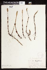 370462[1331086]Moore, John 137651941-05-03 United States, Minnesota, Washington, 2 mi NE of North St. Paul, NE1/4, Sec.6, Oakdale Twp, Washington Co.;;029N;21W;06, 45.033106 -92.966247 |
MIN:Plants | 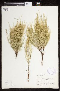 370500[1331135]Moore, John 132201940-06-22 United States, Minnesota, Sibley, 1/4 mi E of Gibbon, Sibley Co.;;112N;31W;, 44.532384 -94.505156 |
MIN:Plants | 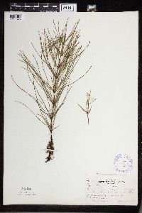 370904[1331386]Moore, John 129521940-06-12 United States, Minnesota, Dakota, Minnesota River bluffs, 1 mi S of Mendota bridge, Dakota Co.;Fort Snelling State Park;028N;23W;, 44.873018 -93.177778 |
Google Map
Google Maps is a web mapping service provided by Google that features a map that users can pan (by dragging the mouse) and zoom (by using the mouse wheel). Collection points are displayed as colored markers that when clicked on, displays the full information for that collection. When multiple species are queried (separated by semi-colons), different colored markers denote each individual species.