University of Minnesota
http://www.umn.edu/
612-625-5000
http://www.umn.edu/
612-625-5000
Minnesota Biodiversity Atlas
Bell Museum
Dataset: MIN-Plants
Taxa: Gesneriaceae
Search Criteria: excluding cultivated/captive occurrences
1
Page 1, records 1-9 of 9
Bell Museum plants | |
 MIN:Plants | 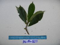 951606[1299022]Weiblen, G.D. YS2G02112010-11-30 Papua New Guinea, Morobe, Yawan Village, -6.1631 146.840217, 1752m |
MIN:Plants | 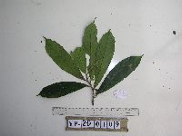 951611[1299017]Weiblen, G.D. YP2D01092012-07-26 Papua New Guinea, Morobe, Yawan Village, -6.1642 146.840083, 1738m |
MIN:Plants | 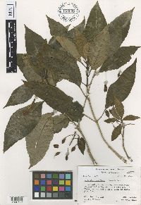 Cyrtandra longiflora John W. Moore 620628[1000772]Moore, J.W. 4571926-12-22 French Polynesia, Society Islands, Raiatea, 3rd valley south of Faaroa Bay, -16.82666 -151.439587, 90m |
MIN:Plants | 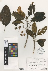 Cyrtandra raiateensis John W. Moore 620123[1000773]Moore, John W. 6611927-03-05 French Polynesia, Society Islands, Raiatea, South end of Opoa Mountain;, -16.865327 -151.394641, 350m |
MIN:Plants | 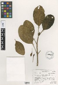 Cyrtandra raiateensis var. elliptica John W. Moore 620451[1000774]Moore, J.W. 3281926-11-18 French Polynesia, Society Islands, Raiatea, 4th valley south of Uturoa, -16.726482 -151.447529, 300m |
MIN:Plants | 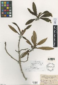 Cyrtandra gayana Heller 191254[1000771]Heller, A.A. 24951895-07-04 United States, Hawaii, Kauai, Island of Kauai, on the Hanapepe and Wahiawa Watershed |
MIN:Plants | 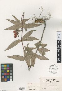 Seemannia cuneata Rusby 191276[1002349]Bang, M. 12121891-00-00 Bolivia, Espirito Santo |
MIN:Plants | 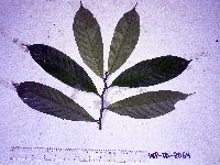 Cyrtandra erectiloba G.W.Gillett 913834[]Weiblen, G.D. & Binatang Research Center WP1B20642006-03-20 Papua New Guinea, Madang, Wanang Village, -5.2373 145.177183, 115m |
MIN:Plants | 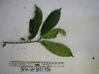 Cyrtandra erectiloba G.W.Gillett 949660[1297979]Weiblen, G.D. YP3B01502012-10-11 Papua New Guinea, Morobe, Yawan Village, -6.1637 146.842017, 1749m |
1
Page 1, records 1-9 of 9
Google Map
Google Maps is a web mapping service provided by Google that features a map that users can pan (by dragging the mouse) and zoom (by using the mouse wheel). Collection points are displayed as colored markers that when clicked on, displays the full information for that collection. When multiple species are queried (separated by semi-colons), different colored markers denote each individual species.