University of Minnesota
http://www.umn.edu/
612-625-5000
http://www.umn.edu/
612-625-5000
Minnesota Biodiversity Atlas
Bell Museum
Dataset: MIN-Plants
Taxa: Haloragaceae
Search Criteria: excluding cultivated/captive occurrences
Bell Museum plants | |
 MIN:Plants |  Myriophyllum NULL 919796[1183291]Pittman, A. B. 8010801 United States, South Carolina, Aiken |
MIN:Plants |  Myriophyllum NULL 459733[1183292]Clark, H. L. 6103 United States, Florida, Franklin |
MIN:Plants |  Myriophyllum NULL 936534[1183293]Schmidt, H. H. 1068 United States, Michigan, Chippewa |
MIN:Plants |  956267[1296003]Schoenike, R. 55-1761955-08-20 United States, Alaska, Glacier Bay National Monument. Ripple Cove area. [Glacier Bay National Park], 58.797428 -136.838127, 61m |
MIN:Plants | Myriophyllum heterophyllum Michaux 907627[1134838]Gerdes, Lynden United States, Minnesota, Saint Louis, Detailed locality information protected. This is typically done to protect rare or threatened species localities. |
MIN:Plants | Myriophyllum heterophyllum Michaux 818081[]Gessler, Walt United States, Minnesota, Saint Louis, Detailed locality information protected. This is typically done to protect rare or threatened species localities. |
MIN:Plants | Myriophyllum heterophyllum Michaux 162074[]Schuette, J. United States, Wisconsin, Brown, Detailed locality information protected. This is typically done to protect rare or threatened species localities. |
MIN:Plants | Myriophyllum heterophyllum Michaux 162070[]Cratty, R. United States, Iowa, Emmet, Detailed locality information protected. This is typically done to protect rare or threatened species localities. |
MIN:Plants | Myriophyllum heterophyllum Michaux 928181[1134837]Gerdes, Lynden; Malinowski, Norma United States, Minnesota, Lake, Detailed locality information protected. This is typically done to protect rare or threatened species localities. |
MIN:Plants | Myriophyllum heterophyllum Michaux 949883[1295976]Gerdes, D. Lawson United States, Minnesota, Saint Louis, Detailed locality information protected. This is typically done to protect rare or threatened species localities. |
MIN:Plants | Proserpinaca pectinata Lamarck 162198[]Langlois, A. s.n.1891-07-10 United States, Louisiana, Saint Tammany, Mandeville |
MIN:Plants | Proserpinaca pectinata Lamarck 162202[]Gross, E. s.n.1887-07-02 United States, New Jersey, Atlantic, Landisville |
MIN:Plants | Myriophyllum pinnatum Britton, Sterns & Poggenburg 162086[]Brinton, J. Bernard s.n.1888-07-11 United States, New Jersey, Cape May, Cape May |
MIN:Plants | Myriophyllum pinnatum Britton, Sterns & Poggenburg 162094[]Eggert, H. s.n.1877-08-21 United States, Missouri, [St. Louis?] |
MIN:Plants |  Myriophyllum pinnatum Britton, Sterns & Poggenburg 951001[1283109]Husveth, Jason J. JJH2015-1012015-07-23 United States, Minnesota, Big Stone, southern boundary of Strata Big Stone Quarry site in Ortonville; T121N R46W SE/SW SEC 22, 45.269253 -96.424314 |
MIN:Plants | 486356[]Rand, Edward s.n.1890-08-29 United States, Maine, Hancock, Mount Desert Island...head Northeast Creek;Acadia National Park |
MIN:Plants | 162183[]Small, John s.n.1889-08-15 United States, Pennsylvania, Luzerne, Lily Lake, Luzerne Co. |
MIN:Plants | Myriophyllum tenellum Bigelow 509355[]Myhre, K. 63951996-07-02 United States, Minnesota, Aitkin, Savanna State Forest. Aitkin County ... Located 1 mile east of Ball Bluff Lake ... north bay of Blackface Lake ... T 51N R23W SE1/4 of NE1/4 of Sec 4. 051N 23W 4, 46.9328861 -93.2627253 |
MIN:Plants |  Myriophyllum tenellum Bigelow 918135[1134973]Gerdes, D. Lawson 6612007-08-01 United States, Minnesota, Lake, Boundary Waters Canoe Area Wilderness / Superior National Forest. T61N R07W S01NENE. Lake County MN. Superior National Forest (BWCAW). Shallow, north bay of large island in west bay of Perent Lake.. 061N 07W 1, 47.8016667 -91.1513889 |
MIN:Plants | Myriophyllum tenellum Bigelow 477588[]Myhre, K. 7924A1998-08-06 United States, Minnesota, Crow Wing, Crow Wing County ... Rogers Lake. Located 5 mi southeast of the town of Emily ... T 137N R 26W NE1/4 of SE1/4 of Sec 24;;137N;26W;24, 46.6657695 -93.9146807 |
MIN:Plants | Myriophyllum tenellum Bigelow 435414[]Myhre, K. 68521997-07-08 United States, Minnesota, Carlton, Carlton Co.; Cole Lake. Located 2 miles southwest of the town of Wright. Plants occur along the northwest bays of lake; T 48N R 21W SE1/4 of NE1/4 of Sec 7. 048N 21W 7, 46.6583955 -93.0536819 |
MIN:Plants | Myriophyllum tenellum Bigelow 491488[]Myhre, K. 88232000-08-18 United States, Minnesota, Itasca, George Washington State Forest. Itasca County ... Beatrice Lake. Located 43 miles northeast of the town of Grand Rapids. Plants occur along the west end of the lake ... T60N R22W NE1/4 of SW1/4 of Sec 1. 060N 22W 1, 47.7129192 -93.0726052 |
MIN:Plants | Myriophyllum tenellum Bigelow 477587[]Myhre, K. 85451999-08-10 United States, Minnesota, Saint Louis, St. Louis County ... Grand Lake. Located 15 miles northwest of Duluth. Plants occur along the southeast shore of the lake ... T 51N R 16W NW1/4 of NE1/4 of Sec 32. 051N 16W 32, 46.858566 -92.417673 |
MIN:Plants |  Myriophyllum tenellum Bigelow 479334[1134935]Scott, P. 14922003-07-29 United States, Minnesota, Cook, COOK CO. Long Island Lake at portage to Karl Lake, BWCAW. T64N R4W sec.13 NESESW.;Boundary Waters Canoe Area Wilderness / Superior National Forest;064N;04W;13, 48.0263604 -90.7777761 |
MIN:Plants |  Myriophyllum tenellum Bigelow 919117[1134910]Holmstrom, R. 00632009-07-04 United States, Minnesota, Saint Louis, Bear Head Lake State Park. St. Louis County...Bear Head Lake State Park. Bear Head Lake, approximately 1.7 km southwest of the park water access and just south of dock for watercraft campsite (W6)...T61N R14W S11 SW of SW. 061N 14W 11, 47.7744444 -92.0925 |
MIN:Plants |  Myriophyllum tenellum Bigelow 905782[1134950]Myhre, K. 100812008-07-14 United States, Minnesota, Cass, Cass County...Wegwos Lake. Located 14 miles southwest of the town of Walker...north end of the lake...T140N R31W SE1/4 of SE1/4 of Sec 30. 140N 31W 30, 46.9061111 -94.6405556 |
MIN:Plants |  Myriophyllum tenellum Bigelow 905017[1134949]Myhre, K. 098782007-07-20 United States, Minnesota, Cass, Cass County...Sand Lake_south basin [sic]. Located 17 miles southeast of the town of Walker...T 140N R 29W NW1/4 of SW1/4 of Sec 27. 140N 29W 27, 46.9119444 -94.3397222 |
MIN:Plants | Myriophyllum tenellum Bigelow 492270[]Myhre, K. 86722000-07-10 United States, Minnesota, Itasca, Itasca County ... Twin Lake. Located 18 miles east northeast of the town of Grand Rapids. Plants occur along the northwest bay of the lake ... T55N R22W NE1/4 of SE1/4 of Sec 18. 055N 22W 18, 47.2463874 -93.1830923 |
MIN:Plants |  Myriophyllum tenellum Bigelow 441159[1134941]Scott, P. 15372003-08-16 United States, Minnesota, Saint Louis, ST. LOUIS CO. Bay on E side of Gebeonequet Lake, BWCAW. T67N R14W sec. 23 SENWNW.;Boundary Waters Canoe Area Wilderness / Superior National Forest;067N;14W;23, 48.2746463 -92.0935696 |
MIN:Plants |  Myriophyllum tenellum Bigelow 914796[1134966]Gerdes, Lynden; et al. 57502009-06-25 United States, Minnesota, Cook, Boundary Waters Canoe Area Wilderness / Superior National Forest. T64N R04W S13SWSWSWNE. Cook County. Superior National Forest. Boundary Waters Canoe Area Wilderness. Southern end of Lower George Lake.. 064N 04W 13, 48.0266667 -90.7763889 |
MIN:Plants |  Myriophyllum tenellum Bigelow 898308[1134947]Myhre, K. 098392006-09-06 United States, Minnesota, Itasca, Itasca County ... Pine Lake. Located 25 miles north of the town of Grand Rapids ... T59N R25W NW1/4 of SE1/4 of Sec 18;;059N;25W;18, 47.5922222 -93.5644444 |
MIN:Plants | Myriophyllum tenellum Bigelow 491487[]Myhre, K. 87022000-07-13 United States, Minnesota, Itasca, Itasca County ... Beauty Lake. Located 22 miles east of the town of Grand Rapids. Plants occur along the west shore of the lake ... T55N R22W SW1/4 of SE1/4 of Sec 24. 055N 22W 24, 47.2321237 -93.0763789 |
MIN:Plants | Myriophyllum tenellum Bigelow 492725[]Myhre, K. 86892000-07-12 United States, Minnesota, Itasca, Itasca County ... Round Lake - east of Grand Rapids. Located 8 miles east of the town of Grand Rapids. Plants occur along the east shore of the lake ... T55N R24W SE1/4 of SW1/4 of Sec 26. 055N 24W 26, 47.2177453 -93.35298 |
MIN:Plants |  Myriophyllum tenellum Bigelow 906952[1134959]Myhre, K. 102902008-08-25 United States, Minnesota, Cass, Land O Lakes State Forest. Cass County...Smokey Hollow Lake. Located 35 miles southeast of the town of Walker...northeast shore...T139N R26W SW1/4 of SW1/4 of Sec 35. 139N 26W 35, 46.8036111 -93.9411111 |
MIN:Plants | Myriophyllum tenellum Bigelow 492271[]Myhre, K. 88102000-08-10 United States, Minnesota, Itasca, George Washington State Forest. Itasca County ... Round Lake (28 miles NE of Grand Rapids) ... Plants occur along the north shore of the lake ... T59N R24W NW1/4 of SW1/4 of Sec 11. 059N 24W 11, 47.6091135 -93.3531329 |
MIN:Plants | Myriophyllum tenellum Bigelow 162141[]Swan, C. s.n.1882-07-29 United States, Massachusetts, Essex, Haggett's Pond, Andover |
MIN:Plants | Myriophyllum tenellum Bigelow 491484[]Myhre, K. 79091998-08-05 United States, Minnesota, Crow Wing, Crow Wing County ... Reno Lake. Located directly southeast of the town of Deerwood. Area Surveyed: south end of the lake ... T 46N R 28W SE1/4 of SE1/4 of Sec 16. 046N 28W 16, 46.4680887 -93.8843701 |
MIN:Plants |  Myriophyllum tenellum Bigelow 906842[1134962]Myhre, K. 102242008-08-13 United States, Minnesota, Saint Louis, Superior National Forest. St. Louis County...Burntside Lake_Hoist Bay. Located 76 miles north of the city of Duluth...Hoist Bay of Burntside Lake...T 63N R 13W NW1/4 of SW1/4 of Sec 32. 063N 13W 32, 47.8952778 -92.0263889 |
MIN:Plants | Myriophyllum tenellum Bigelow 477591[]Myhre, K. 8370A1999-07-09 United States, Minnesota, Saint Louis, Fond du Lac Indian Reservation. St. Louis County ... Lost Lake. Located 25 miles west of Duluth. Plants occur along the southeast shore of the lake ... T 50N R 18W NE1/4 of SW1/4 of Sec 29. 050N 18W 29, 46.7899168 -92.6494493 |
MIN:Plants |  Myriophyllum tenellum Bigelow 906965[1134964]Myhre, K. 100182008-06-26 United States, Minnesota, Cass, Cass County...Moose Lake. Located 25 miles northwest of the town of Brainerd...north end of the lake...T136N R31W SE1/4 of SW1/4 of Sec 10. 136N 31W 10, 46.6036111 -94.5738889 |
MIN:Plants |  Myriophyllum tenellum Bigelow 905785[1134954]Myhre, K. 101302008-07-21 United States, Minnesota, Cass, Cass County ... Egg Lake ... 41 miles southeast of the town of Walker ... T139N R25W SW1/4 of NW1/4 of Sec 24;;139N;25W;24, 46.8413889 -93.7961111 |
MIN:Plants | Myriophyllum tenellum Bigelow 492269[]Myhre, K. 76081998-07-13 United States, Minnesota, Pine, Pine County ... Bass (on co. line). Located 6 miles southwest of the town of Finlayson ... northeast bay of the lake ... T 43N R 21W SE1/4 of SW1/4 of Sec 31. 043N 21W 31, 46.1656546 -93.043334 |
MIN:Plants | Myriophyllum tenellum Bigelow 477596[]Myhre, K. 85081999-07-28 United States, Minnesota, Saint Louis, Superior National Forest. St. Louis County ... George Lake. Located 37 miles northeast of Duluth. Plants occur along the south shore of the lake ... T 56N R 12W SE1/4 of SW1/4 of Sec 35. 056N 12W 35, 47.2922667 -91.8239104 |
MIN:Plants |  Myriophyllum tenellum Bigelow 906958[1134965]Myhre, K. 100432008-07-07 United States, Minnesota, Cass, Cass County...Swede Lake. Located 19 miles southeast of the town of Walker...east shore and NW bay...T139N R 30W SE1/4 of NE1/4 of Sec 29. 139N 30W 29, 46.8297222 -94.4947222 |
MIN:Plants |  Myriophyllum tenellum Bigelow 918050[1134970]Myhre, K. 105182009-07-27 United States, Minnesota, Cass, Cass County...Island Lake_4. Located 28miles southeast of the town of Walker...T140N R27W NE1/4 of SE1/4 of Sec 23;;140N;27W;23, 46.9255556 -94.0516667 |
MIN:Plants |  Myriophyllum tenellum Bigelow 918046[1134907]Myhre, K. 104502009-06-13 United States, Minnesota, Cass, Cass County...Moccasin Lake. Located 13 miles southeast of the town of Walker...T141N R29W NE1/4 of NW1/4 of Sec 33;Chippewa National Forest;141N;29W;33, 46.9916667 -94.3569444 |
MIN:Plants |  Myriophyllum tenellum Bigelow 918047[1134968]Myhre, K. 106982009-08-25 United States, Minnesota, Cass, Cass County...Long Lake_4. Located 18miles southeast of the town of Walker...T139N R29W NW1/4 of NE1/4 of Sec 4;;139N;29W;04, 46.8888889 -94.3488889 |
MIN:Plants |  Myriophyllum tenellum Bigelow 480930[1134940]Scott, P. 16052003-08-21 United States, Minnesota, Saint Louis, ST. LOUIS CO. ... Just N of campsite on Little Loon Lake, BWCAW. T67N R15W sec. 21 NESESE.;Boundary Waters Canoe Area Wilderness / Superior National Forest;067N;15W;21, 48.2737964 -92.2688247 |
MIN:Plants |  Myriophyllum tenellum Bigelow 918186[1134908]Anderson, Chel 21252009-07-31 United States, Minnesota, Cook, Cook County ... East shore of north arm of Mesaba Lake in BWCAW T63N R5W Sec. 3 SW1/4 of NE1/4;Boundary Waters Canoe Area Wilderness / Superior National Forest;063N;05W;03, 47.967773 -90.9486678 |
MIN:Plants |  Myriophyllum tenellum Bigelow 918049[1134895]Myhre, K. 105132009-07-23 United States, Minnesota, Cass, Cass County...Town Line Lake. Located 18 miles southeast of the town of Walker...T142N R28W SW1/4 of SW1/4 of Sec 34;Chippewa National Forest / Leech Lake Indian Reservation;142N;28W;34, 47.0713889 -94.2219444 |
MIN:Plants | Myriophyllum tenellum Bigelow 477586[]Myhre, K. 88332000-08-23 United States, Minnesota, Itasca, George Washington State Forest. Itasca County ... Erskine Lake (NE Itasca Co.) . Located 43 miles northeast of the town of Grand Rapids. Plants occur along the northwest bay of the lake ... T 61N R 24W SE1/4 of NE1/4 of Sec 3. 061N 24W 3, 47.8008814 -93.3918059 |
MIN:Plants |  Myriophyllum tenellum Bigelow 918196[1134909]Anderson, Chel 21182009-08-30 United States, Minnesota, Cook, Cook County ... Just west of portage from Karl to Long Island Lake in BWCAW ... T64N R4W Sec.13 SE1/4 of SW1/4;Boundary Waters Canoe Area Wilderness / Superior National Forest;064N;04W;13, 48.0263604 -90.7777761 |
MIN:Plants |  Myriophyllum tenellum Bigelow 918054[1134901]Myhre, K. 105342009-07-28 United States, Minnesota, Cass, Cass County...Little Sand Lake_2. Located 22 miles southeast of the town of Walker...T138N R29W NW1/4 of NE1/4 of Sec 6;;138N;29W;06, 46.8030556 -94.395 |
MIN:Plants |  Myriophyllum tenellum Bigelow 908536[1134958]Gerdes, Lynden; et al. 56602008-08-18 United States, Minnesota, Lake, Boundary Waters Canoe Area Wilderness / Superior National Forest. T64N R11W S07SWSENE. Lake County, MN. Superior National Forest. Boundary Waters Canoe Area Wilderness. Sandpit Lake; northern shores at far northeast end of lake.. 064N 11W 7, 48.0414223 -91.7892018 |
MIN:Plants |  Myriophyllum tenellum Bigelow 480935[1134936]Scott, P. 14932003-07-29 United States, Minnesota, Cook, COOK CO ... Lower George Lake, BWCAW. T64N R4W sec.13 NWNWSE.;Boundary Waters Canoe Area Wilderness / Superior National Forest;064N;04W;13, 48.0263604 -90.7777761 |
MIN:Plants |  Myriophyllum tenellum Bigelow 909963[1134963]Gerdes, D. Lawson; et al. 6892008-08-25 United States, Minnesota, Lake, Boundary Waters Canoe Area Wilderness / Superior National Forest. T64N R11W S08SENWNW. Lake County, MN. Superior National Forest (BWCAW). South end of Tin Can Mike Lake, approx. 75m northeast of portage from Sandpit Lake.. 064N 11W 8, 48.0452778 -91.775 |
MIN:Plants | Myriophyllum tenellum Bigelow 491497[]Myhre, K. 88302000-08-19 United States, Minnesota, Itasca, George Washington State Forest. Itasca County ... Kelly Lake. Located 32 miles northeast of the town of Grand Rapids. Plants occur along the north shore of the lake ... T60N R24W SE1/4 of SW1/4 of Sec 22. 060N 24W 22, 47.6672057 -93.3782225 |
MIN:Plants |  Myriophyllum tenellum Bigelow 477592[1343422]Myhre, K. 84501999-07-19 United States, Minnesota, Saint Louis, St. Louis County ... Lake one mile northwest of Schultz Lake. Located 17 miles north of Duluth. Plants occur along northeast shore of the lake ... T 52N R 14W NW1/4 of NW1/4 of Sec 8. 052N 14W 8, 47.0034446 -92.143285 |
MIN:Plants | Myriophyllum tenellum Bigelow 282420[]Cooper, William s.n.1930-08-22 United States, Minnesota, Pine, Sturgeon Lake. Pine Co.;;045N;19W;, 46.38111 -92.755 |
MIN:Plants | Myriophyllum tenellum Bigelow 333563[]Horn, A. s.n.1936-07-14 United States, Minnesota, Saint Louis, Auto Club Lake, near Virginia;Superior National Forest;N;;, 47.52326 -92.518718 |
MIN:Plants | Myriophyllum tenellum Bigelow 365072[]Rosendahl, C.; Butters, F. 68341937-08-25 United States, Minnesota, Cass, Pfremmer's Lake, NW of Woman Lake;;N;;, 46.973976 -94.352934 |
MIN:Plants | Myriophyllum tenellum Bigelow 376313[]Morse, Marius s.n.1937-00-00 United States, Minnesota, Crow Wing, Simpson Lake; T138-139N R26W;;N;;, 46.767503 -93.963895 |
MIN:Plants | Myriophyllum tenellum Bigelow 430422[]Scott, P. 8221995-08-18 United States, Minnesota, Cook, Cook Co. Northern Light Lake T63N R2E sec.32 NW SE NW.;Superior National Forest;063N;02E;32, 47.8962083 -90.2224351 |
MIN:Plants | Myriophyllum tenellum Bigelow 439578[]Myhre, K. 47031993-10-24 United States, Minnesota, Aitkin, Aitkin Co. Located 15 mi NE of the town of McGregor, in Savana Portage State Park. T50N R23W SE1/4 of SE1/4 of Sec 12;Savanna Portage State Park;050N;23W;12, 46.8314563 -93.2002679 |
MIN:Plants | Myriophyllum tenellum Bigelow 439656[]Myhre, K. 47011993-10-17 United States, Minnesota, Aitkin, Aitkin Co. Located 1 mi NE of the town of Glen in Clear Lake. T46N R25W NW1/4 of NE1/4 of Sec 33;;046N;25W;33, 46.4254727 -93.5046427 |
MIN:Plants | Myriophyllum tenellum Bigelow 439852[]Myhre, K. 36821993-05-25 United States, Minnesota, Pine, Saint Croix State Forest. Aitkin Co. [this locality actually in Pine Co.] Located near the public access to Rock Lake; T41N R16W SW1/4 of NW1/4 of Aitkin Co. [this locality actually in Pine Co.] Located near the public access to Rock Lake; T41N R16W SW1/4 of NW1/4 of Sec 7. 041N 16W 7, 46.0481439 -92.4149635 |
MIN:Plants | Myriophyllum tenellum Bigelow 439949[]Myhre, K. 34711993-04-22 United States, Minnesota, Pine, Pine Co. Located in the NW bay of Sturgeon Lake; T45N R19W NE1/4 of NE1/4 of sec 9;;045N;19W;9, 46.3969043 -92.751645 |
MIN:Plants | Myriophyllum tenellum Bigelow 439961[]Myhre, K. 35591993-05-09 United States, Minnesota, Pine, Pine Co. Located in the small NW bay of Grindstone Lake; T42N R21W SE1/4 of SE1/4 of Sec 8;;042N;21W;8, 46.1365021 -93.0223318 |
MIN:Plants | Myriophyllum tenellum Bigelow 440201[]Myhre, K. 45991993-09-09 United States, Minnesota, Pine, Pine Co. Locate 4 mi NE of the town of Sturgeon Lake. NW bay of Island Lake. T45N R19W NE1/4 of NE1/4 of Sec 4;;045N;19W;4, 46.4112439 -92.7516162 |
MIN:Plants | Myriophyllum tenellum Bigelow 440204[]Myhre, K. 38621993-06-21 United States, Minnesota, Pine, Pine Co. Located along the S shore of Razor Lake; T41N R17W SW1/4 of SW1/4 of Sec 4;;041N;17W;4, 46.0628066 -92.4984637 |
MIN:Plants | Myriophyllum tenellum Bigelow 441337[]Myhre, K. 34701993-04-21 United States, Minnesota, Pine, Pine Co. Located on the SW shore of Sturgeon Lake; T45N R19W NE1/4 of SW1/4 of Sec 20;;045N;19W;20, 46.367786 -92.7722177 |
MIN:Plants | Myriophyllum tenellum Bigelow 441646[]Gerdes, Lynden 34571999-06-15 United States, Minnesota, Cook, Superior National Forest. T64N R03E S01NW. Cook Co.; Superior National Forest. Northeastern tip of the large, upland island in the northern portio T64N R03E S01NW. Cook Co.; Superior National Forest. Northeastern tip of the large, upland island in the northern portion of South Fowl Lake, just north of campsite.. 064N 03E 1, 48.0572273 -90.0058214 |
MIN:Plants | Myriophyllum tenellum Bigelow 443818[]Myhre, K. 47191994-05-08 United States, Minnesota, Itasca, Chippewa National Forest. Itasca Co.; Located 5 miles southeast of the town of Marcell; northwest shore of Caribou Lake; T 58N R 26W NE1/4 of NE1/ Itasca Co.; Located 5 miles southeast of the town of Marcell; northwest shore of Caribou Lake; T 58N R 26W NE1/4 of NE1/4 of Sec 9. 058N 26W 9, 47.5230295 -93.6509862 |
MIN:Plants | Myriophyllum tenellum Bigelow 443850[]Myhre, K. 47271994-05-09 United States, Minnesota, Itasca, Chippewa National Forest. Itasca Co.; Located 12 miles southeast of the town of Marcell; Plants occur along the south shore of Johnson Lake; T 57N Itasca Co.; Located 12 miles southeast of the town of Marcell; Plants occur along the south shore of Johnson Lake; T 57N R 26W NE1/4 of NW1/4 of Sec 13. 057N 26W 13, 47.421858 -93.5887593 |
MIN:Plants | Myriophyllum tenellum Bigelow 444040[]Myhre, K. 47261994-05-09 United States, Minnesota, Itasca, Chippewa National Forest. Itasca Co.; Located 5.5 miles southeast of the town of Marcell; along the east side of the southeast bay of Crooked Lake Itasca Co.; Located 5.5 miles southeast of the town of Marcell; along the east side of the southeast bay of Crooked Lake; T 59N R 26w SE1/4 of NE1/4 of Sec 25. 059N 26W 25, 47.5662632 -93.586732 |
MIN:Plants | Myriophyllum tenellum Bigelow 444041[]Myhre, K. 47241994-05-08 United States, Minnesota, Itasca, Chippewa National Forest. Itasca Co.; Located 5 miles southeast of the town of Marcell; east bay of Smith Lake. T 59N R 26W SE1/4 of SW1/4 of sec Itasca Co.; Located 5 miles southeast of the town of Marcell; east bay of Smith Lake. T 59N R 26W SE1/4 of SW1/4 of sec 35. 059N 26W 36, 47.5517616 -93.586683 |
MIN:Plants | Myriophyllum tenellum Bigelow 444160[]Myhre, K. 47281994-05-08 United States, Minnesota, Itasca, Chippewa National Forest. Itasca Co.; Located 9 miles southeast of the town of Marcell; Plants observed along the northeast bay of Kremer Lake; T Itasca Co.; Located 9 miles southeast of the town of Marcell; Plants observed along the northeast bay of Kremer Lake; T 58N R 26W SW1/4 of NW1/4 of Sec 34. 058N 26W 34, 47.4655487 -93.6306486 |
MIN:Plants | Myriophyllum tenellum Bigelow 444162[]Myhre, K. 47211994-05-08 United States, Minnesota, Itasca, Chippewa National Forest. Itasca Co.; 4.5 miles southeast of the town of Marcell; northeast bay of East Smith Lake. T 58N R 26W NW1/4 of NE1/4 of Itasca Co.; 4.5 miles southeast of the town of Marcell; northeast bay of East Smith Lake. T 58N R 26W NW1/4 of NE1/4 of sec 2. 058N 26W 2, 47.5375044 -93.6081509 |
MIN:Plants | Myriophyllum tenellum Bigelow 445557[]Fitzloff-Westfield, C.; et al. 950051995-07-26 United States, Minnesota, Cass, Chippewa National Forest / Leech Lake Indian Reservation. Cass Co.; Little Portage Lake. Includes sections 14, 15, 22, 23, Chipp. Nat. Forest, Cass Lake Dist, Comp. 115; T 145N Cass Co.; Little Portage Lake. Includes sections 14, 15, 22, 23, Chipp. Nat. Forest, Cass Lake Dist, Comp. 115; T 145N R 29W Sec 15. 145N 29W 15, 47.3754798 -94.3421729 |
MIN:Plants |  Myriophyllum tenellum Bigelow 447661[1134902]Gerdes, Lynden; et al. 35861999-07-16 United States, Minnesota, Lake, T60N R10W S05SESW. Lake Co. Superior National Forest, Dunnigan Lake.;Superior National Forest;060N;10W;05, 47.7122792 -91.6314545 |
MIN:Plants |  Myriophyllum tenellum Bigelow 452694[1134900]Gerdes, Lynden; et al. 31041998-08-10 United States, Minnesota, Cook, T65N R02W S19NWNE. Cook Co.; Superior National Forest. Northeast corner of Gunflint Lake;Superior National Forest;065N;02W;19, 48.0987095 -90.6304157 |
MIN:Plants | Myriophyllum tenellum Bigelow 453632[]Myhre, K. 62771995-09-14 United States, Minnesota, Aitkin, Savanna State Forest. Aitkin Co. Located 1/2 mi W of Savana [sic] Portage State Park. Plant occur along the shores of Remote Lake; T50N R23W S Aitkin Co. Located 1/2 mi W of Savana [sic] Portage State Park. Plant occur along the shores of Remote Lake; T50N R23W SE1/4 of SE1/4 of Sec 11. 050N 23W 11, 46.8317915 -93.2212602 |
MIN:Plants | Myriophyllum tenellum Bigelow 455825[]Gerdes, Lynden 29231998-07-16 United States, Minnesota, Cook, T64N R03E S03SWNW. Cook Co.; Superior National Forest, Little John Lake.;Superior National Forest;064N;03E;3, 48.0574761 -90.04601 |
MIN:Plants | 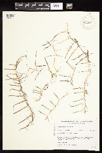 Myriophyllum tenellum Bigelow 455897[1134897]Gerdes, Lynden; et al. 28981998-07-09 United States, Minnesota, Cook, T64N R03E S03NWNW. Cook Co. Superior National Forest, Little John Lake; in northern portion of lake.;Superior National Forest;064N;03E;3, 48.0574761 -90.04601 |
MIN:Plants | Myriophyllum tenellum Bigelow 456976[]Myhre, K. 32381992-08-31 United States, Minnesota, Cass, Cass Co.; located on the west shore of Spider Lake; T 137N R 32W NW1/4 of NE1/4 of Sec 24;Foothills State Forest;137N;32W;24, 46.6663438 -94.6704087 |
MIN:Plants | Myriophyllum tenellum Bigelow 457109[]Myhre, K. 69721997-07-24 United States, Minnesota, Carlton, Fond du Lac Indian Reservation. Carlton Co.; Big Lake. Located 2.5 mi N of the town of Sawyer. Plants occur along the NW bay of the lake; T49N R18W SW1/ Carlton Co.; Big Lake. Located 2.5 mi N of the town of Sawyer. Plants occur along the NW bay of the lake; T49N R18W SW1/4 of SW1/4 of sEc 21. 049N 18W 21, 46.715007 -92.6284166 |
MIN:Plants | Myriophyllum tenellum Bigelow 458707[]Gerdes, Lynden 23941997-08-26 United States, Minnesota, Aitkin, Aitkin Co.; T46N R25W S34NWNW. Aitkin Co.; approximately 1.0 mi NE of Glen; Clear Lake, in the vicinity of the public bo Aitkin Co.; T46N R25W S34NWNW. Aitkin Co.; approximately 1.0 mi NE of Glen; Clear Lake, in the vicinity of the public boat access/beach.. 046N 25W 34, 46.4256936 -93.4833473 |
MIN:Plants | Myriophyllum tenellum Bigelow 458759[]Allard, B. 940712011994-07-12 United States, Minnesota, Itasca, Chippewa National Forest. Itasca Co.; Horseshoe Lake. Collected in Chipp. Nat. For. transects 3,4,8 & 9; in 160N R26W NENE30 and NWNW 29; T60N R26 Itasca Co.; Horseshoe Lake. Collected in Chipp. Nat. For. transects 3,4,8 & 9; in 160N R26W NENE30 and NWNW 29; T60N R26W NE1/4 of NE1/4 of Sec 30. 060N 26W 30, 47.6530167 -93.6947374 |
MIN:Plants | Myriophyllum tenellum Bigelow 458760[]Allard, B. 940712011994-07-12 United States, Minnesota, Itasca, Chippewa National Forest. Itasca Co.; Horseshoe Lake. Collected in Chipp. Nat. For. transects 3,4,8 & 9; in 160N R26W NENE30 and NWNW 29; T60N R26 Itasca Co.; Horseshoe Lake. Collected in Chipp. Nat. For. transects 3,4,8 & 9; in 160N R26W NENE30 and NWNW 29; T60N R26W NE1/4 of NE1/4 of Sec 30. 060N 26W 30, 47.6530167 -93.6947374 |
MIN:Plants | Myriophyllum tenellum Bigelow 458764[]Allard, B. 940712011994-07-12 United States, Minnesota, Itasca, Chippewa National Forest. Itasca Co.; Horseshoe Lake. Collected in Chipp. Nat. For. transects 3,4,8 & 9; in 160N R26W NENE30 and NWNW 29; T60N R26 Itasca Co.; Horseshoe Lake. Collected in Chipp. Nat. For. transects 3,4,8 & 9; in 160N R26W NENE30 and NWNW 29; T60N R26W NE1/4 of NE1/4 of Sec 30. 060N 26W 30, 47.6530167 -93.6947374 |
MIN:Plants | Myriophyllum tenellum Bigelow 458807[]Myhre, K. 70151997-07-30 United States, Minnesota, Carlton, Carlton Co.; Sand Lake (Pine Co.). Located 2 mi SW of the town of Moose Lake. Plants occur along the N bay of the lake; Carlton Co.; Sand Lake (Pine Co.). Located 2 mi SW of the town of Moose Lake. Plants occur along the N bay of the lake; T46N R19W NW1/4 of SW1/4 of Sec 32. 046N 19W 32, 46.4256091 -92.7724467 |
MIN:Plants | Myriophyllum tenellum Bigelow 459419[]Myhre, K. 46401993-09-16 United States, Minnesota, Pine, Pine Co. Located 1.5 mi SW of the town of Willow River; Clear Lake; T44N R20W SE1/4 of SW1/4 of Sec 9;;044N;20W;9, 46.3099627 -92.8765863 |
MIN:Plants | Myriophyllum tenellum Bigelow 459432[]Myhre, K. 45541993-08-25 United States, Minnesota, Pine, Pine Co. Located 3.3 mi NE of the town of Willow River; Rush Lake; T45N R19W SE1/4 of NE1/4 of sec 29;;045N;19W;29, 46.3533211 -92.7721856 |
MIN:Plants | Myriophyllum tenellum Bigelow 459455[]Myhre, K. 35551993-05-09 United States, Minnesota, Pine, Pine Co. Located near the public access at Bass lake; T43N R21W SW1/4 of SW1/4 of Sec 31;;043N;21W;31, 46.1656546 -93.043334 |
MIN:Plants | Myriophyllum tenellum Bigelow 459496[]Myhre, K. 34691993-04-21 United States, Minnesota, Pine, Pine Co. Located on the S shore of Johnson Lake; T45N R19W SW1/4 of NE1/4 of Sec 21;;045N;19W;21, 46.3678578 -92.7512765 |
MIN:Plants | Myriophyllum tenellum Bigelow 461563[]Myhre, K. 55781995-06-15 United States, Minnesota, Aitkin, Hill River State Forest. Aitkin County...Located 4 mi E of the town of Hill City. Plants occur along the shores of Taylor Lake...T52N R25W SW1/4 of NE1/4 of sec 16. 052N 25W 16, 46.9938642 -93.5185596 |
MIN:Plants | Myriophyllum tenellum Bigelow 461584[]Myhre, K. 55091995-06-12 United States, Minnesota, Aitkin, Aitkin Co. Located 1 mi NE of greater downtown Glen; NE shore of Glen; T46N R25W SW1/4 of SE1/4 of sec 28;;046N;25W;28, 46.4399449 -93.5048054 |
MIN:Plants | Myriophyllum tenellum Bigelow 464545[]Gerdes, Lynden; et al. 35861999-07-16 United States, Minnesota, Lake, T60N R10W S05SESW. Lake Co. Superior National Forest, Dunnigan Lake.;Superior National Forest;060N;10W;05, 47.7122792 -91.6314545 |
MIN:Plants | Myriophyllum tenellum Bigelow 475512[]Cholewa, A. 25811999-08-02 United States, Minnesota, Clearwater, Itasca State Park. Clearwater Co, Itasca State Park, Ozawindib Lake, floating just west of outlet stream at north end. T143NR36W NE1/4 of Clearwater Co, Itasca State Park, Ozawindib Lake, floating just west of outlet stream at north end. T143NR36W NE1/4 of NW1/4 of sec.5.. 143N 36W 5, 47.2314256 -95.2657843 |
MIN:Plants | Myriophyllum tenellum Bigelow 475525[]Myhre, K. 53081994-09-13 United States, Minnesota, Itasca, Itasca Co.; Located along the northeast bay of East SMith Lake; T 58N R 26W NW1/4 of NE1/4 of Sec 2;Chippewa National Forest;058N;26W;2, 47.5375044 -93.6081509 |
Google Map
Google Maps is a web mapping service provided by Google that features a map that users can pan (by dragging the mouse) and zoom (by using the mouse wheel). Collection points are displayed as colored markers that when clicked on, displays the full information for that collection. When multiple species are queried (separated by semi-colons), different colored markers denote each individual species.