University of Minnesota
http://www.umn.edu/
612-625-5000
http://www.umn.edu/
612-625-5000
Minnesota Biodiversity Atlas
Bell Museum
Dataset: MIN-Plants
Taxa: Hydrocharitaceae
Search Criteria: excluding cultivated/captive occurrences
Bell Museum plants | |
 MIN:Plants | 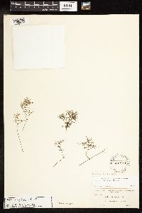 Najas conferta NULL 255908[1189239]Curtiss, A. H. 6858 United States, Florida, Santa Rosa |
MIN:Plants | 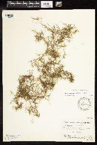 Najas graminea NULL 564168[1189297]Grant, Verne 130471946-08-15 United States, California, Butte, near caretaker's house, Greylodge Game Refuge |
MIN:Plants | 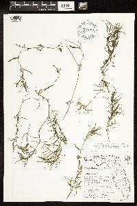 Najas NULL 607962[1189304] |
MIN:Plants | 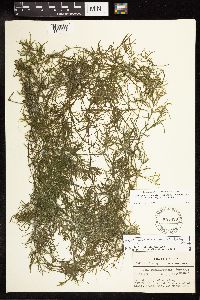 Najas NULL 551829[1189305] |
MIN:Plants | 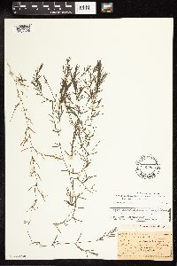 Najas NULL 57928[1189306] |
MIN:Plants | 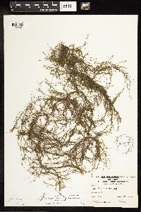 Najas NULL 590771[1189307] |
MIN:Plants | 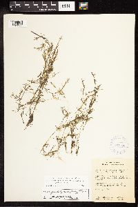 Najas NULL 364796[1189308] |
MIN:Plants | 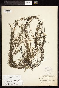 Najas NULL 303295[1189309] |
MIN:Plants | 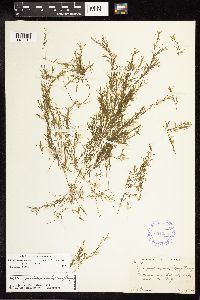 Najas NULL 354236[1189310] |
MIN:Plants | 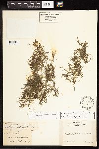 Najas NULL 238340[1189311] |
MIN:Plants | 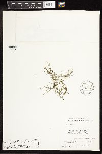 Najas NULL 576367[1189312] |
MIN:Plants | 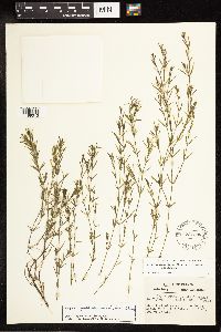 Najas NULL 551838[1189313] |
MIN:Plants |  Najas NULL 582890[1189314] |
MIN:Plants |  Najas NULL 531832[1189315] |
MIN:Plants |  Najas NULL 551843[1189316] |
MIN:Plants |  Najas NULL 564194[1189317] |
MIN:Plants |  Najas NULL 564195[1189318] |
MIN:Plants |  Najas NULL 291367[1189319] |
MIN:Plants |  Najas NULL 57926[1189320] |
MIN:Plants |  Najas NULL 57929[1189321] |
MIN:Plants |  Najas NULL 590897[1189322] |
MIN:Plants |  Najas NULL 483405[1189323] |
MIN:Plants |  Najas NULL 57927[1189324] |
MIN:Plants |  Najas NULL 56970[1189325] |
MIN:Plants |  Najas NULL 57475[1189326] |
MIN:Plants |  Najas NULL 552415[1189327] |
MIN:Plants |  Najas NULL 424352[1189328] |
MIN:Plants |  Najas NULL 621836[1189329] |
MIN:Plants |  Najas NULL 424351[1189330] |
MIN:Plants |  Najas NULL 276523[1189331] |
MIN:Plants |  Najas NULL 353191[1189332] |
MIN:Plants |  Najas NULL 353190[1189333] |
MIN:Plants | 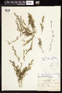 Najas NULL 306511[1189334] |
MIN:Plants | 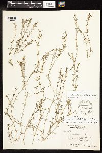 Najas NULL 551841[1189335] |
MIN:Plants | 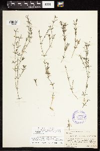 Najas NULL 354232[1189336] |
MIN:Plants | 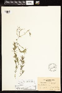 Najas NULL 551839[1189337] |
MIN:Plants |  Najas NULL 386522[1189338] |
MIN:Plants |  Najas NULL 450573[1189339] |
MIN:Plants |  Najas NULL 528809[1189340] |
MIN:Plants |  Najas NULL 449556[1189341] |
MIN:Plants | 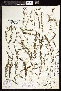 Najas NULL 388294[1189342] |
MIN:Plants | 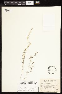 Najas NULL 559889[1189343] |
MIN:Plants | 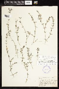 Najas NULL 354231[1189344] |
MIN:Plants | 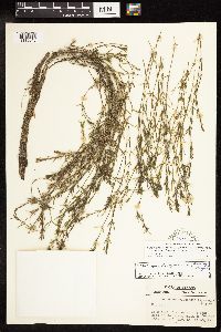 Najas NULL 551840[1189345] |
MIN:Plants | 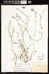 Najas NULL 255905[1189346] |
MIN:Plants | 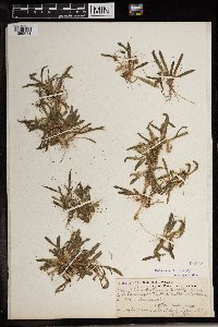 58648[1369041] 10171969-01-15 Sudan, Lemonile region, Gebel (Njemati) |
MIN:Plants |  Najas minor Allioni 438073[1145485]Proulx, N. P12003-08-27 United States, Minnesota, Dakota, Lavon [sic] Lake;;115N;20W;31, 44.721087 -93.24434 |
MIN:Plants | 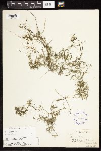 Najas minor NULL 354233[1189359]Muenscher, W. C. 5502 United States, New York, Dutchess |
MIN:Plants | 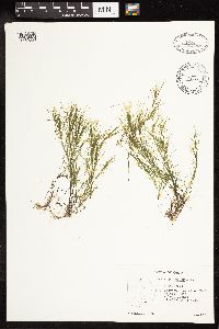 Najas minor NULL 499757[1189360]Hellquist, C. B. 9292 United States, Ohio, Athens |
MIN:Plants | 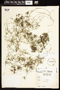 Najas minor NULL 528867[1189361]Muenscher, W. C. s.n. United States, New York, Saratoga |
MIN:Plants | 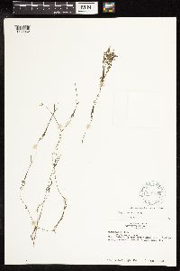 Najas minor NULL 619033[1189362]Albright, D. 200 United States, Ohio, Ottawa |
MIN:Plants | 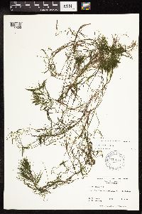 Najas minor NULL 616254[1189363]Leonard, S. W. 2752 United States, South Carolina, Jasper |
MIN:Plants |  Najas minor NULL 590737[1189364]Fore, P. 498 United States, Illinois, Williamson |
MIN:Plants | Elodea canadensis Michaux 435086[]Lee, Michael MDL18341997-07-16 United States, Minnesota, Stearns, Stearns Co.; In Crooked Lake 3-1/2 miles southwest of Clearwater; T122N R27W SE1/4 of NW1/4 Sec. 8;;122N;27W;8, 45.3910727 -94.107163 |
MIN:Plants | Elodea canadensis Michaux 461387[]Gerdes, Lynden; et al. 28041998-07-01 United States, Minnesota, Cook, T65N R01E S27SENW. Cook County; Superior National Forest, BWCAW. Shallow shores of Clearwater Lake, north side of lake.;Boundary Waters Canoe Area Wilderness / Superior National Forest;065N;01E;27, 48.083795 -90.3129582 |
MIN:Plants | Elodea canadensis Michaux 906143[]Perleberg, D.; et al. 7072005-06-07 United States, Minnesota, Hennepin, Hennepin County...Snelling Lake...utm: N: 4969831 E: 485225 DNR Site# 108;Fort Snelling State Park;028N;23W;28, 44.8823429 -93.174242 |
MIN:Plants | Elodea canadensis Michaux 910451[]Perleberg, D.; et al. 13552006-07-13 United States, Minnesota, Cass, County: Cass, Lake ID: 11041200, Lake: Birch...T140, R31W, Sec14, Northwest Bay, DNR Site # 4;Foothills State Forest;140N;31W;14, 46.942993 -94.5647672 |
MIN:Plants | Elodea canadensis Michaux 906272[]Knopik, J.; et al. 9372006-06-29 United States, Minnesota, Cass, Cass County...Woman Lake...utm: N: 5201358 E: 400833 DNR Site# 2024;;;;, 46.9583333 -94.3033333 |
MIN:Plants | Elodea canadensis Michaux 402886[]Hiner, L. s.n.1947-07-10 United States, Wyoming, Teton, Two Ocean lake, Teton Co.;Grand Teton National Park |
MIN:Plants | Elodea canadensis Michaux 519819[]Coulombe-Moore, M.; et al. 1111UM1996-06-25 United States, Wisconsin, Pierce, Pierce Co, Pool 4, River Mile 794.0...UTM E535274 N4938092;;;;, 44.9833333 -92.9166667 |
MIN:Plants | Elodea canadensis Michaux 918069[]Myhre, K. 104512009-06-13 United States, Minnesota, Cass, Cass County...Moccasin Lake. Located 13 miles southeast of the town of Walker...T141N R29W NE1/4 of NW1/4 of Sec 33;Chippewa National Forest;141N;29W;33, 46.9916667 -94.3569444 |
MIN:Plants | Elodea canadensis Michaux 920143[]Smith, Welby 174521990-07-27 United States, Minnesota, Morrison, Camp Ripley Military Reservation. Camp Ripley Military Reservation. Morrison County...Picnic area #3...Mississippi River...UTM: 393800E 5108900N. T 131N R 29W SE1/4 of SE1/4 of Sec 30. 131N 29W 30, 46.1275 -94.3747222 |
MIN:Plants | Elodea canadensis Michaux 906221[]Perleberg, D.; Backowski, Joe 4212004-08-10 United States, Minnesota, Hubbard, County: Hubbard. Lake: Portage. Found in the northwest portion of the lake...DNRSite# 11. utm: 5204415 N 337087 E utm: 5203815 N 337462 E. 140N 35W 5, 46.9714924 -95.1331779 |
MIN:Plants | Elodea canadensis Michaux 906136[]Perleberg, D.; et al. 6942005-06-15 United States, Minnesota, Wadena, Wadena County...Blueberry Lake...utm: N: 5184605 E: 341597. DNR Site# 347;;138N;35W;00, 46.786783 -95.085286 |
MIN:Plants | Elodea canadensis Michaux 906144[]Knopik, J. 7452005-06-23 United States, Minnesota, Morrison, Morrison County...Shamineau Lake...utm: N: 5124270 E: 734344. DNR Site# 910;;132N;31W;00, 46.254553 -94.604775 |
MIN:Plants | Elodea canadensis Michaux 910499[]Loso, Stephanie; et al. 15402007-07-05 United States, Minnesota, Cass, County: Cass, Lake ID: 11016700, Lake: Little Boy...T140, R28W, Sec15, West shore of lake, DNR Site # 9;;140N;28W;15, 46.9420147 -94.2048607 |
MIN:Plants | Elodea canadensis Michaux 917087[]Gerdes, Lynden; et al. 58882009-08-21 United States, Minnesota, Cook, in bay just south of the portage between Red Rock Lake and Red Rock Bay. NWSE of sec.;Boundary Waters Canoe Area Wilderness / Superior National Forest;066N;05W;28, 48.170813 -90.9782474 |
MIN:Plants | Elodea canadensis Michaux 903813[]Lee, Michael MDL41752005-09-15 United States, Minnesota, Becker, Becker County...Otter Tail River four miles north of Frazee...just downstream from the Wannigan Road bridge...T138N R40W NE1/4 of SW1/4 of NE1/4 Sec. 11. 138N 40W 11, 46.7811005 -95.7005368 |
MIN:Plants | Elodea canadensis Michaux 910411[]Kobberdahl, Michael; et al. 14962008-07-17 United States, Minnesota, Cass, Boy Lake, Lake ID: 11014300, Northeast basin, DNR Site # 1294. UTM: 415743, 5218642;Chippewa National Forest / Leech Lake Indian Reservation;142N;27W;16, 47.1158967 -94.1106808 |
MIN:Plants | Elodea canadensis Michaux 424232[]Fassett, N.; et al. 50501927-08-24 United States, Wisconsin, Trempealeau, Trempealeau Co. ...Lake Side Park, (Sect. 35, T.18N, R.9W), Trempealuau;;018N;09W;35 |
MIN:Plants | Elodea canadensis Michaux 910438[]Loso, Stephanie; et al. 14102007-08-23 United States, Minnesota, Cass, Lake ID: 11038300, Lake Pleasant. Northeast shore of lake, near DNR site 1028. [collector provided invalid lat/long];;140N;30W;27, 46.9143561 -94.4598514 |
MIN:Plants | Elodea canadensis Michaux 220930[]Holzinger, J. M. s.n.1901-09-00 United States, Minnesota, Winona, Edge of L. Winona [T107N;R7W], 44.037315 -91.638886 |
MIN:Plants | Elodea canadensis Michaux 267790[]Fassett, N.; Hotchkiss, N. 30521926-08-23 United States, Minnesota, Wabasha, Wabasha Co.; Half Moon Lake;;109N;09W;, 44.258214 -91.908481 |
MIN:Plants | Elodea canadensis Michaux 275834[]Grant, Martin 33661929-09-18 United States, Minnesota, Clearwater, Itasca Park; Clearwater Co. Mississippi River. NW-SW 35 T144N R36W;Itasca State Park;144N;36W;35, 47.2465034 -95.2015772 |
MIN:Plants | Elodea canadensis Michaux 281697[]Delaney, B. s.n.1987-08-26 United States, Minnesota, Anoka, Anoka Co. Cedar Creek Natural History Area. On the E shore of Fish Lake. SW1/4 SW1/4 Sec. 25, T34N, R23W.;Cedar Creek National History Area;034N;23W;25, 45.4067377 -93.1526244 |
MIN:Plants | Elodea canadensis Michaux 306715[]Oosting, H. 281021928-07-21 United States, Minnesota, Anoka, Ham Lake. Anoka Co.;;032N;23W;, 45.2545028 -93.2038334 |
MIN:Plants | Elodea canadensis Michaux 306720[]Oosting, H. 29201929-08-04 United States, Minnesota, Scott, Prior Lake, Scott Co.;;;;, 44.729641 -93.435087 |
MIN:Plants | Elodea canadensis Michaux 306722[]Oosting, H. 281901928-08-31 United States, Minnesota, Anoka, Ham Lake. Anoka Co.;;032N;23W;, 45.2545028 -93.2038334 |
MIN:Plants | Elodea canadensis Michaux 306723[]Oosting, H. 281331928-08-04 United States, Minnesota, Ramsey, Snail Lake - Ramsey Co.;Snail Lake Vadnais Lake County Park;030N;23W;, 45.049555 -93.083289 |
MIN:Plants | Elodea canadensis Michaux 306827[]Moyle, J. 25591935-09-24 United States, Minnesota, Saint Louis, Lake Kabetogama, St. Louis Co.;Voyageurs National Park;;;, 48.487187 -92.78866 |
MIN:Plants | Elodea canadensis Michaux 306828[]Moyle, J. 24501935-09-20 United States, Minnesota, Saint Louis, Pelican Lake. St. Louis Co.;Kabetogama State Forest;;;, 48.061946 -92.905816 |
MIN:Plants | Elodea canadensis Michaux 336387[]Smith, L. s.n.1936-08-14 United States, Minnesota, Itasca, Itasca Co. Maple Lake, T60, R27;Chippewa National Forest;060N;27W;, 47.64748 -93.722135 |
MIN:Plants | Elodea canadensis Michaux 336523[]Smith, L. 4751936-09-01 United States, Minnesota, Itasca & Cass. Winnibigoshish L.;Chippewa National Forest / Leech Lake Indian Reservation;;;, 47.451853 -94.193955 |
MIN:Plants | Elodea canadensis Michaux 336550[]Dobie, John s.n.1936-08-18 United States, Minnesota, Clearwater, Clearwater Co. Long or Lost Lake;;;;, 47.611104 -95.484623 |
MIN:Plants | Elodea canadensis Michaux 336573[]Smith, L. 3791936-08-19 United States, Minnesota, Beltrami, Beltrami Co. Gilstead Lake, T148, R30;Chippewa National Forest;148N;30W;, 47.6285561 -94.4814013 |
MIN:Plants | Elodea canadensis Michaux 336576[]Smith, L. 4021936-08-26 United States, Minnesota, Itasca, Itasca Co. Dora Lake district. Moose Lake. T150N, R27.;Chippewa National Forest;150N;27W;, 47.83105 -94.162294 |
MIN:Plants | Elodea canadensis Michaux 337788[]Smith, L. 3411936-08-20 United States, Minnesota, Cass, Cass Co. Portage Lake, T141, R31.;Chippewa National Forest;141N;31W;, 47.022805 -94.5992013 |
MIN:Plants | Elodea canadensis Michaux 337840[]Smith, L. 4301936-09-27 United States, Minnesota, Itasca, Dora Lake district. Clear Lake T149N, R26W.;Chippewa National Forest;149N;26W;, 47.75195 -93.970463 |
MIN:Plants | Elodea canadensis Michaux 337841[]Smith, L. 4761936-09-01 United States, Minnesota, Itasca, Itasca [checked] & Cass Co. Winnibigoshish L.;Chippewa National Forest / Leech Lake Indian Reservation;;;, 47.441637 -94.199448 |
MIN:Plants | Elodea canadensis Michaux 337842[]Smith, L. 2671936-08-14 United States, Minnesota, Itasca, Itasca Co. Marcell. Maple Lake;Chippewa National Forest;060N;27W;, 47.64748 -93.722135 |
MIN:Plants | Elodea canadensis Michaux 337843[]Moyle, J. 23641936-08-15 United States, Minnesota, Becker, Becker Co. Height of Land Lake;;N;;, 46.894444 -95.601197 |
MIN:Plants | Elodea canadensis Michaux 337844[]Moyle, J. 21951936-07-18 United States, Minnesota, Beltrami, Beltrami Co. 8 mi N of Kelliher;Red Lake State Forest;153N;30W;, 48.0624589 -94.4883377 |
MIN:Plants | Elodea canadensis Michaux 337944[]Smith, L. 3811936-08-22 United States, Minnesota, Beltrami, Beltrami Co. Gilstead Lake. T148 R30;Chippewa National Forest;148N;30W;, 47.6285561 -94.4814013 |
MIN:Plants | Elodea canadensis Michaux 337945[]Smith, L. 3801936-08-22 United States, Minnesota, Beltrami, Beltrami Co. Gilstead Lake, T148, R30.;Chippewa National Forest;148N;30W;, 47.6285561 -94.4814013 |
MIN:Plants | Elodea canadensis Michaux 338105[]Moyle, J. 23441936-08-15 United States, Minnesota, Otter Tail, Ottertail Co. Ottertail Lake;;;;, 46.3977 -95.660619 |
MIN:Plants | Elodea canadensis Michaux 338193[]Moyle, J. 21341936-07-04 United States, Minnesota, Clearwater, Clearwater Co. Nicollet Creek, ca. 1/8 mi from Lake Itasca;Itasca State Park;143N;36W;, 47.19557 -95.2332161 |
MIN:Plants | Elodea canadensis Michaux 338247[]Smith, L.; Moyle, J. 4431936-08-31 United States, Minnesota, Cass, Cass [underlined] and Itasca Co, Winnibigoshish Lake;Chippewa National Forest / Leech Lake Indian Reservation;N;;, 47.436064 -94.182968 |
MIN:Plants | Elodea canadensis Michaux 338248[]Smith, L.; Moyle, J. 3431936-08-20 United States, Minnesota, Cass, Cass Co. Portage;;N;;, 47.342874 -94.308964 |
MIN:Plants | Elodea canadensis Michaux 338249[]Smith, L. 3421936-08-20 United States, Minnesota, Cass, Portage [which Portage Lake?];Chippewa National Forest / Leech Lake Indian Reservation;;;, 47.080375 -94.113255 |
MIN:Plants | Elodea canadensis Michaux 338250[]Smith, L. 4421936-08-31 United States, Minnesota, Cass, Cass [checked] & Itasca Co. Lake Winnibigoshish;Chippewa National Forest / Leech Lake Indian Reservation;;;, 47.439762 -94.196278 |
Google Map
Google Maps is a web mapping service provided by Google that features a map that users can pan (by dragging the mouse) and zoom (by using the mouse wheel). Collection points are displayed as colored markers that when clicked on, displays the full information for that collection. When multiple species are queried (separated by semi-colons), different colored markers denote each individual species.