University of Minnesota
http://www.umn.edu/
612-625-5000
http://www.umn.edu/
612-625-5000
Minnesota Biodiversity Atlas
Bell Museum
Dataset: MIN-Plants
Taxa: Juglandaceae
Search Criteria: excluding cultivated/captive occurrences
Bell Museum plants | |
 MIN:Plants | Juglans californica S. Watson 466751[]Univ. of Calif. Bot. Gard. list 18 - 901976-00-00 United States, California, Los Angeles, Los Angeles Co. |
MIN:Plants | Carya ovata (Miller) K. Koch 598493[]US Nat. Arboretum staff 1041976-00-00 United States, New York, Dutchess, Dutchess Co. |
MIN:Plants |  Carya ovata var. ovata (Miller) K. Koch 429065[1005567]Smith, Welby 151951989-05-31 United States, Minnesota, Freeborn, Carex Wildlife Management Area. Freeborn County ...'Carex' State Wildlife Management Area, about 7 miles east-southeast of Hollandale ... NW1/4 NW1/4 section 23, T 103N R 19W. 103N 19W 23, 43.7155556 -93.0866667 |
MIN:Plants | Carya ovata (Miller) K. Koch 598492[]Davis, Owen s.n.1980-05-30 United States, Iowa, Des Moines, Des Moines Co. |
MIN:Plants |  Carya ovata var. ovata (Miller) K. Koch 508110[1005560]Smith, Welby 257791995-07-25 United States, Minnesota, Houston, Houston County ... About 0.5 mile northwest of Freeburg ... T 102N R 4W SW1/4 of SW1/4 of Sec 19;Dorer Memorial Hardwood State Forest;102N;04W;19, 43.6172222 -91.3708333 |
MIN:Plants |  Carya ovata var. ovata (Miller) K. Koch 455588[1005561]Smith, Welby 288422000-06-27 United States, Minnesota, Winona, Whitewater Wildlife Management Area. Winona County ... Whitewater State Wildlife Management Area; abotu 5 miles SW of Weaver ... T108N R10W NE1/4 of NE1/4 of Sec 15. 108N 10W 15, 44.1597222 -92.0027778 |
MIN:Plants |  Carya ovata var. ovata (Miller) K. Koch 462338[1005564]Smith, Welby 290092000-08-18 United States, Minnesota, Winona, Whitewater Wildlife Management Area. Winona County ... Whitewater State Wildlife Management Area, about 5 miles SW of Weaver ... T 108N R 10W NE1/4 of NE1/4 of Sec 15. 108N 10W 15, 44.1597214 -92.0027771 |
MIN:Plants |  Carya ovata var. ovata (Miller) K. Koch 295921[1283301]Lakela, Olga 10971935-05-12 United States, Minnesota, Winona, Winona Co.; Slope of Gwinn's Bluff, S of Winona.;Great River Bluffs State Park;106N;05W;, 43.939926 -91.391069 |
MIN:Plants |  Carya ovata var. ovata (Miller) K. Koch 306432[1005572]Petruvi, Paul s.n.1924-00-00 United States, Minnesota, Freeborn, Freeborn Co.; About 15 mi. NE of Albert Lea.;;;;, 43.8015 -93.15574 |
MIN:Plants |  Carya ovata var. ovata (Miller) K. Koch 360145[1005580]Rosendahl, C. 66631936-05-17 United States, Minnesota, Winona, Winona Co.; North base of Gwinn's Bluff, Winona.;Great River Bluffs State Park;106N;05W;, 43.96333 -91.43962 |
MIN:Plants |  Carya ovata var. ovata (Miller) K. Koch 412635[1005579]Moore, John 106841939-05-14 United States, Minnesota, Wabasha, Wabasha Co.; 1 mi. north of Minneiska.;;109N;09W;, 44.23311 -91.91725 |
MIN:Plants |  Carya ovata var. ovata (Miller) K. Koch 553837[1283302]Moore, John; et al. 224381954-10-14 United States, Minnesota, Houston, Houston County...South side of Winnebago Valley, 8 mi. up from New Albin.;Dorer Memorial Hardwood State Forest;102N;04W;, 43.62916 -91.31853 |
MIN:Plants |  Carya ovata var. ovata (Miller) K. Koch 553880[1005570]Moore, John; et al. 224371954-10-14 United States, Minnesota, Houston, Houston County...South side of Winnebago Valley, 8 mi. up from New Albin.;Dorer Memorial Hardwood State Forest;102N;04W;, 43.62916 -91.31853 |
MIN:Plants |  Carya ovata var. ovata (Miller) K. Koch 553972[1283303]Moore, John; et al. 224391954-10-14 United States, Minnesota, Houston, Houston County...On south side of Winnebago Valley, 8 mi. up from New Albin.;Dorer Memorial Hardwood State Forest;102N;04W;, 43.617062 -91.280659 |
MIN:Plants |  Carya ovata var. ovata (Miller) K. Koch 591996[1005581]Moore, John 265951964-05-21 United States, Minnesota, Houston, Houston Co.; 3 mi. south west of Caledonia.;Dorer Memorial Hardwood State Forest;102N;05W;, 43.63068 -91.43198 |
MIN:Plants |  Carya ovata var. ovata (Miller) K. Koch 607362[1005571]Moore, John; et al. s.n.1968-06-07 United States, Minnesota, Houston, Houston County...bluffs of the Winnebago Valley, 6 mi. north west of New Albin, Iowa.;Dorer Memorial Hardwood State Forest;102N;04W;, 43.590212 -91.284092 |
MIN:Plants |  Carya ovata var. ovata (Miller) K. Koch 711396[1005566]Smith, Welby 9721979-06-13 United States, Minnesota, Houston, Houston Co. T102N, R7W, NE1/4 NW1/4 Sec. 8. Overlooking Hwy. 4.;Dorer Memorial Hardwood State Forest;102N;07W;8, 43.652 -91.70034 |
MIN:Plants |  Carya ovata var. ovata (Miller) K. Koch 728993[1005569]Berlin, N. 1071979-07-10 United States, Minnesota, Goodhue, Wacouta Pond Natural Area, The Nature Conservancy. Goodhue Co.; Wacouta Pond Natural Area: 5 mi. SE of Red Wing. Portions of : Sec. 6, T112N, R13W and Sec. 31, 32 T113N, R13W.. , 44.545 -92.43472 |
MIN:Plants |  Carya ovata var. ovata (Miller) K. Koch 738372[1005562]Galatowitsch, S. 2301982-06-11 United States, Minnesota, Houston, Houston Co.; Caledonia Oaks: T102N, R5W, E1/2 SW1/4 Sec. 24.;Caledonia Oaks, The Nature Conservancy;102N;05W;24, 43.6231 -91.38242 |
MIN:Plants |  Carya ovata var. ovata (Miller) K. Koch 770627[1005563]Smith, Welby 84691983-07-27 United States, Minnesota, Mower, Mower Co.; About 3 mi. NE of Lyle. NW1/4 NE1/4 Sec. 29, T101N, R17W.;;101N;17W;29, 43.5215 -92.89853 |
MIN:Plants |  Carya ovata var. ovata (Miller) K. Koch 97109[1005578]Butters, F.; et al. 44361924-05-31 United States, Minnesota, Winona, Winona Co.; Near Lamoille.;Dorer Memorial Hardwood State Forest;106N;05W;, 43.96333 -91.43962 |
MIN:Plants |  Carya ovata var. ovata (Miller) K. Koch 97110[1005577]Holzinger, John; Arthur, J. 851886-05-06 United States, Minnesota, Winona, Homer Road.;;106N;06W;, 43.97615 -91.54123 |
MIN:Plants |  Carya ovata var. ovata (Miller) K. Koch 97111[1005575]Butters, F.; et al. 30531915-06-26 United States, Minnesota, Wabasha, West of Wabasha.;Dorer Memorial Hardwood State Forest;111NN;10W;, 44.37893 -92.03917 |
MIN:Plants |  Carya ovata var. ovata (Miller) K. Koch 97112[1005574]Rosendahl, C.; Butters, F. 29791915-06-21 United States, Minnesota, Fillmore, Root River Valley, 2 mi. W of Rushford. Fillmore Co.;Dorer Memorial Hardwood State Forest;104N;08W;, 43.80354 -91.79027 |
MIN:Plants |  Carya ovata var. ovata (Miller) K. Koch 97113[1005576]Rosendahl, C.; Butters, F. s.n.1918-06-21 United States, Minnesota, Wabasha, Wabasha Co.; 3 mi. W of Kellogg, Zumbro Valley.;Dorer Memorial Hardwood State Forest;110N;10W;, 44.3222 -92.00991 |
MIN:Plants |  Carya ovata var. ovata (Miller) K. Koch 97114[1005565]Lyon, H. s.n.1899-06-09 United States, Minnesota, Houston, Winnebago Valley.;Dorer Memorial Hardwood State Forest;;;, 43.76595 -91.33862 |
MIN:Plants |  Carya ovata var. ovata (Miller) K. Koch 97115[1005568]Butters, F.; et al. 30541915-06-26 United States, Minnesota, Wabasha, Along the river road about 1 mi. N of Minneiska. Wabasha Co.;;109N;09W;, 44.23311 -91.91725 |
MIN:Plants |  Carya ovata var. ovata (Miller) K. Koch 97117[1005573]Rosendahl, C. 3381902-06-04 United States, Minnesota, Houston, Spring Grove;;101N;07W;, 43.54392 -91.6707 |
MIN:Plants |  912159[1005664]Smith, Welby 253571994-09-02 United States, Minnesota, Dodge, Dodge County...Dodge Center Creek City Park, about 1.5 miles west-northwest of Dodge Center...dodge Center Creek... T107N R17W SW1/4 of SW1/4 of Sec 28. 107N 17W 28, 44.0405556 -92.8780556 |
MIN:Plants |  509259[1005676]Kaul, R. 67401990-05-24 United States, Minnesota, Steele, Steele County ... slope above the Straight River where Lemond Road approaches Bridge St, Owatonna;;107N;20W;, 44.06611 -93.22607 |
MIN:Plants |  505411[1005670]Smith, Welby 155681989-07-04 United States, Minnesota, Freeborn, Halls Lake Wildlife Management Area. Freeborn County ... Halls Lake National Waterfowl Production Area, about 3.5 miles NE of Alden...NW/14 NE1/4 section 30, T103N R22W. 103N 22W 30, 43.69487 -93.51853 |
MIN:Plants |  488256[1005658]Smith, Welby 270881998-05-15 United States, Minnesota, Sibley, Sibley County ... Rush River State Wayside (Minnesota Valley Recreation Area), about 2 miles southwest of Henderson T112N R26W SW1/4 of SE1/4 of Sec 15. 112N 26W 15, 44.5008333 -93.9380556 |
MIN:Plants |  461945[1005663]Juhnke, C. 247 CMJ FRO1999-05-18 United States, Minnesota, Goodhue, Frontenac State Park Goodhue County ... under power line south of picnic shelter ... T112N R13W SW NW SE 2;Frontenac State Park;112N;13W;02, 44.53507 -92.33916 |
MIN:Plants |  904602[1005668]Smith, Welby 257211995-07-07 United States, Minnesota, Wabasha, Wabasha County...Zumbro River, about 2 miles west-northwest of Kellogg...T110N R10W NW1/4 of NW1/4 of Sec 20;Dorer Memorial Hardwood State Forest;110N;10W;20, 44.3205556 -92.0472222 |
MIN:Plants |  493368[1005675]Smith, Welby 265811997-06-04 United States, Minnesota, Renville, Beaver Falls County Park. Renville County ... Beaver Falls County Park, about 4 miles northeast of Redwood Falls ...T113 N R 35W SW1/4 of NW1/4 of Sec 22. 113N 35W 22, 44.582222 -95.0533371 |
MIN:Plants |  909791[1005665]Smith, Welby 253111994-08-26 United States, Minnesota, Goodhue, Dorer Memorial Hardwood State Forest. Goodhue County...In the Cannon River Valley, about 2 miles southeast of Welch...Cannon River...T 113N R 16W SW1/4 of NW1/4 of Sec 35. 113N 16W 35, 44.5519444 -92.7111111 |
MIN:Plants |  920419[1005700]Smith, Welby 257731995-07-19 United States, Minnesota, Nicollet, Seven Mile Creek County Park. Nicollet County ... Seven-Mile Creek County Park, about 7 miles north of Mankato ... Along 7-Mile Creek ... T109N R27W NW1/4 of NE1/4 of Sec 11. 109N 27W 11, 44.2680556 -94.0344444 |
MIN:Plants |  508047[1005711;1005712]Smith, Welby 289982000-08-16 United States, Minnesota, Fillmore, Forestville State Park. Fillmore County ... Forestville State Park, about 3 miles SW of Carimona ... Root River ... T 102N R 11W SW1/4 of NW1/4 of Sec 18. 102N 11W 18, 43.6402779 -92.2074966 |
MIN:Plants |  906161[1005667]Koenitzer, Andrew; Billat, Chad 42008-09-25 United States, Minnesota, Ramsey, Apiary Woods, St. Paul campus, University of MN.;;029N;23W;20, 44.9844905 -93.1974935 |
MIN:Plants |  920283[1005695]Smith, Welby 240241993-09-24 United States, Minnesota, Wright, Wright County ... Robert E. Ney County Park, on the north side of Lake Mary ... T121N R26W NE1/4 of SE1/4 of Sec 30;Ney County Park;121N;26W;30, 45.2586111 -93.995 |
MIN:Plants |  271225[1005689]R., L. s.n.1923-05-23 United States, Minnesota, Hennepin, Zumbra Heights, Carver Co. [actually in Hennepin Co, just W of Smithtown Bay of Lake Minnetonka];;117N;24W;, 44.9345 -93.70644 |
MIN:Plants |  439776[1005693]Smith, Welby 155811989-07-04 United States, Minnesota, Nobles, Nobles Co. About 8 mi S-SE of Worthington; S side of Indian Lake; NW1/4 SE1/4 sec.34, T101N R39W;;101N;39W;34, 43.50734 -95.50437 |
MIN:Plants |  448610[1283311]Moore, John; Huff, N. 193311946-10-03 United States, Minnesota, Jackson, At Kilen Woods State Park;Kilen Woods State Park;103N;36W;17, 43.7253282 -95.1845719 |
MIN:Plants |  448850[1283314]Moore, John 166641944-07-28 United States, Minnesota, Washington, Washington Co.; Point Douglas;;026N;20W;, 44.751079 -92.817981 |
MIN:Plants |  456719[1005656]Smith, Welby 211141992-07-28 United States, Minnesota, Fillmore, Dorer Memorial Hardwood State Forest. Fillmore County...in the Root River Valley, about 0.5 mi S of Peterson (about 3/8 mi W of mile post 23 on the Root River Trail)...T104N R8W SW1/4 of SE1/4 of Sec 30. 104N 08W 30, 43.7791667 -91.8386111 |
MIN:Plants |  459708[1005659]Lee, Michael MDL2051993-07-02 United States, Minnesota, Dakota, Dakota Co.; 2 miles NE of New Trier; T 113N R 17W NW1/4 of NW1/4 of sec 8;;113N;17W;8, 44.60833 -92.88358 |
MIN:Plants |  488476[1005685]Moore, John 199781949-05-24 United States, Minnesota, Olmsted, Along the Root River 3 mi S of Simpson, Olmsted Co.;Dorer Memorial Hardwood State Forest;105N;13W;, 43.89144 -92.37849 |
MIN:Plants |  507147[1005672]Moore, John 207681950-09-11 United States, Minnesota, Big Stone, Bluffs facing Big Stone Lake at Ortonville;;;;, 45.30472 -96.44444 |
MIN:Plants |  514709[1005669]Smith, Welby 169891990-06-21 United States, Minnesota, Faribault, Pihls County Park. Fairbault [sic] Co.; ... Pihls County Park, on the west side of Rice Lake, about 6 miles south of Wells; UTM: 337413E 157105N, T102N R24W SW1/4 of NW1/4 of Sec 16. 102N 24W 16, 43.63729 -93.71815 |
MIN:Plants |  543322[1005683]Lakela, Olga 217841957-08-03 United States, Minnesota, Lake, On hwy 61 just beyond Ollie's Store, upperside of road, Larsmont area;;;;, 46.97917 -91.74556 |
MIN:Plants |  554680[1005682]Moore, John 232681957-06-18 United States, Minnesota, Martin, Along the E shore of East Chain Lake;;;;, 43.54472 -94.36333 |
MIN:Plants |  585525[1005687]Moore, John; et al. 260081962-06-04 United States, Minnesota, Houston, Houston County...1/2 mi E of Houston;Dorer Memorial Hardwood State Forest;;;, 43.76332 -91.52822 |
MIN:Plants |  586485[1005681]Moore, John 265211963-08-25 United States, Minnesota, Isanti, At old farmstead S of road, S of Beckman Lake, Cedar Creek Natural History Area;Cedar Creek National History Area;034N;23W;, 45.42806 -93.204 |
MIN:Plants |  586584[1005705;1005706]Moore, John 263961963-06-26 United States, Minnesota, Blue Earth, Along the river 3.5 mi W of Good Thunder;;;;, 44.0047 -94.13604 |
MIN:Plants |  603682[1005688]Moore, John; Moore, Marjorie 268591966-06-01 United States, Minnesota, Blue Earth, In river valley; SE1/4 Sec. 25 Mankato Twp.;;;;25, 44.14472 -93.95028 |
MIN:Plants |  603827[1005690]Moore, John; Dorn, Robert 270621967-05-29 United States, Minnesota, Winona, Houston Co. [actually in Winona Co.]; at base of bluffs along the Mississippi River; NW1/4 Sec. 16 Richmond Twp.;Dorer Memorial Hardwood State Forest;106N;05W;16, 43.98359 -91.43235 |
MIN:Plants |  618964[1005704]Morley, T. 12481970-07-23 United States, Minnesota, Redwood, Redwood County...1 mi S, 1/2 mi W of Walnut Grove, 20 ft. S of road, 30 feet W of Plum Creek...NW corner Sec. 36 T109N R39W. 109N 39W 36, 44.2031 -95.48259 |
MIN:Plants |  685109[1005679]Stassen, Carol 1591977-06-27 United States, Minnesota, Lyon, Camden State Park, along main road through the park; T110N R42W Sec. 5 NE1/4;Camden State Park;110N;42W;5, 44.36318 -95.92744 |
MIN:Plants |  747001[1005703;1005702]Galatowitsch, S. 8271982-09-15 United States, Minnesota, Wabasha, [no further data];Kellogg-Weaver Dunes Scientific Natural Area / Kellogg-Weaver Dunes, The Nature Conservancy;109N;09W;, 44.2331079 -91.9172451 |
MIN:Plants |  747195[1005680]Galatowitsch, S. 4231982-07-14 United States, Minnesota, Houston, Caledonia Oaks; T102N R5W E1/2 SW1/4 Sec. 24;Caledonia Oaks, The Nature Conservancy;102N;05W;24, 43.6231 -91.38242 |
MIN:Plants |  781843[1005686]Smith, Welby 93301984-06-23 United States, Minnesota, Mower, Lake Louise State Park, ca. 1 mi NNW of LeRoy, on the banks of the Upper Iowa River; NW1/4 NE1/4 Sec. 28 T101N R14W;Lake Louise State Park;101N;14W;28, 43.5221 -92.51896 |
MIN:Plants |  781933[1005684]Smith, Welby 93431984-06-27 United States, Minnesota, Jackson, Kilen Woods State Park, ca. 8 mi NNW of Jackson, bluff in the Des Moines River Valley; SW1/4 NE1/4 Sec. 17 T103N R35W;Kilen Woods State Park;103N;35W;17, 43.72481 -95.06465 |
MIN:Plants |  789499[1005657]Smith, Welby 101151985-05-18 United States, Minnesota, Fillmore, Fillmore Co. Along Spring Valley Creek, about 2 mi NNW of Wykoff; SE1/4 SE1/4 Sec. 18 T103N R12W;Dorer Memorial Hardwood State Forest;103N;12W;18, 43.72497 -92.31903 |
MIN:Plants |  833533[1352539]Juhnke, C. 1471991-06-25 United States, Minnesota, Fillmore, Forestville State Park. Fillmore Co. T102N R12W Sec.13 SE NW NE; trail along Root River;Forestville State Park;102N;12W;13, 43.6377242 -92.2192693 |
MIN:Plants |  833534[1005661]Juhnke, C. 1451991-06-24 United States, Minnesota, Fillmore, Forestville State Park. Fillmore Co. T102N R12W Sec.20 NE NE SE; N end of parking lot at Mystery Cave II;Forestville State Park;102N;12W;20, 43.62366 -92.2986 |
MIN:Plants |  834204[1005660]Cholewa, A. 23421995-07-10 United States, Minnesota, Stearns, Stearns Co. Paynesville, Highgrove BioReserve, just S of Koronis Hills Golf Course, T122N R32W S20. Upper trail below ho Stearns Co. Paynesville, Highgrove BioReserve, just S of Koronis Hills Golf Course, T122N R32W S20. Upper trail below house. 122N 32W 20, 45.36223 -94.73229 |
MIN:Plants |  97020[1005692]Taylor, B. T1341891-06-00 United States, Minnesota, Waseca, Janesville;;;;, 44.11611 -93.70778 |
MIN:Plants |  97161[1005691]Sheldon, Edmund S11001891-07-00 United States, Minnesota, Brown, Springfield;;;;, 44.23889 -94.97556 |
MIN:Plants |  97162[1005678]Sheldon, Edmund S8071891-07-00 United States, Minnesota, Brown, Sigel Typ.;;;;, 44.2344 -94.5631 |
MIN:Plants |  97163[1005677]Ballard, C. B5521891-07-00 United States, Minnesota, Scott, Spring Lake, Scott Co.;;114N;22W;, 44.67404 -93.46028 |
MIN:Plants |  97164[1005673]Sheldon, Edmund S6231891-06-00 United States, Minnesota, Waseca, Wilton;;;;, 44.01389 -93.53417 |
MIN:Plants |  97166[1283310]Anderson, A. An9391894-09-00 United States, Minnesota, Goodhue, [no further data];;;;, 44.40976099 -92.72282341 |
MIN:Plants |  97167[1005713]Butters, F.; et al. 32731916-06-14 United States, Minnesota, Blue Earth, Mankato;;;;, 44.16361 -93.99917 |
MIN:Plants |  509644[1005671]Smith, Welby 286742000-07-09 United States, Minnesota, Ramsey, Ramsey County ... Swede's Holow City Park, in St. Paul ... T 29N R 22W SE1/4 of NW1/4 of Sec 32;;029N;22W;32, 44.9577778 -93.0763889 |
MIN:Plants |  920196[1005699]Schimpf, D. DJS5982010-07-29 United States, Minnesota, Saint Louis, St. Louis County, Duluth. T49N R15W Sec 23 ... between Munger Trail & small pond.;;049N;15W;23, 46.7116667 -92.2052778 |
MIN:Plants |  913976[1005708;1005707]Smith, Welby 250651994-08-11 United States, Minnesota, Olmsted, Oxbow County Park. Olmsted County... Oxbow County Park, about 2 miles north of Byron...South Branch Middle Fork Zumbro River... T107N R15W NW1/4 of NW1/4 of Sec 17. 107N 15W 17, 44.0769444 -92.6538889 |
MIN:Plants |  466737[1005714]Bright, R. 74-2381974-00-00 United States, Minnesota, Anoka, Anoka Co. Coon Rapids;;;;, 45.12 -93.2875 |
MIN:Plants |  462341[1005710;1005709]Smith, Welby 290072000-08-18 United States, Minnesota, Wabasha, Dorer Memorial Hardwood State Forest. Wabasha County ... Kruger State Recreation Area. In the Zumbro River Valley about 4 miles N-NW of Kellogg ... T 110N R 11W SE1/4 of SE1/4 of Sec 12. 110N 11W 12, 44.3397217 -92.0763855 |
MIN:Plants | 466725[]Arboretum, Cary 73-361973-00-00 United States, New York, Dutchess, Dutchess Co. [cultivated ?] |
MIN:Plants |  489430[1005674]Smith, Welby 250791994-08-12 United States, Minnesota, Rice, About 7 mi north-northwest of Faribault, cannon river;Cannon River Wilderness Park;110N;20W;04, 44.3699989 -93.2388916 |
MIN:Plants |  918232[1005701]Smith, Welby 250751994-08-12 United States, Minnesota, Steele, Steele County...Kaplan Woods City Park, on the south side of Owatonna...Straight River...T107N R20W NE1/4 of NW1/4 of Sec 21. 107N 20W 21, 44.0644444 -93.235 |
MIN:Plants |  491655[1005662]Smith, Welby 288442000-07-27 United States, Minnesota, Winona, Whitewater Wildlife Management Area. Winona County ... Whitewater State Wildlife Management Area; about 5 miles SW of Weaver ... T 108N R 10W NE1/4 of NE1/4 of Sec 15. 108N 10W 15, 44.1597222 -92.0027778 |
MIN:Plants |  917172[1005694]Lee, Michael MDL41652005-09-08 United States, Minnesota, Benton, Benton County...Graham's Island in the Mississippi River at the State Hwy 15 bridge in Sartell/Sauk Rapids...T36N R31W SW1/4 of NE1/4 of NW1/4 Sec. 22 (small, irregular section). 036N 31W 22, 45.59893 -94.18175 |
MIN:Plants |  909214[1005666]Smith, Welby 219681992-09-07 United States, Minnesota, Watonwan, Eagle Nest County Park. Watonwan County...In Eagle Nest County Park, about 5 miles east of St. James...along the South Fork Watonwan River... T 106N R 31W NE1/4 of NE1/4 of Sec 14. 106N 31W 14, 43.9925 -94.5097222 |
MIN:Plants |  922694[1283313]Smith, Welby 234711993-08-10 United States, Minnesota, Cottonwood, About 6 miles north-northwest of Storden, along Dutch Charley Creek. SW1/4 of NE1/4 of Sec;;108N;38W;36, 44.1194444 -95.3513889 |
MIN:Plants |  923129[1283312]Smith, Welby 204001992-06-12 United States, Minnesota, Le Sueur, Chamberlain Woods Scientific Natural Area. Chamberlain Woods State Scientific and Natural Area, about 4 miles south-southwest of Le Sueur in the Minnesota Valley ... T111N R26W SW1/4 of SW1/4 of Sec 22. 111N 26W 22, 44.4005556 -93.9477778 |
MIN:Plants |  919307[1283309]Cholewa, A. 27222010-06-06 United States, Minnesota, Anoka, City of Blaine;<No data>;031N;23W;08, 45.1898985 -93.2348321 |
MIN:Plants |  934754[1283315]Whitfeld, T. J. S.; et al. 8712012-07-17 United States, Minnesota, Wabasha, Wabasha County;Dorer Memorial Hardwood State Forest;;;, 44.28333 -92.21667 |
MIN:Plants |  936723[1283316]Merchant, Steve 991731999-09-15 United States, Minnesota, Chippewa, Chippewa River. NW1/4 of SE1/4 of SW1/4 of section;;118N;41W;26, 45.0001811 -95.7670016 |
MIN:Plants |  943504[1296972]Smith, Welby R. 342032012-08-18 United States, Minnesota, Rock |
MIN:Plants |  973598[1397152]Bezanson, Char A. 811991-06-05 United States, Minnesota, Rice, 0.7 miles northeast of Mazaska Lake., 44.391048 -93.377616 |
MIN:Plants | Carya tomentosa (Poiret) Nuttall 466750[]US Nat. Arboretum staff 77-1111977-00-00 United States, District of Columbia, USNA [Nat. Arboretum] |
MIN:Plants | Carya tomentosa (Poiret) Nuttall 477624[]US Nat. Arboretum staff 921974-00-00 United States, District of Columbia, USNA [Nat. Arboretum]. Cultivated |
MIN:Plants |  Carya cordiformis (Wangenheim) K. Koch 762339[1005534]Smith, Welby 259601995-09-11 United States, Minnesota, Le Sueur, About 1.5 miles east of Waterville. NE1/4 of NE1/4 of section;Sakatah Lake State Park;109N;23W;25, 44.2247222 -93.5269444 |
MIN:Plants |  Carya cordiformis (Wangenheim) K. Koch 507867[1005533]Smith, Welby 290712000-09-02 United States, Minnesota, Anoka, About 3 miles SE of Forest Lake (town). SW1/4 of NE1/4 of section;Lamprey Pass Wildlife Management Area;032N;22W;13, 45.262921 -93.027559 |
MIN:Plants |  Carya cordiformis (Wangenheim) K. Koch 480860[1005528]Smith, Welby 257801995-07-25 United States, Minnesota, Houston, Houston County ... About 0.5 mile northwest of Freeburg ... T 102N R 4W SW1/4 of SW1/4 of sec 19;Dorer Memorial Hardwood State Forest;102N;04W;19, 43.6172222 -91.3708333 |
MIN:Plants |  Carya cordiformis (Wangenheim) K. Koch 482429[1005513]Wheeler, Gerald 159961997-06-08 United States, Minnesota, Nicollet, Swan Lake Wildlife Management Area. Nicollet Co.; Ca. 4 mi. SSW of Nicollet on Rte. 23, N of road, Swan Lake State WMA, North Star Unit; NW1/4 NW1/4 NE1/4 Sec. 28 T109N R28W (Nicollet 28). 109N 28W 28, 44.218 -94.20015 |
MIN:Plants | Carya cordiformis (Wangenheim) K. Koch 598365[]US Nat. Arboretum staff 1061976-00-00 United States, Maryland, Frederick, [no further data] |
MIN:Plants |  Carya cordiformis (Wangenheim) K. Koch 124874[1005526]Smith, Welby 230541993-07-21 United States, Minnesota, Meeker, Meeker County... On the south side of T.H. 12; about 2 miles southeast of Darwin... T119N R30W NW1/4 of SE1/4 of Sec 25;;119N;30W;25, 45.0872222 -94.3916667 |
MIN:Plants | 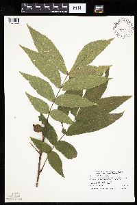 Carya cordiformis (Wangenheim) K. Koch 508858[1005527]Smith, Welby 259751995-09-19 United States, Minnesota, Mower, Lake Louise State Park. Mower County ... In Lake Louise State Park, about one mile northwest of LeRoy ... along the Upper Iowa River ... T 101N R 14W NE1/4 of NW1/4 of sec 28. 101N 14W 28, 43.5286102 -92.5222244 |
Google Map
Google Maps is a web mapping service provided by Google that features a map that users can pan (by dragging the mouse) and zoom (by using the mouse wheel). Collection points are displayed as colored markers that when clicked on, displays the full information for that collection. When multiple species are queried (separated by semi-colons), different colored markers denote each individual species.