University of Minnesota
http://www.umn.edu/
612-625-5000
http://www.umn.edu/
612-625-5000
Minnesota Biodiversity Atlas
Bell Museum
Dataset: MIN-Plants
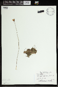
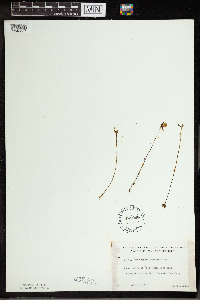
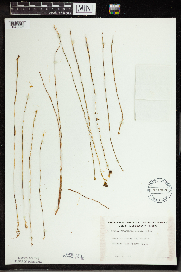
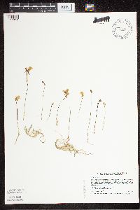
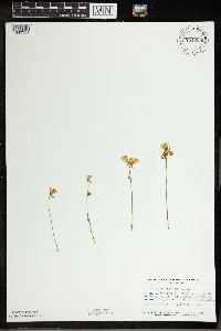
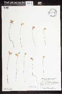
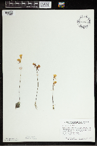
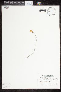
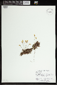
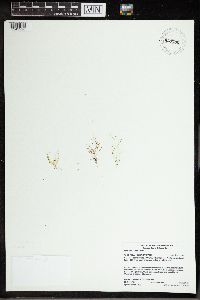
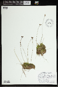
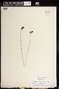
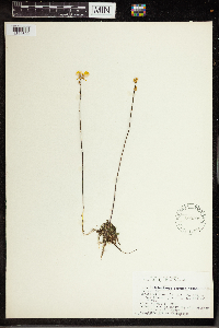
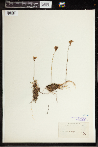
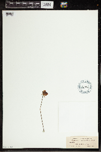
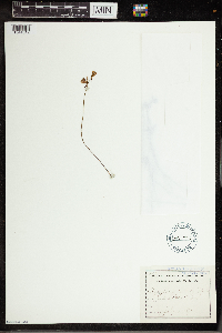
Taxa: Lentibulariaceae
Search Criteria: excluding cultivated/captive occurrences
Bell Museum plants | |
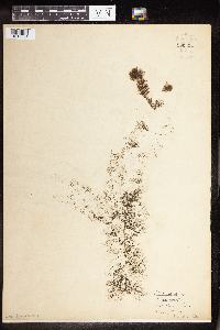
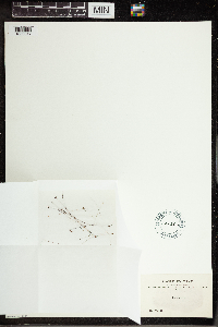
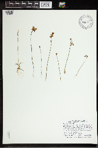
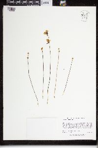
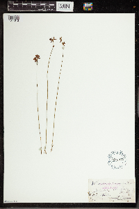
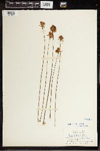
MIN:Plants | 960324[1318851] 1931-05-00 United States, Connecticut |
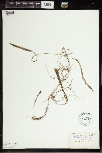
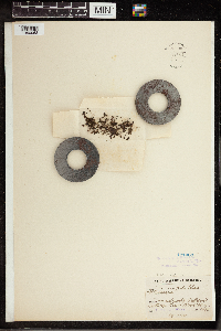
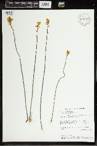
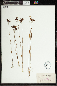
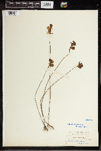
MIN:Plants | 191360[1344579]Nash, George, V. 4921894-04-00 United States, Florida, Lake |
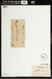
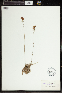
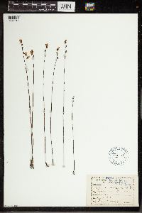
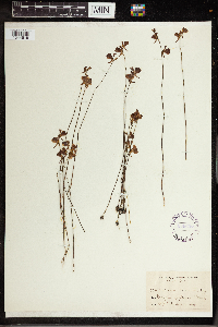
MIN:Plants | 191361[1344580]Clements, F. E. 4921901-08-14 United States, Colorado, Teller, Seven Lakes, 38.781653 -105.008586, 3500m |
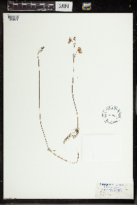
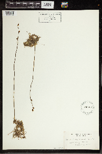
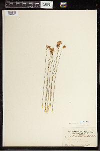
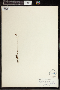
MIN:Plants | 191402[1344581] s.n.1891-04-21 United States, South Carolina |
MIN:Plants | 191362[1350017]Bang, Miguel 2223 Bolivia |
MIN:Plants | 191363[1350063]Wood, J. M. 8301889-04-29 South Africa, Great Noodsberg, -29.334539 30.86478, 914m |
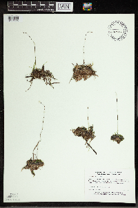
MIN:Plants | 960321[1318854]Fernstrom, Margaret Dixon 60481900-05-23 Switzerland |
MIN:Plants | 960320[1318855]Fernstrom, Margaret Dixon 60631900-00-00 Switzerland |
MIN:Plants | 960317[1318858]fernstrom, Margaret Dixon 60821900-00-00 Switzerland |
MIN:Plants | 960316[1318859]Fernstrom, Margaret Dixon 60791900-05-23 Switzerland |
MIN:Plants | 270583[1344022]Doebley, John F. 3111979-07-04 Switzerland, Bern, Just below Murren on footpath to Gremmelwald, near the town of Stechelburg, 46.56054 7.891598 |
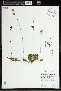
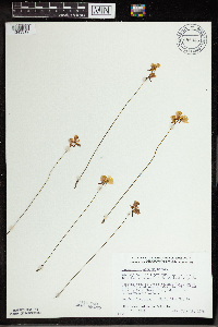
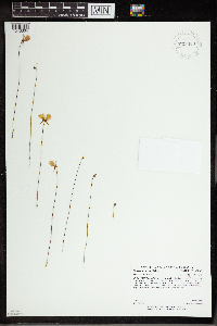
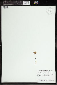
MIN:Plants | Utricularia geminiscapa L. Benjamin 907628[1318636]Gerdes, Lynden; et al. United States, Minnesota, Saint Louis, Detailed locality information protected. This is typically done to protect rare or threatened species localities. |
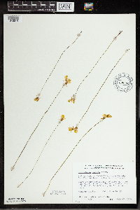
MIN:Plants | Utricularia geminiscapa L. Benjamin 903382[1318639]Lee, Michael United States, Minnesota, Becker, Detailed locality information protected. This is typically done to protect rare or threatened species localities. |
MIN:Plants | Utricularia geminiscapa L. Benjamin 910007[1318642]Milburn, Scott United States, Minnesota, Cass, Detailed locality information protected. This is typically done to protect rare or threatened species localities. |
MIN:Plants | Utricularia geminiscapa L. Benjamin 459795[1318641]Myhre, K. United States, Minnesota, Lake, Detailed locality information protected. This is typically done to protect rare or threatened species localities. |
MIN:Plants | Utricularia geminiscapa L. Benjamin 438652[1318640]Scott, P. United States, Minnesota, Lake, Detailed locality information protected. This is typically done to protect rare or threatened species localities. |
MIN:Plants | Utricularia geminiscapa L. Benjamin 431971[1318638]Gerdes, Lynden United States, Minnesota, Itasca, Detailed locality information protected. This is typically done to protect rare or threatened species localities. |
MIN:Plants | Utricularia geminiscapa L. Benjamin 922703[1318637]et al.; Milburn, Scott United States, Minnesota, Cass, Detailed locality information protected. This is typically done to protect rare or threatened species localities. |
MIN:Plants | Utricularia geminiscapa L. Benjamin 936565[1343337]Husveth, J.; Carolan, Amy United States, Minnesota, Chisago, Detailed locality information protected. This is typically done to protect rare or threatened species localities. |
MIN:Plants | Utricularia geminiscapa L. Benjamin 938067[1343336]Perry, Ethan United States, Minnesota, Saint Louis, Detailed locality information protected. This is typically done to protect rare or threatened species localities. |
MIN:Plants | Utricularia geminiscapa L. Benjamin 938069[1343335]Perry, Ethan United States, Minnesota, Saint Louis, Detailed locality information protected. This is typically done to protect rare or threatened species localities. |
MIN:Plants | Utricularia geminiscapa L. Benjamin 264295[1343334]Thayer, John; et al. United States, Minnesota, Itasca, Detailed locality information protected. This is typically done to protect rare or threatened species localities. |
MIN:Plants | Utricularia geminiscapa L. Benjamin 944776[1343333]Anderson, Chel E. United States, Minnesota, Saint Louis, Detailed locality information protected. This is typically done to protect rare or threatened species localities. |
MIN:Plants | Utricularia geminiscapa L. Benjamin 943319[1290016]Holmstrom, Rebecca United States, Minnesota, Saint Louis, Detailed locality information protected. This is typically done to protect rare or threatened species localities. |
MIN:Plants | Utricularia geminiscapa L. Benjamin 950707[1290009]Perry, Ethan F. United States, Minnesota, Lake, Detailed locality information protected. This is typically done to protect rare or threatened species localities. |
MIN:Plants | Utricularia geminiscapa L. Benjamin 960813[1329751]Malinowski, Norma United States, Minnesota, Saint louis, Detailed locality information protected. This is typically done to protect rare or threatened species localities. |
MIN:Plants | Utricularia geminiscapa L. Benjamin 640168[1344688]Seymour, F.C. United States, New Hampshire, Hillsborough, Detailed locality information protected. This is typically done to protect rare or threatened species localities. |
MIN:Plants | Utricularia geminiscapa L. Benjamin 469669[1344689]Fassett, N.C. United States, Wisconsin, Jackson, Detailed locality information protected. This is typically done to protect rare or threatened species localities. |
MIN:Plants | Utricularia geminiscapa L. Benjamin 676572[1344690]Iltis, Hugh H. United States, Wisconsin, Jackson, Detailed locality information protected. This is typically done to protect rare or threatened species localities. |
MIN:Plants | Utricularia geminiscapa L. Benjamin 640765[1344691]Seymour, F.C. United States, New Hampshire, Hillsborough, Detailed locality information protected. This is typically done to protect rare or threatened species localities. |
MIN:Plants | Utricularia geminiscapa L. Benjamin 483364[1344692]Tucker, J.M. United States, California, Butte, Detailed locality information protected. This is typically done to protect rare or threatened species localities. |
MIN:Plants | Utricularia geminiscapa L. Benjamin 967026[1359688]Bosacker, Laura E. United States, Minnesota, Aitkin, Detailed locality information protected. This is typically done to protect rare or threatened species localities. |
MIN:Plants | Utricularia geminiscapa L. Benjamin 970692[1394181]Dan Engel United States, Minnesota, Cass, Detailed locality information protected. This is typically done to protect rare or threatened species localities. |
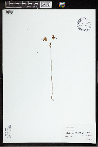
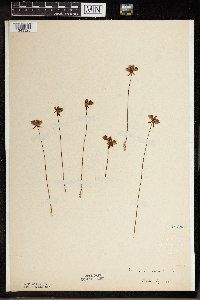
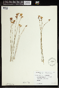
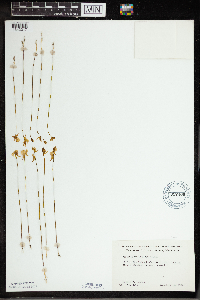
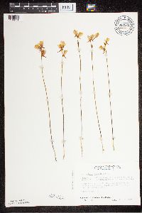
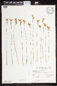
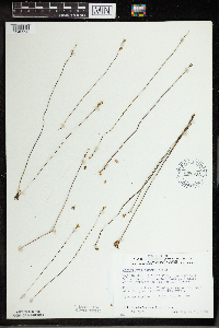
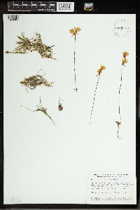
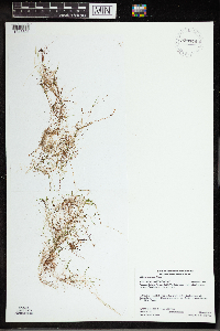
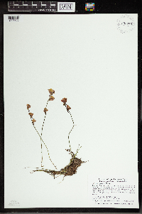
MIN:Plants | Utricularia cornuta Michaux 478901[1318627]Dahle, R. 010232001-06-27 United States, Minnesota, Anoka, Anoka County...In Pioneer Park in Blaine...T 31N R 23W SE1/4 of SE1/4 of Sec 4;;031N;23W;04, 45.2002778 -93.2083333 |
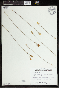
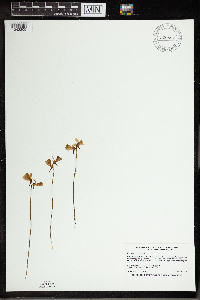
MIN:Plants | Utricularia cornuta Michaux 473172[1343309]Husveth, J. JJH99-0401999-07-22 United States, Minnesota, Anoka, Anoka County ... Pioneer Park, northern Blaine ... T31N R23W SESE SEC 4;;031N;23W;04, 45.1988889 -93.2083333 |
MIN:Plants | Utricularia cornuta Michaux 436760[1343310]Scott, P. 14152002-08-25 United States, Minnesota, Cook, Cook County ... W end of Finn Lake, BWCAW. T64N R3W sec.14 SENESW.;Boundary Waters Canoe Area Wilderness / Superior National Forest;064N;03W;14, 48.024908 -90.6665693 |
MIN:Plants | Utricularia cornuta Michaux 191383[1343325]Anonymous 33421888-07-12 United States, Minnesota, Marshall, Argyle;;156N;48W;, 48.332755 -96.820895 |
MIN:Plants | Utricularia cornuta Michaux 220917[1343331]Shapiro, M. s.n.1925-08-00 United States, Minnesota, Saint Louis, Virginia;;N;;, 47.53779 -92.552714 |
MIN:Plants | Utricularia cornuta Michaux 371709[1343330]Lakela, Olga 47241941-08-09 United States, Minnesota, Lake, Ca. 3 mi. E of the jct. of Ely-Finland road on Isabella-Tofte Road;Superior National Forest;N;;, 47.414618 -91.184875 |
MIN:Plants | Utricularia cornuta Michaux 417526[1343332]Lakela, Olga 110451950-08-03 United States, Minnesota, Saint Louis, Near Wahlsten Station, Hwy. 35, S of Tower.;;N;;, 47.7333 -92.2833 |
MIN:Plants | Utricularia cornuta Michaux 443296[1343324]Lakela, Olga 134731961-07-20 United States, Minnesota, Saint Louis, On Sturgeon Lake Road N of the Observation Tower, ca. 20 mi. N of Hibbing.;;N;;, 47.716656 -92.937689 |
MIN:Plants | Utricularia cornuta Michaux 443442[1318632]Boe, J.; et al. 960711041996-07-11 United States, Minnesota, Aitkin, Fire Tower Pond. SE1/4 of NE1/4 of section.;Savanna State Forest;049N;23W;16, 46.7321249 -93.2653206 |
MIN:Plants | Utricularia cornuta Michaux 473805[1343295]Myhre, K. 5178A1994-07-05 United States, Minnesota, Itasca, Itasca Co.; located one quarter mile north of Joel Lake; T 60N R 26W SE1/4 of SW1/4 of Sec 14;Chippewa National Forest;060N;26W;14, 47.676551 -93.611535 |
MIN:Plants | Utricularia cornuta Michaux 481096[1343327]Lakela, Olga 167421953-08-09 United States, Minnesota, Saint Louis, St. Louis County...Iron Lake, W side, opposite Curtain Falls, Canadian boundary;Boundary Waters Canoe Area Wilderness / Superior National Forest;066N;12W;06, 48.219513 -91.957793 |
MIN:Plants | Utricularia cornuta Michaux 491808[1343326]Lakela, Olga 171811953-09-08 United States, Minnesota, Saint Louis, N of Sturgeon Lake, Hwy. 5.;;N;;, 47.763775 -93.018127 |
MIN:Plants | Utricularia cornuta Michaux 506853[1318634]Smith, Welby 180131990-08-19 United States, Minnesota, Cook, Boundary Waters Canoe Area Wilderness / Superior National Forest. Cook County...in a shallow bay on the N side of Tuscarora Lake in the Boundary Waters Canoe Area Wilderness, Superior National Forest...T64N R4W SE1/4 of NE1/4 of Sec 7. 064N 04W 7, 48.0441666 -90.8761139 |
MIN:Plants | Utricularia cornuta Michaux 519319[1343313]Scott, P. 9061996-08-16 United States, Minnesota, Cook, Cook Co. Fiddle Pond T63NR1W sec.2 NSW.;Superior National Forest;063N;01W;2, 47.9688919 -90.4151467 |
MIN:Plants | Utricularia cornuta Michaux 519382[1343312]Scott, P. 8101995-08-08 United States, Minnesota, Cook, Cook Co. Grand Marais Fen T61N R1E sec.18 NNE.;North Shore / Superior National Forest;061N;01E;18, 47.766516 -90.3717157 |
MIN:Plants | Utricularia cornuta Michaux 525970[1343322]Lakela, Olga 188251955-07-14 United States, Minnesota, Saint Louis, Island Lake, Hwy. 4.;;N;;, 47.019814 -92.145172 |
MIN:Plants | Utricularia cornuta Michaux 526104[`1343329]Lakela, Olga 191321955-08-09 United States, Minnesota, Saint Louis, Gilbert;;N;;, 47.488816 -92.464905 |
MIN:Plants | Utricularia cornuta Michaux 532571[1343323]Lakela, Olga 205231956-07-23 United States, Minnesota, Saint Louis, S of Gilbert, ca. 1 mi. from Bass Lake;;N;;, 47.488816 -92.464905 |
MIN:Plants | Utricularia cornuta Michaux 657406[1343317]Ownbey, Gerald 47901974-07-12 United States, Minnesota, Beltrami, 11.3 mi. N of Waskish.;;N;;, 48.374507 -94.520708 |
MIN:Plants | Utricularia cornuta Michaux 687523[1318631]Wheeler, Gerald; Glaser, Paul 19651977-07-09 United States, Minnesota, Itasca, Site 41. SW1/4 SW1/4 Sec. 22, T57N, R25W. ca. 11 mi. NNE of Grand Rapids.;;057N;25W;22, 47.406624 -93.504033 |
MIN:Plants | Utricularia cornuta Michaux 698379[1318630]Wheeler, Gerald; Glaser, Paul 31801978-07-13 United States, Minnesota, Beltrami, Ca. 18 mi. NW of the Waskish Airport. Western Water Track Area.;Red Lake Wildlife Management Area;155N;33W;10, 48.2594157 -94.8711258 |
MIN:Plants | Utricularia cornuta Michaux 698445[1343319]Wheeler, Gerald 32461978-07-15 United States, Minnesota, Beltrami, Red Lake Indian Reservation. Red Lake Peatland: NW1/4 SE1/4 Sec. 15, T156N, R32W; ca. 16 mi. NW of the Washkish Airport. Western edge of Ovoid Isla Red Lake Peatland: NW1/4 SE1/4 Sec. 15, T156N, R32W; ca. 16 mi. NW of the Washkish Airport. Western edge of Ovoid Islands area; ca. 0.25 mi. SW of Camp No. II. o. 156N 32W 15, 48.3320432 -94.7420637 |
MIN:Plants | Utricularia cornuta Michaux 698494[1343316]Wheeler, Gerald; Glaser, Paul 32981978-07-17 United States, Minnesota, Beltrami, Red Lake Indian Reservation. SW1/4 NE1/4 Sec. 24, T156N, R32W; ca. 14 mi. NW of the Waskish Airport. Ovoid Islands area; ca. 1 1/4 mi. N of Camp No. SW1/4 NE1/4 Sec. 24, T156N, R32W; ca. 14 mi. NW of the Waskish Airport. Ovoid Islands area; ca. 1 1/4 mi. N of Camp No. I.. 156N 32W 24, 48.3176549 -94.6958535 |
MIN:Plants | Utricularia cornuta Michaux 698626[1343296]Wheeler, Gerald; Glaser, Paul 33571978-08-31 United States, Minnesota, Koochiching, Red Lake Peatland Scientific Natural Area. Koochiching Co.; SW1/4 NW1/4 Sec. 15, T156N, R29W; ca. 8.5 mi. E of Rte. 72 and 10.5 mi. NNE of the Waskish Airport Koochiching area.. 156N 29W 15, 48.33164 -94.348901 |
MIN:Plants | Utricularia cornuta Michaux 698630[1343314]Wheeler, Gerald; Glaser, Paul 33611978-08-31 United States, Minnesota, Koochiching, Red Lake Peatland Scientific Natural Area. Koochiching Co.; Red Lake Peatland; NW1/4 NW1/4 Sec. 16, T156N, R29W; ca. 8.5 mi. E of Rte. 72 and 10.5 mi. NNE of the Waskish Airport. Koochiching Area.. 156N 29W 16, 48.33103 -94.37074 |
MIN:Plants | Utricularia cornuta Michaux 702239[1343315]Glaser, Paul 11081979-08-26 United States, Minnesota, Saint Louis, SE1/4 NW1/4 Sec. 8, R12W; N edge of Hornby Lake.;;056N;12W;8, 47.350385 -91.888317 |
MIN:Plants | Utricularia cornuta Michaux 726301[1318626]Smith, Welby 27421980-07-10 United States, Minnesota, Saint Louis, Arlberg Bog. On the N side of Co. Rd. 8, ca. 10.5 mi. due E of Floodwood.;;051N;19W;1, 46.923275 -92.614082 |
MIN:Plants | Utricularia cornuta Michaux 743910[1343328]Ownbey, Gerald 65981980-07-13 United States, Minnesota, Clearwater, Along Rte. 5, 5.4 mi. N of Clearbrook, T150N, R37W, Sec. 31, NE1/4.;;150N;37W;31, 47.7681475 -95.4412689 |
MIN:Plants | Utricularia cornuta Michaux 770710[1343318]Smith, Welby 83421983-07-17 United States, Minnesota, Koochiching, Koochiching Co.; About 9 mi. north of Northome. SW1/4 NE1/4 Sec. 3, T152N, R29W.;Lost River Peatland Scientific Natural Area;152N;29W;3, 48.013141 -94.343678 |
MIN:Plants | Utricularia cornuta Michaux 781095[1343321]Smith, Welby 99071984-08-29 United States, Minnesota, Saint Louis, At the N end of Trout Lake, in the Boundary Waters Canoe Area. SE1/4 SE1/4 Sec. 24, T64N, R16W.;Boundary Waters Canoe Area Wilderness / Superior National Forest;064N;16W;24, 48.4833 -92.8 |
MIN:Plants | Utricularia cornuta Michaux 781323[1318629]Smith, Welby 95931984-07-26 United States, Minnesota, Clearwater, On the E side of Hwy. 5, ca. 2 1/4 mi. N of its jct. with Hwy. 92 in Clearbrook. SW1/4 NW1/4 Sec. 17, T149N, R37W.;;149N;37W;17, 47.7244437 -95.4201159 |
MIN:Plants | Utricularia cornuta Michaux 781828[1343320]Smith, Welby 95691984-07-11 United States, Minnesota, Clearwater, Ca. 9 mi. NE of Clearbrook. SW1/4 NE1/4 Sec. 19, T150N, R36W.;;150N;36W;19, 47.7968443 -95.3119154 |
MIN:Plants | Utricularia cornuta Michaux 834352[1318628]Smith, Welby 20040A1991-08-24 United States, Minnesota, Lake, Superior National Forest. Lake County...About 16 mi NW of Isabella and about 1 mi W of Hwy 1 on FR 424 (Denley Rd.); T60N R11W SW1/4 of SE1/4 of Sec 1. 060N 11W 1, 47.7075005 -91.6616669 |
MIN:Plants | Utricularia cornuta Michaux 914623[1343307]Smith, Welby; et al. 314032009-08-28 United States, Minnesota, Cook, Between Wanihigan and Mulligan Lakes. NW1/4 of SE1/4 of section;Boundary Waters Canoe Area Wilderness / Superior National Forest;063N;03W;01, 47.9655556 -90.6427778 |
MIN:Plants | Utricularia cornuta Michaux 489209[1318635]Gerdes, Lynden 48042003-07-24 United States, Minnesota, Lake, Superior National Forest. T60N R07W S33NWNE Lake County ... Superior National Forest . Approximately 6.41 miles ENE of Isabella, MN and 1.38 mile NW of Scott Lake. Bog pond basin 0.81 mile N of the Wanless Road ... Near east-central edge.. 060N 07W 33, 47.63804 -91.224396 |
MIN:Plants | Utricularia cornuta Michaux 491211[1343311]Smith, Welby 295192005-08-19 United States, Minnesota, Lake, Boundary Waters Canoe Area Wilderness / Superior National Forest. Lake County ... About 2 miles southwest of Bald Eagle Lake in the Boundary Waters Canoe Area Wilderness, Superior National Forest ... T62N R10W SW1/4 of SW1/4 of Sec 33. 062N 10W 33, 47.8074989 -91.6144409 |
MIN:Plants | Utricularia cornuta Michaux 511399[1318633]Lee, Michael MDL26871999-08-10 United States, Minnesota, Lake, North Shore. Lake County ... Along Blesner Creek 6-1/2 miles northeast of Finland. Along County Road 7, opposite its jct. with the Sonju Lake Forest Road ... T58N R6W SW1/4 of NE1/4 of NE1/4 Sec. 31. 058N 06W 31, 47.465174 -91.139867 |
MIN:Plants | Utricularia cornuta Michaux 914626[1343306]Smith, Welby; et al. 314192009-08-29 United States, Minnesota, Cook, Boundary Waters Canoe Area Wilderness / Superior National Forest. Cook County ... Boundary Waters Canoe Area Wilderness, Superior National Forest. Unnamed bay on the north side of Winchell Lake ... T64N R2W NW1/4 of SE1/4 of Sec 30. 064N 02W 30, 47.9941667 -90.6247222 |
MIN:Plants | Utricularia cornuta Michaux 505654[1343308]Myhre, K. 63921996-07-02 United States, Minnesota, Aitkin, Aitkin County ... Located one mile southwest of Blackface Lake ... Long Lake ... T 51N R 23W NE1/4 of NE1/4 of Sec 16;Savanna State Forest;051N;23W;16, 46.904085 -93.2618676 |
MIN:Plants | Utricularia cornuta Michaux 928654[1343303]Smith, Welby 161271989-08-15 United States, Minnesota, Cook, Flowage between South Temperance Lake and Brule Lake. NE of SW of section;Boundary Waters Canoe Area Wilderness / Superior National Forest;063N;03W;18, 47.9390553 -90.7572317 |
MIN:Plants | Utricularia cornuta Michaux 920897[1343305]Smith, Welby 236741993-08-21 United States, Minnesota, Cook, Boundary Waters Canoe Area Wilderness / Superior National Forest. Superior National Forest, Boundary Waters Canoe Area Wilderness...pond between Kiskadinna Lake and Davis Lake...T 64N R 3W SW1/4 of NW1/4 of Sec 27. 064N 03W 27, 47.8736111 -90.6991667 |
MIN:Plants | Utricularia cornuta Michaux 923389[1343304]Rowe, Erika ERR4442008-07-17 United States, Minnesota, Mahnomen, Waubun Prairie Wildlife Management Area / White Earth Indian Reservation. T143N R41W SESE30...Wauben [sic] WMA/Wauben[sic] WPA; 1 mile north of Becker County line; 1.8 miles east of State Hwy 59. 143N 41W 30, 47.1666667 -95.9158333 |
MIN:Plants | Utricularia cornuta Michaux 928659[1343302]Smith, Welby 160971989-08-11 United States, Minnesota, Cook, NW end of Vern Lake. SW1/4 of SE1/4 of section;Boundary Waters Canoe Area Wilderness / Superior National Forest;063N;03W;29, 47.911002 -90.7352286 |
MIN:Plants | Utricularia cornuta Michaux 929446[1343301]Gerdes, Lynden B.; Walewski, Joe W. 61522010-08-04 United States, Minnesota, Lake, Ester Lake. Just north of narrows between Ester Lake and Hanson Lake. SESWSWSW of section;Superior National Forest;066N;06W;35, 48.1511111 -91.0725 |
MIN:Plants | Utricularia cornuta Michaux 935375[1343300]Smith, Welby R; Gerdes, Lynden B 332912011-08-09 United States, Minnesota, Lake, At the west end of Lake Isabella where it joins the Isabella River. SE of NW of section;Boundary Waters Canoe Area Wilderness / Superior National Forest;062N;07W;31, 47.8108667 -91.2675167 |
MIN:Plants | Utricularia cornuta Michaux 938084[1343299]Perry, Ethan 120232012-06-27 United States, Minnesota, Saint Louis, Collected from southwest shore of small bog pond about 650 m west of Esswhtar Lake. SW, 47.0855556 -91.9511111 |
MIN:Plants | Utricularia cornuta Michaux 937780[1343298]Gerdes, Lynden B.; Gockman, Otto 67642012-08-18 United States, Minnesota, Lake, Thomas Lake. Western shoreline of lake ~ 0.28 miles south of portage exiting to Hatchet Lake.;Boundary Waters Canoe Area Wilderness / Superior National Forest;064N;07W;29, 48 -91.251111 |
MIN:Plants | Utricularia cornuta Michaux 142219[1343297]Smith, Welby R.; Gerdes, Lynden B. 318112010-06-29 United States, Minnesota, Cook, Some distance south of Skipper Lake. NE of SE of section;Boundary Waters Canoe Area Wilderness / Superior National Forest;064N;02W;08, 48.0372222 -90.6008333 |
MIN:Plants | Utricularia cornuta Michaux 960325[1318850] 1906-07-00 |
MIN:Plants | Utricularia cornuta Michaux 960740[1329345]Lee, Michael MDL32412002-08-26 United States, Minnesota, Lake, Strongly rolling morainal terrain south of Dumbbell Lake, 3.5 miles east-southeast of Isabella. SE1/4 of NE1/4 of SE1/4 Sec. 12, Superior National Forest, 47.610151 -91.289154 |
MIN:Plants | Utricularia cornuta Michaux 937374[1344606]Miller, James S. 84351994-11-12 United States, Florida, Okaloosa, Eglin Air Force Base, 1 miles West of Florida State Route 85 on Route 211., 30.681667 -86.583889, 50m |
MIN:Plants | Utricularia cornuta Michaux 191381[1344607]Nash, Geo. V. s.n.1894-07-16 United States, Florida, Lake |
MIN:Plants | Utricularia cornuta Michaux 523387[1344608] s.n.1903-09-26 United States, Michigan, Vestaburg, 43.399198 -84.905571 |
MIN:Plants | Utricularia cornuta Michaux 589208[1344609]Eiten, George P-71959-08-01 United States, New Jersey, Ocean, Rt. 539, 1/2 way between junction. of 530-539 and 72-539. Ocean co, 39.764228 -74.368234 |
MIN:Plants | Utricularia cornuta Michaux 191389[1344610]Waghorne, Rev. A.C. s.n.1895-07-27 Canada, Newfoundland |
MIN:Plants | Utricularia cornuta Michaux 191392[1344611]Tracy, S.M. 84851903-05-28 United States, Florida, Santa Rosa Island, 30.396448 -86.733791 |
MIN:Plants | Utricularia cornuta Michaux 191372[1344612] 83541891-07-12 United States, Indiana, Lake, Whiting, 41.679758 -87.494487 |
MIN:Plants | Utricularia cornuta Michaux 191377[1344613]Mitchays, E.H. s.n.1886-07-09 United States, Massachusetts |
MIN:Plants | Utricularia cornuta Michaux 191371[1344614]Sheldon, C.S. s.n.1882-07-14 United States, New York, Oswego |
MIN:Plants | Utricularia cornuta Michaux 191391[1344615]Brinton, J.B. s.n.1889-09-00 United States, New Jersey, Cranberry road; Egg Harbor, 39.383653 -74.597092 |
MIN:Plants | Utricularia cornuta Michaux 191386[1344616]Hitchcock, A.S. 2621900-07-00 United States, Florida, Lee, Fort Myers, 26.63721 -81.880739 |
MIN:Plants | Utricularia cornuta Michaux 191394[1344617]Barnhart, John Hendley 27661899-05-12 United States, Florida, Hillsborough, Cross Bayou, 27.838477 -82.752693 |
MIN:Plants | Utricularia cornuta Michaux 191393[1344618]Tracy, S.M. 75591901-05-28 United States, Florida, Johns Pass, 26.069816 -81.791477 |
MIN:Plants | Utricularia cornuta Michaux 306637[1344619]Smith, Benjamin H. s.n.1904-03-12 United States, Florida, [Orkney?] |
MIN:Plants | Utricularia cornuta Michaux 191385[1344620]Schrenk, Hermann s.n.1892-09-17 United States, New York, H.S. Meadowbrook Bog; Long Island; Hempstead Plains, 40.7 -73.6167 |
MIN:Plants | Utricularia cornuta Michaux 191390[1344621]Camp, S. H. s.n.1895-07-09 United States, Michigan, Jackson |
MIN:Plants | Utricularia cornuta Michaux 191380[1344622] s.n.1880-11-00 United States, Alaska, Spring Hill |
Google Map
Google Maps is a web mapping service provided by Google that features a map that users can pan (by dragging the mouse) and zoom (by using the mouse wheel). Collection points are displayed as colored markers that when clicked on, displays the full information for that collection. When multiple species are queried (separated by semi-colons), different colored markers denote each individual species.
