University of Minnesota
http://www.umn.edu/
612-625-5000
http://www.umn.edu/
612-625-5000
Minnesota Biodiversity Atlas
Bell Museum
Dataset: MIN-Plants
Taxa: Lobeliaceae
Search Criteria: excluding cultivated/captive occurrences
Bell Museum plants | |
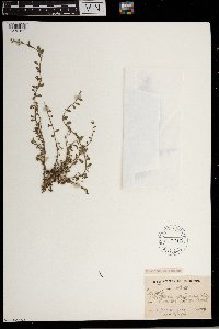
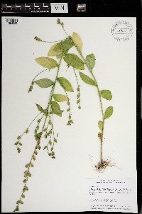
MIN:Plants | 197919[1372125]J. Medly Wood s.n.1890-12-04 South Africa, Natal, 4000m |
MIN:Plants | 582164[1372132]Sidey, James L. 36851963-03-00 South Africa, East Cape |
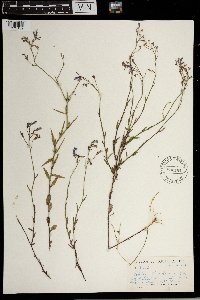
MIN:Plants | 582385[1299496]Sidey, James 34291960-01-00 South Africa, East Cape Region, [no further data] |
MIN:Plants | 197892[1372126]Schlechter 2261892-02-16 South Africa, Capeflats prope Claremont, 24m |
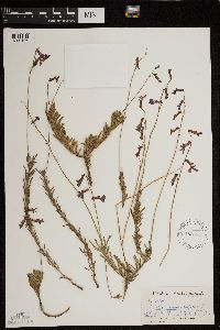
MIN:Plants | 197891[1372127]J. Medley Wood 48461893-07-11 South Africa, Natal, 250m |
MIN:Plants | 569711[1372128]Sidey, J. L. 36161961-12-00 South Africa, Bathurst Dist. E. cape |
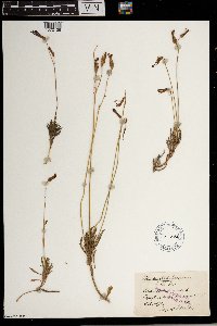
MIN:Plants | 441146[]Scott, P. 18372004-08-24 United States, Minnesota, Lake, Nickel Lake. NWNESW of section;Superior National Forest;062N;10W;29, 47.8266734 -91.6289786 |
MIN:Plants | 197977[]Wheeler, William 6121899-08-24 United States, Minnesota, Houston, Brownsville;;103N;04W;, 43.7185403 -91.3173949 |
MIN:Plants | 197978[]Taylor, B. T15381892-08-00 United States, Minnesota, Chisago, Chisago City;;N;;, 45.367787 -92.888565 |
MIN:Plants | 197979[]Sandberg, John s.n.1890-08-00 United States, Minnesota, Hennepin, [no further data];;;;, 45 -93.47 |
MIN:Plants | 197980[]Aiton, G. s.n.1890-07-00 United States, Minnesota, Chisago, [no further data];;;;, 45.528143 -92.910889 |
MIN:Plants | 197981[]Hvoslef, H. s.n.1935-00-00 United States, Minnesota, Fillmore, Lanesboro;;N;;, 43.717075 -91.971329 |
MIN:Plants | 197982[]Wheeler, William 5541899-08-18 United States, Minnesota, Houston, Jefferson;Dorer Memorial Hardwood State Forest;101N;04W;35, 43.50806 -91.28287 |
MIN:Plants | 224955[]Rosendahl, C. 51121926-08-26 United States, Minnesota, Houston, Sheldon Valley;Dorer Memorial Hardwood State Forest;N;;, 43.678301 -91.593199 |
MIN:Plants | 264086[]Holzinger, John s.n.1905-07-00 United States, Minnesota, Winona, Pleasant Valley, Winona Co.;;N;;, 44.018852 -91.609314 |
MIN:Plants | 264274[]Holzinger, John s.n.1905-07-00 United States, Minnesota, Winona, Pleasant Valley, Winona Co.;;N;;, 44.018852 -91.609314 |
MIN:Plants | 333529[]Oestlund, O. 2841888-08-20 United States, Minnesota, Hennepin, [no further data];;;;, 45 -93.47 |
MIN:Plants | 371710[]Lakela, Olga 45431941-07-13 United States, Minnesota, Saint Louis, At the Randolph's Resort, Crane Lake;Superior National Forest;N;;, 48.2833 -92.4667 |
MIN:Plants | 383632[]Moore, John 160181943-08-25 United States, Minnesota, Winona, Winona Co.; Below Gwinn's Bluff;Great River Bluffs State Park;106N;05W;, 43.942065 -91.4667 |
MIN:Plants | 383690[]Moore, John 159931943-08-24 United States, Minnesota, Fillmore, 2 mi. up the Root River from Peterson;;N;;, 43.764787 -91.878836 |
MIN:Plants | 385933[]Rosendahl, C. 77471945-09-15 United States, Minnesota, Houston, Below W Beaver Spring, Sec. 17, Caledonia Twp.;Beaver Creek Valley State Park;102N;06W;17, 43.6378795 -91.5811022 |
MIN:Plants | 407423[]Lakela, Olga 96721949-09-01 United States, Minnesota, Saint Louis, Shore of Lake Kabetogama. Park Point Resort.;Voyageurs National Park;N;;, 48.429495 -92.998535 |
MIN:Plants | 429404[]Myhre, K. 9581991-09-04 United States, Minnesota, Aitkin, Aitkin Co.; 4 miles south of Glen, 5 miles east, 1 mile south; T 45N R 24W NE1/4 of NW1/4 of Sec 29;;045N;24W;29, 46.3551056 -93.4000467 |
MIN:Plants | 440898[]Smith, Welby 138811987-08-16 United States, Minnesota, Lake, Boundary Waters Canoe Area Wilderness / Superior National Forest. Lake County...In the BWCAW, Superior National Forest. Along portage; between Square Lake and Kawasachong Lake. NE1/4 SE1/4 sec.8, T62N R6W. 062N 06W 8, 47.868402 -91.11862453 |
MIN:Plants | 442959[]Lakela, Olga 137401951-09-13 United States, Minnesota, Saint Louis, Shorewoods at Crane lake, the Congdon Resort;Superior National Forest;N;;, 48.2833 -92.4667 |
MIN:Plants | 443495[]Boe, J. 960826041996-08-26 United States, Minnesota, Aitkin, Aitkin Co.; Hedbom Trail 2.0 miles east of corner; T 051N R 022W NW1/4 of NW1/4 of Sec 15;Savanna State Forest;051N;22W;15, 46.9035542 -93.1110334 |
MIN:Plants | 459010[]Gerdes, Lynden 23041997-08-11 United States, Minnesota, Aitkin, Aitkin Co.; T50N R22W S06NENW. Aitkin Co.; Savanna State Park, NE of Savanna Lake along forest trail.;Savanna Portage State Park;050N;22W;6, 46.845996 -93.1774497 |
MIN:Plants | 462458[]Lakela, Olga 148901952-07-13 United States, Minnesota, Saint Louis, Pine Island, Kabetogama Lake;Voyageurs National Park;N;;, 48.448524 -92.930707 |
MIN:Plants | 462697[]Lakela, Olga 149191952-07-13 United States, Minnesota, Saint Louis, Pine Island in Lake Kabetogama;Voyageurs National Park;N;;, 48.448524 -92.930707 |
MIN:Plants | 491862[]Lakela, Olga 167551953-08-10 United States, Minnesota, Saint Louis, St. Louis County...Beatty Portage from Lac La Croix;Boundary Waters Canoe Area Wilderness / Superior National Forest;067N;15W;20, 48.3333 -92.1167 |
MIN:Plants | 515164[]Myhre, K. 7451991-08-26 United States, Minnesota, Aitkin, Savanna Portage State Park. Aitkin Co.; North on Savana [sic] Portage State Park road to Loon Lake; trail around Loon Lake; T 50N R 23W SE1/4 of SE1 Aitkin Co.; North on Savana [sic] Portage State Park road to Loon Lake; trail around Loon Lake; T 50N R 23W SE1/4 of SE1/4 of Sec 12. 050N 23W 12, 46.8314563 -93.2002679 |
MIN:Plants | 518781[]Smith, Welby 147531988-08-08 United States, Minnesota, Washington, Washington Co.; at the south end of Marine; St. Croix River. SW1/4 NW1/4 sec.7, T 31N R 19W;;031N;19W;7, 45.19 -92.771274 |
MIN:Plants | 520621[]Nation, R. 94-2901994-07-18 United States, Minnesota, Mower, Lake Louise State Park. Mower Co.; Tract 16B. T101N R14W SE1/4 of SE1/4 of sec.20;Lake Louise State Park;101N;14W;20, 43.5365716 -92.5389859 |
MIN:Plants | 583978[]Gunderson, R. 5351961-08-06 United States, Minnesota, Washington, Washington County ... St. Croix River, 3 mi. N of Stillwater;Saint Croix National Riverway;030N;20W;, 45.099799 -92.806041 |
MIN:Plants | 616850[]Moore, John; Moore, Marjorie 4411969-08-26 United States, Minnesota, Crow Wing, Crow Wing Natural History Area. Near the creek SE of Chandler Lake, SW1/4 Sec. 22, Garrison Twp.;Crow Wing Natural Area;044N;28W;22, 46.2789902 -93.8633363 |
MIN:Plants | 696691[]Smith, Welby 7771978-08-12 United States, Minnesota, Wright, Wright Co.; T121N, R27W, NW1/4 Sec. 5. T121N, R27W, NW1/4 Sec. 5. Between Clearwater Lake and Bass Lake.;;121N;27W;5, 45.322602 -94.111449 |
MIN:Plants | 697743[]Ownbey, Gerald; et al. 53471976-08-26 United States, Minnesota, Houston, Houston Co. Rt. 26, 1.3 mi. N of Iowa border at New Albin.;Dorer Memorial Hardwood State Forest;101N;04W;, 43.5438967 -91.3125642 |
MIN:Plants | 698928[]Sather, Nancy; et al. 3031976-07-19 United States, Minnesota, Lake, Lake Co, Plot 17. N1/2 SE1/4 NW1/4 Sec. 18, T60N, R11W.;Superior National Forest;060N;11W;18, 47.6847379 -91.7786208 |
MIN:Plants | 698929[]Sather, Nancy; et al. 2891976-07-21 United States, Minnesota, Lake, Lake Co, S1/2 SW1/4 NW1/4 Sec. 13, T60N, R11W. Plot 26.;Superior National Forest;060N;11W;13, 47.6835907 -91.6654576 |
MIN:Plants | 700485[]Ownbey, Gerald 61531978-08-15 United States, Minnesota, Houston, Houston Co. T102N, R5W, NW1/4 Sec. 22. Mayville Twp. N-facing bluff of N Fork, Crooked Creek.;Dorer Memorial Hardwood State Forest;102N;05W;22, 43.6232853 -91.4223316 |
MIN:Plants | 704664[]Smith, Welby 17161979-08-16 United States, Minnesota, Wabasha, T109N, R09W, NE1/4 NE1/4 Sec. 19. 1.6 km. due E of Hwy. 61.;;109N;09W;19, 44.229186 -91.939369 |
MIN:Plants | 722612[]Lustig, K. 9881979-08-23 United States, Minnesota, Anoka, Anoka County...Boot Lake SNA: 18 mi. SE of Cambridge, Sec. 17, 18, 19, 20, T33N, R22W;Boot Lake Scientific Natural Area;033N;22W;00, 45.3406583 -93.0814633 |
MIN:Plants | 729921[]Converse, C. 7181980-07-23 United States, Minnesota, Pine, Pine Co. Kettle River Natural Area: 5.5 mi E of Hinckley. NE1/4 SE1/4 Sec. 22, T141N, R20W.;Kettle River Scientific Natural Area / Sandstone National Wildlife Refuge;141N;20W;22, 46.021973 -92.855355 |
MIN:Plants | 747296[]Galatowitsch, S. 8211982-09-12 United States, Minnesota, Houston, Caledonia Oaks: T102N, R5W, E1/2 SW/4 Sec. 24.;Caledonia Oaks, The Nature Conservancy;102N;05W;24, 43.6231026 -91.3824233 |
MIN:Plants | 758980[]Smith, Welby 74161982-08-20 United States, Minnesota, Mower, Cartney Wildlife Management Area. Cartney State Wildlife Management Area, ca. 5 mi. NNW of Le Roy. Adjacent to the West Branch Little Iowa River. NW1/4 Cartney State Wildlife Management Area, ca. 5 mi. NNW of Le Roy. Adjacent to the West Branch Little Iowa River. NW1/4 NE1/4 Sec. 5, T101N, R14W.. 101N 14W 5, 43.5800482 -92.5392342 |
MIN:Plants | 770606[]Smith, Welby 86491983-08-16 United States, Minnesota, Mower, Lake Louise State Park, ca. 1.5 mi. NW of Le Roy. On the N bank of the Iowa River. NE1/4 NW1/4 Sec. 28, T101N, R14W.;Lake Louise State Park;101N;14W;28, 43.5220987 -92.5189584 |
MIN:Plants | 776297[]Morley, T. 16611985-07-28 United States, Minnesota, Scott, Murphy-Hanrahan County Park Reserve. Scott Co. Murphy-Hanrehan Park Reserve, Credit River Twp. N1/2 NE1/4 Sec. 3. SE part of outermost cross-country ski tr Scott Co. Murphy-Hanrehan Park Reserve, Credit River Twp. N1/2 NE1/4 Sec. 3. SE part of outermost cross-country ski trail. Pond is on E side of trail at foot of first N-facing slope going N from the. 114N 21W 3, 44.715047 -93.324045 |
MIN:Plants | 796492[]Cholewa, A.; Engels, A. 15141988-08-05 United States, Minnesota, Aitkin, Aitkin Co. Savanna Portage State Park; along portage trail near road to Loon and Savanna Lakes; T50N, R22W, Sec. 7;Savanna Portage State Park;050N;22W;7, 46.8314352 -93.1778424 |
MIN:Plants | 800918[]Smith, Welby 124491986-08-11 United States, Minnesota, Goodhue, Goodhue County...Hay Creek Recreation Area, ca. 2 mi. S of Red Wing. NE1/4 NE1/4 Sec. 12, T112N, R15W;Dorer Memorial Hardwood State Forest;112N;15W;12, 44.5247231 -92.5538864 |
MIN:Plants | 829787[]Fuge, E. 601993-08-13 United States, Minnesota, Dakota, Dakota Co. 6 mi S of Hastings S of Red Wing Tr at end of Records Tr.; T114N R16W NW1/4 of SE1/4 of Sec.32;Dorer Memorial Hardwood State Forest;114N;16W;32, 44.6367137 -92.7622913 |
MIN:Plants | 831051[]Cholewa, A. 20521992-06-00 United States, Minnesota, Aitkin, Aitkin Co. Hwy. 65 at Snake River, canoe access on co.rd. 61, T44N R23W Sec. 32.;;044N;23W;32, 46.2528633 -93.2721609 |
MIN:Plants | 836201[]Cholewa, A.; Engels, A. 24741995-09-08 United States, Minnesota, Aitkin, Savanna Portage State Park. Aitkin Co. Savanna Portage State Park, about 17 mi NE of McGregor, ridge between Savanna and Wolf lakes, T50N R22W S6 ne Aitkin Co. Savanna Portage State Park, about 17 mi NE of McGregor, ridge between Savanna and Wolf lakes, T50N R22W S6 near center. 050N 22W 6, 46.845996 -93.1774497 |
MIN:Plants | 839356[]Cholewa, A.; Engels, A. 23671995-07-27 United States, Minnesota, Aitkin, Savanna Portage State Park. Aitkin Co. Savanna Portage State Park, about 17 mi NE of McGregor, E side of Savanna Lake at boat access, T50N R22W S6 S Aitkin Co. Savanna Portage State Park, about 17 mi NE of McGregor, E side of Savanna Lake at boat access, T50N R22W S6 SE1/4 of NW1/4.. 050N 22W 6, 46.845996 -93.1774497 |
MIN:Plants | 841183[]Smith, Welby 137871987-08-11 United States, Minnesota, Washington, Washington Co. About 3 mi NW of Afton; SW1/4 NE1/4 sec.4, T28N R20W;;028N;20W;4, 44.943753 -92.809329 |
MIN:Plants | 916968[]Gerdes, Lynden 58722009-08-11 United States, Minnesota, Cook, Superior National Forest. T64N R01E S30NWNW Cook County, MN. Superior National Forest. Approximately 0.46 miles southeast of Locket Lake and 0.61 miles southwest of the Gunflint Trail...NAD 83 / 696139 / 5319317. 064N 01E 30, 47.9969444 -90.3705556 |
MIN:Plants | 921216[]Smith, Welby 24928A1994-07-26 United States, Minnesota, Aitkin, Savanna Portage State Park; about one mile west of Shumway Lake...T 50N R 22W SW1/4 of SE1/4 of Sec 7;Savanna Portage State Park;050N;22W;07, 46.8286111 -93.1744444 |
MIN:Plants | 930054[]Smith, Welby 160161989-07-31 United States, Minnesota, Kanabec, Along the Snake River; West side of Mora. NE1/4 of SE1/4 of section;;039N;24W;10, 45.8823676 -93.3178125 |
MIN:Plants | 931546[]Gerdes, Lynden B. 63242011-07-30 United States, Minnesota, Lake, Superior National Forest. Approxmiately 9.15 miles north of Isabella, MN and 0.62 miles east of the Northwest Road (FR 373) and FR 903 junction. NWSNESW. 061N 08W 20, 47.7480556 -91.3777778 |
MIN:Plants | 931516[]Gerdes, Lynden B. 63692011-08-14 United States, Minnesota, Lake, Baird Station area; approximately 15.26 miles NW of Isabella, MN and 0.15 miles north of Tony Lake. NWNWSENW of section;Superior National Forest;061N;10W;32, 47.7297222 -91.6341667 |
MIN:Plants | 959676[1318008]Lynden B. Gerdes 73322015-07-28 United States, Minnesota, Saint Louis, Superior National Forest. Approximately 5.54 miles NE of Cusson, MN. Along the old RR grade that runs easterly off FR 5609., 48.13222222 -92.73138889 |
MIN:Plants | 969844[1371432]J. Vigness-Pint 12003-07-07 United States, Minnesota, Ramsey, Drainage Area: Maplewood Priory Preserve, 44.988632 -92.989979 |
MIN:Plants | []Timothy J. S. Whitfeld 35022022-08-26 United States, Minnesota, Washington, Crystal Spring Scientific and Natural Area, 0.4 miles northeast of the intersection of Scandia Trail North and Hwy 95, 45.257812 -92.768018, 275m |
MIN:Plants | 970864[1394332]Smith, Welby R WRS358002017-08-24 United States, Minnesota, Winona, Whitewater State Wildlife Management Area, about 4.2 km (2.6 miles) NE of Elba at a heading of 43 degrees., 44.1162833 -91.98275 |
MIN:Plants | Cyanea leptostegia A. Gray 196801[]Heller, A. 27931895-09-02 United States, Hawaii, Kauai, Kauai, on Kaholuamanoa, above Waimea |
MIN:Plants | Lobelia spicata Lamarck 456051[]DeMink, L. 3672000-08-19 United States, Minnesota, Morrison, Crane Meadows National Wildlife Refuge; NWNE 30-T40N-R31W;Crane Meadows National Wildlife Refuge;040N;31W;30, 45.9338958 -94.2515644 |
MIN:Plants | Lobelia spicata Lamarck 483925[]Anderson, Craig 5371999-07-14 United States, Minnesota, Otter Tail, Ottertail Co.; Glacial Lake Agassiz; T131N R44W: NW1/4 of SE 1/4 of SW1/4 of Sect. 33;;131N;44W;33, 46.11589 -96.2144699 |
MIN:Plants | Lobelia spicata Lamarck 478987[]Ellsworth, L. 21302001-07-06 United States, Minnesota, Sherburne, Sherburne National Wildlife Refuge; SWNW 23-35-28; Santiago Savanna;Sherburne National Wildlife Refuge;035N;28W;23, 45.508593 -93.789216 |
MIN:Plants | Lobelia spicata Lamarck 491029[]Biederman, L.; et al. 98-231998-06-29 United States, Minnesota, Roseau, Roseau County ... along railroad ... T162N R40W NENE20;;162N;40W;20, 48.775139 -95.810817 |
MIN:Plants | Lobelia spicata Lamarck 498974[]Juhnke, C. 399 CMJ FRO1999-06-30 United States, Minnesota, Goodhue, Frontenac State Park. Frontenac State Park Goodhue County ...Next to prairie bluff just up the main park road north of the contact station ... NW NE NW 11. 112N 13W 11, 44.5199905 -92.3392244 |
MIN:Plants | Lobelia spicata Lamarck 539911[]Tester, John s.n.1957-07-23 United States, Minnesota, Mahnomen, Mahnomen County...Waubun prairie, 3-4 miles w. and 1 mile s. of Waubun. Sect. 33, T. 143N, R. 42W.;Waubun Prairie Wildlife Management Area / White Earth Indian Reservation;143N;42W;33, 47.1589041 -96.0074302 |
MIN:Plants | Lobelia spicata Lamarck 504865[]Nation, R.; Bolin, Kathy 94-2081994-07-01 United States, Minnesota, Mower, Lake Louise State Park. Mower County...Tract 13S. T101N R14W SE1/4 of SE1/4 of Sec.21.;Lake Louise State Park;101N;14W;21, 43.5365784 -92.5190432 |
MIN:Plants | Lobelia spicata Lamarck 198128[]Manning, Sara 35071892-07-07 United States, Minnesota, Wabasha, Lake City;;N;;, 44.451618 -92.279547 |
MIN:Plants | Lobelia spicata Lamarck 198129[]Aiton, G. 56-11890-07-00 United States, Minnesota, [no further data];;;;, 46 -94 |
MIN:Plants | Lobelia spicata Lamarck 198131[]Manning, Sara s.n.1886-06-18 United States, Minnesota, Wabasha, Lake City;;N;;, 44.451618 -92.279547 |
MIN:Plants | Lobelia spicata Lamarck 198136[]Sheldon, Edmund S31161892-07-00 United States, Minnesota, Mille Lacs, Princeton;;N;;, 45.566841 -93.586091 |
MIN:Plants | Lobelia spicata Lamarck 198139[]Burglehaus, F. s.n.1892-06-00 United States, Minnesota, Hennepin, Near Minneapolis;;N;;, 44.970736 -93.263149 |
MIN:Plants | Lobelia spicata Lamarck 198145[]Herrick, C. 284-11877-06-18 United States, Minnesota, Hennepin, Minneapolis;;N;;, 44.970736 -93.263149 |
MIN:Plants | Lobelia spicata Lamarck 198152[]Ainslie, G. s.n.1902-07-04 United States, Minnesota, Olmsted, Rochester;;106N;14W;, 43.97834 -92.49834 |
MIN:Plants | Lobelia spicata Lamarck 198160[]Sheldon, Edmund S6331891-06-00 United States, Minnesota, Waseca, Wilton;;N;;, 44.013852 -93.534387 |
MIN:Plants | Lobelia spicata Lamarck 198161[]Ballard, C. B4611891-07-00 United States, Minnesota, Scott, Prior's Lake;;N;;, 44.720982 -93.425645 |
MIN:Plants | Lobelia spicata Lamarck 198163[]Holzinger, John s.n.1886-06-00 United States, Minnesota, Winona, Winona Co.;;N;;, 44.059339 -91.678454 |
MIN:Plants | Lobelia spicata Lamarck 198166[]Sheldon, Edmund S32891892-07-00 United States, Minnesota, Mille Lacs, Bridgeman [other collections by Sheldon indicated Mille Lacs Co.; original name for current town of Foreston];;037N;27W;33, 45.6560302 -93.7079902 |
MIN:Plants | Lobelia spicata Lamarck 198168[]Frost, W. F2151892-07-00 United States, Minnesota, Kandiyohi, Willmar;;N;;, 45.123361 -95.046775 |
MIN:Plants | Lobelia spicata Lamarck 198170[]Taylor, B. T5501891-06-00 United States, Minnesota, Waseca, Janesville;;N;;, 44.121254 -93.709206 |
MIN:Plants | Lobelia spicata Lamarck 198172[]Sandberg, John s.n.1883-00-00 United States, Minnesota, Goodhue, Cannon Falls;;N;;, 44.511808 -92.905141 |
MIN:Plants | Lobelia spicata Lamarck 224964[]Butters, F.; et al. 50561926-07-23 United States, Minnesota, Anoka, Along Central Ave. road, northern Anoka Co.;;032N;23W;, 45.2545028 -93.2038334 |
MIN:Plants | Lobelia spicata Lamarck 224973[]Rosendahl, C. s.n.1924-09-19 United States, Minnesota, Scott, Savage. Minnesota River bottoms;;115N;22W;, 44.798765 -93.395607 |
MIN:Plants | Lobelia spicata Lamarck 291846[]Fryklund, P. s.n.1925-08-17 United States, Minnesota, Roseau, [no further data];;;;, 48.785741 -95.789307 |
MIN:Plants | Lobelia spicata Lamarck 348904[]McCartney, James 751938-07-14 United States, Minnesota, Scott, Hwy. 5 and Grass [sic =Geis] Lake;;114N;23W;00, 44.689828 -93.549216 |
MIN:Plants | Lobelia spicata Lamarck 356565[]Rosendahl, C.; Dahlberg, R. s.n.1918-08-00 United States, Minnesota, Marshall, Golden Valley;;N;;, 48.364143 -96.344717 |
MIN:Plants | Lobelia spicata Lamarck 359330[]Alaspa, E.; Alaspa, H. s.n.1940-08-05 United States, Minnesota, Wright, 5 mi S of Annandale, Wright Co.;;120N;27W;, 45.19034 -94.124427 |
MIN:Plants | Lobelia spicata Lamarck 359962[]Rosendahl, C.; Moyle, J.; Butters, F. 70681938-09-04 United States, Minnesota, Pennington, 5 mi N of Thief River Falls;;N;;, 48.172133 -96.182726 |
MIN:Plants | Lobelia spicata Lamarck 360669[]Butters, F. s.n.1918-09-00 United States, Minnesota, Saint Louis, Crab Lake, NE St. Louis Co.;;N;;, 47.942436 -92.063524 |
MIN:Plants | Lobelia spicata Lamarck 372001[]Moore, John; et al. 147221941-07-06 United States, Minnesota, Douglas, Along the railroad, 1 mi N of Garfield. Douglas Co.;;;;, 45.955273 -95.491987 |
MIN:Plants | Lobelia spicata Lamarck 381168[]Rosendahl, C.; et al. 75211942-06-16 United States, Minnesota, Winona, 3 mi. N and 1/2 mi. E of Utica;;;;, 44.01897 -91.944808 |
MIN:Plants | Lobelia spicata Lamarck 386036[]Moyle, J. 40151945-08-02 United States, Minnesota, Freeborn, S of Albert Lea;;N;;, 43.594826 -93.370326 |
MIN:Plants | Lobelia spicata Lamarck 396841[]Stevens, O. s.n.1947-07-26 United States, Minnesota, Clay, [no further data];Buffalo River State Park;139N;46W;10, 46.8693271 -96.4734276 |
MIN:Plants | Lobelia spicata Lamarck 412665[]Moore, John; Moore, Marjorie 116201939-08-10 United States, Minnesota, Kittson, Along the roadside. N section line of Sec. 15, Poppeeton Twp, 3.9 mi. E of Lancaster.;;N;;, 48.858283 -96.718432 |
MIN:Plants | Lobelia spicata Lamarck 426876[]Smith, Welby 209041992-07-15 United States, Minnesota, Marshall, Marshall Co.; In Old Mill State Park, about 11 miles east of Argyle; T 156N R 46W NW1/4 of SE1/4 of sec 4;Old Mill State Park;156N;46W;4, 48.3602791 -96.5702744 |
MIN:Plants | Lobelia spicata Lamarck 445814[]Moore, John; Huff, N. 179481945-07-25 United States, Minnesota, Morrison, 5 1/2 mi E of Little Falls;;N;;, 45.976297 -94.247915 |
Google Map
Google Maps is a web mapping service provided by Google that features a map that users can pan (by dragging the mouse) and zoom (by using the mouse wheel). Collection points are displayed as colored markers that when clicked on, displays the full information for that collection. When multiple species are queried (separated by semi-colons), different colored markers denote each individual species.
