University of Minnesota
http://www.umn.edu/
612-625-5000
http://www.umn.edu/
612-625-5000
Minnesota Biodiversity Atlas
Bell Museum
Dataset: MIN-Plants
Taxa: Oxalidaceae
Search Criteria: excluding cultivated/captive occurrences
Bell Museum plants | |
 MIN:Plants | Oxalis NULL 454079[]Young, Mary 1091916-09-16 United States, Texas, Brewster, Valley Chisos Mts.;Big Bend National Park |
MIN:Plants | 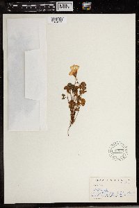 589842[1369577]Sidey, James L. 39511964-12-00 South Africa, Piet-Retief Dist. E. Tul |
MIN:Plants | 477138[]Hammer, W. s.n.2002-07-18 United States, Minnesota, Ramsey, Ramsey County, Arden Hills. Twin Cities Army Ammunition Plant-Arden Hills Army Training Site. Grass management unit 20. North central part of NW 1/4, NW 1/4, section 15, T.30 N, R.23W. 030N 23W 15, 45.091799 -93.164651 |
MIN:Plants | 909244[]Gerdes, Lynden 56462008-08-13 United States, Minnesota, Lake, T60N R10W S08NWSW Lake County ... Superior National Forest. Approximately 14.54 miles WNW of Isabella, MN. Highway 1.;Superior National Forest;060N;10W;08, 47.6963889 -91.6411111 |
MIN:Plants | 479126[]Husveth, J. 95-34281995-09-14 United States, Minnesota, Dakota, Dakota Co, T115N R16W SW1/4 of the SE1/4 of S31, Vermillion River.;;115N;16W;31, 44.718342 -92.779779 |
MIN:Plants | 510275[]Wheeler, Gerald 198201999-06-04 United States, Minnesota, Jackson, Ca. 6.5 mi. NE of Lakefield. (Belmont Township). N1/2 SE1/4 of section;Kilen Woods State Park;103N;35W;17, 43.72481 -95.06465 |
MIN:Plants | 479124[]Schik, K. 95-2771995-08-02 United States, Minnesota, Kittson, Kittson Co, T160N R50W SW1/4 of the SW1/4 of S22; Red River;;160N;50W;22, 48.668085 -97.09558 |
MIN:Plants | 910776[]Smith, Welby 217831992-08-31 United States, Minnesota, Redwood, Redwood County...Alexander Ramsey Municipal Park in Redwood Falls...along the Redwood River...T 113N R 36W R 36W NW1/4 of SE1/4 of Sec 36. 113N 36W 36, 44.5480556 -95.1244444 |
MIN:Plants | 509285[]Roitsch, C. 5062000-08-01 United States, Minnesota, Morrison, [no further data];Crane Meadows National Wildlife Refuge;;;, 45.9667 -94.3667 |
MIN:Plants | 896817[]Haferman, J. 2091996-06-24 United States, Minnesota, Scott, Approx. 0.1 miles NNE of intersection of State Highway 13 and County Road 44 on N side of highway. SW1/4 of SW1/4 of section.;;115N;22W;36, 44.72459 -93.40903 |
MIN:Plants | 461647[]Husveth, J. 96-0741996-06-13 United States, Minnesota, Houston, Houston Co, T104N R4W NE1/4 of the NW1/4 of S28; Root River.;;104N;04W;28, 43.787163 -91.326481 |
MIN:Plants | 145353[]Taylor, B. T1221891-06-00 United States, Minnesota, Waseca, Janesville;;N;;, 44.116078 -93.708004 |
MIN:Plants | 145354[]Sheldon, Edmund S36651892-08-00 United States, Minnesota, Otter Tail, Fergus Falls;;N;;, 46.283015 -96.077558 |
MIN:Plants | 145355[]Taylor, B. T5861891-06-00 United States, Minnesota, Faribault, Minnesota Lake;;N;;, 43.837621 -93.860827 |
MIN:Plants | 145356[]Sandberg, John 3811891-07-00 United States, Minnesota, Goodhue, Cannon Falls;;N;;, 44.506911 -92.905484 |
MIN:Plants | 145357[]Sheldon, Edmund S9651891-07-00 United States, Minnesota, Brown, Sleepy Eye;;N;;, 44.297183 -94.72415 |
MIN:Plants | 145367[]Moyer, Lycurgus s.n.1893-09-00 United States, Minnesota, Chippewa, Montevideo;;117N;40W;, 44.941389 -95.722222 |
MIN:Plants | 145369[]Roberts, Thomas s.n.1879-08-29 United States, Minnesota, Lake, Beaver Bay;North Shore;055N;08W;12, 47.2577 -91.300444 |
MIN:Plants | 145395[]Ballard, C. B5341891-07-00 United States, Minnesota, Scott, Cleary's Lake, Scott Co.;;114N;22W;, 44.691967 -93.400179 |
MIN:Plants | 145396[]Sandberg, John s.n.1881-06-00 United States, Minnesota, Goodhue, Cannon Falls;;N;;, 44.506911 -92.905484 |
MIN:Plants | 145397[]Sandberg, John s.n.1870-07-00 United States, Minnesota, Hennepin, [no further data];;;;, 45 -93.47 |
MIN:Plants | 145398[]MacMillan, C.; et al. 428Sk1900-08-00 United States, Minnesota, Polk, Crookston;;150N;46W;30, 47.782 -96.60007 |
MIN:Plants | 145399[]Sheldon, Edmund S1661891-06-00 United States, Minnesota, Blue Earth, Madison Lake;;N;;, 44.190628 -93.807612 |
MIN:Plants | 145400[]Sheldon, Edmund s.n.1895-06-00 United States, Minnesota, Hennepin, Ft. Snelling;Fort Snelling Military Reservation;028N;23W;, 44.890943 -93.184951 |
MIN:Plants | 145401[]Herrick, C. 109-31876-07-03 United States, Minnesota, Hennepin, Minneapolis;;N;;, 44.979965 -93.263836 |
MIN:Plants | 145402[]Lyon, H. 811899-06-12 United States, Minnesota, Houston, Winnebago Valley, Houston Co.;Dorer Memorial Hardwood State Forest;N;;, 43.537379 -91.40119 |
MIN:Plants | 145465[]Ainslie, G. 22541902-07-14 United States, Minnesota, Olmsted, Rochester;;106N;14W;, 43.97834 -92.49834 |
MIN:Plants | 145479[]Frost, W. F1371892-06-00 United States, Minnesota, Meeker, Acton [pioneer village];;119N;32W;26, 45.08778 -94.66538 |
MIN:Plants | 145480[]Ballard, C. B9271892-06-00 United States, Minnesota, Nicollet, Nicollet;;109N;28W;, 44.276077 -94.187463 |
MIN:Plants | 145481[]Ballard, C. B6581891-07-23 United States, Minnesota, Carver, Waconia;;116N;25W;, 44.850796 -93.786909 |
MIN:Plants | 145482[]Herrick, C. s.n.1884-07-03 United States, Minnesota, Saint Louis, St. Louis R. [other collections indicated St. Louis Co.];;;;, 47.589862 -92.461466 |
MIN:Plants | 145483[]Sheldon, Edmund S28481892-07-00 United States, Minnesota, Kanabec, Mora, Kanabec Co.;;;;, 45.876903 -93.293835 |
MIN:Plants | 145484[]Ballard, C. B9271892-06-00 United States, Minnesota, Nicollet, Nicollet;;109N;28W;, 44.276077 -94.187463 |
MIN:Plants | 145485[]Sheldon, Edmund S201891-06-00 United States, Minnesota, Le Sueur, Elysian;;109N;24W;, 44.198577 -93.673838 |
MIN:Plants | 145486[]Taylor, B. T7471891-07-00 United States, Minnesota, Pope, Glenwood;;N;;, 45.648982 -95.401248 |
MIN:Plants | 145487[]Aiton, G. s.n.1878-06-00 United States, Minnesota, Nicollet, [no further data], 44.355991 -94.236166 |
MIN:Plants | 145488[]Sheldon, Edmund S24021892-06-00 United States, Minnesota, Aitkin, Farm Island Lake;;N;;, 46.422051 -93.772021 |
MIN:Plants | 145489[]Ballard, C. B221891-06-09 United States, Minnesota, Carver, Chaska;;N;;, 44.789407 -93.602179 |
MIN:Plants | 145490[]Sheldon, Edmund S30321892-06-00 United States, Minnesota, Mille Lacs, Milaca;;N;;, 45.755799 -93.654408 |
MIN:Plants | 145491[]Skinner, S. 2131902-06-23 United States, Minnesota, Jackson, Heron Lake;;N;;, 43.794959 -95.320276 |
MIN:Plants | 145492[]Rosendahl, C. 22661909-07-10 United States, Minnesota, Snelling Reservation [old regional park spanning junction of Minnesota and Mississippi rivers];;028N;23W;, 44.90516 -93.16646 |
MIN:Plants | 145493[]Manning, Sara s.n.1883-09-27 United States, Minnesota, Wabasha, Lake City;;111N;12W;, 44.449412 -92.266844 |
MIN:Plants | 265374[]Goldsmith, G. G391912-00-00 United States, Minnesota, Rice, Northfield;;N;;, 44.458298 -93.161604 |
MIN:Plants | 270046[]Wheeler, William 601893-07-00 United States, Minnesota, Houston, Winnebago Valley, Houston Co.;Dorer Memorial Hardwood State Forest;N;;, 43.537379 -91.40119 |
MIN:Plants | 278050[]Roberts, Thomas s.n.1877-06-26 United States, Minnesota, Hennepin, Minneapolis;;N;;, 44.979965 -93.263836 |
MIN:Plants | 345931[]Jukkola, E. 341937-06-24 United States, Minnesota, Hennepin, Near East River Road, S of the Botany Building, Minneapolis.;;N;;, 44.969855 -93.228731 |
MIN:Plants | 350195[]McCartney, James 81938-06-21 United States, Minnesota, Scott, S side of the Minnesota River between Hwy. 50 and Savage.;;;;, 44.780856 -93.34222 |
MIN:Plants | 352659[]Linnaean Club, U of M, 2871943-07-10 United States, Minnesota, Rice, Nerstrand Woods, Rice Co, on the way to the falls.;Nerstrand Woods State Park;110N;19W;, 44.341172 -93.111247 |
MIN:Plants | 357729[]Butters, F.; et al. 67101936-08-20 United States, Minnesota, Fillmore, just E of Preston, along old hwy;;;;, 43.671235 -92.069483 |
MIN:Plants | 359282[]Alaspa, E.; Alaspa, H. s.n.1940-08-08 United States, Minnesota, Carlton, Lawn in Cloquet;;N;;, 46.72161 -92.459357 |
MIN:Plants | 360903[]Moyle, J. 35031940-06-23 United States, Minnesota, Lake, Near Two Harbors;;N;;, 47.022711 -91.670732 |
MIN:Plants | 364254[]Moyle, J. 29421937-08-24 United States, Minnesota, Jackson, Heron Lake;;N;;, 43.794959 -95.320276 |
MIN:Plants | 367187[]Koelnau, L. 531938-09-08 United States, Minnesota, Hennepin, S side of the road, across from Botany Greenhouse, University of Minnesota, Minneapolis;;N;;, 44.97441 -93.233002 |
MIN:Plants | 370192[]Moore, John; et al. 142321941-06-13 United States, Minnesota, Norman, Banks of Red River, 1 mi W of Hendrum;;;;, 47.265877 -96.835146 |
MIN:Plants | 370218[]Moore, John; et al. 142061941-06-13 United States, Minnesota, Clay, Hwy 75, 3.5 mi N of Moorhead;;;;, 46.92452 -96.767581 |
MIN:Plants | 370510[]Moore, John 132101940-06-22 United States, Minnesota, Renville, Along the dirt road 1 mi E of Fairfax, Renville Co.;;113N;32W;, 44.529127 -94.700506 |
MIN:Plants | 370905[]Moore, John; Moore, Marjorie 129531940-06-12 United States, Minnesota, Dakota, Minnesota River bluffs, 1 mi S of Mendota bridge;;028N;23W;, 44.873018 -93.177778 |
MIN:Plants | 378949[]Lakela, Olga 55071943-09-12 United States, Minnesota, Saint Louis, Tischer Creek woods, Hunter's Hill, Duluth.;;N;;, 46.7833 -92.1 |
MIN:Plants | 380135[]Lakela, Olga 53971943-08-13 United States, Minnesota, Saint Louis, Corner of 24th Ave. and E 5th St, Duluth.;;N;;, 46.7833 -92.1 |
MIN:Plants | 380136[]Lakela, Olga 54051943-08-17 United States, Minnesota, Saint Louis, Tischer Creek woods, S-facing slope of Hunter's Hill, Duluth.;;N;;, 46.7833 -92.1 |
MIN:Plants | 381749[]Moore, John; et al. 153181942-06-19 United States, Minnesota, Steele, Straight River, bridge at N end of Medford, Medford Twp. NE1/4 Sec. 8. Steele Co.;;108N;20W;08, 44.180211 -93.244574 |
MIN:Plants | 381825[]Allison, Helen s.n.1944-08-03 United States, Minnesota, Grant, NE Grant County, Lake Pelican;;N;;, 46.057685 -95.802308 |
MIN:Plants | 383554[]Rosendahl, C.; Moore, John 158861943-07-31 United States, Minnesota, Washington, Along Soo Line rr right of way, highway 96, about 5 miles east of White Bear;;030N;21W;, 45.058828 -92.92333 |
MIN:Plants | 383576[]Moore, John 159311943-08-18 United States, Minnesota, Dakota, Four Corners, Dakota Co.;;113N;17W;, 44.608261 -92.864268 |
MIN:Plants | 383600[]Moore, John 159551943-08-21 United States, Minnesota, Fillmore, Chatfield, Fillmore Co.;;104N;11W;, 43.825032 -92.16065 |
MIN:Plants | 383744[]Moore, John 159631943-08-23 United States, Minnesota, Houston, Along Winnebago Creek, 7 mi. SE of Caledonia.;Dorer Memorial Hardwood State Forest;N;;, 43.536915 -91.393887 |
MIN:Plants | 383756[]Moore, John 160531943-09-01 United States, Minnesota, Washington, Washington Co.; Bank along the backwater of the Mississippi River; NW1/4 Sec. 24, Cottage Grove Twp.;;027N;22W;24, 44.814763 -92.999814 |
MIN:Plants | 385633[]Moyle, J. 39461945-07-23 United States, Minnesota, Chippewa, Chippewa Co. Watson;;118N;41W;, 45.00968 -95.801418 |
MIN:Plants | 385713[]Lakela, Olga 58501944-09-03 United States, Minnesota, Saint Louis, At the corner of 24th Ave. E. 5th St, lower side, E, Duluth;;N;;, 46.7833 -92.1 |
MIN:Plants | 385714[]Lakela, Olga 58491944-09-03 United States, Minnesota, Saint Louis, Border of a garden at the corner of Woodland Ave. and 21st Ave. E upper side, Duluth.;;N;;, 46.7833 -92.1 |
MIN:Plants | 396834[]Stevens, O. s.n.1947-07-11 United States, Minnesota, Clay, Buffalo State Park, along river;Buffalo River State Park;139N;46W;10, 46.86404 -96.46709 |
MIN:Plants | 407153[]Lakela, Olga 96091949-09-01 United States, Minnesota, Saint Louis, On a small island in Lake Kabetogama;Voyageurs National Park;N;;, 48.470908 -93.008801 |
MIN:Plants | 411966[]Moore, John; Moore, Marjorie 100091937-06-04 United States, Minnesota, Washington, Piont Douglas, just W of the road to Stillwater;;026N;20W;, 44.750016 -92.813508 |
MIN:Plants | 412028[]Moore, John; Moore, Marjorie 113051939-07-29 United States, Minnesota, Lake of the Woods, Along the N shore of Magnuson Island;Northwest Angle;168N;34W;, 49.346587 -95.047469 |
MIN:Plants | 412795[]Moore, John; Moore, Marjorie 119871939-08-22 United States, Minnesota, Lake of the Woods, Shore at the mouth of the Rapid River, Clementson;;160N;30W;, 48.6833 -94.4333 |
MIN:Plants | 419853[]Lakela, Olga 112411950-08-08 United States, Minnesota, Saint Louis, Savanna River bank at Floodwood.;;051N;20W;, 46.92911 -92.919648 |
MIN:Plants | 437009[]Moore, John; Hall, Robert 163011944-06-08 United States, Minnesota, Nobles, Along Rock Island right-of-way, 1 mi. N of Worthington.;;N;;, 43.634449 -95.596398 |
MIN:Plants | 437167[]Moore, John; Hall, Robert 162661944-06-07 United States, Minnesota, Faribault, RR right of way, 1/2 mi SW of Winnebago;;N;;, 43.762612 -94.172886 |
MIN:Plants | 437212[]Moore, John; Hall, Robert 166241944-06-14 United States, Minnesota, Renville, R.R. right-of-way, 3 mi. E of Franklin. Renville Co.;;113N;34W;, 44.528278 -94.819603 |
MIN:Plants | 437291[]Moore, John; Hall, Robert 165171944-06-12 United States, Minnesota, Murray, Beside the rr, 1.5 mi SE of Slayton, on hwy 59;;N;;, 43.972377 -95.734495 |
MIN:Plants | 439649[]Myhre, K. 40291993-07-05 United States, Minnesota, Pine, Pine Co. Located 2 mi NE of the town of Sandstone; escarpment of the Kettle River; T43N R20W NW1/4 of SE1/4 of Sec 35;Banning State Park;043N;20W;35, 46.164078 -92.834671 |
MIN:Plants | 442164[]Moore, John; Huff, N. 190641946-08-16 United States, Minnesota, Stevens, Stevens Co.; 6 mi. north west of Morris;;125N;42W;, 45.672951 -95.913941 |
MIN:Plants | 442483[]Lakela, Olga 133561951-07-18 United States, Minnesota, Saint Louis, Side of trail to Moose Bay from Frontier Lodge, Ash River;Kabetogama State Forest;068N;19W;04, 48.41713 -92.789044 |
MIN:Plants | 444605[]Smith, Welby 195431991-07-16 United States, Minnesota, Koochiching, Koochiching State Forest. Koochiching County...On the north side of TH 65, about 18 miles northwest of Silverdale... T 65N R 24W SE1/4 of NE1/4 of Sec 3. 065N 24W 3, 48.1500015 -93.4186096 |
MIN:Plants | 445219[]Moore, John; et al. 175111945-06-29 United States, Minnesota, Isanti, 4 mi. S of Braham;;;;, 45.664581 -93.170433 |
MIN:Plants | 446280[]Moore, John; Huff, N. 187991946-07-31 United States, Minnesota, Benton, 5 mi. NE of St. Cloud;;N;;, 45.603511 -94.094452 |
MIN:Plants | 446801[]Moore, John; Huff, N. 196061947-06-18 United States, Minnesota, Kandiyohi, Sibley State Park;Sibley State Park;N;;, 45.319687 -95.02307 |
MIN:Plants | 447655[]Gerdes, Lynden 37071999-08-03 United States, Minnesota, Cook, Superior National Forest. T65N R03W S36NWNE. Cook Co. Superior National Forest, Loon Lake area. Near small wetland drainage entering the southeast T65N R03W S36NWNE. Cook Co. Superior National Forest, Loon Lake area. Near small wetland drainage entering the southeastern most bay of Loon Lake, roadside of FR318 near Border Route trailhead.. 065N 03W 36, 48.070251 -90.65246 |
MIN:Plants | 457876[]Manning, Sara s.n.1884-06-10 United States, Minnesota, Wabasha, Lake City;;111N;12W;, 44.449412 -92.266844 |
MIN:Plants | 462596[]Lakela, Olga 147801952-07-10 United States, Minnesota, Saint Louis, Shore of Rainy Lake, Cranberry Bay;Voyageurs National Park;N;;, 48.623498 -93.206383 |
MIN:Plants | 462742[]Lakela, Olga 149231952-07-13 United States, Minnesota, Saint Louis, Shore of Pine Island, in Kabetogama Lake;Voyageurs National Park;069N;21W;, 48.470908 -93.008801 |
MIN:Plants | 462743[]Lakela, Olga 148291952-07-10 United States, Minnesota, Saint Louis, Shor of Dryweed Island in Rainy Lake, NW corner of the county;Voyageurs National Park;N;;, 48.623498 -93.206383 |
MIN:Plants | 488443[]Moore, John 200231949-06-01 United States, Minnesota, Otter Tail, Shore of Big Pine Lake;;N;;, 46.609302 -95.4955 |
MIN:Plants | 493014[]Lakela, Olga 168561953-08-17 United States, Minnesota, Saint Louis, RR embankment at Palmers, SE corner of the county;;N;;, 46.924658 -91.850737 |
MIN:Plants | 500061[]Rustad, Orwin 151946-06-10 United States, Minnesota, Rice, Prairie at Faribault;;N;;, 44.294964 -93.268827 |
MIN:Plants | 501641[]Stevens, O. s.n.1954-09-14 United States, Minnesota, Pipestone, Pipestone National Monument;Pipestone National Monument;106N;46W;, 44.013519 -96.324755 |
MIN:Plants | 507138[]Moore, John 207151950-06-22 United States, Minnesota, Faribault, 1/2 mi W of Guckeen;;N;;, 43.651343 -94.234974 |
MIN:Plants | 507206[]Moore, John 206231950-06-19 United States, Minnesota, Martin, Along the N end of Fox Lake;;N;;, 43.677018 -94.697833 |
MIN:Plants | 519009[]Smith, Welby 154001989-06-16 United States, Minnesota, Anoka, Anoka Co.; Carlos Avery Wildlife Management Area, about 8 miles E-SE of East Bethel; NE1/4 SE1/4 sec.21, T 33N R 22W;Carlos Avery Wildlife Management Area;033N;22W;21, 45.336301 -93.086812 |
MIN:Plants | 519785[]Smith, Welby 189911991-06-25 United States, Minnesota, Todd, Buckhorn Wildlife Management Area. Todd Co.; Buckhorn State Wildlife Management Area, about 2 miles E of Grey Eagle; Todd Co.; Buckhorn State Wildlife Management Area, about 2 miles E of Grey Eagle; T127N R32W NW1/4 of SW1/4 of Sec 10. 127N 32W 10, 45.8250008 -94.6986084 |
Google Map
Google Maps is a web mapping service provided by Google that features a map that users can pan (by dragging the mouse) and zoom (by using the mouse wheel). Collection points are displayed as colored markers that when clicked on, displays the full information for that collection. When multiple species are queried (separated by semi-colons), different colored markers denote each individual species.