University of Minnesota
http://www.umn.edu/
612-625-5000
http://www.umn.edu/
612-625-5000
Minnesota Biodiversity Atlas
Bell Museum
Dataset: MIN-Plants
Taxa: Pandaceae
Search Criteria: excluding cultivated/captive occurrences
1
Page 1, records 1-7 of 7
Bell Museum plants | |
 MIN:Plants | 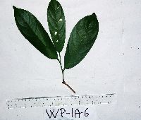 Galearia celebica Koord. 915178[]Weiblen, G.D. & Binatang Research Center WP1A00062006-03-04 Papua New Guinea, Madang, Wanang Village, -5.2373 145.177183, 115m |
MIN:Plants | 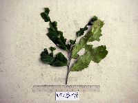 Galearia celebica Koord. 915182[]Weiblen, G.D. & Binatang Research Center WP4B09382007-08-13 Papua New Guinea, Madang, Wanang Village, -5.2373 145.177183, 115m |
MIN:Plants | 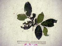 Galearia celebica Koord. 915183[]Weiblen, G.D. & Binatang Research Center WP5B11292007-10-10 Papua New Guinea, Madang, Wanang Village, -5.2373 145.177183, 115m |
MIN:Plants | 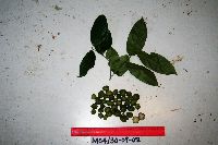 Galearia celebica Koord. 922075[]Ctvrtecka, R. 24382008-09-30 Papua New Guinea, Madang, Mis Village, -5.15 145.783, 10m |
MIN:Plants | Galearia celebica Koord. 923654[]T. J. S. Whitfeld PC4E01742008-09-03 Papua New Guinea, Madang, -5.2243 145.07235, 115m |
MIN:Plants | 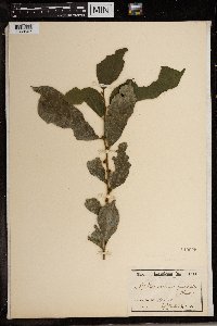 Microdesmis puberula Hook. f. ex Planch. 149225[1369507]Zenker 6721894-00-00 Cameroon, Yaoundé |
MIN:Plants | 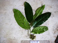 923241[]Ctvrtecka, R. 18492008-08-21 Papua New Guinea, Madang, Wanang Village, -5.23088 145.182, 115m |
1
Page 1, records 1-7 of 7
Google Map
Google Maps is a web mapping service provided by Google that features a map that users can pan (by dragging the mouse) and zoom (by using the mouse wheel). Collection points are displayed as colored markers that when clicked on, displays the full information for that collection. When multiple species are queried (separated by semi-colons), different colored markers denote each individual species.