University of Minnesota
http://www.umn.edu/
612-625-5000
http://www.umn.edu/
612-625-5000
Minnesota Biodiversity Atlas
Bell Museum
Dataset: MIN-Plants
Taxa: Phytolaccaceae
Search Criteria: excluding cultivated/captive occurrences
1
Page 1, records 1-19 of 19
Bell Museum plants | |
 MIN:Plants | 435253[]US Nat. Arboretum staff s.n.1981-00-00 United States, Virginia, Accomack, Accomack Co. |
MIN:Plants | 541014[]Umbach, L. 49551909-09-08 United States, Indiana, Porter, Northern Porter County...Dune Park on Lake Michigan (7 mi. E. of Gary, Ind, SE of Chicago).;Indiana Dunes National Lakeshore;;;, 41.663093 -87.032128 |
MIN:Plants | 435252[]US Nat. Arboretum staff 84-1061984-00-00 United States, Maryland, Prince Georges, Prince Georges Co. |
MIN:Plants | 347415[]Ludwig, Ernest 2541937-07-27 United States, New Jersey, Cape May, Cape May County...Goshen Landing, 1.25 mi. W. of Goshen |
MIN:Plants |  962671[1346216]Reiger-Borer, Anthony 20180012018-10-02 United States, Minnesota, Dakota, 44.57006 -92.98894 |
MIN:Plants |  962673[1346218]Reiger-Borer, Anthony 20180022018-10-02 United States, Minnesota, Dakota, 44.57006 -92.98894 |
MIN:Plants |  963537[1348921]Nee, M. H. 645722018-09-09 United States, Wisconsin, Sauk, 4 km NW of center of Spring Green, N end of Pearl Road, adjacent to west unit of Spring Green Preserve State Natural Area, 43.2475 -90.255, 225m |
MIN:Plants |  968108[1368711]Natalie Nguyen 252016-09-23 United States, Rhode Island, Newport, Goosewing Beach, end of South Shore Road, 2.25 miles southeast of Little Compton Commons, between Tunipus and Quicksand ponds., 41.4961556 -71.1328833 |
MIN:Plants | 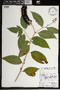 968145[1368757]Vivan Lu 372017-09-29 United States, Rhode Island, Newport, Simmons Mill Wildlife Management Area, 250 meters east of intersecton of Colebrook Road and Long Hwy., 41.5392611111 -71.1528277778, 35m |
MIN:Plants | 358478[]Moyer, Lycurgus s.n.1911-03-15 United States, Florida, Everglades;Everglades National Park |
MIN:Plants | 358479[]Moyer, Lycurgus s.n.1911-03-15 United States, Florida, Everglades;Everglades National Park |
MIN:Plants | 106319[]Steele, E.; et al. 471901-08-24 United States, Virginia, Page, Stony Man Mountain and vicinity in the Blue Ridge, near Luray;Shenandoah National Park, 1097m |
MIN:Plants | 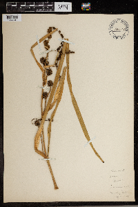 965941[1356699] 1944-07-21 United States, District of Columbia, Toward Marist College Catholic University Campus |
MIN:Plants | 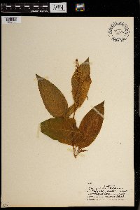 0967782[1368335]R.Hinds s.n.1938-04-02 United States |
MIN:Plants | 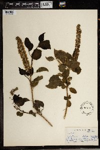 Phytolacca dodecandra L'Hér. 553092[1369739]Sidey, J. L. 23941954-09-00 South Africa, Natal, Kranskots area |
MIN:Plants | 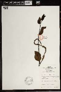 Phytolacca dodecandra L'Hér. 577855[1369740]Troupin, G. 6071959-03-24 Rwanda, Byumba, Mutara region, around Mimuli, IRSAC reserve, Cyabayaga swamp, 1400 - 1450m |
MIN:Plants | 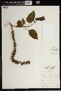 Phytolacca dodecandra L'Hér. 578002[1369741]Mat. Alcool II.6451959-04-01 Rwanda, Region du Mutara, environ de Mimuli, reserve IRSAC, colline Mimuli. Nom(s) Vern.: UMUHOKO, (dial Kinyaruanda), 1400 - 1450m |
MIN:Plants | 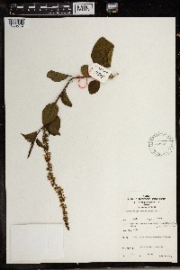 Phytolacca dodecandra L'Hér. 577959[1369742]Troupin, G. 8191959-10-09 Rwanda, Byumba, Mutara region, around Mimuli, IRSAC reserve, Bukire hill, 1400 - 1450m |
MIN:Plants | 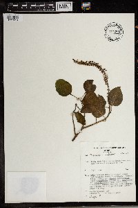 Phytolacca dodecandra L'Hér. 717281[1369743]Mesfin, T 2381978-01-13 Ethiopia, 11km from Mettu on the Mettu-Gore road; past the smal district of Alle, 1750m |
1
Page 1, records 1-19 of 19
Google Map
Google Maps is a web mapping service provided by Google that features a map that users can pan (by dragging the mouse) and zoom (by using the mouse wheel). Collection points are displayed as colored markers that when clicked on, displays the full information for that collection. When multiple species are queried (separated by semi-colons), different colored markers denote each individual species.