University of Minnesota
http://www.umn.edu/
612-625-5000
http://www.umn.edu/
612-625-5000
Minnesota Biodiversity Atlas
Bell Museum
Dataset: MIN-Plants
Taxa: Plumbaginaceae
Search Criteria: excluding cultivated/captive occurrences
1
Page 1, records 1-18 of 18
Bell Museum plants | |
 MIN:Plants | 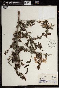 582356[1369747]Sidey, J. L. 33541959-02-00 South Africa, Natal, Umkomaas Valley |
MIN:Plants | Limonium carolinianum (Walter) Britton 383791[]Anonymous s.n.1901-08-00 United States, Maine, Hancock, Mt. Desert Island;Acadia National Park |
MIN:Plants | Limonium carolinianum (Walter) Britton 447927[]Abbott, Robinson s.n.1978-03-22 United States, Texas, Nueces, Nueces County...Padre Is. National Seashore off Bird Island Rd, Padre Island;Padre Island National Seashore |
MIN:Plants | 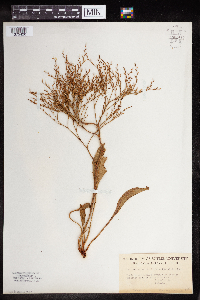 Limonium carolinianum (Walter) Britton 964512[1375420] United States, Maine |
MIN:Plants | 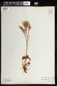 Limonium carolinianum (Walter) Britton 964513[1375421] United States, Massachusetts |
MIN:Plants | 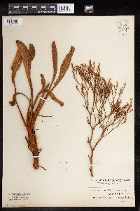 Limonium carolinianum (Walter) Britton 964514[1375422] United States, Massachusetts |
MIN:Plants |  Limonium carolinianum (Walter) Britton 964515[1375423] United States, Maine |
MIN:Plants |  Limonium carolinianum (Walter) Britton 968151[1368742]Mary H. Dennis 212016-08-02 United States, Maine, Hancock, inner harbor of Whitmore Neck, end of Oceanville Road., 44.1904917 -68.6463722 |
MIN:Plants | Armeria maritima (Miller) Willdenow 417468[]Spetzman, L. 41181950-07-17 United States, Alaska, Arctic North Slope...Noatak & Kugururok R.;Noatak National Preserve;;;, 67.9666672 -161.9166718, 152m |
MIN:Plants |  Armeria maritima (Miller) Willdenow 951061[1290470]Gerenday, A. s.n.1977-08-00 Canada, Northwest Territories, Baffin Island. Mermaid Fjord. |
MIN:Plants |  Armeria maritima (Miller) Willdenow 972370[1395920]Janssens, J. 75/3201975-07-30 United Kingdom, Scotland, Isle of Skye, Broadway |
MIN:Plants | 335015[]Harris, J. Arthur C 2812201928-09-21 United States, Arizona, Pima, Mouth of Bobaquivari Canyon;Organ Pipe Cactus National Monument |
MIN:Plants | Armeria maritima subsp. californica (Boissier) A.E. Porsild 279294[]Bracelin, H. 181930-04-20 United States, California, Marin, Marin Co. ... Point Reyes ... near Light House grounds.;Point Reyes National Seashore, 150m |
MIN:Plants | Armeria maritima subsp. californica (Boissier) A.E. Porsild 678706[]Cramer, Carol 361967-05-06 United States, California, Marin, Point Reyes National Seashore. ...below U.S. Coast Guard Station at Point Reyes, Marin County Leadfield Rd, 3.5 mi SE of Leadfield.., 6m |
MIN:Plants | 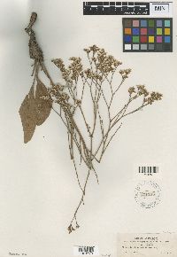 Limonium limbatum Small 171135[1001673]Wooton, E.O. 1721897-07-19 United States, New Mexico, Dona Ana, Plains north of the White Sands, 1250m |
MIN:Plants | 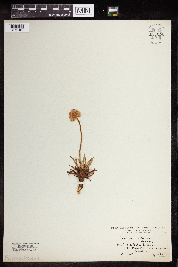 Armeria alpina Willd. 964150[1375119] Austria |
MIN:Plants | 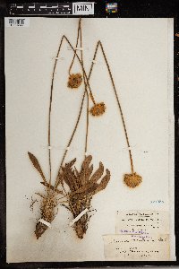 Armeria mauritanica Wallr. 171058[1369744]Gallerand 8121953-06-11 Algeria, Philippeville (formerly) |
MIN:Plants | 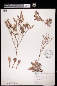 Limonium binervosum (G.E. Sm.) C.E. Salmon 972665[1398218]Janssens, J. 75/4111975-08-05 United Kingdom, England, Shakespeare Cliff 308/398 |
1
Page 1, records 1-18 of 18
Google Map
Google Maps is a web mapping service provided by Google that features a map that users can pan (by dragging the mouse) and zoom (by using the mouse wheel). Collection points are displayed as colored markers that when clicked on, displays the full information for that collection. When multiple species are queried (separated by semi-colons), different colored markers denote each individual species.