University of Minnesota
http://www.umn.edu/
612-625-5000
http://www.umn.edu/
612-625-5000
Minnesota Biodiversity Atlas
Bell Museum
Dataset: MIN-Plants
Taxa: Rosaceae
Search Criteria: excluding cultivated/captive occurrences
Bell Museum plants | |
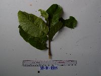
MIN:Plants | 951735[1299289]Weiblen, G.D. YS3F03332010-08-06 Papua New Guinea, Morobe, Yawan Village, -6.16255 146.839933, 1721m |
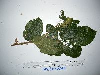
MIN:Plants | 951802[1297967]Weiblen, G.D. YP2C00922011-02-21 Papua New Guinea, Morobe, Yawan Village, -6.163017 146.842983, 1732m |
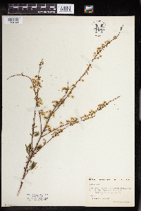
MIN:Plants | 961644[1340104]Megeath, Geo 1940-05-27 United States, Minnesota, Rice, East side of brush patch across the road from Oak Lawn Cemetary, 44.458298 -93.161604 |
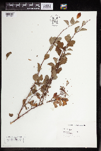
MIN:Plants | 961635[1340113]Bullard, James 1925-00-00 United States, Minnesota, Rice, Cemetary, 44.458298 -93.161604 |
MIN:Plants | Geum NULL 582037[1284270]Morean, Edith 1141962-08-07 United States, Washington, Clallam, Olympic National Park. Between Obstruction Point and Hurricane Ridge Road. |
MIN:Plants | 0967849[1368393]Warren D. Manhart s.n.1939-11-08 United States, Wyoming, Yellowstone Park |
MIN:Plants | Amelanchier NULL 479100[1283659]Little Jr., Elbert 427691991-07-22 United States, Minnesota, Cook, Cook County...Near Hovland, 20 mi NE of Grand Marais, N shore of Lake Superio;Grand Portage State Forest / North Shore;062N;04E;, 47.954739 -90.029827 |
MIN:Plants | Amelanchier NULL 407195[1283650]Lakela, Olga 86211949-06-27 United States, Minnesota, Saint Louis, Bear Island Lake, south of Ely, St. Louis Co.;Superior National Forest;061N;13W;, 47.9 -91.8667 |
MIN:Plants | Amelanchier NULL 419518[1283651]Lakela, Olga 103531950-06-12 United States, Minnesota, Saint Louis, above the cabins at Gappas Landing, Lake Kabetogama;Voyageurs National Park;;;, 48.470908 -93.008801 |
MIN:Plants | Amelanchier NULL 442503[1283655]Lakela, Olga 134381951-07-19 United States, Minnesota, Saint Louis, Big Island in Namakan Lake. St. Louis Co.;Voyageurs National Park;;;, 48.433517 -92.705646 |
MIN:Plants | Amelanchier NULL 282691[1283656]Swanson, Gustav s.n.1932-08-14 United States, Minnesota, Lake of the Woods, Northwest Angle;Northwest Angle;;;, 49.345235 -94.970765 |
MIN:Plants | Amelanchier NULL 418896[1283657]Ahlgren, Clifford 4881949-00-00 United States, Minnesota, Lake, Lake Co. ... Sec. 9 T. 64 N R. 10 W;Boundary Waters Canoe Area Wilderness / Superior National Forest;064N;10W;09, 48.028382 -91.387532 |
MIN:Plants | Amelanchier NULL 527503[1283781]Lakela, Olga 128331954-00-00 United States, Minnesota, Saint Louis, Sand Point Lake, north of Crane Lake, St. Louis Co.;Voyageurs National Park;068N;17W;, 48.2833 -92.4667 |
MIN:Plants | Amelanchier NULL 420084[1283653]Lakela, Olga 111731950-08-08 United States, Minnesota, Saint Louis, Savanna River woods, west of Floodwood on Highway 29, St. Louis Co.;;;;, 46.92911 -92.919648 |
MIN:Plants | Amelanchier NULL 420859[1283654]Lakela, Olga 115311950-08-21 United States, Minnesota, Saint Louis, Crooked Lake at Curtain Falls. St. Louis Co.;Boundary Waters Canoe Area Wilderness / Superior National Forest;066N;12W;, 48.203274 -91.857461 |
MIN:Plants | Amelanchier NULL 492916[1283652]Lakela, Olga 166741953-08-08 United States, Minnesota, Saint Louis, St. Louis County...on Lac La Croix near the Resort;Boundary Waters Canoe Area Wilderness / Superior National Forest;;;, 48.3333 -92.1167 |
MIN:Plants | Amelanchier NULL 829867[1283646]Delaney, B. 911631991-06-11 United States, Minnesota, Morrison, Morrison County...SE Morrison Co, 3 mi W and 4.5 mi N of county borders. NW1/4 SW1/4 sec.10, T39N, R28W;;039N;28W;10, 45.887488 -93.819166 |
MIN:Plants | Amelanchier NULL 838340[1283649]Myhre, K. 3657A1993-05-22 United States, Minnesota, Pine, Pine County...1/2 mi E of the town of Sandstone on the E bank of the Kettle River...T42N R20W NW1/4 of NE1/4 of Sec 15;Banning State Park;042N;20W;15, 46.145255 -92.860815 |
MIN:Plants | Amelanchier NULL 838343[1283648]Myhre, K. 35741993-05-12 United States, Minnesota, Pine, Pine County...along the N section of Hell's Gate Rapids of the Kettle River...T43N R20W NW1/4 of SW1/4 of Sec 35.;Banning State Park;043N;20W;35, 46.164078 -92.834671 |
MIN:Plants | Amelanchier NULL 527254[1283647]Lakela, Olga 153141952-07-26 United States, Minnesota, Saint Louis, St. Louis County ... Northland Golf Course, East Superior St, Duluth.;;;;, 46.7833 -92.1 |
MIN:Plants | Amelanchier NULL 293999[1283666]Swanson, Gustav s.n.1934-09-29 United States, Minnesota, Carlton, Cloquet;Fond du Lac Indian Reservation;049N;17W;, 46.72161 -92.459357 |
MIN:Plants | Amelanchier NULL 294058[1283663]Nielsen, E. 23561933-09-14 United States, Minnesota, Ramsey, Mississippi River below the Ford Plant, St. Paul.;;028N;23W;, 44.908149 -93.194135 |
MIN:Plants | Amelanchier NULL 349045[1283664]Nielsen, E. 10431931-04-18 United States, Minnesota, Kanabec, 1 mi N of Mora, left side of raod just below farmhouse, Mora;;039N;24W;, 45.876899 -93.262639 |
MIN:Plants | Amelanchier NULL 349046[1283662]Nielsen, E. 10421931-00-00 United States, Minnesota, Kanabec, North side of Sun [Ann?] River, 2 miles south of Mora. 125 ft. up dump road from No. 1040.;Ann River Wildlife Management Area;039N;24W;, 45.846882 -93.3299 |
MIN:Plants | Amelanchier NULL 349047[1283661]Nielsen, E. 10411931-04-18 United States, Minnesota, Kanabec, North side of Ann River, 2 mi S of Mora. 150 ft. north of 1040.;Ann River Wildlife Management Area;039N;24W;, 45.846882 -93.3299 |
MIN:Plants | Amelanchier NULL 391970[1283660]Lakela, Olga 63021946-05-12 United States, Minnesota, Saint Louis, Swan River near Palmers;;051N;12W;, 46.9167 -91.85 |
MIN:Plants | Amelanchier NULL 393023[1283665]Lakela, Olga 67561946-09-04 United States, Minnesota, Cook, Lake Superior at Temperance River.;North Shore / Temperance River State Park;059N;04W;, 47.557593 -90.875149 |
MIN:Plants | Amelanchier NULL 479112[1283658]Little Jr., Elbert 427851991-07-24 United States, Minnesota, Cook, Cook County...Eagle Mountain, Superior National Forest [ca.] 10 mi N of Grand Marais.;Boundary Waters Canoe Area Wilderness / Superior National Forest;063N;02W;, 47.89519 -90.334273 |
MIN:Plants | 961916[1340383]Stork, H. E. 1925-00-00 United States, Minnesota, Itasca |
MIN:Plants | 962104[1340681] United Kingdom, Scotland |
MIN:Plants | 962712[1346256]Dzuik, Peter M. MWI18-0112016-05-26 United States, Minnesota, Crow wing, West side of CR 105 about .5 mi N of CR 11 ; T136N R25W NW Sec 14, 46.595073 -93.8099347 |
MIN:Plants | 955951[1295501]Lawrence, D. B. s.n.1941-08-17 United States, Alaska, Glacier Bay National Monument; nunatak on east side of head of Muir Inlet; summit ridge. [Glacier Bay National Park], 58.797428 -136.838127, 358m |
MIN:Plants | 956206[1296109]Schoenike, R. 55-441955-08-06 United States, Alaska, Anchorage Cove., 58.621111 -137.664722 |
MIN:Plants | 956198[1296049]Lawrence, D. B. s.n.1949-08-16 United States, Alaska, Glacier Bay National Monument. Station 49-3. [Glacier Bay National Park], 58.797428 -136.838127 |
MIN:Plants | 956173[1296021]Lawrence, D. B. s.n.1949-08-12 United States, Alaska, Glacier Bay National Monument. Station 49-3. [Glacier Bay National Park], 58.797428 -136.838127 |
MIN:Plants | 956282[1296157]Schoenike, R. 55-1861955-09-04 Canada, British Columbia, Sloko River flats below the Chasm (NE of Juneau). |
MIN:Plants | 956281[1296156]Schoenike, R. 55-1901955-09-04 Canada, British Columbia, Sloko River flats below the Chasm (NE of Juneau). |
MIN:Plants | 956255[1296134]Schoenike, R. 55-1841955-08-29 United States, Alaska, Haines Highway, mile 25, at river crossing. |
MIN:Plants | 484321[1031693]Juhnke, C. 324 CMJ FRO1999-06-09 United States, Minnesota, Goodhue, Frontenac State Park Goodhue County ... At parking lot north of Rattlesnake Bluff ...T112N R13W NW NE NE 5;Frontenac State Park;112N;13W;05, 44.5075 -92.32611 |
MIN:Plants | 910760[1284701]Gerdes, Lynden B. 55422008-06-11 United States, Minnesota, Saint Louis, Superior National Forest. Bass Lake Hiking Trail, approximately 4.33 miles NNW of Ely, MN. Adjacent to the hiking trail ~ 0.20 miles west of Bass Lake. T63N R12W S03SWSW, 47.9647222 -91.8597222 |
MIN:Plants | 905468[1284679]Gerdes, Lynden B. 44842001-09-05 United States, Minnesota, Lake, Isabella. Approx. 0.54 mile SW of Tony Lake on woods trail leaving east off Hwy. 1. T60N R10W S06NENE of section [Superior National Forest], 47.61713 -91.354871 |
MIN:Plants | 899102[1031931]Myhre, K. 25961992-07-07 United States, Minnesota, Cass, Located 4 miles east of Cass Lake. NE1/4 of SW1/4 of Section;Chippewa National Forest / Leech Lake Indian Reservation;146N;29W;31, 47.42068 -94.40521 |
MIN:Plants | 263538[1284716]Rosendahl, C.O. 55911928-07-02 United States, Minnesota, Clearwater, Elk Pasture. [tasca State Park; T143N;R36W], 47.218777 -95.232437 |
MIN:Plants | 263543[1284726;1284727]Rosendahl, C.O. 57061928-07-16 United States, Minnesota, Cass, Norway Beach, Cass Lake [Chippewa National Forest / Leech Lake Indian Reservation; T145N;R30W], 47.36791 -94.48038 |
MIN:Plants | 472910[1031730]Nation, R. 94-1211994-06-21 United States, Minnesota, Mower, Lake Louise State Park. Mower County...tract #13N. T101N R14W NE1/4 of SE1/4 of Sec. 21;Lake Louise State Park;101N;14W;21, 43.53658 -92.51904 |
MIN:Plants | 131538[1284609]Sandberg, John s.n.1890-07-00 United States, Minnesota, Hennepin, [no further data];;;;, 44.97441 -93.233002 |
MIN:Plants | Rubus NULL 529071[1031774]Lakela, Olga 155711952-08-22 United States, Minnesota, Saint Louis, Curtain Falls, resort grounds, Crooked Lake, International boundary.;Boundary Waters Canoe Area Wilderness / Superior National Forest;066N;12W;06, 48.203274 -91.857461 |
MIN:Plants | Rubus NULL 529073[1031773]Lakela, Olga 155721952-08-22 United States, Minnesota, Saint Louis, Curtain Falls resort grounds, Crooked Lake, International Boundary.;Boundary Waters Canoe Area Wilderness / Superior National Forest;066N;12W;06, 48.203274 -91.857461 |
MIN:Plants | 333560[1284717]Rosendahl, C.O. s.n.1935-07-26 United States, Minnesota, Scott, Savage [T115N;R21W], 44.753049 -93.361742 |
MIN:Plants | Rubus NULL 446370[1284613]Moore, John; et al. 187531946-07-25 United States, Minnesota, Anoka, At crossing of Elwell Road and Main St. Road, E of Anoka.;;;;, 45.197803 -93.387262 |
MIN:Plants | 529052[1284688]Lakela, Olga 158361952-09-11 United States, Minnesota, Saint Louis, High above Sand Point Lake, 7 mi. N of Crane Lake. [Voyageurs National Park], 48.2833 -92.4667 |
MIN:Plants | Rubus NULL 529079[1284612]Lakela, Olga 143601952-06-21 United States, Minnesota, Saint Louis, S of Namakan Narrows, Sand Point Lake.;Voyageurs National Park;068N;17W;, 48.483546 -92.838098 |
MIN:Plants | 722559[1284687]Lustig, Karen 5001979-06-14 United States, Minnesota, Anoka, Boot Lake Scientific Natural Area. 18 mi. SE of Cambridge. sec. 17, 18, 19, 20, T33N R22W, 45.34066 -93.08146 |
MIN:Plants | Rubus NULL 722834[1284611]Lustig, K. 4071979-06-06 United States, Minnesota, Anoka, 18 mi. SE of Cambridge.;Boot Lake Scientific Natural Area;033N;22W;, 45.34066 -93.08146 |
MIN:Plants | 416850[1284720]Lakela, Olga 85971949-06-26 United States, Minnesota, Saint Louis, Ely-Finland Road, near White Iron Lake [Superior National Forest], 47.9 -91.8667 |
MIN:Plants | 463308[1284722]Lakela, Olga 126881951-06-26 United States, Minnesota, Saint Louis, Portage River.; Echo Trail NW of Ely [Superior National Forest; T65N;R14W;S24], 47.9 -91.8667 |
MIN:Plants | 481138[1284650]Lakela, Olga 171741953-09-07 United States, Minnesota, Saint Louis, Highway 5, about 3 mi N of Sturgeon Lake, N of Hibbing. [George Washington State Forest], 47.810123 -92.8667 |
MIN:Plants | 543070[1284689]Lakela, Olga 204951956-07-14 United States, Minnesota, Lake, Portage to Ella Hall Lake on Four-mile-portage to Basswood Lake. [Boundary Waters Canoe Area Wilderness / Superior National Forest; T64N;R10W;S30], 48.074893 -91.57512 |
MIN:Plants | 543193[1284666]Lakela, Olga 20495a1956-07-14 United States, Minnesota, Lake, Portage to Ella Hall Lake on Four-mile-portage to Basswood Lake. [Boundary Waters Canoe Area Wilderness / Superior National Forest; T64N;R10W;S30], 48.074893 -91.57512 |
MIN:Plants | 132040[1284718]Butters, F.K. 50661926-08-03 United States, Minnesota, Anoka, Near N end of Moore Lake. [T30N;R24W], 45.076528 -93.247936 |
MIN:Plants | 262089[1284713]Butters, F.K. s.n.1927-08-00 United States, Minnesota, Saint Louis, Along portage into Clear Lake, 47.887454 -91.851712 |
MIN:Plants | 273181[]Butters, F. s.n.1927-08-00 United States, Minnesota, Saint Louis, Along portage into Clear Lake.;;;;, 47.887454 -91.851712 |
MIN:Plants | 386088[1284719]Lakela, Olga 58431944-08-20 United States, Minnesota, Lake, On Finland - Cramer Road., 47.414636 -91.249048 |
MIN:Plants | 420643[1284686]Lakela, Olga 120801950-09-06 United States, Minnesota, Saint Louis, Side Lake at Sturgeon Lake, N of Hibbing. George Washington State Forest; T60N;R21W], 47.665207 -93.015739 |
MIN:Plants | 506700[1284708]Rosendahl, C.O. 79891953-10-16 United States, Minnesota, Anoka, east side of highway 65, about 0.2 mi. north of Johnsville [now Blaine] W side of Hwy. 65, ca. 0.2 mi. N of Johnsville. [T31N R23W], 45.201052 -93.234051 |
MIN:Plants | 506701[1284709]Rosendahl, C.O. 79901953-10-16 United States, Minnesota, Anoka, east side of highway 65, short distance south of Soderville. [T32N;R23W;S5], 45.287055 -93.233233 |
MIN:Plants | 526719[1284723]Lakela, Olga 178421954-07-12 United States, Minnesota, Saint Louis, Trout River, portage from Vermilion Lake [Boundary Waters Canoe Area Wilderness / Superior National Forest; T63N;R16W;S24], 47.883729 -92.425514 |
MIN:Plants | 529072[1284714]Lakela, Olga 158221952-09-13 United States, Minnesota, Saint Louis, Swan River, highway # 73, S of Hibbing, 47.166604 -92.875752 |
MIN:Plants | 529076[1284712]Lakela, Olga 145281952-07-05 United States, Minnesota, Saint Louis, S of Aurora on St. Louis River Road., 47.5167 -92.2333 |
MIN:Plants | 529082[1284711]Lakela, Olga 156061952-08-23 United States, Minnesota, Saint Louis, Iron Lake, W of Curtain Falls, International Boundary [Boundary Waters Canoe Area Wilderness / Superior National Forest; T66N;R12W;S6], 48.219513 -91.957793 |
MIN:Plants | 542930[1284710]Lakela, Olga 21411a1957-07-07 United States, Minnesota, Saint Louis, White Face River Road about 1.5 mi W of Cotton [T54N;R17W], 47.16401 -92.527809 |
MIN:Plants | 543204[1284715]Lakela, Olga 218211957-08-04 United States, Minnesota, Saint Louis, [no further data], 47.589862 -92.461466 |
MIN:Plants | 615928[1284721]Moore, John W. 272861969-06-27 United States, Minnesota, Isanti, Rise along the W shore of Beckman Lake; Athens Twp.; Cedar Creek National History Area [T34N;R23W;S22], 45.42391 -93.186379 |
MIN:Plants | Rubus NULL 833664[1284614]Smith, Welby 142481988-06-17 United States, Minnesota, Washington, About 4.5 miles SE of Forest Lake (town); S side of Halfbreed Lake. SE1/4 SE1/4 of section;;032N;21W;24, 45.2425 -92.9005556 |
MIN:Plants | Rubus NULL 131539[1284590]Sandberg, John s.n.1881-06-00 United States, Minnesota, Goodhue, Cannon Falls;;112N;17W;18, 44.50707 -92.90512 |
MIN:Plants | 131542[1284673]Sheldon, E. P. S25741892-06-00 United States, Minnesota, Mille Lacs, Mille Lacs Reservation [Mille Lacs Indian Reservation; T42N;R27W], 46.084999 -93.663298 |
MIN:Plants | 131559[1284700]Moyer, Lycurgus R. 19061897-06-25 United States, Minnesota, Ramsey, New Brighton [T30N;R23W], 45.08003 -93.16693 |
MIN:Plants | 131562[1284724;1284725]Smith, Arthur s.n.1926-09-15 United States, Minnesota, Koochiching, Big Falls. [T154N;R25W], 48.191063 -93.806569 |
MIN:Plants | 131623[1284671]Sheldon, E. P. S30301892-07-00 United States, Minnesota, Mille Lacs, Milaca [T38N;R27W;S25], 45.75697 -93.64757 |
MIN:Plants | 131629[1284674]Rosendahl, C.O. s.n.1926-05-15 United States, Minnesota, Houston, Rosendahl Farm, Spring Grove [T101N;R7W], 43.56108 -91.635979 |
MIN:Plants | 131630[1284670]Sheldon, E. P. S1471891-06-00 United States, Minnesota, Blue Earth, Madison Lake [T109N;R25W], 44.23947 -93.82835 |
MIN:Plants | 131656[1031932]Rosendahl, C. 5761902-06-22 United States, Minnesota, Houston, Spring Grove;;101N;07W;11, 43.56111 -91.63583 |
MIN:Plants | Rubus NULL 132027[1284597]Rosendahl, C. 48521925-07-11 United States, Minnesota, Becker, West of Arago. Becker Co.;;141N;36W;00, 47.051304 -95.208724 |
MIN:Plants | 132071[1284661]Sandberg, J. H. s.n.1894-06-00 United States, Minnesota, Hennepin, Vicinity of Minneapolis [T29N;R24W], 44.99193 -93.28815 |
MIN:Plants | 132073[1284657]Rosendahl, C.O. 25851912-06-04 United States, Minnesota, Hennepin, W of Cedar Lake [other Rosendahl collections indicated this was in Minneapolis], 44.960017 -93.328896 |
MIN:Plants | 132074[1284659]Sheldon, E. P. S74821894-05-30 United States, Minnesota, Dakota, Near Lakeville, 44.649687 -93.24272 |
MIN:Plants | 132075[1284646]Holzinger, J. M. 4911885-06-08 United States, Minnesota, Winona, Rush Creek Valley [probably the portion in Winona Co. as Holzinger collected extensively in Winona Co.], 43.916464 -91.829037 |
MIN:Plants | 132076[1284660]Rosendahl, C.O. 2991902-06-03 United States, Minnesota, Houston, Spring Grove [T101N;R7W;S11], 43.56565 -91.64095 |
MIN:Plants | 132078[1284648]Watson, Hattie 131886-06-10 United States, Minnesota, Dakota, Farmington [T114N;R20W], 44.640243 -93.14355 |
MIN:Plants | 132255[1284697]Aiton, George B. s.n.1891-05-00 United States, Minnesota, Hennepin, near Minneapolis [T29N;R24W], 44.99193 -93.28815 |
MIN:Plants | Rubus NULL 132256[1284637]Rosendahl, C. 24801910-06-10 United States, Minnesota, Fort Snelling Reservation [old regional park spanning junction of Minnesota and Mississippi rivers];;028N;23W;00, 44.875594 -93.213123 |
MIN:Plants | Rubus NULL 132257[1284621]Rosendahl, C. 25811912-06-04 United States, Minnesota, Hennepin, W of Cedar Lake [other Rosendahl collections indicated this was in Minneapolis];;029N;24W;32, 44.960959 -93.329496 |
MIN:Plants | Rubus NULL 132265[1284627]Wheeler, William 3961899-07-24 United States, Minnesota, Houston, Jefferson [pioneer village near Iowa line], Houston Co.;Dorer Memorial Hardwood State Forest;101N;04W;35, 43.508039 -91.282558 |
MIN:Plants | 132266[1284691]Rosendahl, C.O. 28561915-06-11 United States, Minnesota, Anoka, southern Anoka Co., 45.143594 -93.238227 |
MIN:Plants | 132268[1284705]Kassube, J. C. s.n.1878-06-00 United States, Minnesota, Hennepin, Minneapolis [T29N;R24W;S25], 44.96996 -93.23702 |
MIN:Plants | 132269[1284696]Sandberg, J. H. s.n.1890-07-00 United States, Minnesota, Hennepin, [no further data], 44.97441 -93.233002 |
MIN:Plants | Rubus NULL 132270[1284628]Butters, F.; et al. 33561916-08-08 United States, Minnesota, Stearns, near St. Cloud [prob. in outcrops of Waite Park];;;;, 45.557187 -94.224158 |
MIN:Plants | 132271[1284695]Sheldon, E. P. s.n.1895-05-00 United States, Minnesota, Hennepin, Prospect Park, Minneapolis [T29N;R24W], 44.99193 -93.28815 |
MIN:Plants | Rubus NULL 132272[1284635]Ballard, C. B2341891-06-20 United States, Minnesota, Scott, Jordan, Scott Co.;;114N;23W;19, 44.66697 -93.63399 |
MIN:Plants | 132273[1284698]Butters, F.K. 33661916-08-11 United States, Minnesota, Anoka, Near Ham Lake [T32N;R23W], 45.257018 -93.222366 |
Google Map
Google Maps is a web mapping service provided by Google that features a map that users can pan (by dragging the mouse) and zoom (by using the mouse wheel). Collection points are displayed as colored markers that when clicked on, displays the full information for that collection. When multiple species are queried (separated by semi-colons), different colored markers denote each individual species.
