University of Minnesota
http://www.umn.edu/
612-625-5000
http://www.umn.edu/
612-625-5000
Minnesota Biodiversity Atlas
Bell Museum
Dataset: MIN-Plants
Taxa: Tamaricaceae
Search Criteria: excluding cultivated/captive occurrences
1
Page 1, records 1-10 of 10
Bell Museum plants | |
 MIN:Plants | Tamarix chinensis Loureiro 794632[]Schaaf, J. 3101982-07-26 United States, Nevada, Pershing, Pershing Co. ... Rye Patch Reservoir, 1268m |
MIN:Plants | Tamarix ramosissima Ledeb. 936635[]Johnson, R. RJ-12-0682012-07-21 United States, Minnesota, Crow Wing, Cuyuna Boy Scout Camp. UTM: 421225E 5172623N.;;;;, 46.7025219 -94.0304625 |
MIN:Plants | Tamarix ramosissima Ledeb. []Hammack, S. GW25882005-06-29 United States, Colorado, Delta, Adobe Hills, 38.761528 -107.6515, 2070m |
MIN:Plants | 657959[]Feller, Ilka s.n.1974-08-22 United States, Minnesota, Itasca, Keewatin. Hanna Mining Company., 47.399656 -93.072415 |
MIN:Plants | 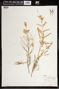 961472[1334917] United States, New Mexico |
MIN:Plants | 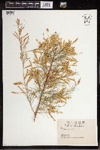 961471[1334918] United States, Colorado |
MIN:Plants | 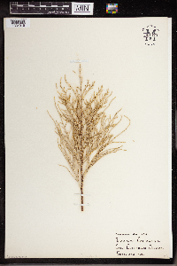 961470[1334919] United States, California |
MIN:Plants | 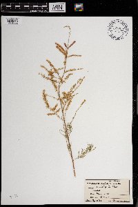 0968704[1391302]Hinds, R. s.n.1938-05-02 United States, Texas, College St. [Station] |
MIN:Plants | 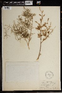 155224[1369758]Alice Carter Cook 7141897-07-00 Spain, Canary Islands: Gran Canaria: Tafira |
MIN:Plants | 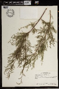 Tamarix nilotica (Ehrenb.) Bunge 738312[1369759]Hunn, John 591981-03-16 Egypt |
1
Page 1, records 1-10 of 10
Google Map
Google Maps is a web mapping service provided by Google that features a map that users can pan (by dragging the mouse) and zoom (by using the mouse wheel). Collection points are displayed as colored markers that when clicked on, displays the full information for that collection. When multiple species are queried (separated by semi-colons), different colored markers denote each individual species.