University of Minnesota
http://www.umn.edu/
612-625-5000
http://www.umn.edu/
612-625-5000
Minnesota Biodiversity Atlas
Bell Museum
Dataset: MIN-Plants
Taxa: Tofieldiaceae
Search Criteria: excluding cultivated/captive occurrences
Bell Museum plants | |
 MIN:Plants | 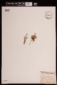 951077[1290492]Gerenday, A. s.n.1977-08-00 Canada, Northwest Territories, Baffin Island. Mermaid Fjord (head of). |
MIN:Plants | Triantha glutinosa (Michaux) Baker 599637[]Cooper, William 1131921-08-23 United States, Alaska, Glacier Bay, Station 5;Glacier Bay National Park;;;, 58.59655 -135.84048 |
MIN:Plants | Triantha glutinosa (Michaux) Baker 540035[]Tester, John s.n.1957-07-03 United States, Minnesota, Mahnomen, 3-4 miles W and 1 mile S of Waubun;Waubun Prairie Wildlife Management Area / White Earth Indian Reservation;143N;42W;33, 47.1589 -96.00743 |
MIN:Plants | Triantha glutinosa (Michaux) Baker 90216[]Cusick, W. 29871902-08-27 United States, Oregon, Klamath, Crater Lake, summit of the Cascade Mts. [Crater Lake National Park] |
MIN:Plants | Triantha glutinosa (Michaux) Baker 507851[]Anderson, Craig 10182000-07-14 United States, Minnesota, Becker, Becker County ... T142N R42W: 1/4 of NE1/4 of SE1/4 of Sect. 13;White Earth Indian Reservation;142N;42W;13, 47.113445 -95.936453 |
MIN:Plants | Triantha glutinosa (Michaux) Baker 90226[]Rosendahl, C. 26701912-08-31 United States, Michigan, Keweenaw, Tobin's Harbor, Isle Royale;Isle Royale National Park;;;, 67.9666672 -161.9166718 |
MIN:Plants | Triantha glutinosa (Michaux) Baker 493884[]Aaseng, N. 91725091991-07-25 United States, Minnesota, Roseau, Roseau County .. Sprague Creek Peatland, Lost River State Forest ... SW1/4 NW1/4 Sec.34 T164N R40W;Lost River State Forest / Sprague Creek Peatland Scientific Natural Area;164N;40W;34, 48.9888889 -95.8077778 |
MIN:Plants | Triantha glutinosa (Michaux) Baker 507854[]Anderson, Craig 10542000-07-26 United States, Minnesota, Becker, Becker County ... Spring Creek WMA ... T142N R42W: 1/4 of SW1/4 of SW1/4 of sect. 13;Spring Creek Wildlife Management Area / White Earth Indian Reservation;142N;42W;13, 47.109876 -95.952607 |
MIN:Plants | Triantha glutinosa (Michaux) Baker 484134[]Anderson, Craig 10092000-07-13 United States, Minnesota, Becker, Becker Co.; T142N R41W: 1/4 of NE1/4 of SW1/4 of Sect. 29 [sic];;142N;41W;29, 47.08389 -95.903573 |
MIN:Plants | Triantha glutinosa (Michaux) Baker 226901[]Cooper, William 321909-07-06 United States, Michigan, Keweenaw, Rock Harbor, Isle Royale;Isle Royale National Park;;;, 67.9666672 -161.9166718 |
MIN:Plants | Triantha glutinosa (Michaux) Baker 229303[]Cooper, William 871909-07-11 United States, Michigan, Keweenaw, Rock Harbor, Isle Royale;Isle Royale National Park;;;, 67.9666672 -161.9166718 |
MIN:Plants | Triantha glutinosa (Michaux) Baker 599641[]Cooper, William 1211929-07-09 United States, Alaska, Glacier Bay, Station 39.;Glacier Bay National Park;;;, 58.596449 -136.14293 |
MIN:Plants | Triantha glutinosa (Michaux) Baker 491188[]Biederman, L.; et al. 98-291998-07-01 United States, Minnesota, Marshall, Marshall County ... between railroad track and Hwy 32 in Holt township ... T156N R43W;;156N;43W;, 48.291916 -96.192531 |
MIN:Plants | Triantha glutinosa (Michaux) Baker 427949[]Anderson, Craig 10002000-07-11 United States, Minnesota, Becker, 1/4 [sic] of SW1/4 of NE1/4 of Section;Pederson Waterfowl Area / White Earth Indian Reservation;142N;41W;29, 47.087744 -95.89805 |
MIN:Plants | Triantha glutinosa (Michaux) Baker 226187[]Stork, H.; et al. 331925-07-11 United States, Montana, Glacier Natl. Park;Glacier National Park |
MIN:Plants | Triantha glutinosa (Michaux) Baker 483903[]Anderson, Craig 10372000-07-20 United States, Minnesota, Becker, Becker Co.; T142N R42W: 1/4 of SE1/4 of NW1/4 of Sect. 6 [sic];;142N;42W;6, 47.146193 -96.057362 |
MIN:Plants | Triantha glutinosa (Michaux) Baker 441016[]Puchalski, L. 4671993-07-11 United States, Minnesota, Polk, Polk Co.; T148N R45W NE1/4 of NW1/4 of Sec 5;;148N;45W;5, 47.666027 -96.420386 |
MIN:Plants | Triantha glutinosa (Michaux) Baker 441327[]Dana, R. 920741992-07-21 United States, Minnesota, Kittson, Kittson Co.; T163N R46W NW1/4 of SE1/4 of sEc 23;;163N;46W;23, 48.9244461 -96.5650024 |
MIN:Plants | Triantha glutinosa (Michaux) Baker 443625[]Sather, Nancy; et al. s.n.1996-08-26 United States, Minnesota, Mahnomen, Mahnomen County...in most active seepage zone...T144 R41 SE of Sec 36;White Earth Indian Reservation;144N;41W;36, 47.3333 -95.8167, 411m |
MIN:Plants | Triantha glutinosa (Michaux) Baker 443629[]Sather, Nancy 218501995-07-14 United States, Minnesota, Mahnomen, Bejou Wildlife Management Area / White Earth Indian Reservation. Mahnomen Co.; Bejou WPA. About 1/2 mile east of Co 134, in the north side of open prairie; T 146N R 41W NE1/4 of NW1/4 o Mahnomen Co.; Bejou WPA. About 1/2 mile east of Co 134, in the north side of open prairie; T 146N R 41W NE1/4 of NW1/4 of Sec 7. 146N 41W 7, 47.477641 -95.922694 |
MIN:Plants | Triantha glutinosa (Michaux) Baker 443633[]Sather, Nancy 218521995-07-01 United States, Minnesota, Mahnomen, Mahnomen Co.; Santee Prairie SNA; T 145N R 41W SE1/4 of NE1/4 of Sec 7;Santee Prairie Scientific Natural Area / White Earth Indian Reservation;145N;41W;7, 47.390616 -95.922408 |
MIN:Plants | Triantha glutinosa (Michaux) Baker 458608[]Puchalski, L. 4691993-07-11 United States, Minnesota, Polk, Polk Co.; T148N R44W SW1/4 of SE1/4 of Sec 31;;148N;44W;31, 47.593859 -96.312283 |
MIN:Plants | Triantha glutinosa (Michaux) Baker 458791[]Puchalski, L. 4411993-09-06 United States, Minnesota, Mahnomen, Mahnomen Co.; Waubun WMA. On E side of railroad tracks; T143N R42W SE1/4 of SW1/4 of Sec 25;Waubun Prairie Wildlife Management Area / White Earth Indian Reservation;143N;42W;25, 47.173142 -95.943663 |
MIN:Plants | Triantha glutinosa (Michaux) Baker 460194[]Sather, Nancy s.n.1993-07-02 United States, Minnesota, Polk, Polk Co.; MN County Biological Survey site 53; along the north section line ditch; T149 R43 NWNW of Sec 20;;T149N R43W S20, 47.708719 -96.191264 |
MIN:Plants | Triantha glutinosa (Michaux) Baker 460925[]Puchalski, L. 2771993-07-14 United States, Minnesota, Mahnomen, Nelson Prairie / White Earth Indian Reservation. Mahnomen Co.; Southeast corner of Nelson Prairie WPA by highway 59; in SW corner of section; T 146N R 42W SE1/4 of SE1/4 Mahnomen Co.; Southeast corner of Nelson Prairie WPA by highway 59; in SW corner of section; T 146N R 42W SE1/4 of SE1/4 of Sec 10. 146N 42W 10, 47.477586 -95.98676 |
MIN:Plants | Triantha glutinosa (Michaux) Baker 460932[]Puchalski, L. 2781993-07-14 United States, Minnesota, Mahnomen, Mahnomen Co.; Wambach WMA; along the south side of access road; T 145N R 42W NW1/4 of NW1/4 of Sec 12;Wambach Wildlife Management Area / White Earth Indian Reservation;145N;42W;12, 47.390681 -95.943976 |
MIN:Plants | Triantha glutinosa (Michaux) Baker 475346[]Sather, Nancy s.n.1994-08-14 United States, Minnesota, Becker, Becker Co.; just south of Becker County line; T142 R41 NENW of Sec 5;White Earth Indian Reservation;142N;41W;5, 47.149071 -95.903286 |
MIN:Plants | Triantha glutinosa (Michaux) Baker 514970[]Lee, Michael MDL18431997-07-18 United States, Minnesota, Stearns, Stearns County...along Sedan Brook 3 1/2 miles north-northeast of Brooten...T124N R35W NE1/4 of SE1/4 of NW1/4 Sec.17;Sedan Brook Prairie Scientific Natural Area;124N;35W;17, 45.462923 -95.10071 |
MIN:Plants | Triantha glutinosa (Michaux) Baker 515607[]Sather, Nancy 94321994-07-25 United States, Minnesota, Mahnomen, Waubun Prairie Wildlife Management Area / White Earth Indian Reservation. Mahnomen County...Waubun WPA White Earth Reservation; between flowing well and channelized portion of ... spring creek...T143N R41W SW1/4 of SE1/4 of Sec 30. 143N 41W 30, 47.1680565 -95.9188919 |
MIN:Plants | Triantha glutinosa (Michaux) Baker 518998[]Puchalski, L. 3811993-08-10 United States, Minnesota, Polk, Polk Co.; T150N R39W NW1/4 of SE1/4 of Sec 22;;150N;39W;22, 47.797388 -95.633726 |
MIN:Plants | Triantha glutinosa (Michaux) Baker 827909[]Dana, R. 910121991-07-03 United States, Minnesota, Marshall, Marshall County; west of glacial lake beach ridge; W1/2 NW1/4 NE1/4 Sec. 2 T158N R46W;;158N;46W;2, 48.5419998 -96.5510025 |
MIN:Plants | Triantha glutinosa (Michaux) Baker 827961[]Dana, R. 910381991-08-12 United States, Minnesota, Kittson, Kittson Co.; SE1/4 NW1/4 NW1/4 Sec.34 T160N R46W;;160N;46W;34, 48.6419983 -96.5800018 |
MIN:Plants | Triantha glutinosa (Michaux) Baker 828654[]Rosendahl, C. 74451940-08-21 United States, Minnesota, Clearwater, Clearwater Co, Iron Springs, south side of road.;Iron Springs Bog Scientific Natural Area;144N;36W;, 47.260649 -95.244129 |
MIN:Plants | Triantha glutinosa (Michaux) Baker 829966[]Delaney, B. 912011991-06-26 United States, Minnesota, Kittson, Kittson County...Halma Prairie, DNR Wildlife Management Area...SW1/4 NW1/4 sec.18, T160N, R46W;Halma Swamp Wildlife Management Area;160N;46W;18, 48.6827774 -96.6461105 |
MIN:Plants | Triantha glutinosa (Michaux) Baker 830131[]Converse, C. 29211991-07-06 United States, Minnesota, Polk, Polk Co. Dugdale Wildlife Management Area; NE1/4 SW1/4 Sec.27 T149N R44W;Dugdale Wildlife Management Area;149N;44W;27, 47.694607 -96.27692 |
MIN:Plants | Triantha glutinosa (Michaux) Baker 828477[]Dana, R. 901141990-08-31 United States, Minnesota, Kittson, Kittson Co.; SW1/4 of SW1/4 Sec 1 T159N R46W;;159N;46W;1, 48.6160011 -96.5360031 |
MIN:Plants | Triantha glutinosa (Michaux) Baker 830444[]Delaney, B. 912261991-07-03 United States, Minnesota, Kittson, Kittson County...about 2.5 mi E and 5 mi N of Halma...SE1/4 SW1/4 sec.25, T161N, R46W;Lake Bronson Parkland Scientific Natural Area;161N;46W;25, 48.731945 -96.5491638 |
MIN:Plants | Triantha glutinosa (Michaux) Baker 831637[]Harris, Fred 920361992-07-08 United States, Minnesota, Pennington, Pennington Co.; E of Goose Lake prairie-wetland complex; NW1/4 Sec.16 T153N R45W;;153N;45W;16, 48.072167 -96.44721 |
MIN:Plants | Triantha glutinosa (Michaux) Baker 831639[]Harris, Fred 920911992-07-28 United States, Minnesota, Pennington, Pennington Co.; Glacial Lake Agassiz beach ridge; NW1/4 NE1/4 Sec.7 T153N R44W;;153N;44W;7, 48.086303 -96.360433 |
MIN:Plants | Triantha glutinosa (Michaux) Baker 831644[]Harris, Fred 920711992-07-13 United States, Minnesota, Polk, Polk Co. Pembina WMA; NE1/4 SE1/4 Sec.1 T152N R46W;Pembina Wildlife Management Area;152N;46W;1, 48.014378 -96.493382 |
MIN:Plants | Triantha glutinosa (Michaux) Baker 831666[]Harris, Fred 921351992-07-22 United States, Minnesota, Pennington, Pennington Co. On W side of marshes in Goose Lake prairie-wetland complex; NE1/4 NE1/4 Sec.8 T153N R45W;;153N;45W;8, 48.086851 -96.468647 |
MIN:Plants | Triantha glutinosa (Michaux) Baker 831669[]Harris, Fred 921831992-07-06 United States, Minnesota, Pennington, Pennington Co.; in interbeach zone of Glacial Lake Agassiz; SE1/4 SW1/4 Sec.18 T154N R44W;;154N;44W;18, 48.159748 -96.358079 |
MIN:Plants | Triantha glutinosa (Michaux) Baker 483905[]Anderson, Craig 10392000-07-14 United States, Minnesota, Becker, Becker Co.; Partly on a WMA; T142N R42W: 1/4 of NE1/4 of NE1/4 of Sect. 1 [sic];;142N;42W;1, 47.149441 -95.935735 |
MIN:Plants | Triantha glutinosa (Michaux) Baker 90217[]Wheeler, William 7381900-08-00 United States, Michigan, Keweenaw, Tobin's Harbor, Isle Royale;Isle Royale National Park;;;, 67.9666672 -161.9166718 |
MIN:Plants | Triantha glutinosa (Michaux) Baker 493871[]Aaseng, N. 92826021992-08-26 United States, Minnesota, Roseau, Roseau County ... Approx. 1.5 mi. W of Hwy 310, approx. 200 m S. of Canadian Border ...T164N R40W Sec.27 NE/SW;Lost River State Forest;164N;40W;27, 48.993363 -95.800803 |
MIN:Plants | Triantha glutinosa (Michaux) Baker 499516[]Aaseng, N. 91717031991-07-17 United States, Minnesota, Roseau, Roseau County ... Bemis Peatland in Beltrami Island State Forest ~1 mi. west of Bemis Hill ...T160N R38W Sec.01 NE/NW;Beltrami Island State Forest;160N;38W;01, 48.7094444 -95.4847222 |
MIN:Plants | Triantha glutinosa (Michaux) Baker 540022[]Tester, John s.n.1957-04-15 United States, Minnesota, Mahnomen, 3-4 miles W and 1 mile S of Waubun;Waubun Prairie Wildlife Management Area / White Earth Indian Reservation;143N;42W;33, 47.1589 -96.00743 |
MIN:Plants | Triantha glutinosa (Michaux) Baker 483904[]Anderson, Craig 10382000-07-20 United States, Minnesota, Becker, Becker Co.; T142N R42W: 1/4 of NE1/4 of NE1/4 of Sect. 1 [sic];;142N;42W;1, 47.149441 -95.935735 |
MIN:Plants | Triantha glutinosa (Michaux) Baker 90246[]Nelson, Aven; et al. 63821899-08-09 United States, Wyoming, Park, Yellowstone National Park ... Lewis River;Yellowstone National Park |
MIN:Plants | Triantha glutinosa (Michaux) Baker 579028[]Kaul, R. 16501960-07-01 United States, Montana, Glacier National Park ... Logan Pass;Glacier National Park |
MIN:Plants | Triantha glutinosa (Michaux) Baker 490958[]Maguire, Bassett 6461932-07-25 United States, Montana, Glacier National Park ... Cracker Lake. alt. 6151 ft.;Glacier National Park |
MIN:Plants | Triantha glutinosa (Michaux) Baker 493872[]Aaseng, N. 91722081991-07-22 United States, Minnesota, Roseau, Beltrami Island State Forest. Roseau County ... Bemis Peatland, Beltrami Island State Forest, approx 1 mi. northeast of Bemis Hill ... NW1/4 NE1/4 Sec.32 T161N R37W. 161N 37W 32, 48.7244444 -95.4475 |
MIN:Plants | Triantha glutinosa (Michaux) Baker 608069[]Aaseng, N. 91720031991-07-20 United States, Minnesota, Roseau, Roseau County ... Bemis Peatland in Beltrami Island State Forest ~1 mi. west of Bemis Hill ...T160N R38W Sec.01 SW/NE;Beltrami Island State Forest;160N;38W;01, 48.706044 -95.483912 |
MIN:Plants | Triantha glutinosa (Michaux) Baker 929831[]Milburn, Scott SAM10-0242010-07-31 United States, Minnesota, Polk, UTM(15): 301007E 5296735N. SESW of section;;150N;39W;21, 47.7931611 -95.6571167 |
MIN:Plants | 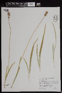 Triantha glutinosa (Michaux) Baker 953224[1295999]Milburn, Scott A. SAM15-0042015-08-07 United States, Minnesota, Red Lake |
MIN:Plants | 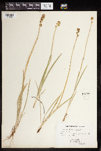 Triantha glutinosa (Michaux) Baker 960499[1318967]Stork, H.E. 1948-07-24 United States, Minnesota |
MIN:Plants | 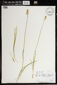 Triantha glutinosa (Michaux) Baker 966784[1359533]Anderson, Derek S. 27122017-07-08 United States, Minnesota, Polk, Thorson Prairie WMA. About 5 km northwest of Melvin on State Highway 102. About 500 meters west of Highway 102 on unnamed east-west road just north of the large "S" curve in State Hwy. 102., 47.66 -96.42 |
MIN:Plants | Tofieldia coccinea Richardson 417000[]Spetzman, L. 41401950-07-17 United States, Alaska, Arctic North Slope ... Noatak & Kugururok R.;Noatak National Preserve;;;, 67.9666672 -161.9166718, 152m |
MIN:Plants | Tofieldia coccinea Richardson 699955[]Glaser, Paul 8201975-07-02 United States, Alaska, Mt. McKinley National Park ... NW1/4Sec. 21 T17S R14W, Thorofare Pass;Denali National Park;017S;14W;21, 1158m |
MIN:Plants | Tofieldia coccinea Richardson 408363[]Spetzman, L. 16511949-07-05 United States, Alaska, Arctic North Slope ... Anaktuvuk Pass;Gates of the Arctic National Park;;;, 68.2833333 -151.4166667, 762m |
MIN:Plants | Tofieldia coccinea Richardson 530173[]Hardy, Robert 1631945-07-08 United States, Alaska, Aleutians ... Attu Is. ... on west side of Chichagof Harbor;Aleutian Islands Wilderness;;;, 52.928602 173.243336, 15m |
MIN:Plants | Tofieldia coccinea Richardson 699953[]Glaser, Paul 884a1975-07-24 United States, Alaska, Mt. McKinley National Park ... N1/2SW1/4Sec. 18 T17S R14W, Thorofare Bluffs;Denali National Park;017S;14W;18, 1433m |
MIN:Plants | Tofieldia coccinea Richardson 382538[]Moore, M. s.n.1944-07-11 United States, Alaska, Aleutian Islands ... Adak Island;Aleutian Islands Wilderness;;;, 51.88 -176.65806 |
MIN:Plants | Tofieldia coccinea Richardson 548436[]Spetzman, L. 38751951-07-15 United States, Alaska, Canning R. & Ignek Cr.;Arctic National Wildlife Refuge;;;, 69.5833359 -146.25, 305m |
MIN:Plants | Tofieldia coccinea Richardson 408364[]Spetzman, L. 19821949-07-17 United States, Alaska, Arctic North Slope ... Kanayut Lake;Gates of the Arctic National Park;;;, 68.3333359 -151, 914m |
MIN:Plants | Tofieldia coccinea Richardson 356408[]West, Phebe s.n.1933-08-15 United States, Alaska, Atka, Aleutian Islands;Aleutian Islands Wilderness;;;, 52.196111 -174.20056 |
MIN:Plants | Tofieldia coccinea Richardson 356542[]West, Phebe 541932-07-03 United States, Alaska, Atka, Aleutian Islands;Aleutian Islands Wilderness;;;, 52.196111 -174.20056 |
MIN:Plants | Tofieldia coccinea Richardson 699956[]Glaser, Paul 884b1975-07-24 United States, Alaska, Mt. McKinley National Park ... N1/2SW1/4Sec. 18 T17S R14W, Thorofare Bluffs;Denali National Park;017S;14W;18, 1433m |
MIN:Plants | Tofieldia coccinea Richardson 408479[]Spetzman, L. 18741949-07-11 United States, Alaska, Arctic North Slope ... Anaktuvuk Pass;Gates of the Arctic National Park;;;, 68.2833333 -151.4166667, 762m |
MIN:Plants | Tofieldia coccinea Richardson 699952[]Glaser, Paul 3391972-07-09 United States, Alaska, Mt. McKinley National Park ... NE1/4NE1/4Sec. 19 T17S R14W, Thorofare Pass;Denali National Park;017S;14W;19, 1158m |
MIN:Plants | Tofieldia coccinea Richardson 548396[]Spetzman, L. 36941951-07-20 United States, Alaska, Arctic North Slope ... Katakturuk River, Ignek Valley;Arctic National Wildlife Refuge;;;, 69.5833359 -145.5833282, 610m |
MIN:Plants | Tofieldia coccinea Richardson 548582[]Spetzman, L. 38741951-07-15 United States, Alaska, Canning R. & Ignek Cr.;Arctic National Wildlife Refuge;;;, 69.5833359 -146.25, 305m |
MIN:Plants | Tofieldia coccinea Richardson 601068[]Munns, C. 4831966-06-29 United States, Alaska, Primrose Ridge in McKinley National Park;Denali National Park |
MIN:Plants | Tofieldia coccinea Richardson 399365[]Spetzman, L. 3701947-07-23 United States, Alaska, Canning River ... where river leaves mountains;Arctic National Wildlife Refuge;;;, 69.2833333 -146 |
MIN:Plants | Tofieldia coccinea Richardson 382537[]Moore, M. s.n.1944-07-30 United States, Alaska, Aleutian Islands ... Adak Island;Aleutian Islands Wilderness;;;, 51.88 -176.65806 |
MIN:Plants |  Tofieldia coccinea Richardson 960410[1318909]Eyerdam, W.J. 39491945-08-15 United States, Alaska, Port Vita, Raspberry Strait, Raspberry Island, Kodiak Group |
MIN:Plants |  Tofieldia coccinea Richardson 960409[1318910]Eyerdam, W.J. 1946-08-25 United States, Alaska, Port Vita, Raspberry Strait, Raspberry Island, Kodiak group |
MIN:Plants | Triantha occidentalis (S. Watson) R.R. Gates 551414[]Cotter, Shirley 13031950-08-01 United States, Montana, Logan Pass, Glacier park;Glacier National Park;;;, 67.9666672 -161.9166718 |
MIN:Plants | Triantha occidentalis (S. Watson) R.R. Gates 520303[]Lawrence, Donald s.n.1952-08-24 United States, Alaska, Bartlett Cove.;Glacier Bay National Park;;;, 58.45 -135.7833333 |
MIN:Plants | Triantha occidentalis (S. Watson) R.R. Gates 90244[]Elmer, A.D.E. 25041900-08-00 United States, Washington, Clallam, Olympic Mts. [Olympic National Park] |
MIN:Plants | Triantha occidentalis (S. Watson) R.R. Gates 607388[]Rowley, John s.n.1954-08-25 United States, Oregon, Klamath, Growing in Custer Springs Bog; Crater Lake National Park |
MIN:Plants | Triantha occidentalis (S. Watson) R.R. Gates 600018[]Cooper, William 601935-07-30 United States, Alaska, Glacier Bay, Station 7E.;Glacier Bay National Park;;;, 58.607862 -135.84184 |
MIN:Plants | Triantha occidentalis (S. Watson) R.R. Gates 520302[]Lawrence, Donald s.n.1952-08-24 United States, Alaska, Bartlett Cove.;Glacier Bay National Park;;;, 58.45 -135.7833333 |
MIN:Plants | Triantha occidentalis (S. Watson) R.R. Gates 584650[]Morean, Edith 1581962-08-09 United States, Washington, Clallam, Olympic National Park. High divide near Seven Lakes Basin.;Olympic National Park |
MIN:Plants | Triantha occidentalis (S. Watson) R.R. Gates 297217[]Williams, Louis 11951933-06-30 United States, Wyoming, Teton, west of Taggart Lake, Teton National Park.;Grand Teton National Park, 2286m |
MIN:Plants | Tofieldia pusilla (Michaux) Persoon 90264[]Wheeler, William United States, Michigan, Keweenaw, Detailed locality information protected. This is typically done to protect rare or threatened species localities. |
MIN:Plants | Tofieldia pusilla (Michaux) Persoon 699963[]Glaser, Paul United States, Alaska, Detailed locality information protected. This is typically done to protect rare or threatened species localities. |
MIN:Plants | Tofieldia pusilla (Michaux) Persoon 408618[]Spetzman, L. United States, Alaska, Detailed locality information protected. This is typically done to protect rare or threatened species localities. |
MIN:Plants | Tofieldia pusilla (Michaux) Persoon 401571[]Spetzman, L. United States, Alaska, Detailed locality information protected. This is typically done to protect rare or threatened species localities. |
MIN:Plants | Tofieldia pusilla (Michaux) Persoon 226899[]Cooper, William United States, Michigan, Keweenaw, Detailed locality information protected. This is typically done to protect rare or threatened species localities. |
MIN:Plants | Tofieldia pusilla (Michaux) Persoon 699961[]Glaser, Paul United States, Alaska, Detailed locality information protected. This is typically done to protect rare or threatened species localities. |
MIN:Plants | Tofieldia pusilla (Michaux) Persoon 699957[]Glaser, Paul United States, Alaska, Detailed locality information protected. This is typically done to protect rare or threatened species localities. |
MIN:Plants | Tofieldia pusilla (Michaux) Persoon 438087[]Gould, William Canada, Nunavut, Detailed locality information protected. This is typically done to protect rare or threatened species localities. |
MIN:Plants | Tofieldia pusilla (Michaux) Persoon 401572[]Spetzman, L. United States, Alaska, Detailed locality information protected. This is typically done to protect rare or threatened species localities. |
MIN:Plants | Tofieldia pusilla (Michaux) Persoon 296395[]Mexia, Ynes United States, Alaska, Detailed locality information protected. This is typically done to protect rare or threatened species localities. |
MIN:Plants | Tofieldia pusilla (Michaux) Persoon 401573[]Spetzman, L. United States, Alaska, Detailed locality information protected. This is typically done to protect rare or threatened species localities. |
MIN:Plants | Tofieldia pusilla (Michaux) Persoon 699962[]Glaser, Paul United States, Alaska, Detailed locality information protected. This is typically done to protect rare or threatened species localities. |
MIN:Plants | Tofieldia pusilla (Michaux) Persoon 226906[]Rosendahl, C.; Butters, F. United States, Minnesota, Cook, Detailed locality information protected. This is typically done to protect rare or threatened species localities. |
MIN:Plants | Tofieldia pusilla (Michaux) Persoon 276779[]Huff, N. United States, Minnesota, Cook, Detailed locality information protected. This is typically done to protect rare or threatened species localities. |
MIN:Plants | Tofieldia pusilla (Michaux) Persoon 694913[]Cutler, Bruce United States, Minnesota, Cook, Detailed locality information protected. This is typically done to protect rare or threatened species localities. |
Google Map
Google Maps is a web mapping service provided by Google that features a map that users can pan (by dragging the mouse) and zoom (by using the mouse wheel). Collection points are displayed as colored markers that when clicked on, displays the full information for that collection. When multiple species are queried (separated by semi-colons), different colored markers denote each individual species.