University of Minnesota
http://www.umn.edu/
612-625-5000
http://www.umn.edu/
612-625-5000
Minnesota Biodiversity Atlas
Dataset: MIN-Lichens
Taxa: Allocetraria
Search Criteria: excluding cultivated/captive occurrences
1
Page 1, records 1-19 of 19
Bell Museum lichens | |
 MIN:Lichens | Allocetraria oakesiana (Tuck.) Randlane & A. Thell 917395[]Lendemer, J.C. 122252008-06-29 United States, Pennsylvania, Wayne, Ridge E of Lodge, Above Wallenpaupack Ledges, Paupack Township; Lacawac Sanctuary, 41.38333333 -75.28333333 |
MIN:Lichens | Allocetraria oakesiana (Tuck.) Randlane & A. Thell 917731[]Harris, R.C. 540802008-04-05 United States, Virginia, Smyth, Whitetop Mountain; Jefferson National Forest, 36.63805556 -81.60583333 |
MIN:Lichens | Allocetraria oakesiana (Tuck.) Randlane & A. Thell 917737[]Harris, R.C. 545752008-05-18 United States, Vermont, Essex, Near Moose Bog; Wenlock Wildlife Management Area, 44.76222222 -71.73583333 |
MIN:Lichens | Allocetraria oakesiana (Tuck.) Randlane & A. Thell 922865[]Gockman, O. United States, Minnesota, Lake, Detailed locality information protected. State Threatened List |
MIN:Lichens | Allocetraria oakesiana (Tuck.) Randlane & A. Thell 922867[]Gockman, O. United States, Minnesota, Cook, Detailed locality information protected. State Threatened List |
MIN:Lichens | Allocetraria oakesiana (Tuck.) Randlane & A. Thell 922870[]Gockman, O. United States, Minnesota, Lake, Detailed locality information protected. State Threatened List |
MIN:Lichens | Allocetraria oakesiana (Tuck.) Randlane & A. Thell 933088[]Wetmore, C. United States, Minnesota, Cook, Detailed locality information protected. State Threatened List |
MIN:Lichens | Allocetraria oakesiana (Tuck.) Randlane & A. Thell 392538[]Gockman, Otto United States, Minnesota, Cook, Detailed locality information protected. State Threatened List |
MIN:Lichens | Allocetraria oakesiana (Tuck.) Randlane & A. Thell 961167[]Otto Gockman; Dylan Lueth 050722011-06-06 United States, Minnesota, Lake, Superior National Forest. Approximately 1km southwest of Wanless and 1.5km north of Crooked Lake. This lichen was observed growing at the bases of large Abies balsamea and Picea mariana in a fire-dependent community., 47.628614 -91.089382 |
MIN:Lichens | Allocetraria oakesiana (Tuck.) Randlane & A. Thell 961155[]Otto Gockman; Brandon Hanko 050782011-07-26 United States, Minnesota, Lake, Superior National Forest. Approximately 1.5km southeast of Hoist Lake. Observed growing at the base of an Abies balsamea in a fire-dependent community., 47.611159 -91.161035 |
MIN:Lichens | Allocetraria oakesiana (Tuck.) Randlane & A. Thell 961153[]Otto Gockman; Ann Fisher 050912012-05-25 United States, Minnesota, Cook, Superior National Forest. Approximately 7.1km northwest of Shroeder and 1.1km west of Dogwood Lake. This lichen was observed growing at the base of a gigantic (approximately 76cm a DBH) Betula cordifolia in a fire dependent community dominated by Thuja occidentalis., 47.585693 -90.964447 |
MIN:Lichens | 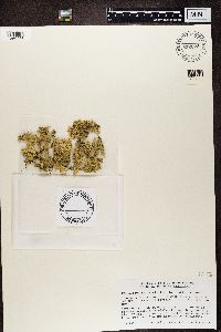 Allocetraria nivalis (L.) Randlane & Saag 832673[1360233]Faltynowicz, W. Poland |
MIN:Lichens | 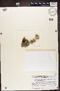 Allocetraria oakesiana (Tuck.) Randlane & A. Thell 883499[1365948]Lendemer, J.C. United States, West Virginia, Pocahontas |
MIN:Lichens | 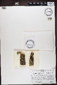 Allocetraria oakesiana (Tuck.) Randlane & A. Thell 885724[1365998]Lendemer, J.C. United States, Pennsylvania, Luzerne |
MIN:Lichens | 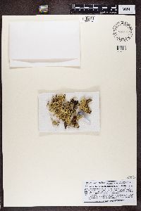 Allocetraria flavonigrescens A. Thell & Randlane 880462[1388954]Obermayer, W. China, Tibet |
MIN:Lichens |  Allocetraria globulans (Nyl. ex Hue) A. Thell & Randlane 880461[1388955]Obermayer, W. China, Tibet |
MIN:Lichens |  Allocetraria madreporiformis (With.) Kärnefelt & A. Thell 880460[1388956]Obermayer, W. Italy, Trentino-South Tyrol |
MIN:Lichens |  Allocetraria madreporiformis (With.) Kärnefelt & A. Thell 868410[1389329]Obermayer, W. Austria, Tyrol |
MIN:Lichens |  Allocetraria globulans (Nyl. ex Hue) A. Thell & Randlane 871843[1389373]Obermayer, W. China, Tibet |
1
Page 1, records 1-19 of 19
Google Map
Google Maps is a web mapping service provided by Google that features a map that users can pan (by dragging the mouse) and zoom (by using the mouse wheel). Collection points are displayed as colored markers that when clicked on, displays the full information for that collection. When multiple species are queried (separated by semi-colons), different colored markers denote each individual species.