University of Minnesota
http://www.umn.edu/
612-625-5000
http://www.umn.edu/
612-625-5000
Minnesota Biodiversity Atlas
Dataset: MIN-Lichens
Taxa: Loxosporopsis
Search Criteria: excluding cultivated/captive occurrences
1
Page 1, records 1-4 of 4
Bell Museum lichens | |
 MIN:Lichens | Loxosporopsis corallifera Brodo, Henssen & Imshaug 838065[]Brodo, I. 108591967-07-09 Canada, British Columbia, Queen Charlotte Islands; Moresby Island, Along Deena River |
MIN:Lichens | Loxosporopsis corallifera Brodo, Henssen & Imshaug 870358[]Rosentreter, R. 72011991-11-28 United States, Oregon, Lane, Sutton Creek Recreation Area, Entrance Road; Siuslaw National Forest, 44.03333333 -124.1 |
MIN:Lichens | 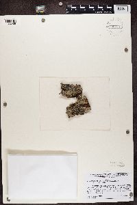 Loxosporopsis corallifera Brodo, Henssen & Imshaug 935734[1366265]Lendemer, J.C. Canada, British Columbia |
MIN:Lichens |  Loxosporopsis corallifera Brodo, Henssen & Imshaug 868337[1386469]Tonsberg United States, Washington, Snohomish |
1
Page 1, records 1-4 of 4
Google Map
Google Maps is a web mapping service provided by Google that features a map that users can pan (by dragging the mouse) and zoom (by using the mouse wheel). Collection points are displayed as colored markers that when clicked on, displays the full information for that collection. When multiple species are queried (separated by semi-colons), different colored markers denote each individual species.