University of Minnesota
http://www.umn.edu/
612-625-5000
http://www.umn.edu/
612-625-5000
Minnesota Biodiversity Atlas
Dataset: MIN-Lichens
Taxa: Rostania
Search Criteria: excluding cultivated/captive occurrences
1
Page 1, records 1-1 of 1
Bell Museum lichens | |
 MIN:Lichens | 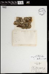 Rostania occultata (Bagl.) Otálora, P.M. Jørg. & Wedin 970072[1371674]Wetmore, Clifford M. 330381978-06-12 United States, Minnesota, Saint louis, Voyageurs National Park, four miles west of Kettle Falls on north side of Mica Bay in northwestern Namakan Lake; T170N R19W Sec 35 |
1
Page 1, records 1-1 of 1
Google Map
Google Maps is a web mapping service provided by Google that features a map that users can pan (by dragging the mouse) and zoom (by using the mouse wheel). Collection points are displayed as colored markers that when clicked on, displays the full information for that collection. When multiple species are queried (separated by semi-colons), different colored markers denote each individual species.