University of Minnesota
http://www.umn.edu/
612-625-5000
http://www.umn.edu/
612-625-5000
Minnesota Biodiversity Atlas
Bell Museum
Dataset: NGBRC
Taxa: Chloranthaceae
Search Criteria: excluding cultivated/captive occurrences
1
Page 1, records 1-8 of 8
Plant records from the New Guinea Binatang Research Center | |
 NGBRC | 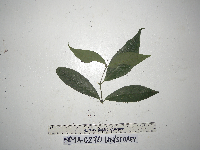 Chloranthus elatior Link NP1A0270[]Binatang Research Center NP1A02702021-07-10 Papua New Guinea, Madang, Numba, -5.7222 145.2714, 1200m |
NGBRC | 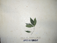 Chloranthus elatior Link NP1B0315[]Binatang Research Center NP1B03152021-07-10 Papua New Guinea, Madang, Numba, -5.7222 145.2714, 1200m |
NGBRC | 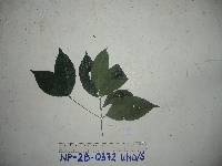 Chloranthus elatior Link NP2B0372[]Binatang Research Center NP2B03722021-07-10 Papua New Guinea, Madang, Numba, -5.7222 145.2714, 1200m |
NGBRC | 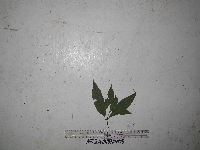 Chloranthus elatior Link NP3A0487[]Binatang Research Center NP3A04872021-07-10 Papua New Guinea, Madang, Numba, -5.7222 145.2714, 1200m |
NGBRC | 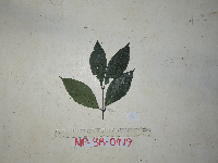 Chloranthus elatior Link NP3B0479[]Binatang Research Center NP3B04792021-07-10 Papua New Guinea, Madang, Numba, -5.7222 145.2714, 1200m |
NGBRC | 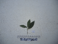 Chloranthus elatior Link NS2A0339[]Binatang Research Center NS2A03392021-07-10 Papua New Guinea, Madang, Numba, -5.7222 145.2714, 1200m |
NGBRC | 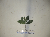 Chloranthus elatior Link NS3A0419[]Binatang Research Center NS3A04192021-07-10 Papua New Guinea, Madang, Numba, -5.7222 145.2714, 1200m |
NGBRC | Chloranthus elatior Link NS4A0511[]Binatang Research Center NS4A05112021-07-10 Papua New Guinea, Madang, Numba, -5.7222 145.2714, 1200m |
1
Page 1, records 1-8 of 8
Google Map
Google Maps is a web mapping service provided by Google that features a map that users can pan (by dragging the mouse) and zoom (by using the mouse wheel). Collection points are displayed as colored markers that when clicked on, displays the full information for that collection. When multiple species are queried (separated by semi-colons), different colored markers denote each individual species.