University of Minnesota
http://www.umn.edu/
612-625-5000
http://www.umn.edu/
612-625-5000
Minnesota Biodiversity Atlas
Bell Museum
Dataset: NGBRC
Taxa: Chrysobalanaceae
Search Criteria: excluding cultivated/captive occurrences
1
Page 1, records 1-12 of 12
Plant records from the New Guinea Binatang Research Center | |
 NGBRC | 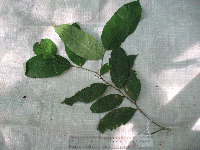 Maranthes corymbosa Blume PA2E0063[]Binatang Research Center PA2E00632009-09-20 Papua New Guinea, Madang Province, Wanang, -5.237483 145.115733, 129m |
NGBRC | 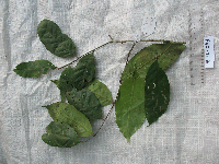 Maranthes corymbosa Blume PB5E0341[]Binatang Research Center PB5E03412008-09-28 Papua New Guinea, Madang Province, Wanang, -5.226533 145.085317, 130m |
NGBRC | Maranthes corymbosa Blume WC22B0900[]Binatang Research Center WC22B09002014-11-06 Papua New Guinea, Madang Province, Wanang Conservation, -5.25 145.055556, 150m |
NGBRC | Maranthes corymbosa Blume WC31L0968[]Binatang Research Center WC31L09682014-11-17 Papua New Guinea, Madang Province, Wanang Conservation, -5.263889 145.041667, 150m |
NGBRC | Maranthes corymbosa Blume WC38D0872[]Binatang Research Center WC38D08722014-11-05 Papua New Guinea, Madang Province, Wanang Conservation, -5.277778 145.069444, 150m |
NGBRC | Maranthes corymbosa Blume WC38D0876[]Binatang Research Center WC38D08762014-11-05 Papua New Guinea, Madang Province, Wanang Conservation, -5.277778 145.069444, 150m |
NGBRC | Maranthes corymbosa Blume WC43A0351[]Binatang Research Center WC43A03512014-10-20 Papua New Guinea, Madang Province, Wanang Conservation, -5.291667 145.097222, 150m |
NGBRC | WC02C1596[]Binatang Research Center WC02C15962014-11-30 Papua New Guinea, Madang Province, Wanang Conservation, -5.208333 145.069444, 150m |
NGBRC |  Atuna racemosa Rafin. YS4J7023[]Binatang Research Center YS4J70232021-07-10 Papua New Guinea, Morobe Province, Yawan, -6.164683 146.841717, 1855m |
NGBRC | 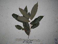 Parinari nonda F. Muell. ex Benth. NP2A0114[]Binatang Research Center NP2A01142014-06-24 Papua New Guinea, Madang, Numba, -5.7222 145.2714, 1200m |
NGBRC | 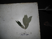 Parinari nonda F. Muell. ex Benth. NP3A0523[]Binatang Research Center NP3A05232015-03-11 Papua New Guinea, Madang, Numba, -5.7222 145.2714, 1200m |
NGBRC | 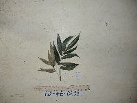 Parinari nonda F. Muell. ex Benth. NP4B0608[]Binatang Research Center NP4B06082015-03-11 Papua New Guinea, Madang, Numba, -5.7222 145.2714, 1200m |
1
Page 1, records 1-12 of 12
Google Map
Google Maps is a web mapping service provided by Google that features a map that users can pan (by dragging the mouse) and zoom (by using the mouse wheel). Collection points are displayed as colored markers that when clicked on, displays the full information for that collection. When multiple species are queried (separated by semi-colons), different colored markers denote each individual species.