University of Minnesota
http://www.umn.edu/
612-625-5000
http://www.umn.edu/
612-625-5000
Minnesota Biodiversity Atlas
Bell Museum
Dataset: NGBRC
Taxa: Costaceae
Search Criteria: excluding cultivated/captive occurrences
1
Page 1, records 1-9 of 9
Plant records from the New Guinea Binatang Research Center | |
 NGBRC | Ctvrtecka3861[]Ctvrtecka, R. 38612009-01-29 Papua New Guinea, Madang Province, Ohu, -5.21667 145.683, 100m |
NGBRC | 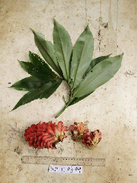 Cheilocostus speciosus (J.Koenig) C.D.Specht Ctvrtecka4554[]Ctvrtecka, R. 45542009-03-11 Papua New Guinea, Madang Province, Wanang, -5.23088 145.182, 115m |
NGBRC | 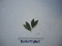 Cheilocostus speciosus (J.Koenig) C.D.Specht NS2A0335[]Binatang Research Center NS2A03352021-07-10 Papua New Guinea, Madang, Numba, -5.7222 145.2714, 1200m |
NGBRC | 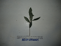 Cheilocostus speciosus (J.Koenig) C.D.Specht NS1A0280[]Binatang Research Center NS1A02802021-07-10 Papua New Guinea, Madang, Numba, -5.7222 145.2714, 1200m |
NGBRC | 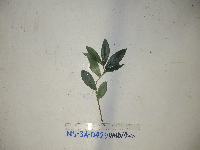 Cheilocostus speciosus (J.Koenig) C.D.Specht NS3A0429[]Binatang Research Center NS3A04292021-07-10 Papua New Guinea, Madang, Numba, -5.7222 145.2714, 1200m |
NGBRC | Cheilocostus speciosus (J.Koenig) C.D.Specht NS4A0522[]Binatang Research Center NS4A05222021-07-10 Papua New Guinea, Madang, Numba, -5.7222 145.2714, 1200m |
NGBRC | 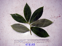 Tapeinochilos pubescens Ridl. WP3C2821[]Binatang Research Center WP3C28212008-09-23 Papua New Guinea, Madang Province, Wanang, -5.2373 145.177183, 115m |
NGBRC | 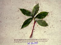 Tapeinochilos pubescens Ridl. WS5A2217[]Binatang Research Center WS5A22172008-09-21 Papua New Guinea, Madang Province, Wanang, -5.229583 145.178467, 115m |
NGBRC | 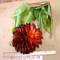 Tapeinochilos recurvatus K.Schum. Ctvrtecka3845[]Ctvrtecka, R. 38452009-01-29 Papua New Guinea, Madang Province, Ohu, -5.21667 145.683, 100m |
1
Page 1, records 1-9 of 9
Google Map
Google Maps is a web mapping service provided by Google that features a map that users can pan (by dragging the mouse) and zoom (by using the mouse wheel). Collection points are displayed as colored markers that when clicked on, displays the full information for that collection. When multiple species are queried (separated by semi-colons), different colored markers denote each individual species.