University of Minnesota
http://www.umn.edu/
612-625-5000
http://www.umn.edu/
612-625-5000
Minnesota Biodiversity Atlas
Bell Museum
Dataset: NGBRC
Taxa: Cycadaceae
Search Criteria: excluding cultivated/captive occurrences
1
Page 1, records 1-14 of 14
Plant records from the New Guinea Binatang Research Center | |
 NGBRC | 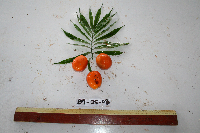 Cycas L. Ctvrtecka0509[]Ctvrtecka, R. 05092008-03-25 Papua New Guinea, Madang Province, Baitabag, -5.13333 145.767, 50m |
NGBRC | 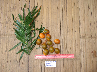 Ctvrtecka2175[]Ctvrtecka, R. 21752008-09-11 Papua New Guinea, Madang Province, Ohu, -5.21667 145.683, 100m |
NGBRC | 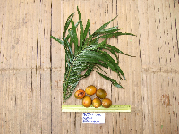 Ctvrtecka2502[]Ctvrtecka, R. 25022008-10-03 Papua New Guinea, Madang Province, Ohu, -5.21667 145.683, 100m |
NGBRC | 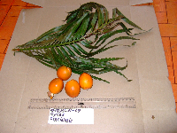 Ctvrtecka3691[]Ctvrtecka, R. 36912009-01-15 Papua New Guinea, Madang Province, Ohu, -5.21667 145.683, 100m |
NGBRC | 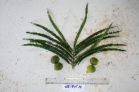 Ctvrtecka0666[]Ctvrtecka, R. 06662008-04-17 Papua New Guinea, Madang Province, Mis, -5.15 145.783, 10m |
NGBRC | 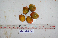 Ctvrtecka0767[]Ctvrtecka, R. 07672008-04-24 Papua New Guinea, Madang Province, Mis, -5.15 145.783, 10m |
NGBRC | 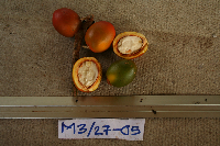 Ctvrtecka1011[]Ctvrtecka, R. 10112008-05-27 Papua New Guinea, Madang Province, Mis, -5.15 145.783, 10m |
NGBRC | 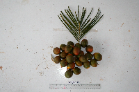 Cycas schumanniana Lauterb. Ctvrtecka0346[]Ctvrtecka, R. 03462008-03-11 Papua New Guinea, Madang Province, Mis, -5.15 145.783, 10m |
NGBRC | 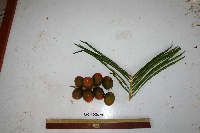 Cycas schumanniana Lauterb. Ctvrtecka0486[]Ctvrtecka, R. 04862008-03-21 Papua New Guinea, Madang Province, Mis, -5.15 145.783, 10m |
NGBRC | 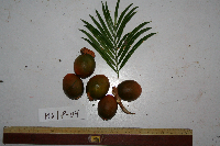 Cycas schumanniana Lauterb. Ctvrtecka0572[]Ctvrtecka, R. 05722008-04-08 Papua New Guinea, Madang Province, Mis, -5.15 145.783, 10m |
NGBRC | 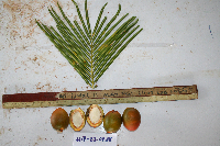 Cycas schumanniana Lauterb. Ctvrtecka0740[]Ctvrtecka, R. 07402008-04-22 Papua New Guinea, Madang Province, Mis, -5.15 145.783, 10m |
NGBRC | 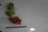 Cycas schumanniana Lauterb. Ctvrtecka0937[]Ctvrtecka, R. 09372008-05-20 Papua New Guinea, Madang Province, Mis, -5.15 145.783, 10m |
NGBRC | 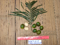 Cycas scratchleyana F.Muell. Ctvrtecka4651[]Ctvrtecka, R. 46512008-06-19 Papua New Guinea, Madang Province, Ohu, -5.21667 145.683, 100m |
NGBRC | Cycas scratchleyana F.Muell. Ctvrtecka1972[]Ctvrtecka, R. 19722008-08-28 Papua New Guinea, Madang Province, Ohu, -5.21667 145.683, 100m |
1
Page 1, records 1-14 of 14
Google Map
Google Maps is a web mapping service provided by Google that features a map that users can pan (by dragging the mouse) and zoom (by using the mouse wheel). Collection points are displayed as colored markers that when clicked on, displays the full information for that collection. When multiple species are queried (separated by semi-colons), different colored markers denote each individual species.