University of Minnesota
http://www.umn.edu/
612-625-5000
http://www.umn.edu/
612-625-5000
Minnesota Biodiversity Atlas
Bell Museum
Dataset: NGBRC
Taxa: Dioscoreaceae
Search Criteria: excluding cultivated/captive occurrences
1
Page 1, records 1-14 of 14
Plant records from the New Guinea Binatang Research Center | |
 NGBRC | NS4A0542[]Binatang Research Center NS4A05422014-03-05 Papua New Guinea, Madang, Numba, -5.7222 145.2714, 1200m |
NGBRC | 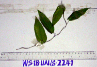 WS1B2241[]Binatang Research Center WS1B22412012-05-11 Papua New Guinea, Madang Province, Wanang, -5.229583 145.178467, 115m |
NGBRC | 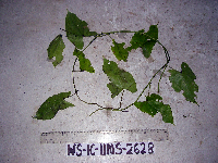 WS1C2628[]Binatang Research Center WS1C26282012-05-11 Papua New Guinea, Madang Province, Wanang, -5.229583 145.178467, 115m |
NGBRC |  WS1D2880[]Binatang Research Center WS1D28802012-05-11 Papua New Guinea, Madang Province, Wanang, -5.229583 145.178467, 115m |
NGBRC |  WS2C2582[]Binatang Research Center WS2C25822012-05-11 Papua New Guinea, Madang Province, Wanang, -5.229583 145.178467, 115m |
NGBRC | 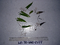 WS3D2777[]Binatang Research Center WS3D27772012-05-11 Papua New Guinea, Madang Province, Wanang, -5.229583 145.178467, 115m |
NGBRC | 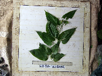 WS5B2455[]Binatang Research Center WS5B24552012-05-11 Papua New Guinea, Madang Province, Wanang, -5.229583 145.178467, 115m |
NGBRC | 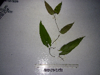 WS5D2653[]Binatang Research Center WS5D26532012-05-11 Papua New Guinea, Madang Province, Wanang, -5.229583 145.178467, 115m |
NGBRC | 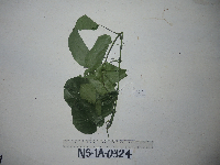 NS1A0324[]Binatang Research Center NS1A03242014-06-04 Papua New Guinea, Madang, Numba, -5.7222 145.2714, 1200m |
NGBRC | 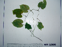 WS1A2000[]Binatang Research Center WS1A20002007-07-17 Papua New Guinea, Madang Province, Wanang, -5.229583 145.178467, 115m |
NGBRC | 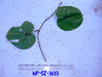 WP5E3033[]Binatang Research Center WP5E30332007-11-22 Papua New Guinea, Madang Province, Wanang, -5.2373 145.177183, 115m |
NGBRC |  WS2C2574[]Binatang Research Center WS2C25742007-07-20 Papua New Guinea, Madang Province, Wanang, -5.229583 145.178467, 115m |
NGBRC |  WS2C2593[]Binatang Research Center WS2C25932007-07-17 Papua New Guinea, Madang Province, Wanang, -5.229583 145.178467, 115m |
NGBRC | 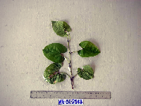 WS3C2543[]Binatang Research Center WS3C25432007-07-17 Papua New Guinea, Madang Province, Wanang, -5.229583 145.178467, 115m |
1
Page 1, records 1-14 of 14
Google Map
Google Maps is a web mapping service provided by Google that features a map that users can pan (by dragging the mouse) and zoom (by using the mouse wheel). Collection points are displayed as colored markers that when clicked on, displays the full information for that collection. When multiple species are queried (separated by semi-colons), different colored markers denote each individual species.