University of Minnesota
http://www.umn.edu/
612-625-5000
http://www.umn.edu/
612-625-5000
Minnesota Biodiversity Atlas
Bell Museum
Dataset: JFBM-Fishes
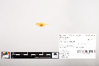
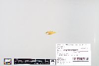
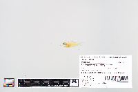
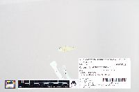
Taxa: Ambassidae
Search Criteria: excluding cultivated/captive occurrences
1
Page 1, records 1-18 of 18
Bell Museum fishes | |
JFBM:Fishes | 48491[]Hundt, Peter; Egan, Josh; Kaeoprakan, Patcharee 2015-11-09 Thailand, Chonburi, Rock wall, near mangrove observation pier, Samaesan Villa Village, Sattahip, 12.6022222 100.9515833 |
JFBM:Fishes | 48495[]Hundt, Peter; Egan, Josh; Kaeoprakan, Patcharee 2015-11-12 Thailand, Chonburi, On rocks from point North to Hotel pool, Jomtien Beach, Bang Lamung District, Pattaya, 12.9100083 100.8555972 |
JFBM:Fishes | 47653[]Egan, Josh; Zhao, Yu-Shen 2013-08-11 Taiwan (Republic of China), Chiayi, Tidal mud flat, near Haomeili, 23.3602861 120.1298944 |
JFBM:Fishes | 47502[]Egan, Josh; Zhao, Yu-Shen 2013-08-14 Taiwan (Republic of China), Chiayi, Tidal mud flat, near Haomeili, 23.3602861 120.1298944 |
JFBM:Fishes | 48025[]Egan, Josh; Hundt, Peter; Chung, Li-An 2014-06-15 Taiwan (Republic of China), Chiayi, Tidal mud flat near oyster farming platforms, Haomei, 23.3602861 120.1298944 |
JFBM:Fishes | 48137[]Egan, Josh 2014-07-08 Australia, Queensland, Captains Creek outflow, Rowes Bay, Townsville, Queensland, Australia, -19.24053 146.791239 |
JFBM:Fishes | 47590[]Egan, Josh; Zhao, Yu-Shen 2013-08-04 Taiwan (Republic of China), Chiayi, Sandy beach near Haomeili, 23.3635139 120.1296528 |
JFBM:Fishes | 47885[]Hundt, Peter; Chew, Uik-Sen 2014-07-28 Taiwan (Republic of China), Chiayi, Estuary, Northwest of seawall, near Haomeili, 23.3602222 120.1301972 |
JFBM:Fishes | 47989[]Egan, Josh; Hundt, Peter; Chew, Uik-Sen 2014-06-14 Taiwan (Republic of China), Chiayi, Sandy beach near Haomeili, 23.3635139 120.1296528 |
JFBM:Fishes | 48005[]Egan, Josh; Hundt, Peter; Chew, Uik-Sen 2014-06-14 Taiwan (Republic of China), Chiayi, Tidal mud flat near oyster farming platforms, Haomei, 23.3602861 120.1298944 |
JFBM:Fishes | 47949[]Egan, Josh 2014-07-01 Australia, Queensland, Dungeness boat ramp in Lucinda, Queensland, Australia, -18.523917 -146.317919 |
JFBM:Fishes | 48078[]Egan, Josh 2014-07-02 Australia, Queensland, Lucinda retired molasses jetty, Queensland, Australia, -18.52175 146.331564 |
JFBM:Fishes | 48079[]Egan, Josh 2014-07-06 Australia, Queensland, Townsille Strand Jetty, Townsville, Queensland, Australia, -19.250299 146.822267 |
JFBM:Fishes | 48124[]Egan, Josh; Bradley, Michael 2014-07-12 Australia, Queensland, Picnic Bay tide pools, Magnetic Island, Queensland, Australia, -19.180562 146.842595 |
JFBM:Fishes | 48121[]Egan, Josh 2014-07-08 Australia, Queensland, Ross River wetland pools, Townsville, Queensland, Australia, -19.302669 146.783996 |
JFBM:Fishes | 49101[]Egan, Josh; Hammer, Michael; Daly, Gavin 2018-05-05 Australia, Northern Territory, Stokes Hill Warf, Darwin City, Northern Territory, Australia, -12.469183 130.850662 |
JFBM:Fishes | 49112[]Egan, Josh; Hammer, Michael 2018-05-06 Australia, Northern Territory, Stokes Hill Warf, Darwin City, Northern Territory, Australia, -12.469183 130.850662 |
JFBM:Fishes | Ambassis urotaenia Bleeker 48512[]Hundt, Peter; Egan, Josh; Kaeoprakan, Patcharee 2015-11-18 Thailand, Krabi, Rocks at northeast end of beach, Koh Ngai, 7.4238889 99.2052778 |
1
Page 1, records 1-18 of 18
Google Map
Google Maps is a web mapping service provided by Google that features a map that users can pan (by dragging the mouse) and zoom (by using the mouse wheel). Collection points are displayed as colored markers that when clicked on, displays the full information for that collection. When multiple species are queried (separated by semi-colons), different colored markers denote each individual species.


