University of Minnesota
http://www.umn.edu/
612-625-5000
http://www.umn.edu/
612-625-5000
Minnesota Biodiversity Atlas
Bell Museum
Dataset: JFBM-Fishes
Taxa: Callionymidae
Search Criteria: excluding cultivated/captive occurrences
1
Page 1, records 1-8 of 8
Bell Museum fishes | |
JFBM:Fishes | 48071[]Egan, Josh; Buelow, Christina 2014-07-27 Australia, Queensland, Rowes Bay, beach access 10, near Townsville, Queensland, Australia, -19.2176083 146.7784139 |
JFBM:Fishes | 48198[]Egan, Josh; Chew, Uik-Sen; Tsai, Meng-Cheng 2014-05-28 Taiwan (Republic of China), Pingtung, Donggang Fish Market, Donggang Port, Donggang Township, 22.4662917 120.4439722 |
JFBM:Fishes | 48232[]Egan, Josh; Buelow, Christina 2014-07-27 Australia, Queensland, Rowes Bay, beach access 10, near Townsville, Queensland, Australia, -19.2176083 146.7784139 |
JFBM:Fishes | 48821[]Hundt, Peter; Egan, Josh; Ghedotti, Michael; Chew, Uik-Sen 2016-05-16 Taiwan (Republic of China), Taitung, Rocky outcropping, just North of Green Island Culture Park, off Huandao Rd, Green Island, 22.6769722 121.4958889 |
JFBM:Fishes | 46274[]P.J. Hundt, A.M. Simons, B.A. Young, K.A. Moots 2010-07-29 Guam, Dog Leg Reef, off Family Beach, near Piti village, 13.4641667 144.6466667 |
JFBM:Fishes | 47819[]Hundt, Peter; Chew, Uik-Sen 2014-08-01 Taiwan (Republic of China), Pingtung, Rocky reef at Xia Tang Zi, 0.5 km N of Maobitou Park, approximately 200 m S of Coastal Road, beach access via narrow walking path through forest, 21.9269167 120.7397778 |
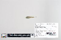
JFBM:Fishes | Callionymus sagitta Pallas 47517[]Egan, Josh; Chew, Uik-Sen 2013-08-01 Taiwan (Republic of China), Miaoli, Mouth of Chonggang River, Houlong township, Miaoli county, Taiwan, 24.6228861 120.7543389 |
JFBM:Fishes | Callionymus sagitta Pallas 47969[]Egan, Josh; Hundt, Peter; Chew, Uik-Sen; Tsai, Wen-Yu 2014-06-12 Taiwan (Republic of China), Miaoli, Mouth of Chonggang River, Houlong township, Miaoli county, Taiwan, 24.6228861 120.7543389 |
1
Page 1, records 1-8 of 8
Google Map
Google Maps is a web mapping service provided by Google that features a map that users can pan (by dragging the mouse) and zoom (by using the mouse wheel). Collection points are displayed as colored markers that when clicked on, displays the full information for that collection. When multiple species are queried (separated by semi-colons), different colored markers denote each individual species.

