University of Minnesota
http://www.umn.edu/
612-625-5000
http://www.umn.edu/
612-625-5000
Minnesota Biodiversity Atlas
Bell Museum
Dataset: JFBM-Fishes
Taxa: Cottidae
Search Criteria: excluding cultivated/captive occurrences
Bell Museum fishes | |
 JFBM:Fishes | 2918[]Summer Crew United States, Minnesota, Winona, Mississippi River, below Whitman Dam, 44.16164 -91.80965 |
JFBM:Fishes | 19944[]P. Needham United States, Oregon, Klamath, Sprague River |
JFBM:Fishes |  17300[]Carter, G. 1953-00-00 United States, Oregon, Benton, Oak Creek, Corvallis, 44.56014 -123.28965 |
JFBM:Fishes |  46594[]Huff, David; Oregon Department of Environmental Quality 2005-07-09 United States, Oregon, Douglas, Wolf Creek, 43.4563889 -123.6094444 |
JFBM:Fishes |  46532[]Huff, David; Oregon Department of Environmental Quality 2001-08-15 United States, Oregon, Lane, Siuslaw River, 43.8825 -123.5066667 |
JFBM:Fishes |  46516[]Huff, David; Oregon Department of Environmental Quality 2001-08-23 United States, Oregon, Douglas, Heddin Creek, 43.6075 -123.6363889 |
JFBM:Fishes | 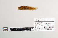 46528[]Huff, David; Oregon Department of Environmental Quality 2001-07-02 United States, Oregon, Tillamook, Tillamook River, at River Mile 1489, 45.3663889 -123.8316667 |
JFBM:Fishes | 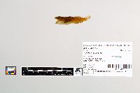 46526[]Huff, David; Oregon Department of Environmental Quality 2001-08-13 United States, Oregon, Douglas, Lutsinger Creek, 43.6361111 -123.7255556 |
JFBM:Fishes | 16798[]S. Weitzman and wife 1950-07-01 United States, California, Marin, Duxbury Reef, 37.8883324 -122.6983337 |
JFBM:Fishes | 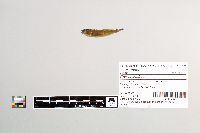 46596[]Huff, David; Oregon Department of Environmental Quality 2006-08-24 United States, Oregon, Linn, North Santiam River, 44.7202778 -122.9530556 |
JFBM:Fishes | 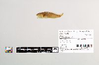 46542[]Huff, David; Oregon Department of Environmental Quality 2002-07-09 United States, Oregon, Wheeler, Lake Creek, 44.8575 -119.9686111 |
JFBM:Fishes | 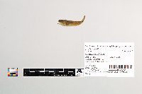 46600[]Huff, David; Oregon Department of Environmental Quality 2006-09-23 United States, Oregon, Lane, McKenzie River, 44.1233333 -123.0966667 |
JFBM:Fishes | 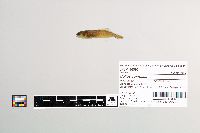 46595[]Huff, David; Oregon Department of Environmental Quality 2006-08-15 United States, Oregon, Lane, Row River, at river mile 2.5, near Cottage Grove, 43.7905556 -123.0241667 |
JFBM:Fishes | 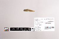 19493[]Quimby, Alan 1963-00-00 United States, Montana, Flathead, Kalispell, 48.19579 -114.31291 |
JFBM:Fishes | 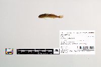 46584[]Huff, David; Oregon Department of Environmental Quality 2006-08-07 United States, Oregon, Clackamas, Clackamas River, at River Mile 60.2, 45.0194444 -121.9930556 |
JFBM:Fishes |  46523[]Huff, David; Oregon Department of Environmental Quality 2002-08-01 United States, Oregon, Linn, Soda Fork at River Mile 3.24, 44.4369444 -122.2527778 |
JFBM:Fishes |  22713[]Daniels; Geary 1974-08-09 United States, California, Shasta, Spring Creek, Fall River Basin |
JFBM:Fishes |  17297[]Weatherbee; Deckert 1953-04-11 United States, Oregon, Lincoln, Drift Creek, 4 miles from mouth, near Taft, 44.89942 -123.97488 |
JFBM:Fishes |  19081[]Riddle, Betty 1959-00-00 United States, Alaska, unspecified |
JFBM:Fishes |  18917[]Bishop, R. 1959-07-15 United States, Alaska, Bristol Bay, Nanek River, 20 miles above mouth, 20 miles E of King Salmon, 58.62693 -156.1377 |
JFBM:Fishes |  19995[]Huver, Charles 1955-06-15 United States, Alaska, Kodiak Island, Bare Lake off mouth of Magpie Creek, Kodiak Island, 57.19646 -154.28444 |
JFBM:Fishes |  46537[]Huff, David; Oregon Department of Environmental Quality 2001-08-26 United States, Oregon, Lane, Big Creek, in Rock Creek Wilderness, 44.1708333 -124.1058333 |
JFBM:Fishes |  46549[]Huff, David; Oregon Department of Environmental Quality 2002-09-16 United States, Oregon, Lincoln, Elkhorn Creek, 44.5016667 -123.9891667 |
JFBM:Fishes | 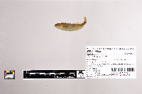 46509[]Huff, David; Oregon Department of Environmental Quality 2001-08-27 United States, Oregon, Tillamook, Beaver Creek, 0,79 mile upstream of confluencw with Nestucca River, 45.2852778 -123.8238889 |
JFBM:Fishes | 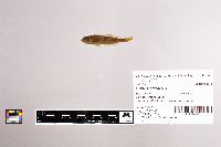 17299[]Weatherbee; Deckert; Kerns 1953-05-21 United States, Oregon, Lincoln, Scott Creek, tributary to Alsea River, 44.39945 -123.83181 |
JFBM:Fishes | 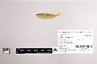 46536[]Huff, David; Oregon Department of Environmental Quality 2001-08-23 United States, Oregon, Curry, Sixes Creek, 42.8041667 -124.3061111 |
JFBM:Fishes | 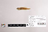 18900[]Wilson, John 1932-00-00 United States, Washington, Franklin/Benton, Columbia River, Pasco-Kennewick, 46.21125 -119.13723 |
JFBM:Fishes | 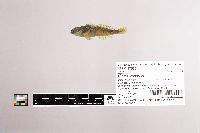 47562[]Egge, Jacob; Shields, Evan; Ankenman, Brianne 2011-06-08 United States, Washington, Wahkiakum, Elochoman River just off Elochoman Valley Highway at intersection with Schoonover Road, 46.2209167 -123.3435333 |
JFBM:Fishes | 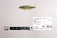 47564[]Egge, Jacob; Ankenman, Brianne; Shields, Evan 2011-06-13 United States, Washington, Jefferson, Hoh River at Willoughby Creek off Hoh Road, 47.8228 -124.1985 |
JFBM:Fishes | 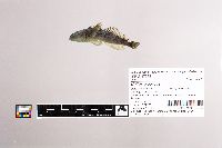 47563[]Egge, Jacob; Ankenman, Brianne; Shields, Evan 2011-06-20 United States, Washington, Snohomish, Jim Creek at Jordan Road, ca. 2 miles E of Arlington, 48.1835333 -122.0767 |
JFBM:Fishes | 43573[]Schmidt, Konrad; United States Geological Survey 2004-05-12 United States, Wisconsin, Ashland, Lake Superior, Apostle Islands off W side of Outer Island, 22.2 mi NE of Bayfield, 47.04065 -90.4858 |
JFBM:Fishes | 41893[]Schmidt, Konrad; Cholweth, G.; Evrard, L. 2003-05-13 United States, Wisconsin, Ashland, Lake Superior off Stockton Island (station 2 -serial #005) 27 miles NE of Ashland, 46.90759 -90.51361 |
JFBM:Fishes | 14954[]Eddy, Samuel 1947-06-21 United States, Minnesota, Cook, Lake Superior, 25 miles off Grand Marais, 47.48009 -90.01648 |
JFBM:Fishes | 42574[]Schmidt, Konrad 2004-05-11 United States, Wisconsin, Ashland, Lake Superior, Apostle Islands, Bear Island, 47.0036125 -90.7402802 |
JFBM:Fishes | 22326[]Maxwell, Clint 1982-11-01 United States, Minnesota, Lake, Lake Superior, just out from Beaver Bay, 47.2578 -91.27785 |
JFBM:Fishes | 24402[]Etnier, David 1989-07-18 United States, Minnesota, Cook, Saganaga Lake, Jocks Narrows, 48.24422 -90.88423 |
JFBM:Fishes | 19814[]Eddy, Samuel 1940-00-00 United States, Minnesota, Cook, Lake Superior, Grand Marais, 47.72362 -90.3186 |
JFBM:Fishes | 22866[]Persons 1985-08-02 United States, Minnesota, Cook, Saganaga Lake, 48.21461 -90.905 |
JFBM:Fishes | 14496[]no data 1946-06-13 United States, Minnesota, Cook, Lake Superior, 20 mi off Grand Marais |
JFBM:Fishes | 25373[]Etnier, David; Etnier, M.; Shields, Barbara 1991-08-08 United States, Minnesota, Cook, Sagnaga Lake, north shore, 48.24663 -90.90912 |
JFBM:Fishes | 26509[]Minnesota Department of Natural Resources 1992-07-00 Canada, Ontario, Lake Superior, Thunder Bay-Rossport, Ontario, Canada, 48.47656 -88.26965 |
JFBM:Fishes | 42575[]Schmidt, Konrad 2004-05-10 United States, Wisconsin, Ashland, Lake Superior, Apostle Islands, North Channel at North end of Madeline Island, 46.8697205 -90.5897217 |
JFBM:Fishes | 38097[]Krosch, H. 1969-00-00 United States, Minnesota, Washington, St. Croix River, Lake St. Croix, downstream of Bayport, ca. River Mile 17.5- 19.0, 45 -92.7666702 |
JFBM:Fishes | 43571[]Schmidt, Konrad; United States Geological Survey 2004-05-12 United States, Wisconsin, Ashland, Lake Superior, Apostle Islands S of Cat Island, 17.3 miles NE of Bayfield, 46.98822 -90.55756 |
JFBM:Fishes | 48399[]Nagle, Brett; Winter, Tyler 2010-06-22 United States, Minnesota, Lake, Snowbank Lake, 47.99087 -91.40138 |
JFBM:Fishes | 49030[]United States Fish and Wildlife Service 2002-07-21 Canada, Ontario, off Sandy Islands, Lake Superior, 46.88185 -84.7116833 |
JFBM:Fishes | 16815[]Weitzman, S. 1950-08-20 United States, Oregon, Curry, Pacific Ocean, beach at end of Mill Beach Road, Brookings, 42.0480537 -124.2916641 |
JFBM:Fishes | 20105[]P.G. Putnam 1963-09-00 United States, Washington, Skagit, Puget Sound, vicinity of Anacortes |
JFBM:Fishes | 16774[]R. Livingstone, Jr. 1951-03-21 United States, Alaska, unspecified |
JFBM:Fishes | 16777[]R. Livingstone, Jr. 1951-03-17 United States, Port Frederick sec USCGS chart #8304 |
JFBM:Fishes | 19441[]U.S. Fish and Wildlife Laboratory 1962-00-00 United States, Maine, Lincoln, Gulf of Maine, vicinity of Boothbay Harbor, 43.84369 -69.63409 |
JFBM:Fishes | 19436[]U.S. Fish and Wildlife Laboratory 1961-00-00 United States, Maine, Gulf of Maine, vicinity of Boothbay Harbor |
JFBM:Fishes | 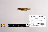 46514[]Huff, David; Oregon Department of Environmental Quality 2002-08-15 United States, Oregon, Lane, Marten Creek, 44.12 -122.5252778 |
JFBM:Fishes | 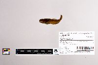 46539[]Huff, David; Oregon Department of Environmental Quality 2002-09-23 United States, Oregon, Josephine, West Fork Williams Creek, 42.1794444 -123.3436111 |
JFBM:Fishes | 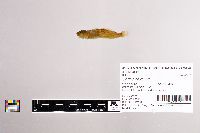 46517[]Huff, David; Oregon Department of Environmental Quality 2002-09-04 United States, Oregon, Lane, South Fork McKenzie River, 43.955 -121.9861111 |
JFBM:Fishes | 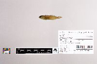 46587[]Huff, David; Oregon Department of Environmental Quality 2006-09-13 United States, Oregon, Lane, Coast Fork Willamette River, 43.6075 -123.0805556 |
JFBM:Fishes | 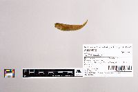 46521[]Huff, David; Oregon Department of Environmental Quality 2002-07-30 United States, Oregon, Linn, Tributary to Marion Creek, tributary to North Santiam River, 44.5925 -121.4480556 |
JFBM:Fishes |  46570[]Huff, David; Oregon Department of Environmental Quality 2006-08-22 United States, Oregon, Lane, Willamette River, 44.0466667 -123.0577778 |
JFBM:Fishes |  46515[]Huff, David; Oregon Department of Environmental Quality 2001-09-12 United States, Oregon, Clackamas, Eagle Creek, 45.3233333 -122.3019444 |
JFBM:Fishes |  46592[]Huff, David; Oregon Department of Environmental Quality 2006-09-06 United States, Oregon, Clackamas, Eagle Creek, at River Mile 2.0, 45.345 -122.3555556 |
JFBM:Fishes |  18922[]Wilson, John 1932-04-30 United States, Washington, Walla Walla, Columbia River, at Pasco/Kennewick, 46.22023 -119.11514 |
JFBM:Fishes |  46535[]Huff, David; Oregon Department of Environmental Quality 2001-07-31 United States, Oregon, Linn, Blowout Creek, North Santiam River behind Detroit Dam, 44.6366667 -122.1133333 |
JFBM:Fishes |  46510[]Huff, David; Oregon Department of Environmental Quality 2002-07-10 United States, Oregon, Morrow, Alder Creek, 45.0522222 -119.4525 |
JFBM:Fishes |  17353[]Needham, Paul 1951-07-24 United States, California, Nevada, Sagehen Creek, Sagehen Creek Field Station, 39.43089 -120.23815 |
JFBM:Fishes |  46582[]Huff, David; Oregon Department of Environmental Quality 2006-08-07 United States, Oregon, Marion, Silver Creek, 45.0097222 -122.7916667 |
JFBM:Fishes |  46557[]Huff, David; Oregon Department of Environmental Quality 2002-07-16 United States, Oregon, Umatilla, Camas Creek, 45.0422222 -118.9780556 |
JFBM:Fishes | 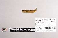 46522[]Huff, David; Oregon Department of Environmental Quality 2003-08-05 United States, Oregon, Lane, Lost Creek, 43.8430556 -122.78 |
JFBM:Fishes | 16808[]Weitzman, S. 1950-07-01 United States, California, Marin, Pacific Ocean, Duxbury Reef, 37.8883324 -122.6983337 |
JFBM:Fishes | 14807[]G. Maxfield United States, Washington, Puget Sound |
JFBM:Fishes | 18424[]Allen 1900-00-00 United States, California, Monterey, Pacific Grove, 36.63647 -121.92764 |
JFBM:Fishes | 16795[]S. Weitzman and G. Hanomoto 1950-10-22 United States, California, Marin, Duxbury Reef, 37.8883324 -122.6983337 |
JFBM:Fishes | 16814[]Weitzman, S. 1950-10-22 United States, California, Marin, Pacific Ocean, Duxbury Reef, 37.8883324 -122.6983337 |
JFBM:Fishes | 16960[]Breckenridge, Walter; Wilkie, R. 1953-07-26 Canada, Nunavut, Back River, 15 miles below mouth of Meadow River, 140 miles NW of Baker Lake |
JFBM:Fishes | 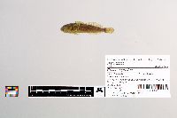 22725[]Church, Wade; McCormack, David 1983-07-07 United States, Minnesota, Itasca, Bear River at County Road 528, 0.5 miles off Through Highway 65, 47.75502 -93.17316 |
JFBM:Fishes | 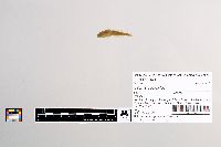 16949[]Breckenridge, Walter; Wilkie, R. 1953-07-18 Canada, tiny pool at edge of Back River, 15 miles below mouth of Meadow River, 140 miles NW of Baker Lake, Keewatin Territory |
JFBM:Fishes | 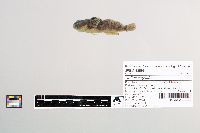 43898[]Niemela, Scott 2004-06-29 United States, Minnesota, Fillmore, Canfield Creek, just upstream of southern boundary of Forestville Mystery Cave State Park, 2 miles S of Forestville, 43.6160538 -92.22496672 |
JFBM:Fishes |  35407[]Kenyon, W. 1941-08-14 United States, Minnesota, Cook, Devil Track River, at mouth, 47.7687 -90.2611 |
JFBM:Fishes |  43968[]Feist, Mike United States, Minnesota, Winona, South Fork Whitewater River; in Whitewater Wildlife Management Area; 4.5 miles NE of St. Charles, 44.0097237 -91.9766693 |
JFBM:Fishes |  43902[]Niemela, Scott 2004-06-24 United States, Minnesota, Winona, Coolridge Creek, upstream of County Road 2, ca. 7 miles NW of Rushford, 43.87540002 -91.87591679 |
JFBM:Fishes |  22736[]Ashmun, H.; McCormack, David 1983-08-31 United States, Minnesota, Cook, Plouff Creek, at County Road 33, 47.80024 -90.93521 |
JFBM:Fishes |  22734[]Ashmun, H.; McCormack, David 1983-08-30 United States, Minnesota, Cook, Temperance River at National Forest Development Road, 2 miles E of County Road 2, 47.80082 -90.8456 |
JFBM:Fishes |  20789[]Stasiak, Richard; Underhill, James 1969-10-29 United States, Minnesota, Winona, Garvin Brook, 44.00624 -91.8091 |
JFBM:Fishes |  22735[]Ashmun, H.; McCormack, David 1983-08-30 United States, Minnesota, Cook, Temperance River at National Forest Development Road, 4 miles E of County Road 2, 47.82537 -90.83479 |
JFBM:Fishes |  46691[]Hall, Carol 2010-06-10 United States, Minnesota, Winona, Gilmore Creek, at Gilmore Avenue Bridge in Southwest Winona, 44.04803213 -91.69146844 |
JFBM:Fishes |  16955[]Breckenridge, Walter; Wilkie, R. 1953-07-18 Canada, tiny pool above high water, Back River, 15 miles below mouth of Meadow River, 140 miles NW of Baker Lake, Keewatin Territory |
JFBM:Fishes |  45849[]Koschak, M.; Teeter, A.; Carter, Chandra 2008-07-16 United States, Minnesota, Houston, Beaver Creek, downstream of County-State-Aid-Highway 12, 4.5 miles W of Caledonia, 43.63456 -91.61111 |
JFBM:Fishes |  43920[]Weitzell, Roy 2004-08-04 United States, Minnesota, Olmsted, Cascade Creek downstream of US Highway 52 in Rochester, 44.02712376 -92.47380517 |
JFBM:Fishes |  17722[]Underhill, James Canada, Yukon/Northwest Territory, Yukon, Northwest Territory |
JFBM:Fishes |  22731[]Ashmun, H.; McCormack, David 1983-08-29 United States, Minnesota, Cook, Heartbreak Creek, at Six Hundred Road, 47.6116 -90.91925 |
JFBM:Fishes |  22727[]Ashmun, H.; McCormack, David 1983-08-24 United States, Minnesota, Lake, Caribou River at Minnesota Highway 61, in Caribou Falls State Park, 47.46389 -91.031 |
JFBM:Fishes |  22724[]Church, Wade; McCormack, David 1983-07-06 United States, Minnesota, Itasca, Bear River at County Road 528, 1 mile S of County Road 22, 47.76647 -93.10591 |
JFBM:Fishes |  21849[]Lueben; Ross, Marvin 1974-08-15 United States, Minnesota, Fillmore, Gribb Creek at County Road 23, 1 mile S of Whalan, 43.72186 -91.91523 |
JFBM:Fishes | 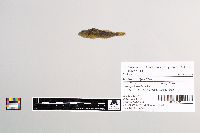 22733[]Ashmun, H.; McCormack, David 1983-08-30 United States, Minnesota, Cook, Swanson Creek at County Road 2, 47.78288 -90.88045 |
JFBM:Fishes | 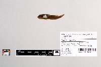 20198[]Eddy, Samuel 1947-08-02 United States, Minnesota, Hubbard, Kabekona River at US Highway 71 bridge, 47.24096 -94.87669 |
JFBM:Fishes | 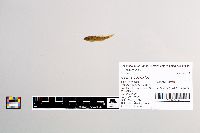 21298[]Ross, Marvin; Lueben 1974-08-23 United States, Minnesota, Fillmore, Upper Bear Creek, at County Road 5, 2 miles S of Chatfield, 43.81093 -92.19598 |
JFBM:Fishes | 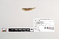 45795[]Koschak, M. 2008-07-09 United States, Minnesota, Fillmore, Forestville Creek, adjacent to County Road 118, 5 miles S of Wykoff, 43.63574 -92.22278 |
JFBM:Fishes | 11528[] United States, Minnesota, Lake, Knife River, at mouth, 46.94902 -91.77822 |
JFBM:Fishes |  27230[]Baness, E. 1993-06-10 United States, Minnesota, Houston, East Branch Beaver Creek, Beaver Creek Valley State Park, 43.64142 -91.58023 |
JFBM:Fishes |  26981[]Schmidt, Konrad 1993-08-07 United States, Minnesota, Fillmore, South Branch Root River at Seven Springs, 43.62511 -92.28245 |
JFBM:Fishes |  27201[]Schmidt, Konrad 1993-06-04 United States, Minnesota, Carlton, Anderson Creek at County Highway 8, 46.47563 -92.45454 |
Google Map
Google Maps is a web mapping service provided by Google that features a map that users can pan (by dragging the mouse) and zoom (by using the mouse wheel). Collection points are displayed as colored markers that when clicked on, displays the full information for that collection. When multiple species are queried (separated by semi-colons), different colored markers denote each individual species.