University of Minnesota
http://www.umn.edu/
612-625-5000
http://www.umn.edu/
612-625-5000
Minnesota Biodiversity Atlas
Bell Museum
Dataset: JFBM-Fishes
Taxa: Diodontidae
Search Criteria: excluding cultivated/captive occurrences
1
Page 1, records 1-7 of 7
Bell Museum fishes | |
 JFBM:Fishes | 42357[]C. Milstein, J. Starkus, M. Anderson, and Gustavus Adolphus Group 1969-01-11 Puerto Rico, Playa Papaya Beach, 2 mi E of Magueyes Island, La Parguera |
JFBM:Fishes | 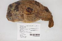 19232[]Gosline, William 1960-00-00 United States, Hawaii, Oahu, Pacific Ocean off Oahu, 21.28937 -157.91748 |
JFBM:Fishes | 47965[]Egan, Josh; Hundt, Peter; Chew, Uik-Sen; Tsai, Wen-Yu 2014-06-12 Taiwan (Republic of China), Miaoli, Mouth of Chonggang River, Houlong township, Miaoli county, Taiwan, 24.6228861 120.7543389 |
JFBM:Fishes | 18757[]U.G. Springer 1957-07-00 United States, Texas, Nueces, Gulf of Mexico at Aransas Pass off Port Aransas, 27.8386116 -97.0497208 |
JFBM:Fishes | 16388[]no data 1951-00-00 Undefined, Undefined, Undefined, Gulf of Mexico |
JFBM:Fishes | 38691[]P.J. Ocklensclelaya 1974-10-13 Mexico, Vera Cruz, Found on beach at Jicacal |
JFBM:Fishes | 47252[]Huver, Charles 1972-00-00 United States, Texas, Nueces, Port Aransas |
1
Page 1, records 1-7 of 7
Google Map
Google Maps is a web mapping service provided by Google that features a map that users can pan (by dragging the mouse) and zoom (by using the mouse wheel). Collection points are displayed as colored markers that when clicked on, displays the full information for that collection. When multiple species are queried (separated by semi-colons), different colored markers denote each individual species.