University of Minnesota
http://www.umn.edu/
612-625-5000
http://www.umn.edu/
612-625-5000
Minnesota Biodiversity Atlas
Bell Museum
Dataset: JFBM-Fishes
Taxa: Mugilidae
Search Criteria: excluding cultivated/captive occurrences
1
Page 1, records 1-46 of 46
Bell Museum fishes | |
 JFBM:Fishes | 47943[]Egan, Josh 2014-07-01 Australia, Queensland, Dungeness boat ramp in Lucinda, Queensland, Australia, -18.523917 -146.317919 |
JFBM:Fishes | 48831[]Hundt, Peter; Egan, Josh; Ghedotti, Michael; Chew, Uik-Sen 2016-05-09 Taiwan (Republic of China), Pingtung, Tidepools on both sides of jetty, approximately 2 km North of Maobitou Park, 21.9324167 120.7450833 |
JFBM:Fishes | 18690[]S. Eddy and T. Hellier 1958-02-04 United States, Texas, Nueces, Tide trap at Biological Station in Port Aransas, 27.8336105 -97.058609 |
JFBM:Fishes | 47583[]Egan, Josh; Zhao, Yu-Shen 2013-08-04 Taiwan (Republic of China), Chiayi, Tidal mud flat, near Haomeili, 23.3602861 120.1298944 |
JFBM:Fishes | 46458[]P.J. Hundt, A.M. Simons, B.A. Young 2010-07-10 United States, Florida, Indian River, Indian River, at Captain Forster Hammock Preserve, on Historic Jungle Trail, 1 mile East of Wabasso, on Orchid Island, 27.7508333 -80.4006667 |
JFBM:Fishes | 18578[]Brown, William 1953-04-14 United States, Texas, Chambers, Canal on Barrow Ranch, S of Anahuac, 29.59734 -94.3959 |
JFBM:Fishes | 18645[]S. Eddy, T. Hellier, W.M. McConnell 1958-02-04 United States, Texas, Nueces, Padre Island Lagoon (Laguna Madre), 20 mi. South of Port Aransas, 27.6350002 -97.2330551 |
JFBM:Fishes | 42365[]C. Milstein, J. Starkus, M. Anderson, and Gustavus Adolphus Group 1969-01-11 Puerto Rico, Playa Papaya Beach, 2 mi E of Magueyes Island, La Parguera |
JFBM:Fishes | 37428[]South African Institute for Aquatic Biodiversity 2004-06-25 South Africa, Eastern Cape, upper reaches of Umgazi Estuary, 15 km S of Port St. John's, -31.6333333 29.4333325 |
JFBM:Fishes | 37426[]South African Institute for Aquatic Biodiversity 2004-06-25 South Africa, Eastern Cape, upper reaches of Umgazi Estuary, 15 km S of Port St. John's, -31.6444436 29.4419442 |
JFBM:Fishes | 37435[]South African Institute for Aquatic Biodiversity 2004-06-25 South Africa, Eastern Cape, upper reaches of Umgazi Estuary, 15 km S of Port St. John's, -31.6333333 29.4333325 |
JFBM:Fishes | 37450[]South African Institute for Aquatic Biodiversity 2004-06-25 South Africa, Eastern Cape, upper reaches of Umgazi Estuary, 15 km S of Port St. John's, -31.6444436 29.4419442 |
JFBM:Fishes | 37524[]South African Institute for Aquatic Biodiversity 2004-06-25 South Africa, Eastern Cape, upper reaches of Umgazi Estuary, 15 km S of Port St. John's, -31.6333333 29.4333325 |
JFBM:Fishes | 17007[]R. Darnell 1953-04-00 United States, Louisiana, Jefferson, Gulf of Mexico at Gand Isle, 29.2405548 -89.9880524 |
JFBM:Fishes | 16753[]Harry and Zelenka 1951-07-05 United States, Mississippi, Gulf Port |
JFBM:Fishes | 16325[]Cross, Frank 1950-05-07 United States, Florida, Escambia, Pensacola, 30.42131 -87.21692 |
JFBM:Fishes | 17777[]U of GA Icht. Class 1954-05-08 United States, Georgia, McIntosh, Beach pool, Sapelo Island, 31.3858337 -81.285553 |
JFBM:Fishes | 16553[]W. Moore 1957-04-15 United States, Louisiana, St. Charles, Bonnet-Carre Spillway |
JFBM:Fishes | 17006[]R. Darnell 1953-04-00 United States, Louisiana, Jefferson, Gulf of Mexico at Gand Isle, 29.2405548 -89.9880524 |
JFBM:Fishes | 14756[]E.K. Jordan 1910-00-00 United States, Hawaii, Honolulu, Pacific Ocean at Honolulu |
JFBM:Fishes | 43876[]Simons, Andrew; Gidmark, Nick 2005-07-13 United States, Florida, Volusia/Lake, Lake George at Zinder Point Boat Ramp, ca. 4 airmiles NW of Astor, 29.2013893 -81.577774 |
JFBM:Fishes | 16881[]Suttkus, Royal; Eddy, Samuel; Darnell, Rezneat; Joseph, E. 1953-03-21 United States, Louisiana, St. Charles, Mississippi River, Bonnet Carre Spillway, borrow pits, Norco, 30.0027 -90.44147 |
JFBM:Fishes | 18556[]Flury, Alvin 1953-07-28 United States, Texas, Hidalgo, Rio Grande River at Bentsen State Park, 8 miles west of Mission, 26.15975 -98.38806 |
JFBM:Fishes | 37431[]South African Institute for Aquatic Biodiversity 2004-06-25 South Africa, Eastern Cape, upper reaches of Umgazi Estuary, 15 km S of Port St. John's, -31.6333333 29.4333325 |
JFBM:Fishes | 47426[]Egan, Josh; Zhao, Yu-Shen; Kuo, Chien-Hsien 2013-07-08 Taiwan (Republic of China), Pingtung, Tidepools, Haikou, Hengchon Township, 21.9883333 120.7081583 |
JFBM:Fishes |  48674[]Egan, Josh; Zhao, Yu-Shen 2013-08-11 Taiwan (Republic of China), Chiayi, Tidal mud flat, near Haomeili, 23.3602861 120.1298944 |
JFBM:Fishes | 480003[]Egan, Josh; Hundt, Peter; Chew, Uik-Sen 2014-06-14 Taiwan (Republic of China), Chiayi, Tidal mud flat near oyster farming platforms, Haomei, 23.3602861 120.1298944 |
JFBM:Fishes | 48107[]Egan, Josh; Johnson, Ross; Bradley, Michael 2014-07-09 Australia, Queensland, Peninsula near Victoria Creek and town of Taylors Beach, Queensland, Australia, -18.6373389 -146.3333833 |
JFBM:Fishes | 48123[]Egan, Josh 2014-07-08 Australia, Queensland, Ross River wetland pools, Townsville, Queensland, Australia, -19.302669 146.783996 |
JFBM:Fishes | 48143[]Egan, Josh 2014-07-08 Australia, Queensland, Captains Creek outflow, Rowes Bay, Townsville, Queensland, Australia, -19.24053 146.791239 |
JFBM:Fishes |  48672[]Egan, Josh; Hundt, Peter; Chew, Uik-Sen 2014-06-14 Taiwan (Republic of China), Chiayi, Tidal mud flat near oyster farming platforms, Haomei, 23.3602861 120.1298944 |
JFBM:Fishes |  Chelon macrolepis Smith 47649[]Egan, Josh; Zhao, Yu-Shen 2013-08-11 Taiwan (Republic of China), Chiayi, Tidal mud flat, near Haomeili, 23.3602861 120.1298944 |
JFBM:Fishes |  Chelon macrolepis Smith 47595[]Egan, Josh; Zhao, Yu-Shen 2013-08-04 Taiwan (Republic of China), Chiayi, Sandy beach near Haomeili, 23.3635139 120.1296528 |
JFBM:Fishes |  Chelon macrolepis Smith 47501[]Egan, Josh; Zhao, Yu-Shen 2013-08-14 Taiwan (Republic of China), Chiayi, Tidal mud flat, near Haomeili, 23.3602861 120.1298944 |
JFBM:Fishes |  Chelon macrolepis Smith 47883[]Hundt, Peter; Chew, Uik-Sen 2014-07-28 Taiwan (Republic of China), Chiayi, Estuary, Northwest of seawall, near Haomeili, 23.3602222 120.1301972 |
JFBM:Fishes |  Chelon macrolepis Smith 47990[]Egan, Josh; Hundt, Peter; Chew, Uik-Sen 2014-06-14 Taiwan (Republic of China), Chiayi, Sandy beach near Haomeili, 23.3635139 120.1296528 |
JFBM:Fishes |  Chelon macrolepis Smith 47976[]Egan, Josh; Chen, Vincent 2014-06-09 Taiwan (Republic of China), Shuang Chun beach, Tainan County, Taiwan (Republic of China), 23.305965 120.108181 |
JFBM:Fishes | 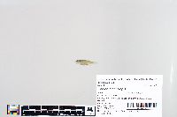 Chelon macrolepis Smith 48024[]Egan, Josh; Hundt, Peter; Chung, Li-An 2014-06-15 Taiwan (Republic of China), Chiayi, Tidal mud flat near oyster farming platforms, Haomei, 23.3602861 120.1298944 |
JFBM:Fishes |  Chelon macrolepis Smith 48673[]Egan, Josh; Hundt, Peter; Chew, Uik-Sen 2014-06-14 Taiwan (Republic of China), Chiayi, Tidal mud flat near oyster farming platforms, Haomei, 23.3602861 120.1298944 |
JFBM:Fishes | 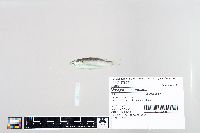 Moolgarda cunnesius Valenciennes 47626[]Egan, Josh; Zhao, Yu-Shen 2013-08-11 Taiwan (Republic of China), Chiayi, Sandy beach near Haomeili, 23.3635139 120.1296528 |
JFBM:Fishes | 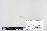 Moolgarda cunnesius Valenciennes 47958[]Egan, Josh; Hundt, Peter; Chew, Uik-Sen; Tsai, Wen-Yu 2014-06-12 Taiwan (Republic of China), Miaoli, Mouth of Chonggang River, Houlong township, Miaoli county, Taiwan, 24.6228861 120.7543389 |
JFBM:Fishes | 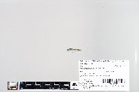 Moolgarda cunnesius Valenciennes 47981[]Egan, Josh; Chen, Vincent; Liang, Ji; Kuo, Chien-Hsien 2014-05-27 Taiwan (Republic of China), Chiayi, Sandy beach near Haomeili, 23.3635139 120.1296528 |
JFBM:Fishes |  Moolgarda cunnesius Valenciennes 48003[]Egan, Josh; Hundt, Peter; Chew, Uik-Sen 2014-06-14 Taiwan (Republic of China), Chiayi, Tidal mud flat near oyster farming platforms, Haomei, 23.3602861 120.1298944 |
JFBM:Fishes |  Moolgarda cunnesius Valenciennes 48671[]Egan, Josh; Hundt, Peter; Chew, Uik-Sen 2014-06-14 Taiwan (Republic of China), Chiayi, Sandy beach near Haomeili, 23.3635139 120.1296528 |
JFBM:Fishes | 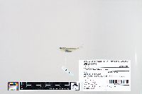 Moolgarda cunnesius Valenciennes 48670[]Egan, Josh; Hundt, Peter; Chung, Li-An 2014-06-15 Taiwan (Republic of China), Chiayi, Tidal mud flat near oyster farming platforms, Haomei, 23.3602861 120.1298944 |
JFBM:Fishes |  Moolgarda cunnesius Valenciennes 48675[]Egan, Josh; Zhao, Yu-Shen 2013-08-04 Taiwan (Republic of China), Chiayi, Sandy beach near Haomeili, 23.3635139 120.1296528 |
1
Page 1, records 1-46 of 46
Google Map
Google Maps is a web mapping service provided by Google that features a map that users can pan (by dragging the mouse) and zoom (by using the mouse wheel). Collection points are displayed as colored markers that when clicked on, displays the full information for that collection. When multiple species are queried (separated by semi-colons), different colored markers denote each individual species.