University of Minnesota
http://www.umn.edu/
612-625-5000
http://www.umn.edu/
612-625-5000
Minnesota Biodiversity Atlas
Bell Museum
Dataset: JFBM-Fishes
Taxa: Platycephalidae
Search Criteria: excluding cultivated/captive occurrences
1
Page 1, records 1-7 of 7
Bell Museum fishes | |
 JFBM:Fishes | 48070[]Egan, Josh; Buelow, Christina 2014-07-27 Australia, Queensland, Rowes Bay, beach access 10, near Townsville, Queensland, Australia, -19.2176083 146.7784139 |
JFBM:Fishes | 48102[]Egan, Josh; Johnson, Ross; Bradley, Michael 2014-07-09 Australia, Queensland, Peninsula near Victoria Creek and town of Taylors Beach, Queensland, Australia, -18.6373389 -146.3333833 |
JFBM:Fishes | 48229[]Egan, Josh; Buelow, Christina 2014-07-18 Australia, Queensland, Rowes Bay, beach access 10, near Townsville, Queensland, Australia, -19.2176083 146.7784139 |
JFBM:Fishes | 48239[]Egan, Josh; Johnson, Ross; Bradley, Michael 2014-07-09 Australia, Queensland, Peninsula near Victoria Creek and town of Taylors Beach, Queensland, Australia, -18.6373389 -146.3333833 |
JFBM:Fishes | 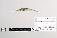 48717[]Egan, Josh; Chew, Uik-Sen; Hundt, Peter; Ghedotti, Michael 2016-05-19 Taiwan (Republic of China), Taiwan Strait, 22.661874 119.895642 |
JFBM:Fishes | 49157[]Egan, Josh; Chew, Uik-Sen; Ghedotti, Michael 2016-05-08 Taiwan (Republic of China), Chiayi, Tidal mudflat near oyster farming platforms, Haomei Estuary, Chiayi County, Taiwan, 23.3602861 120.1298944 |
JFBM:Fishes | 48087[]Egan, Josh 2014-07-29 Australia, Queensland, Ross River wetland pools, Townsville, Queensland, Australia, -19.302669 146.783996 |
1
Page 1, records 1-7 of 7
Google Map
Google Maps is a web mapping service provided by Google that features a map that users can pan (by dragging the mouse) and zoom (by using the mouse wheel). Collection points are displayed as colored markers that when clicked on, displays the full information for that collection. When multiple species are queried (separated by semi-colons), different colored markers denote each individual species.