University of Minnesota
http://www.umn.edu/
612-625-5000
http://www.umn.edu/
612-625-5000
Minnesota Biodiversity Atlas
Bell Museum
Dataset: MIN-Plants
Search Criteria: Comoros; excluding cultivated/captive occurrences
1
Page 1, records 1-17 of 17
Bell Museum plants | |
 MIN:Plants | Ficus lutea Vahl 431501[]Sewall, B.J. BJS 1092002-03-11 Comoros, Island: Anjouan (Nzwani); watershed: Mutsamudu River; watershed locality: Pentagone/Msakini; nearest village: Sangani, -12.192183 44.42005, 637m |
MIN:Plants |  489531[1369002]Brent J. Sewall 102001-08-28 Comoros, Island of Anjouan (Nzwani), Hapemba, -12.2004 44.4204, 788m |
MIN:Plants | 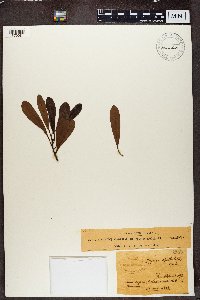 Myrica spathulata Mirb. 455284[1370081]Humblot 1921883-10-28 Comoros, NE |
MIN:Plants | 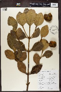 Calophyllum L. 488973[1370089]Sewall, B. J BJS1072002-03-11 Comoros, West Indian Ocean, Anjouan, Sangani, Mutsamudu River Watershed, Hapemba, -12.2 44.416667, 788m |
MIN:Plants | 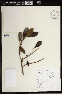 432518[1369588]Brent J. Sewall BJS 122001-08-28 Comoros, Island Anjouan (Nzwani). Mutsamudu River Watershed. Nearest village: Sangani, Locality: Ntringi, -12.2053 44.4241, 906m |
MIN:Plants | 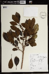 489549[1369589]Sewall, Brent J. 1042002-03-12 Comoros, Anjouan (Nzwani), Near Sangani, Pentagone, -12.19005 44.422767, 742m |
MIN:Plants | 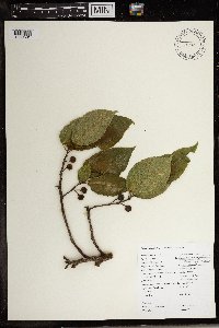 432520[1369591]Sewall, Brent J. 142001-08-28 Comoros, Anjouan (Nzwani), near Sangani, Ntringi, -12.20585 44.423833, 923m |
MIN:Plants | 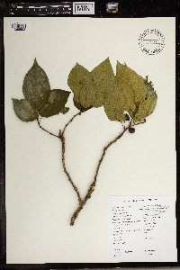 432521[1369592]Sewall, Brent J. 132001-08-28 Comoros, Anjouan (Nzwani), near Sangani, Ntringi, -12.2053 44.423933, 914m |
MIN:Plants | 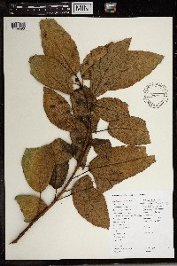 489556[1369593]Sewall, B. J BJS 1022002-02-28 Comoros, West Indian Ocean, Anjouan, Sangani, Mutsamudu River Watershed, Ntringi, -12.208333 44.416667, 1070m |
MIN:Plants |  489543[1369596]Sewall, Brent J. 1012002-02-28 Comoros, Anjouan (Nzwani), near Sangani, Ntringi, -12.207817 44.423333, 1015m |
MIN:Plants | 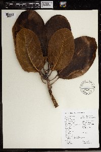 Ficus lutea Vahl 969447[1369597]Sewall, Brent J. 1092002-03-11 Comoros, Anjouan (Nzwani), near Sangani, Pentagone/Msakini, -12.192183 44.42005, 637m |
MIN:Plants | 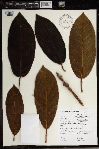 Ficus lutea Vahl 489553[1369598]Sewall, B. J BJS112001-08-28 Comoros, West Indian Ocean, Anjouan, Sangani, Mutsamudu River Watershed, Ntringi, -12.2 44.416667, 915m |
MIN:Plants | 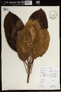 Ficus lutea Vahl 969448[1369599]Brent J. Sewall BJS 1032002-03-11 Comoros, Anjouan (Nzwani). Mutsamudu River Watershed. Nearest village Sangani, Pentagona/ Msakini, -12.192283 44.420567, 749m |
MIN:Plants | 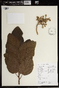 489557[1369607]Sewall, Brent J. 1052002-03-12 Comoros, Anjouan (Nzwani), near Sangani/Hombo, -12.180417 44.4052, 238m |
MIN:Plants | 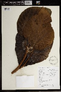 431316[1369608]Sewall, B. J BJS1082002-03-11 Comoros, West Indian Ocean, Anjouan, Sangani, Mutsamudu River Watershed, Pentagone/ Msakini, -12.191667 44.416667, 718m |
MIN:Plants |  488976[1302326]Sewall, B. J 22001-07-13 Comoros, West Indian Ocean, Anjouan, Mutsamudu River Watershed, About 100m uphill from coordinates, -12.192 44.420333, 760m |
MIN:Plants |  432519[1372001]Brent J. Sewall 152001-08-28 Comoros, Anjouan (Nzwani), near Sangani, Hapemba, -12.2004 44.4204, 788m |
1
Page 1, records 1-17 of 17
Google Map
Google Maps is a web mapping service provided by Google that features a map that users can pan (by dragging the mouse) and zoom (by using the mouse wheel). Collection points are displayed as colored markers that when clicked on, displays the full information for that collection. When multiple species are queried (separated by semi-colons), different colored markers denote each individual species.